England - a fully detailed list of all the Mountains, Peaks, Tops and Hills (Page 4 of 6)
England is defined as the whole of the country of England which includes the National Parks of Dartmoor, Exmoor, The Lake District, The Peak District, The North York Moors, Northumberland, The South Downs and The Yorkshire Dales, as well as The Chilterns, The Cotswolds, The Forest of Bowland, The North Peninnes, The Shropshire Hills and The South Peninnes.
If you count only the Mountains (Hewitts) there are 180 tops to climb, bag & conquer and the highest point is Scafell Pike at 978m (3,210ft).
To see these Mountains, Peaks, Tops and Hills displayed in different ways - see the options in the left-hand column and towards the bottom of this page.
LOG ON and RELOAD this page to show which Mountains, Peaks, Tops and Hills you have already climbed, bagged & conquered [. . . more details]
Page 4 of 6 Go to page:
1 2 3 4 5 6 |
See this list in: Alphabetical Order‡
| Height Order
To reverse the order select the link again.
Mountain, Peak, Top or Hill:
Bagged
91. Ill Bell
757m (2,484ft)
Wainwright (No. 60)
Mountain (66th in England, 114th in England & Wales)
Nuttall (80th in England, 138th in England & Wales)
To walk, climb & bag Ill Bell use any of these easy-to-follow walks:
See the location of Ill Bell and walks up it on a google MapIll Bell is on interactive maps:
OS Explorer (Orange Covers): OL7
OS Landranger (Pink Covers): 90
Ill Bell is on downloadable PDF you can Print or Save to your Phone:
*Version including the walk routes marked on it that you need to follow to Walk all 214 Wainwrights in just 59 walks. |
92. Ill Crag
931m (3,054ft)
Mountain (5th in England, 16th in England & Wales)
Nuttall (6th in England, 18th in England & Wales)
To walk, climb & bag Ill Crag use any of these easy-to-follow walks:
See the location of Ill Crag and walks up it on a google MapIll Crag is on interactive maps:
OS Explorer (Orange Covers): OL6
OS Landranger (Pink Covers): 89 and
90
Ill Crag is on downloadable PDF you can Print or Save to your Phone:
*Version including the walk routes marked on it that you need to follow to Walk all 214 Wainwrights in just 59 walks. |
93. Ingleborough
724m (2,375ft)
Mountain (83rd in England, 144th in England & Wales)
Nuttall (104th in England, 178th in England & Wales)
Marilyn (26th in England, 540th in GB)
OS Trig Point
To walk, climb & bag Ingleborough use any of these easy-to-follow walks:
See the location of Ingleborough and walks up it on a google MapIngleborough is on interactive maps:
OS Explorer (Orange Covers): OL2
OS Landranger (Pink Covers): 98
Ingleborough is on downloadable PDF you can Print or Save to your Phone:
|
94. Iron Crag
640m (2,100ft)
Mountain (151st in England, 258th in England & Wales)
Nuttall (200th in England, 348th in England & Wales)
To walk, climb & bag Iron Crag use either of these easy-to-follow walks:
See the location of Iron Crag and walks up it on a google MapIron Crag is on interactive maps:
OS Explorer (Orange Covers): OL4
OS Landranger (Pink Covers): 89
Iron Crag is on downloadable PDF you can Print or Save to your Phone:
*Version including the walk routes marked on it that you need to follow to Walk all 214 Wainwrights in just 59 walks. |
95. Kentmere Pike
730m (2,396ft)
Wainwright (No. 72)
Mountain (80th in England, 138th in England & Wales)
Nuttall (101st in England, 172nd in England & Wales)
OS Trig Point
To walk, climb & bag Kentmere Pike use either of these easy-to-follow walks:
See the location of Kentmere Pike and walks up it on a google MapKentmere Pike is on interactive maps:
OS Explorer (Orange Covers): OL7
OS Landranger (Pink Covers): 90
Kentmere Pike is on downloadable PDF you can Print or Save to your Phone:
*Version including the walk routes marked on it that you need to follow to Walk all 214 Wainwrights in just 59 walks. |
96. Killhope Law
673m (2,208ft)
Mountain (123rd in England, 207th in England & Wales)
Nuttall (165th in England, 278th in England & Wales)
OS Trig Point
To walk, climb & bag Killhope Law use any of these easy-to-follow walks:
See the location of Killhope Law and walks up it on a google MapKillhope Law is on interactive maps:
OS Explorer (Orange Covers): OL31
OS Landranger (Pink Covers): 86 and
87
Killhope Law is on downloadable PDF you can Print or Save to your Phone:
|
97. Kinder Scout
636m (2,087ft)
Mountain (156th in England, 265th in England & Wales)
Nuttall (207th in England, 356th in England & Wales)
Marilyn (47th in England, 710th in GB)
Kinder Scout is the highest point in The Peak District National Park and the highest point in the county of Derbyshire.
To walk, climb & bag Kinder Scout use any of these easy-to-follow walks:
See the location of Kinder Scout and walks up it on a google MapKinder Scout is on interactive maps:
OS Explorer (Orange Covers): OL1
OS Landranger (Pink Covers): 110
Kinder Scout is on downloadable PDF you can Print or Save to your Phone:
|
98. Kirk Fell
802m (2,631ft)
Wainwright (No. 33)
Mountain (42nd in England, 77th in England & Wales)
Nuttall (49th in England, 92nd in England & Wales)
Marilyn (15th in England, 391st in GB)
To walk, climb & bag Kirk Fell use any of these easy-to-follow walks:
See the location of Kirk Fell and walks up it on a google MapKirk Fell is on interactive maps:
OS Explorer (Orange Covers): OL4
OS Landranger (Pink Covers): 89 and
90
Kirk Fell is on downloadable PDF you can Print or Save to your Phone:
*Version including the walk routes marked on it that you need to follow to Walk all 214 Wainwrights in just 59 walks. |
99. Kirk Fell (East Top)
787m (2,583ft)
Mountain (50th in England, 89th in England & Wales)
Nuttall (59th in England, 108th in England & Wales)
To walk, climb & bag Kirk Fell (East Top) use any of these easy-to-follow walks:
See the location of Kirk Fell (East Top) and walks up it on a google MapKirk Fell (East Top) is on interactive maps:
OS Explorer (Orange Covers): OL4
OS Landranger (Pink Covers): 89 and
90
Kirk Fell (East Top) is on downloadable PDF you can Print or Save to your Phone:
*Version including the walk routes marked on it that you need to follow to Walk all 214 Wainwrights in just 59 walks. |
100. Knock Fell
794m (2,606ft)
Mountain (45th in England, 83rd in England & Wales)
Nuttall (54th in England, 101st in England & Wales)
To walk, climb & bag Knock Fell use this easy-to-follow walk:
See the location of Knock Fell and walks up it on a google MapKnock Fell is on interactive maps:
OS Explorer (Orange Covers): OL31
OS Landranger (Pink Covers): 91
Knock Fell is on downloadable PDF you can Print or Save to your Phone:
|
101. Knott (Uldale Fells)
710m (2,330ft)
Wainwright (No. 83)
Mountain (94th in England, 158th in England & Wales)
Nuttall (118th in England, 200th in England & Wales)
Marilyn (28th in England, 567th in GB)
OS Trig Point
To walk, climb & bag Knott (Uldale Fells) use any of these easy-to-follow walks:
See the location of Knott (Uldale Fells) and walks up it on a google MapKnott (Uldale Fells) is on interactive maps:
OS Explorer (Orange Covers): OL4
OS Landranger (Pink Covers): 89 and
90
Knott (Uldale Fells) is on downloadable PDF you can Print or Save to your Phone:
*Version including the walk routes marked on it that you need to follow to Walk all 214 Wainwrights in just 59 walks. |
102. Lingmell
807m (2,648ft)
Wainwright (No. 35)
Mountain (37th in England, 70th in England & Wales)
Nuttall (44th in England, 85th in England & Wales)
To walk, climb & bag Lingmell use any of these easy-to-follow walks:
See the location of Lingmell and walks up it on a google MapLingmell is on interactive maps:
OS Explorer (Orange Covers): OL6
OS Landranger (Pink Covers): 89 and
90
Lingmell is on downloadable PDF you can Print or Save to your Phone:
*Version including the walk routes marked on it that you need to follow to Walk all 214 Wainwrights in just 59 walks. |
103. Little Dun Fell
842m (2,763ft)
Mountain (26th in England, 52nd in England & Wales)
Nuttall (32nd in England, 60th in England & Wales)
To walk, climb & bag Little Dun Fell use this easy-to-follow walk:
See the location of Little Dun Fell and walks up it on a google MapLittle Dun Fell is on interactive maps:
OS Explorer (Orange Covers): OL31
OS Landranger (Pink Covers): 91
Little Dun Fell is on downloadable PDF you can Print or Save to your Phone:
|
104. Little Fell (Burton Fell)
748m (2,455ft)
Mountain (69th in England, 122nd in England & Wales)
Nuttall (85th in England, 149th in England & Wales)
OS Trig Point
To walk, climb & bag Little Fell (Burton Fell) use this easy-to-follow walk:
See the location of Little Fell (Burton Fell) and walks up it on a google MapLittle Fell (Burton Fell) is on interactive maps:
OS Explorer (Orange Covers): OL19
OS Landranger (Pink Covers): 91
Little Fell (Burton Fell) is on downloadable PDF you can Print or Save to your Phone:
|
105. Little Fell (Lunds Fell) (Mallerstang)
667m (2,189ft)
Mountain (130th in England, 221st in England & Wales)
Nuttall (174th in England, 294th in England & Wales)
A survey in Oct 2022 detrmined that the summit of Little Fell was at Sails, 500m S of the high point marked on OS Map OL19. However, the name of top remains Little Fell (Lunds Fell) (Mallerstang).
To walk, climb & bag Little Fell (Lunds Fell) (Mallerstang) use this easy-to-follow walk:
See the location of Little Fell (Lunds Fell) (Mallerstang) and walks up it on a google MapLittle Fell (Lunds Fell) (Mallerstang) is on interactive maps:
OS Explorer (Orange Covers): OL19
OS Landranger (Pink Covers): 98
Little Fell (Lunds Fell) (Mallerstang) is on downloadable PDF you can Print or Save to your Phone:
|
106. Little Hart Crag
637m (2,091ft)
Wainwright (No. 119)
Mountain (155th in England, 264th in England & Wales)
Nuttall (205th in England, 354th in England & Wales)
To walk, climb & bag Little Hart Crag use any of these easy-to-follow walks:
See the location of Little Hart Crag and walks up it on a google MapLittle Hart Crag is on interactive maps:
OS Explorer (Orange Covers): OL5 and
OL7
OS Landranger (Pink Covers): 90
Little Hart Crag is on downloadable PDF you can Print or Save to your Phone:
*Version including the walk routes marked on it that you need to follow to Walk all 214 Wainwrights in just 59 walks. |
107. Little Man (Skiddaw)
865m (2,839ft)
Wainwright (No. 15)
Mountain (17th in England, 39th in England & Wales)
Nuttall (21st in England, 46th in England & Wales)
To walk, climb & bag Little Man (Skiddaw) use any of these easy-to-follow walks:
See the location of Little Man (Skiddaw) and walks up it on a google MapLittle Man (Skiddaw) is on interactive maps:
OS Explorer (Orange Covers): OL4
OS Landranger (Pink Covers): 89 and
90
Little Man (Skiddaw) is on downloadable PDF you can Print or Save to your Phone:
*Version including the walk routes marked on it that you need to follow to Walk all 214 Wainwrights in just 59 walks. |
108. Loadpot Hill
672m (2,205ft)
Wainwright (No. 102)
Mountain (125th in England, 210th in England & Wales)
Nuttall (167th in England, 281st in England & Wales)
OS Trig Point
To walk, climb & bag Loadpot Hill use any of these easy-to-follow walks:
See the location of Loadpot Hill and walks up it on a google MapLoadpot Hill is on interactive maps:
OS Explorer (Orange Covers): OL5
OS Landranger (Pink Covers): 90
Loadpot Hill is on downloadable PDF you can Print or Save to your Phone:
*Version including the walk routes marked on it that you need to follow to Walk all 214 Wainwrights in just 59 walks. |
109. Long Side
734m (2,409ft)
Wainwright (No. 71)
Mountain (79th in England, 136th in England & Wales)
Nuttall (98th in England, 168th in England & Wales)
To walk, climb & bag Long Side use any of these easy-to-follow walks:
See the location of Long Side and walks up it on a google MapLong Side is on interactive maps:
OS Explorer (Orange Covers): OL4
OS Landranger (Pink Covers): 89 and
90
Long Side is on downloadable PDF you can Print or Save to your Phone:
*Version including the walk routes marked on it that you need to follow to Walk all 214 Wainwrights in just 59 walks. |
110. Lonscale Fell
715m (2,346ft)
Wainwright (No. 80)
Mountain (90th in England, 153rd in England & Wales)
Nuttall (113th in England, 192nd in England & Wales)
To walk, climb & bag Lonscale Fell use any of these easy-to-follow walks:
See the location of Lonscale Fell and walks up it on a google MapLonscale Fell is on interactive maps:
OS Explorer (Orange Covers): OL4
OS Landranger (Pink Covers): 89 and
90
Lonscale Fell is on downloadable PDF you can Print or Save to your Phone:
*Version including the walk routes marked on it that you need to follow to Walk all 214 Wainwrights in just 59 walks. |
111. Lovely Seat
675m (2,214ft)
Mountain (121st in England, 204th in England & Wales)
Nuttall (161st in England, 273rd in England & Wales)
Lovely Seat was promoted to Marilyn status in 1995 but demoted again in 2010.
To walk, climb & bag Lovely Seat use this easy-to-follow walk:
See the location of Lovely Seat and walks up it on a google MapLovely Seat is on interactive maps:
OS Explorer (Orange Covers): OL30
OS Landranger (Pink Covers): 98
Lovely Seat is on downloadable PDF you can Print or Save to your Phone:
|
112. Meldon Hill (Dufton Fell)
767m (2,517ft)
Mountain (61st in England, 106th in England & Wales)
Nuttall (75th in England, 130th in England & Wales)
OS Trig Point
To walk, climb & bag Meldon Hill (Dufton Fell) use this easy-to-follow walk:
See the location of Meldon Hill (Dufton Fell) and walks up it on a google MapMeldon Hill (Dufton Fell) is on interactive maps:
OS Explorer (Orange Covers): OL19 and
OL31
OS Landranger (Pink Covers): 91
Meldon Hill (Dufton Fell) is on downloadable PDF you can Print or Save to your Phone:
|
113. Melmerby Fell
709m (2,326ft)
Mountain (96th in England, 162nd in England & Wales)
Nuttall (120th in England, 204th in England & Wales)
To walk, climb & bag Melmerby Fell use this easy-to-follow walk:
See the location of Melmerby Fell and walks up it on a google MapMelmerby Fell is on interactive maps:
OS Explorer (Orange Covers): OL31
OS Landranger (Pink Covers): 91
Melmerby Fell is on downloadable PDF you can Print or Save to your Phone:
|
114. Mickle Fell
788m (2,586ft)
Mountain (49th in England, 88th in England & Wales)
Nuttall (58th in England, 107th in England & Wales)
Marilyn (17th in England, 414th in GB)
Mickle Fell is the highest point in the county of County Durham.
To walk, climb & bag Mickle Fell use this easy-to-follow walk:
See the location of Mickle Fell and walks up it on a google MapMickle Fell is on interactive maps:
OS Explorer (Orange Covers): OL19
OS Landranger (Pink Covers): 91 and
92
Mickle Fell is on downloadable PDF you can Print or Save to your Phone:
|
115. Middlehope Moor
612m (2,008ft)
Mountain (176th in England, 309th in England & Wales)
Nuttall (247th in England, 431st in England & Wales)
OS Trig Point
To walk, climb & bag Middlehope Moor use this easy-to-follow walk:
See the location of Middlehope Moor and walks up it on a google MapMiddlehope Moor is on interactive maps:
OS Explorer (Orange Covers): OL31
OS Landranger (Pink Covers): 87
Middlehope Moor is on downloadable PDF you can Print or Save to your Phone:
|
116. Murton Fell
673m (2,210ft)
Mountain (122nd in England, 206th in England & Wales)
Nuttall (163rd in England, 276th in England & Wales)
To walk, climb & bag Murton Fell use either of these easy-to-follow walks:
See the location of Murton Fell and walks up it on a google MapMurton Fell is on interactive maps:
OS Explorer (Orange Covers): OL19
OS Landranger (Pink Covers): 91
Murton Fell is on downloadable PDF you can Print or Save to your Phone:
|
117. Nine Standards Rigg
662m (2,172ft)
Mountain (134th in England, 229th in England & Wales)
Nuttall (180th in England, 306th in England & Wales)
Marilyn (43rd in England, 673rd in GB)
OS Trig Point
To walk, climb & bag Nine Standards Rigg use any of these easy-to-follow walks:
See the location of Nine Standards Rigg and walks up it on a google MapNine Standards Rigg is on interactive maps:
OS Explorer (Orange Covers): OL19
OS Landranger (Pink Covers): 91 and
92
Nine Standards Rigg is on downloadable PDF you can Print or Save to your Phone:
|
118. Pen-y-ghent
694m (2,277ft)
Mountain (108th in England, 179th in England & Wales)
Nuttall (142nd in England, 233rd in England & Wales)
Marilyn (33rd in England, 606th in GB)
OS Trig Point
To walk, climb & bag Pen-y-ghent use any of these easy-to-follow walks:
See the location of Pen-y-ghent and walks up it on a google MapPen-y-ghent is on interactive maps:
OS Explorer (Orange Covers): OL2
OS Landranger (Pink Covers): 98
Pen-y-ghent is on downloadable PDF you can Print or Save to your Phone:
|
119. Pike of Blisco (Pike o' Blisco)
705m (2,314ft)
Wainwright (No. 86)
Mountain (101st in England, 167th in England & Wales)
Nuttall (126th in England, 210th in England & Wales)
Marilyn (30th in England, 580th in GB)
To walk, climb & bag Pike of Blisco (Pike o' Blisco) use any of these easy-to-follow walks:
See the location of Pike of Blisco (Pike o' Blisco) and walks up it on a google MapPike of Blisco (Pike o' Blisco) is on interactive maps:
OS Explorer (Orange Covers): OL6
OS Landranger (Pink Covers): 89 and
90
Pike of Blisco (Pike o' Blisco) is on downloadable PDF you can Print or Save to your Phone:
*Version including the walk routes marked on it that you need to follow to Walk all 214 Wainwrights in just 59 walks. |
120. Pike of Stickle (Pike o' Stickle)
708m (2,324ft)
Wainwright (No. 84)
Mountain (97th in England, 163rd in England & Wales)
Nuttall (121st in England, 205th in England & Wales)
To walk, climb & bag Pike of Stickle (Pike o' Stickle) use any of these easy-to-follow walks:
See the location of Pike of Stickle (Pike o' Stickle) and walks up it on a google MapPike of Stickle (Pike o' Stickle) is on interactive maps:
OS Explorer (Orange Covers): OL6
OS Landranger (Pink Covers): 89 and
90
Pike of Stickle (Pike o' Stickle) is on downloadable PDF you can Print or Save to your Phone:
*Version including the walk routes marked on it that you need to follow to Walk all 214 Wainwrights in just 59 walks. |
Page 4 of 6 Go to page:
1 2 3 4 5 6 |
View these 180 Mountains, Peaks, Tops and Hills:
Is there a Mountain, Peak, Top or Hill missing from the above google map or list?
Let us know an we will add it to our database.

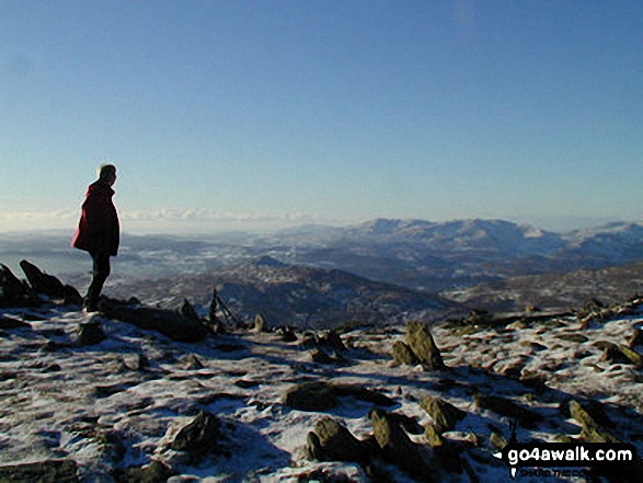
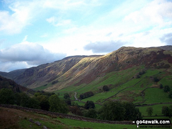
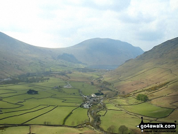
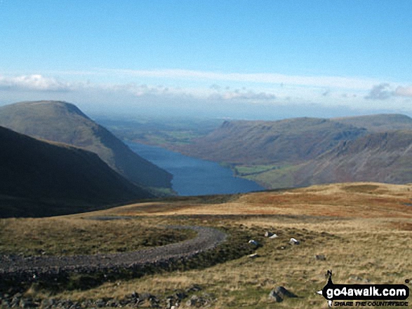
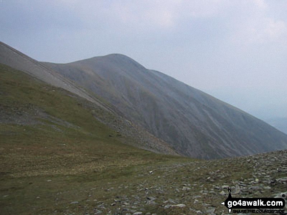
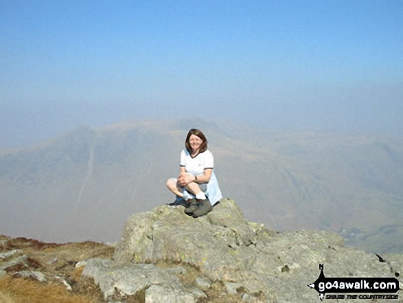
 The view from Scafell Pike in England
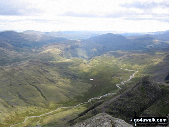
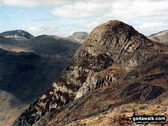


