
![]()
Kirk Fell
802m (2631ft)
The Western Fells, The Lake District, Cumbria, England
Not familiar with this top?
   |
|---|
Vital Statistics:
| Length: | 7.5ml (12km) |
|---|---|
| Ascent: | 3,289ft (1,002m) |
| Time: | 6 hrs |
| Grade: |  (Moderate) (Moderate) |
Route Summary:
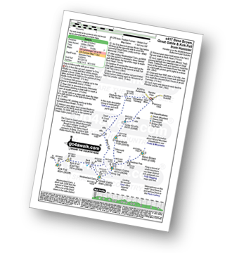
Honister Pass - Honister Hause - Grey Knotts - Brandreth - Green Gable - Windy Gap - Great Gable - Westmorland Cairn - Beck Head - Beckhead Tarn - Kirk Fell (East Top) - Kirk Fell - Moses' Trod - Wainwright's Coast to Coast Walk - Honister Pass
|
|---|
Vital Statistics:
| Length: | 7.75ml (12.5km) |
|---|---|
| Ascent: | 4,808ft (1,465m) |
| Time: | 7.75hrs |
| Grade: |  (Hard) (Hard) |
Route Summary:
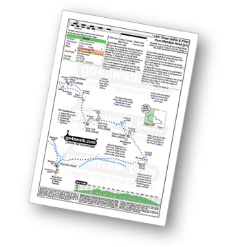
Wasdale Head - Kirk Fell - Kirk Fell (East Top) - Black Sail Pass - Looking Stead (Pillar) - High Level Route - Robinson's Cairn - Pillar - Wind Gap - Black Crag (Pillar) - Scoat Fell (Little Scoat Fell) - Steeple - Red Pike (Wasdale) - Dore Head - Mosedale Beck - Wasdale Head - Wast Water.
|
|---|
Vital Statistics:
| Length: | 8.5ml (13.5km) |
|---|---|
| Ascent: | 4,260ft (1,298m) |
| Time: | 7.25hrs |
| Grade: | (Hard) |
Route Summary:
Honister Pass - Honister Hause - Green Crag (Buttermere) - Black Beck - Blackbeck Tarn - Innominate Tarn - Hay Stacks (Haystacks) - Scarth Gap - Ennerdale - River Liza - Black Sail Hut (Youth Hostel) - Black Sail Path - Kirk Fell - Kirk Fell (East Top) - Beckhead Tarn - Beck Head - Great Gable - Westmorland Cairn - Windy Gap - Green Gable - Gillercomb Head - Brandreth - Grey Knotts - Honister Hause.
|
|---|
Vital Statistics:
| Length: | 9ml (14.5km) |
|---|---|
| Ascent: | 3,965ft (1,208m) |
| Time: | 7½ hrs |
| Grade: | (Hard) |
Route Summary:
Honister Pass - Honister Hause - Grey Knotts - Brandreth - Blackmoor Pols - Base Brown - Mitchell Cove - Green Gable - Windy Gap - Great Gable - Westmorland Cairn - Beck Head - Beckhead Tarn - Kirk Fell (East Top) - Kirk Fell - Moses' Trod - Wainwright's Coast to Coast Walk - Honister Pass
|
|---|
Vital Statistics:
| Length: | 11.25ml (18km) |
|---|---|
| Ascent: | 5,819ft (1,773m) |
| Time: | 10 hrs |
| Grade: |  (Very Hard) (Very Hard) |
Route Summary:
Wasdale Head - Moses' Trod - Lingmell Beck - Gable Beck Bridge - Sty Head - Great Gable - Westmorland Cairn - Beck Head - Beckhead Tarn - Kirk Fell (East Top) - Kirk Fell - Black Sail Pass - Looking Stead (Pillar) - High Level Route - Robinson's Cairn - Pillar - Wind Gap - Black Crag (Pillar) - Scoat Fell (Little Scoat Fell) - Steeple - Red Pike (Wasdale) - Dore Head - Mosedale Beck - Wasdale Head - Wast Water.
|
|---|
Vital Statistics:
| Length: | 18.75ml (30km) |
|---|---|
| Ascent: | 7,309ft (2,408m) |
| Time: | 14.75hrs |
| Grade: | (Very Hard) |
Route Summary:
Bowness Knott Car Park Ennerdale - Low Gillerthwaite Field Centre - High Gillerthwaite Yourth Hostel - Red Pike (Buttermere) - High Stile - High Crag (Buttermere) - Seat (Buttermere) - Scarth Gap - Hay Stacks (Haystacks) - Innominate Tarn - Blackbeck Tarn - Black Beck - Green Crag (Buttermere) - Great Round How - Brandreth - Gillercomb Head - Green Gable - Windy Gap - Great Gable - Westmorland Cairn - Beck Head - Beckhead Tarn - Kirk Fell (East Top) - Kirk Fell - Black Sail Pass - Looking Stead (Pillar) - High Level Route - Robinson's Cairn - Pillar - Wind Gap - Black Crag (Pillar) - High Beck - Low Beck - Ennerdale.
See Kirk Fell and the surrounding tops on our free-to-access 'Google Style' Peak Bagging Maps:
The Western Fells of The Lake District National Park
Less data - quicker to download
The Whole of The Lake District National Park
More data - might take a little longer to download
See Kirk Fell and the surrounding tops on our downloadable Peak Bagging Maps in PDF format:

NB: Whether you print off a copy or download it to your phone, these PDF Peak Baggers' Maps might prove incredibly useful when your are up there on the tops and you cannot get a phone signal.
*This version is marked with the walk routes you need to follow to Walk all 214 Wainwrights in just 59 walks.
You can find Kirk Fell & all the walks that climb it on these unique free-to-access Interactive Walk Planning Maps:
1:25,000 scale OS Explorer Map (orange/yellow covers):
1:50,000 scale OS Landranger Maps (pink/magenta covers):
 Fellow go4awalkers who have already walked, climbed, summited & bagged Kirk Fell
James Hughes walked up Kirk Fell on August 10th, 2025 [from/via/route] c417 Base Brown, Great Gable & Kirk Fell from Honister [weather] Warmish, sometimes overcast, sometimes sunny. - Stomp up to Grey Knotts from Honister - didn't feel too bad as started at decent height. Easy yomp over to Brandreth before hitting the path to descend to Base Brown. Good views then steepish ascent back to Green Gable. Good vista of Great Gable & Moses Trod below. Hard trek up Great Gable on rocky terrain. Topped & then overshot after the memorial to return to path down to Kirk Fell. Took one of the false boulder paths cited by Wainwright which ended in scree Sunday. The error of my ways became more apparent looking back as the scree looks quite severe. Had actually ascended Great Gable before from Kirk Fell col which was easier, although easy to understand how it would be hard in the mist. Another there & back on Kirk Fell - big flat top. Return via Moses Trod back to tramway track. Pint of Wainwright Amber Ale at Borrowdale Hotel. Average.
Doug Martin climbed Kirk Fell on August 1st, 2016 [from/via/route] Straight up the nose from Wasdale Inn [with] Solo [weather] One of those rare days - ideal for walking with some sunshine, cool breeze. - Was making excellent time on the up until I hit the scree - sticks would have come in handy. Great feeling of exhilaration on reaching top & shelter. The off down to Black Sail pass not as bad as I'd been led to believe. Kept looking across to Dore Head at base of Red Pike & Yewbarrow thinking I must be mad & coming down it at end of day confirmed I was. Met up with John & Alex for dinner at Netherwasdale. They were camping - I was knackered.
Geoff Hand bagged Kirk Fell on September 3rd, 2024 [from/via/route] Walk C417 Great Gable & Kirk Fell from Honister. Set off from Honister & climbed Grey Knotts, from there onto Glamara. We then climbed towards Green Gable but went South to pick up Brown Base. We retraced our steps, climbed green gable & onto Gt Gable. Leaving Gt Gable in cloud we found the path down to Beck Head. When reached there the cloud had lifted off Kirk fell so we went for it. Came back by Moses's trod & the dismantled tramway to Honister. [with] Tess, my Jack Russell [weather] Started off quite sunny, however cloud moved in & covered Gt Gable. A bit drisly towards the end. - A really tough walk, one I would think twice about in the future. Very pleased with my navigation of Gt Gable as it was spot on! According to my garmin I didn't quite hit the top of Grey Knots & Brandreth. I find this incredible as I did a lot of tramping around to make sure I hit the tops today. So I'm claiming them anyway. NB I've also done them both before.
Christine Shepherd hiked Kirk Fell on June 4th, 2007 [from/via/route] Walked from Honister Slate mine using walk c151 Climbed again on 23.08.2021 from Wasdale, the first fell in a long day's walking using walk c240. [with] On my own [weather] Hot & hazy - Followed the walk route over Kirk fell but didn't climb Great Gable on this occasion as my husband was waiting for me at Honister. On my second visit I descended via the scree slope. An exciting descent but not for the faint hearted. Climbed for a third time on 8.6.23 using walk c417, in gorgeous sunshine with a pleasant breeze.
Ian Ashton summited Kirk Fell on May 13th, 2023 [with] Jph
Martyn Atherton conquered Kirk Fell on September 20th, 2020 [from/via/route] c338 Grey Knotts, Brandreth, Green Gable, Great Gable, Kirk Fell [with] Martyn and Paul [weather] Cloudy at first then very warm & sunny - Great view of the mines
Paul Macey scaled Kirk Fell on June 6th, 2022 [from/via/route] C417 in reverse [with] Luke [weather] Cloudy but cloud above summits
Darren Wilson walked up Kirk Fell on June 20th, 2021 [from/via/route] Last Wainright walks Red Pike, Scoat Fell, Steeple, Pillar & Kirk Fell [with] Mike [weather] Sunny dry beautiful day out, steep climb up
Christina Lander climbed Kirk Fell on June 4th, 2021 [from/via/route] Wasdale Head - Kirk Fell - Pillar - Yewbarrow - Wasdale Head [with] Dick [weather] A beautiful, sunny day - During our holiday staying at Station House, Troutbeck, Penrith
Kevin Foster bagged Kirk Fell on May 14th, 2021 [from/via/route] Honister Pass (slate mine). [with] By myself. [weather] Low clouds down on tops gradually lifting. - The true summit of Kirk Fell is a short stroll from the East top across a grassy dip. The descent to Black Sail Pass looks a bit daunting but isn't too bad if taken carefully. Again the views are worth it especially of Lingmell , the Scafell massif & Wasdale.
To add (or remove) your name and experiences on this page - Log On and edit your Personal Mountain Bagging Record
. . . [see more walk reports]
More Photographs & Pictures of views from, on or of Kirk Fell
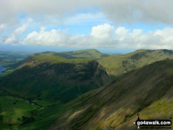
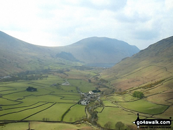
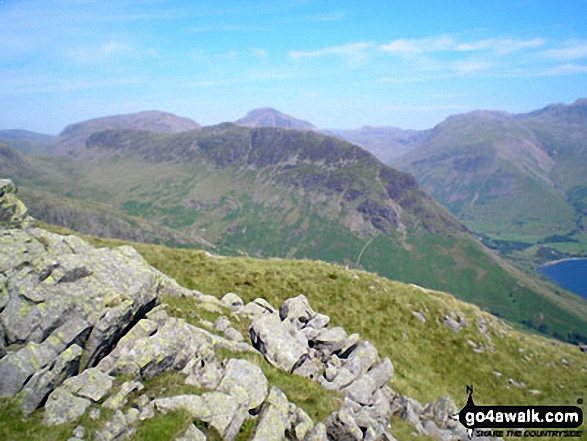
Wast Water, Wasdale and Yewbarrow with Middle Fell (left) Seatallan (background centre), Red Pike (Wasdale) (right) and the shoulder of Kirk Fell (centre foreground) from Westmorland Cairn on Great Gable
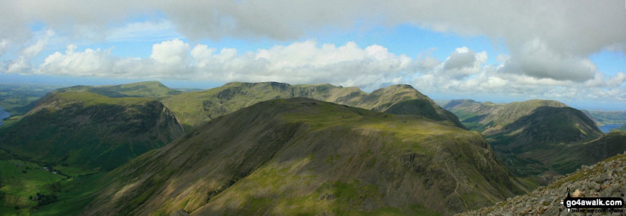
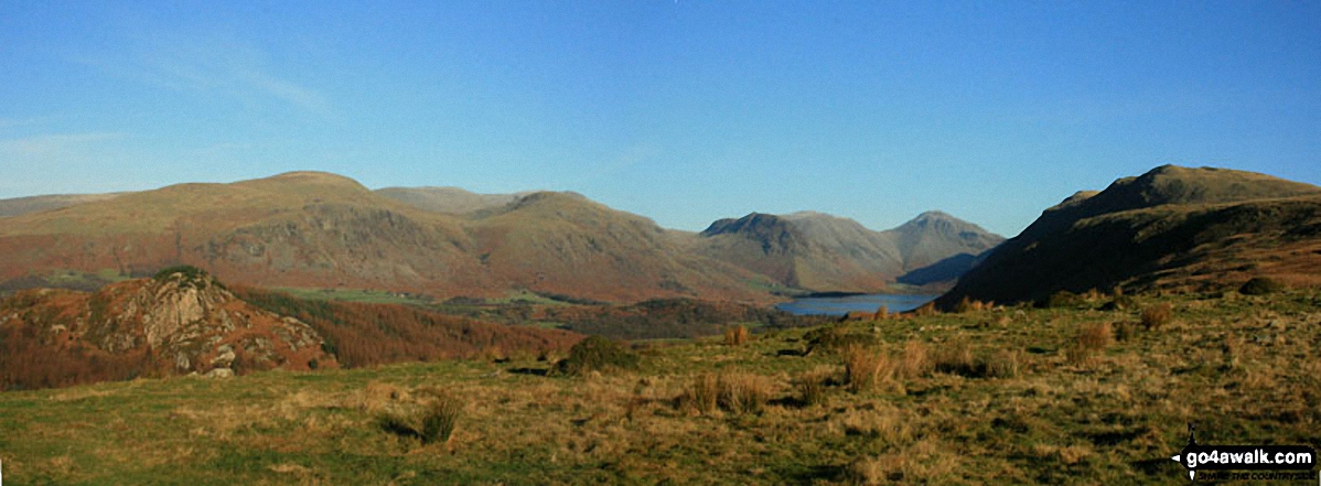
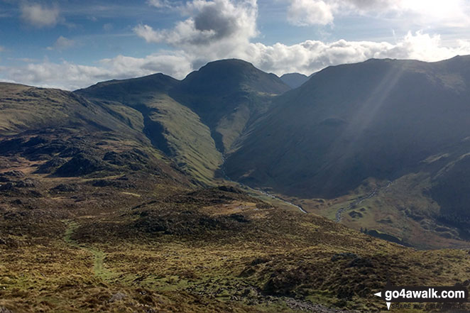
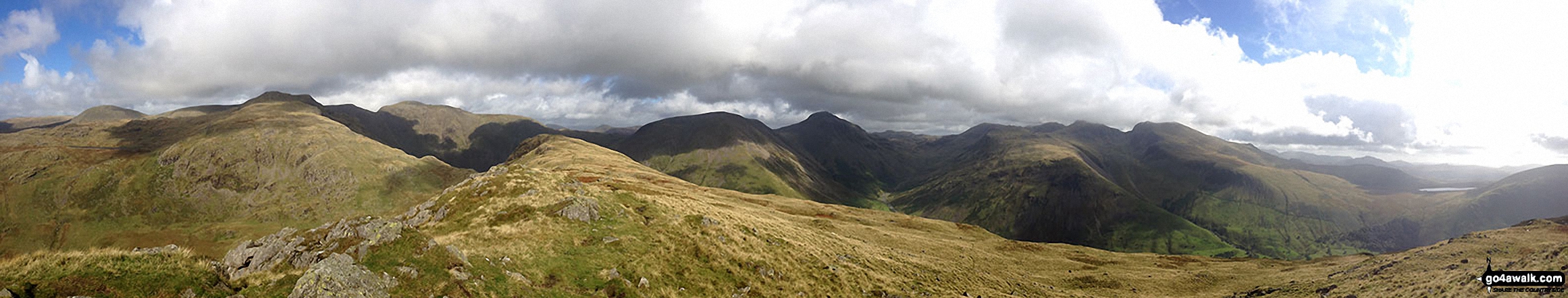
Westmorland Cairn, Great Gable panorama featuring Kirk Fell (foreground centre), Wast Water, Wasdale and Yewbarrow with Middle Fell and Seatallan beyond (left), Red Pike (Wasdale), Little Scoat Fell and Pillar behind Kirk Fell (centre) and Ennerdale with Red Pike (Buttermere), High Stile, High Crag and Crummock Water (right)
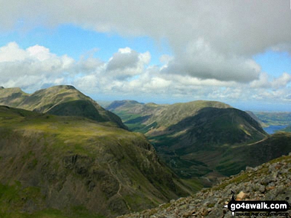
Kirk Fell (foreground), Pillar, Ennerdale, Red Pike (Buttermere), High Stile, High Crag and Crummock Water (far right) from Westmorland Cairn, Great Gable
Seatallan, Great Scoat Fell, Little Scoat Fell, Red Pike (Wasdale), Yewbarrow, Kirk Fell, Great Gable and Whin Rigg from Irton Pike
Yewbarrow with Kirk Fell, Great Gable and Lingmell beyond from Middle Fell (Wasdale)
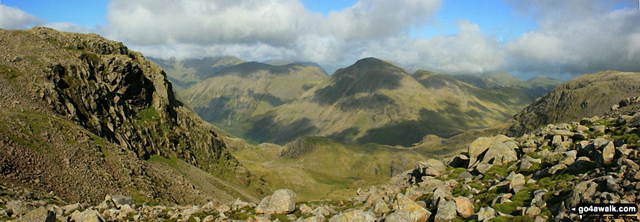
A grand view overlooking the valley of upper Wasdale from Esk Hause with Pillar, Kirk Fell, Great Gable and Green Gable taking centre stage

Wast Water and Wasdale Head from the lower slopes of Great Gable and Kirk Fell
Red Pike (Wasdale) and Little Scoat Fell (left), Mosedale, Pillar and Kirk Fell (centre) and Great Gable (right) from the summit of Scafell Pike

Red Pike (centre left), Pillar, Yewbarrow (centre), Kirk Fell & Great Gable (right) beyond Wast Water from Whin Rigg
Innominate Tarn, Hay Stacks with Great Gable, Kirk Fell and Scafell Pike in the distance
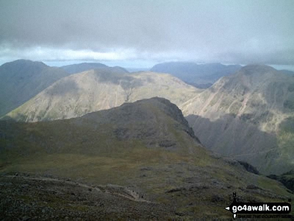
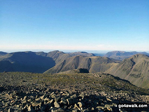
Green Gable, Great Gable (left of centre), Kirk Fell (centre) and Pillar (right) with the Scafell Massif beyond (centre) from High Crag
Haycock, Little Scoat Fell, Red Pike (Wasdale), Pillar, Top of Stirrup Crag, Kirk Fell, Great Gable, Great End, Lingmell, Scafell Pike, Sca Fell, Slightside, Harter Fell (Eskdale) and Burnmoor Tarn from the summit of Yewbarrow
. . . see all 65 walk photographs & pictures of views from, on or of Kirk Fell
Send us your photographs and pictures on, of, or from Kirk Fell
If you would like to add your walk photographs and pictures featuring views from, on or of Kirk Fell to this page, please send them as email attachments (configured for any computer) along with your name to:
and we shall do our best to publish them.
(Guide Resolution = 300dpi. At least = 660pixels (wide) x 440 pixels (high).)

You can also submit photos via our Facebook Page.
NB. Please indicate where each photo was taken and whether you wish us to credit your photos with a Username or your First Name/Last Name.
Not familiar with this top?


