   |
Vital Statistics:
| Length: | 7¼mls (11.5km) |
| Ascent: | 3,046ft (928m) |
| Time: | 5¾hrs |
| Grade: |  |

Route outline for walk c208:
Great Langdale - The New Dungeon Ghyll - Stickle Ghyll - Whitegill Crag - Blea Rigg - Sergeant Man - High Raise (Langdale) - The Langdale Pikes - Thunacar Knott - Pavey Ark - Harrison Stickle - Pike of Stickle (Pike O' Stickle) - Loft Crag - Mark Gate - The New Dungeon Ghyll - Great Langdale
Peaks, Summits and Tops reached on this walk:
 3 English Mountains |
 8 Wainwrights |
 6 English Nuttalls |
 0 English Deweys |
 0 Wainwright Outlying Fells |
 1 Marilyn |
 0 Bridgets |
Peak Bagging Statistics for this walk:
The highest point of this walk is High Raise (Langdale) at 762m (2501ft). High Raise (Langdale) is classified as an English Mountain (Hewitt) (65th highest in England, 111th highest in England & Wales) and a Wainwright (No. 57).
High Raise (Langdale) is also known as an English Nuttall (79th highest in England, 135th highest in England & Wales) and an English Marilyn (20th highest in England, 467th highest in the UK).
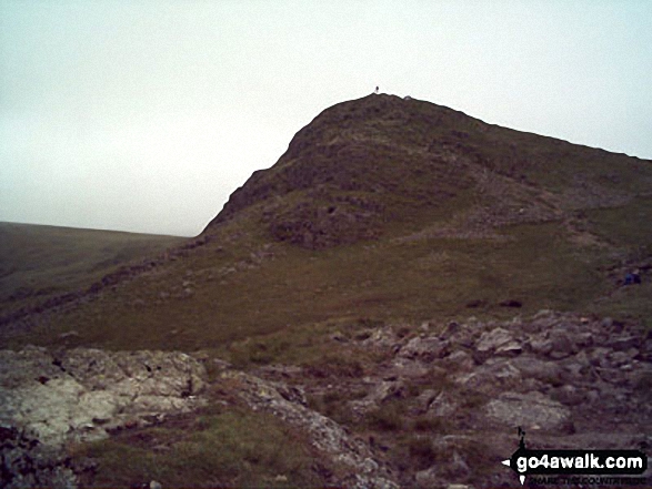
The summit of High Raise (Langdale) is marked by an Ordnance Survey Trig Point.
Completing this walk will also take you to the top of Sergeant Man at 736m (2416ft). Sergeant Man is classified as an Wainwright (No. 69).
Along the way you will also bag:
- Harrison Stickle at 736m (2415ft). Harrison Stickle is classified as an English Mountain (Hewitt) (77th highest in England, 132nd highest in England & Wales), a Wainwright (No. 70) and an English Nuttall (96th highest in England, 163rd highest in England & Wales).
- Thunacar Knott at 723m (2373ft). Thunacar Knott is classified as a Wainwright (No. 76) and an English Nuttall (105th highest in England, 179th highest in England & Wales)
- Pike of Stickle (Pike o' Stickle) at 708m (2324ft). Pike of Stickle (Pike o' Stickle) is classified as an English Mountain (Hewitt) (97th highest in England, 163rd highest in England & Wales), a Wainwright (No. 84) and an English Nuttall (121st highest in England, 205th highest in England & Wales).
- Pavey Ark at 700m (2297ft). Pavey Ark is classified as a Wainwright (No. 89) and an English Nuttall (134th highest in England, 221st highest in England & Wales)
- Loft Crag at 681m (2235ft). Loft Crag is classified as a Wainwright (No. 98) and an English Nuttall (151st highest in England, 255th highest in England & Wales)
- Blea Rigg at 541m (1776ft). Blea Rigg is classified as a Wainwright (No. 152)
You can find this walk and other nearby walks on these unique free-to-access Interactive Walk Planning Maps:
1:25,000 scale OS Explorer Map (orange/yellow covers):
1:50,000 scale OS Landranger Maps (pink/magenta covers):
Some Photos and Pictures from Walk c208 Harrison Stickle and High Raise from The New Dungeon Ghyll, Great Langdale
In no particular order . . .


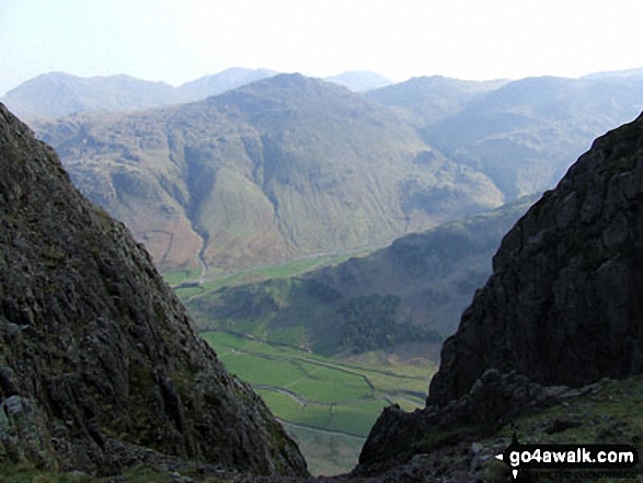
Great Langdale with Pike of Blisco (Pike o' Blisco) beyond from the path to Pike of Stickle (The Langdale Pikes)

*Cinkle Crags, Bow Fell (Bowfell) and the Langdale Pikes from Great Langdale in the early morning
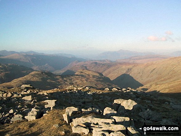
Low White Stones (foreground) with Borrowdale beyond from High Raise (Langdale)

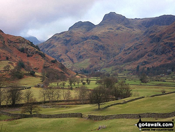
*Crinkle Crags featuring Crinkle Crags (Long Top), Gunson Knott & Crinkle Crags (South Top) (left), Bow Fell (Bowfell) (centre) and The Langdale Pikes (right) from Great Langdale
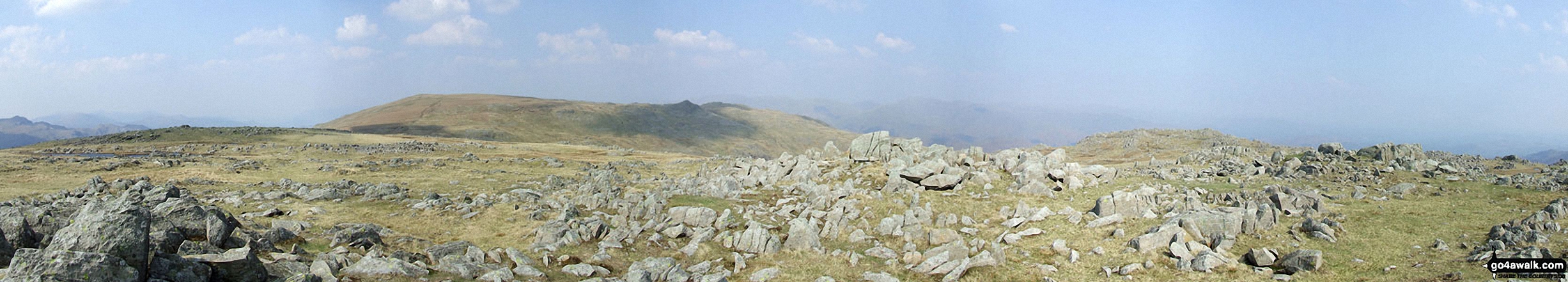
*High Raise (Langdale) and Seargent Man (dark pimple left of centre) and Codale Head from Thunacar Knott
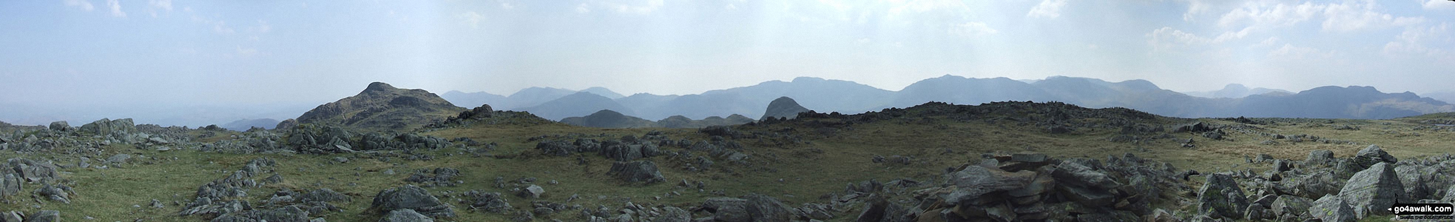
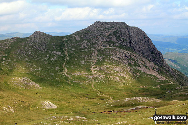
*Harrison Stickle (left) and Pike of Stickle (right) and the Langdale Pikes Plateau from Thunacar Knott

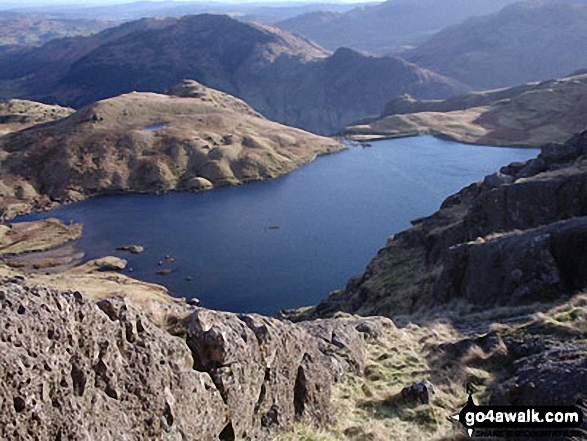
2/3rds way up Pavey Ark on Tuesday this week. Lovely views overlooking Stickle Tarn and beyond to Pike of Blisco (Pike o' Blisco) and The Coniston Fells!
Send us your photographs and pictures from your walks and hikes
We would love to see your photographs and pictures from walk c208 Harrison Stickle and High Raise from The New Dungeon Ghyll, Great Langdale. Send them in to us as email attachments (configured for any computer) along with your name and where the picture was taken to:
and we shall do our best to publish them.
(Guide Resolution = 300dpi. At least = 660 pixels (wide) x 440 pixels (high).)

You can also submit photos from walk c208 Harrison Stickle and High Raise from The New Dungeon Ghyll, Great Langdale via our Facebook Page.
NB. Please indicate where each photo was taken.


