
![]()
Middlehope Moor
612m (2008ft)
The North Pennines, County Durham, England
Tap/mouse over a coloured circle (1-3 easy walks, 4-6 moderate walks, 7-9 hard walks) and click to select.
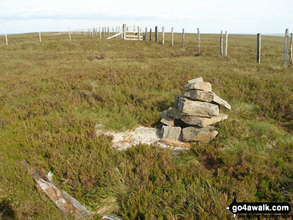
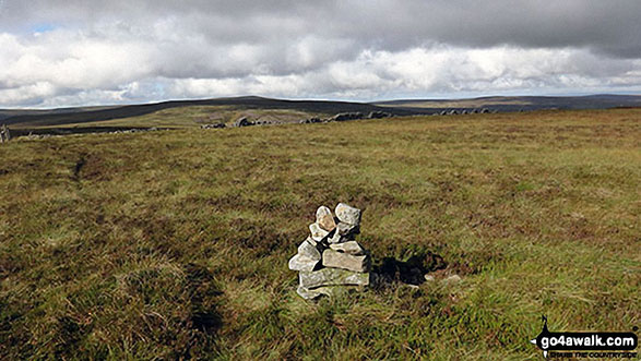
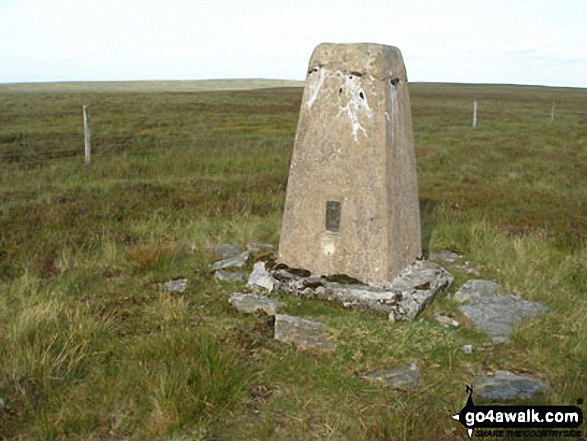
The summit of Middlehope Moor is marked by a cairn 750m NW of an Ordnance Survey Trig Point.
Not familiar with this top?
   |
|---|
Vital Statistics:
| Length: | 9.5ml (15km) |
|---|---|
| Ascent: | 1,378ft (420m) |
| Time: | 4.75hrs |
| Grade: |  (Moderate) (Moderate) |
Route Summary:
Allenheads - Dirt Pots - The Weardale Way - Killhope Law - Stangend Currick - Middlehope Moor - Shorngate Cross - Allenheads
See Middlehope Moor and the surrounding tops on our free-to-access 'Google Style' Peak Bagging Map:
The North Pennines
Less data - quicker to download
See Middlehope Moor and the surrounding tops on our downloadable Peak Bagging Map in PDF format:

NB: Whether you print off a copy or download it to your phone, this PDF Peak Baggers' Map might prove incredibly useful when your are up there on the tops and you cannot get a phone signal.
You can find Middlehope Moor & all the walks that climb it on these unique free-to-access Interactive Walk Planning Maps:
1:25,000 scale OS Explorer Map (orange/yellow covers):
1:50,000 scale OS Landranger Map (pink/magenta covers):
 Fellow go4awalkers who have already walked, climbed, summited & bagged Middlehope Moor
David Peebles walked up Middlehope Moor on June 29th, 2024 [from/via/route] National Cycle Route 7 car park (on county lines) [with] Solo walk [weather] Great Sunshine but overcast with rain later - Wet boots due to boggy ground. New boot decisions to make for Birthday.
Caroline Winter climbed Middlehope Moor on August 23rd, 2021 [from/via/route] Lay by on B6295 at Northumberland Border, fence line to 612 m [with] Becky [weather] Warm - Short walk over rough grass terrain, found another party balloon, which may have followed us from earlier walk today to Deadstones, so we tied it to the fence.
Angela Moroney bagged Middlehope Moor on May 20th, 2021 [from/via/route] road [with] Jane ludders [weather] wind rain
Darren Mortimer hiked Middlehope Moor on October 8th, 2017 [with] Dermot Palmer
Kevin Foster summited Middlehope Moor on March 2nd, 2019 [from/via/route] Cowshill. [with] Henry. [weather] Cloudy, Sunny but with a sharp cold wind that picked up as the day went on. - Today was my final visit to the North Pennines to mop up the two remaining mountains on my list. First - Middlehope Moor - a straightforward ascent up a stony enclosed lane which becomes a distinct grassy track higher up over Burtree Fell. A small pile of stones marks the summit with widespread views all round. The OS trig pillar, which is bizarrely 200 metres further East over very boggy ground, is not really worth the effort to reach it & is in fact a few metres lower than the true summit. The return descent to Cowshill via the track I ascended was very pleasant with great views back down into the Weardale valley.
Mark Davidson conquered Middlehope Moor on July 21st, 2008 [with] Alone [weather] Rough going with plenty of bog despite good dry weather
Christine Shepherd scaled Middlehope Moor on October 2nd, 2016 [from/via/route] Walked from the county border on the B6295. [with] On my own [weather] Sunny with a chilly breeze on top. - Decided to bag this from the road as the route described on n106 suggests that the ground between Killhope law & this summit is very rough. I am hoping to save Killhope Law as my last English Nuttall & as friends will be joining me I didn't think that they would appreciate the bogs. A pleasant stroll from the road.
Chris Faulkner walked up Middlehope Moor on February 22nd, 2014 [from/via/route] Via Killhope Law from Allenhead [with] Michelle Chandler [weather] Sunshine, showers, windy & cold - No paths. Boggy, wet lots of heather. Sam had to be pulled out of a bog hole full of water!
Ray O'hara climbed Middlehope Moor on August 21st, 2012 [from/via/route] N106 [weather] Overcast & windy - Not the most inspiring of summits, quite boggy in places. The route across Stangend Currick being fairly boggy & laborious to traverse
Patrick Rogozinski, Kate Colbrook and Trevor Williams have all walked, climbed & bagged Middlehope Moor.
To add (or remove) your name and experiences on this page - Log On and edit your Personal Mountain Bagging Record
More Photographs & Pictures of views from, on or of Middlehope Moor
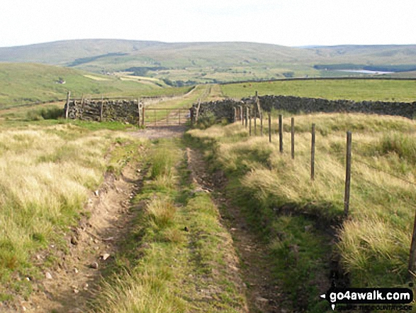
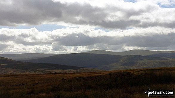
Descending the Burtree Fell track from Middlehope Moor to Cowshill with Burnhope Reservoir and Burnhope Seat in the distance
Send us your photographs and pictures on, of, or from Middlehope Moor
If you would like to add your walk photographs and pictures featuring views from, on or of Middlehope Moor to this page, please send them as email attachments (configured for any computer) along with your name to:
and we shall do our best to publish them.
(Guide Resolution = 300dpi. At least = 660pixels (wide) x 440 pixels (high).)

You can also submit photos via our Facebook Page.
NB. Please indicate where each photo was taken and whether you wish us to credit your photos with a Username or your First Name/Last Name.
Not familiar with this top?


