
![]()
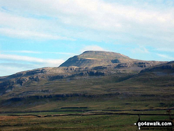
Ingleborough
724m (2375ft)
The Southern Dales Area, The Yorkshire Dales, North Yorkshire, England
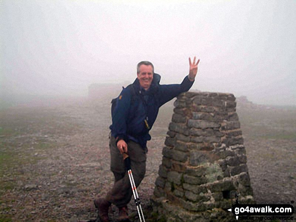
The summit of Ingleborough is marked by an Ordnance Survey Trig Point.

Not familiar with this top?
You can walk/hike to the top of Ingleborough by using any of these 9 easy‑to‑follow route maps:
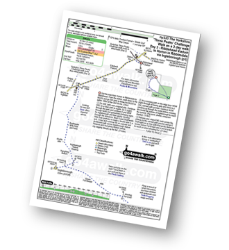
Walk ny333 The Yorkshire Three Peaks Challenge as a 3 day walk - Day 3 from Horton in Ribblesdale
The Yorkshire Three Peaks - the civilised way
   |
|---|
Vital Statistics:
| Length: | 9ml (14.5km) |
|---|---|
| Ascent: | 1,644ft (501m) |
| Time: | 5 hrs |
| Grade: |  (Moderate) (Moderate) |
Route Summary:
Ribblehead - (Railway Station - After Train Journey From Horton in Ribblesdale) - B6255 - Old Hill Inn - Chapel-le-Dale - Braithwaite Wife Hole - Ingleborough - Pen-y-ghent Cafe - Horton in Ribblesdale.
Walk ny130 Ingleborough and Raven Scar from The Old Hill Inn, Ribblehead
Fine views of Whernside and Ribblehead
|
|---|
Vital Statistics:
| Length: | 8.25ml (13km) |
|---|---|
| Ascent: | 1,932ft (589m) |
| Time: | 5 hrs |
| Grade: |  (Moderate) (Moderate) |

Route Summary:
Ribblehead - (The Old Hill Inn) - Chapel-le-Dale - Braithwaite Wife Hole - Ingleborough Nature Reserve - Humphrey Bottom - Ingleborough - Quaking Pot - Crina Bottom Farm - White Scars - High Howeth - Raven Scar - Harry Hallam's Moss - Old Hill Inn - Ribblehead
Walk ny119 Ingleborough from Clapham
One of the famous 'Three Peaks'
|
|---|
Vital Statistics:
| Length: | 8.5ml (13.5km) |
|---|---|
| Ascent: | 2,178ft (664m) |
| Time: | 5 hrs |
| Grade: | (Moderate) |

Route Summary:
Clapham - Limekiln Plantation - Clapdale Farm - Ingleborough Cave - Trow Gill - Hernal Moss - Gaping Gill - Seat Haw - Little Ingleborough - Ingleborough - Little Ingleborough - Newby Moss - Cote Haw - Newby Cote - Clapham
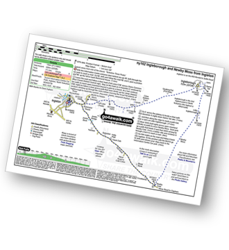
Walk ny102 Ingleborough and Newby Moss from Ingleton
Superb views from one of the classic 'Yorkshire Three Peaks'
|
|---|
Vital Statistics:
| Length: | 9.5ml (15km) |
|---|---|
| Ascent: | 2,250ft (686m) |
| Time: | 5½ hrs |
| Grade: | (Moderate) |
Route Summary:
Ingleton - Ingleton Information Centre - Richmond House - Fell Lane - Crina Bottom Farm - Quaking Pot - Ingleborough - Little Ingleborough - Newby Moss - Newby Cote - Bleak Bank - Duck Dub - Holly Platt - Slatenber - Jenkin Bridge - Ingleton
Walk ny191 Ingleborough and Raven Scar from Ingleton
Superb views from this classic mountain
|
|---|
Vital Statistics:
| Length: | 9.5ml (15km) |
|---|---|
| Ascent: | 2,362ft (720m) |
| Time: | 5.75hrs |
| Grade: | (Moderate) |

Route Summary:
Ingleton - Ingleton Tourist Information Centre - Fell Lane - Crina Bottom Farm - Quaking Pot - Ingleborough - Humphrey Bottom - Ingleborough Nature Reserve - Raven Scar - High Howeth - Harry Hallam's Moss - White Scars - Ingleton
Walk ny154 Ingleborough and the Ingleton Waterfalls from Ingleton
Superb views and fabulous waterfalls
|
|---|
Vital Statistics:
| Length: | 10ml (16km) |
|---|---|
| Ascent: | 2,244ft (684m) |
| Time: | 5.75hrs |
| Grade: | (Moderate) |

Route Summary:
Ingleton - Fell Lane - Crina Bottom Farm - Quaking Pot - Ingleborough - Humphrey Bottom - Ingleborough Nature Reserve - Braithwaite Wife Hole - Souther Scales Farm - Chapel-le-Dale - Twistleton Scars - Oddies Lane - The Ingleton Waterfalls Trail - Beezley Falls - Snow Falls - Ingleton
Walk ny171 Ingleborough and Simon Fell from The Old Hill Inn, Ribblehead
Fine views of Whernside and the magnificent Ribblehead viaduct
|
|---|
Vital Statistics:
| Length: | 11.5ml (18.5km) |
|---|---|
| Ascent: | 2,227ft (679m) |
| Time: | 6½ hrs |
| Grade: | (Moderate) |

Route Summary:
Ribblehead - (The Old Hill Inn) - Ingleborough Nature Reserve - Humphrey Bottom - Ingleborough - Simon Fell - Park Fell (Ribblehead) - New Close Farm - Ribblehead - Gunnerfleet Farm - Ivescar Farm - Broadrake Farm - Ellerbeck Farm - Jingle Pot - Chaple-le-Dale - The Old Hill Inn - Ribblehead
Walk ny322 The Yorkshire Three Peaks Challenge as a 2 day walk - Day 2 from Horton in Ribblesdale
Do the Yorkshire Three Peaks over a weekend
|
|---|
Vital Statistics:
| Length: | 14ml (22.5km) |
|---|---|
| Ascent: | 3,207ft (977m) |
| Time: | 8½ hrs |
| Grade: |  (Hard) (Hard) |

Route Summary:
Horton in Ribblesdale - Railway Station - Train Journey - Ribblehead Railway Station - Ribblehead - Blea Moor - Whernside - Broadrake Farm - Ribblehead - Blea Moor - Whernside - Broadrake Farm - Chapel-le-Dale - Braithwaite Wife Hole - Ingleborough - Pen-y-ghent Cafe - Horton in Ribblesdale.
Walk ny101 The Yorkshire Three Peaks from Horton in Ribblesdale
Easy walking - but very arduous, very long and with 3 big ascents
|
|---|
Vital Statistics:
| Length: | 24ml (38.5km) |
|---|---|
| Ascent: | 5,297ft (1,614m) |
| Time: | 14 hrs |
| Grade: |  (Very Hard) (Very Hard) |

Route Summary:
Horton in Ribblesdale - Pen-y-ghent Cafe - Brackenbottom - Gavel Rigg - The Pennine Way - Pen-y-ghent - Hunt Pot - Hull Pot - Whitber Hill - God's Bridge - Brow Gill Beck - Nether Lodge - River Ribble - Lodge Hall (or Ingman Lodge) - Ribblehead - Blea Moor - Whernside - Broadrake Farm - Chapel-le-Dale - Braithwaite Wife Hole - Ingleborough - Pen-y-ghent Cafe - Horton in Ribblesdale.
See Ingleborough and the surrounding tops on our free-to-access 'Google Style' Peak Bagging Maps:
The Southern Dales Area of The Yorkshire Dales National Park
Less data - quicker to download
The Whole of The Yorkshire Dales National Park
More data - might take a little longer to download
See Ingleborough and the surrounding tops on our unique, downloadable, PDF Peak Bagging Map:

NB: Whether you print off a copy or download it to your phone, this PDF Peak Baggers' Map might prove incredibly useful when your are up there on the tops and you cannot get a phone signal.
You can find Ingleborough & all the walks that climb it on these unique free-to-access Interactive Walk Planning Maps:
1:25,000 scale OS Explorer Map (orange/yellow covers):
1:50,000 scale OS Landranger Map (pink/magenta covers):
 Fellow go4awalkers who have already walked, climbed, scaled, summited, hiked & bagged Ingleborough
Tia Cain has walked up Ingleborough [from/via/route] Car park in the village [with] Hilary [weather] Perfectly clear & dry - Prosecco at the top was ace! very large area at the top of the peak & a great shelter for food & rest
Alan Smith climbed it on July 12th, 2025 [from/via/route] With Kev from ribblehead [with] kev [weather] Warm sunny & clear
Hazel Gilbert bagged it on August 22nd, 2007 [with] Lawrence
David Peebles hiked Ingleborough on June 20th, 2024 [from/via/route] parked at Horton in Ribblesdale [with] Solo [weather] Mixed Weather. Warm but wet a bits - Great walk.
Sarah Moore summited on July 30th, 2022 [from/via/route] Three Peaks [with] On my own - but thanks to Steve the Scouser...the 2 lads from Grimsby and the 4 guys who finished at the same time! [weather] Awful!!
To add (or remove) your name and experiences on this page - Log On and edit your Personal Mountain Bagging Record
. . . [see more walk reports]
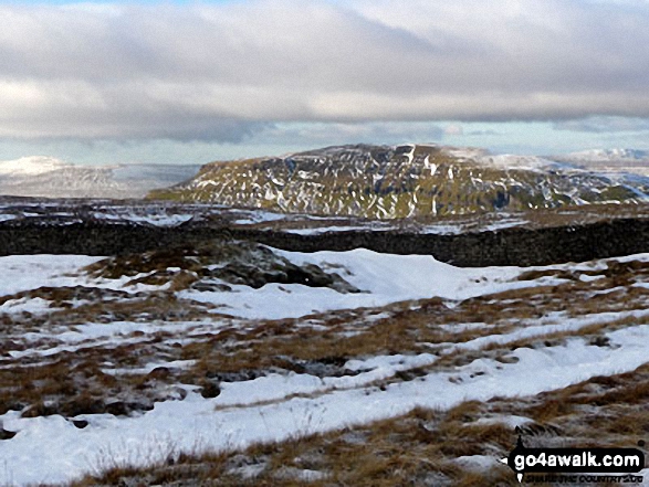
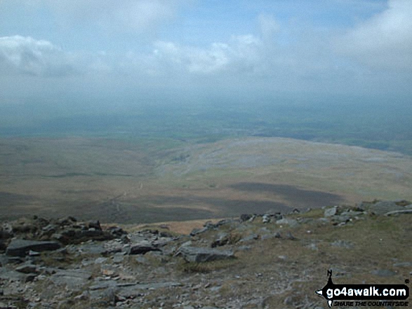
More Photographs & Pictures of views from, on, or of, Ingleborough
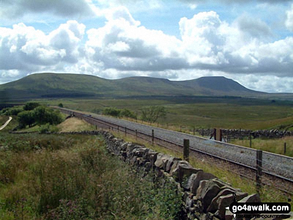
The Yorkshire Three Peaks - Ingleborough (left), Pen-y-ghent (centre) and Whernside (right) from the summit of Fountains Fell


. . . see all 50 walk photographs & pictures of views from, on, or of, Ingleborough
Send us your photographs and pictures on, of, or from Ingleborough
If you would like to add your walk photographs and pictures to this page, please send them as email attachments (configured for any computer) along with your name to:
and we shall do our best to publish them.
(Guide Resolution = 300dpi. At least = 660pixels (wide) x 440 pixels (high).)

You can also submit photos via our Facebook Page.
NB. Please indicate where each photo was taken and whether you wish us to credit your photos with a Username or your First Name/Last Name.


