
![]()
Killhope Law
673m (2208ft)
The North Pennines, County Durham, England
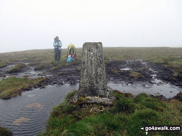
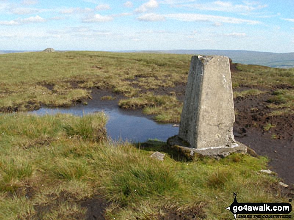
The summit of Killhope Law is marked by an Ordnance Survey Trig Point.
Not familiar with this top?
You can walk/hike to the top of Killhope Law by using any of these 3 easy‑to‑follow route maps:
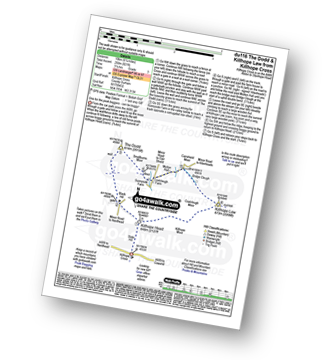
Walk du116 The Dodd and Killhope Law from Killhope Cross
One for the peak baggers - Killhope Head can be boggy!
   |
|---|
Vital Statistics:
| Length: | 6.25ml (10km) |
|---|---|
| Ascent: | 821ft (250m) |
| Time: | 3.25hrs |
| Grade: |  (Easy) (Easy) |
Route Summary:
Killhope Cross - Killhope Head - Black Hill - The Dodd - Smallburns Moor - Sunnyside Farm - Coalcleugh Farm - Mufton Hall - Carrshield Moor - Bridge Cleugh - Killhope Law - Killhope Head - Killhope Cross
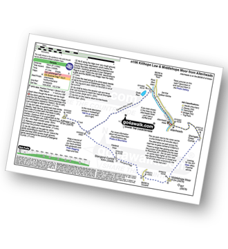
Walk n106 Killhope Law and Middlehope Moor from Allenheads
Good views though the terrain can be rough
|
|---|
Vital Statistics:
| Length: | 9.5ml (15km) |
|---|---|
| Ascent: | 1,378ft (420m) |
| Time: | 4.75hrs |
| Grade: |  (Moderate) (Moderate) |
Route Summary:
Allenheads - Dirt Pots - The Weardale Way - Killhope Law - Stangend Currick - Middlehope Moor - Shorngate Cross - Allenheads
Walk n151 Killhope Law and Carrshield Moor from Allenheads
Rough terrain and wild moorland
|
|---|
Vital Statistics:
| Length: | 12.75ml (20.5km) |
|---|---|
| Ascent: | 1,759ft (536m) |
| Time: | 6½ hrs |
| Grade: |  (Moderate) (Moderate) |

Route Summary:
Allenheads - Dirt Pots - The Weardale Way - Killhope Law - Shivery Hill - Carshield Moor - Scum Hill - Hartley Moor - Nan Davison's Cleugh - Philipson's Fold - Knockshield Moor - Black Way (Track) - Swinhope Shield - High Knock Shield - Knock Shield - Knockburn Farm - River East Allen - Low Sipton Shield - Sipton Terrace - Teedham Green - Corn Mill - Low Huntwell - Dirt Pots - Allenheads
See Killhope Law and the surrounding tops on our free-to-access 'Google Style' Peak Bagging Map:
The North Pennines
Less data - quicker to download
See Killhope Law and the surrounding tops on our unique, downloadable, PDF Peak Bagging Map:

NB: Whether you print off a copy or download it to your phone, this PDF Peak Baggers' Map might prove incredibly useful when your are up there on the tops and you cannot get a phone signal.
You can find Killhope Law & all the walks that climb it on these unique free-to-access Interactive Walk Planning Maps:
1:25,000 scale OS Explorer Map (orange/yellow covers):
1:50,000 scale OS Landranger Maps (pink/magenta covers):
 Fellow go4awalkers who have already walked, climbed, scaled, summited, hiked & bagged Killhope Law
David Peebles walked up Killhope Law on June 29th, 2024 [from/via/route] Carpark near Coalcleugh [with] Solo walk [weather] Great Sunshine but overcast with rain later - Wet boots due to boggy ground. New boot decisions to make for Birthday.
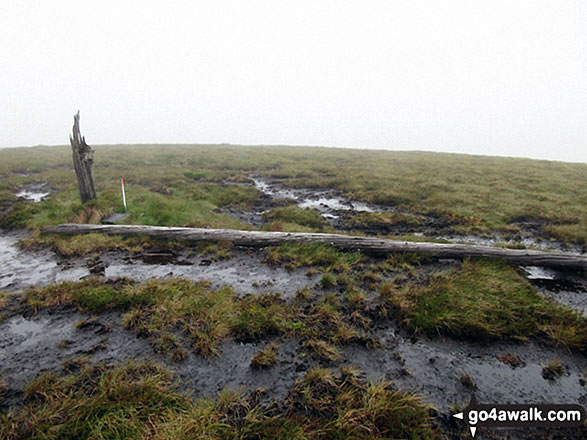
Caroline Winter climbed it on August 20th, 2021 [from/via/route] Lay by near Lead mining centre, Carriers Hill, High Linn, Shooting Cabin, Killhope Law [with] Becky [weather] Warm & humid - Carrier Hill wood land cut down. Made to broken stake on Killhope Law top. Took route parallel, south of Shooting cabin, but difficult progress due to bracken & heather
Angela Moroney bagged it on May 20th, 2021 [from/via/route] road [with] Jane ludders [weather] wind rain
Sarah Baker hiked Killhope Law on March 8th, 2020 [with] Larry baker [weather] Cold - fell down a bog hole
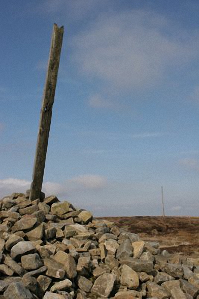
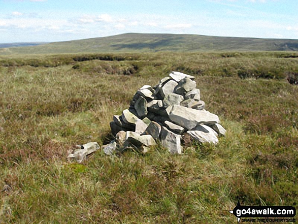
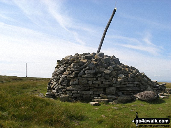
Kevin Foster summited on January 27th, 2019 [from/via/route] Killhope Cross road summit. [with] Henry. [weather] Clear conditions, frozen ground with a light covering of snow. - Tough moorland walking with sketchy or nonexistent paths. One for the Peak baggers definitely. Nice distance views from the summit which has a large pile of stones, trig point but sadly the tall wooden pole has snapped off & fallen down.
To add (or remove) your name and experiences on this page - Log On and edit your Personal Mountain Bagging Record
. . . [see more walk reports]
More Photographs & Pictures of views from, on, or of, Killhope Law


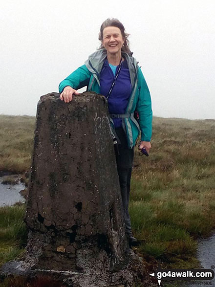
Me on the summit trig point of Killhope Law, my final English Nuttall
. . . see all 13 walk photographs & pictures of views from, on, or of, Killhope Law
Send us your photographs and pictures on, of, or from Killhope Law
If you would like to add your walk photographs and pictures to this page, please send them as email attachments (configured for any computer) along with your name to:
and we shall do our best to publish them.
(Guide Resolution = 300dpi. At least = 660pixels (wide) x 440 pixels (high).)

You can also submit photos via our Facebook Page.
NB. Please indicate where each photo was taken and whether you wish us to credit your photos with a Username or your First Name/Last Name.


