The Southern Fells area of The Lake District National Park - a fully detailed list of all the Mountains, Peaks, Tops and Hills
The Southern Fells area of The Lake District National Park, Cumbria is enclosed by:
- Seatoller and the Langdale Valley to the North
- Sty Head Pass, Wasdale Head and Wast Water to the North West
- An imaginary line from the Southern Tip of Wast Water to Seathwaite (Duddon Valley), along the Walna Scar Road to Coniston Village and then North East to Ambleside
If you include just the Wainwrights, the Mountains (Hewitts) and the Nuttalls there are 52 tops to climb, bag & conquer and the highest point is Scafell Pike at 978m (3,210ft).
To see these Mountains, Peaks, Tops and Hills displayed in different ways - see the options in the left-hand column and towards the bottom of this page.
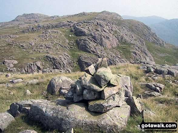
![]() Your Personal Bagging Record for The Southern Fells area of The Lake District
Your Personal Bagging Record for The Southern Fells area of The Lake District
When logged on, you can mark each Mountain, Peak, Top or Hill as 'bagged' by either:
- if you opt to display the tops in this area using a google map, click or tap on its symbol on the map below. This will open a text window. Click or tap on the 'Record [mountain name] as Bagged, Climbed & Conquered' link towards the bottom of the text window, or
- if you opt to display the tops in this area as a list, click or tap on the red 'not yet' symbol to the right of the name of each 'top'
Either method will open a new page where you can complete all your details such as:
- when you bagged the Mountain, Peak, Top or Hill;
- which route you took
- who you went with
- what the weather was like
- any other comment that will remind you of the day
Once you have completed your details and click or tap the submit button, you will automatically return to this page and the top you bagged will show with a green tick.
NB. None of the above fields are 'mandatory' - you can leave them blank if you wish.
NNB. You also have the option whether to display your peak bagging exploits to other users of this site or keep them private so only you can see them when you are logged on.
Furthermore, since you can also access your Personal Mountain & Hill Bagging Record via go4awalk Mobile you can quickly & easily record, edit and view your achievements - whether you are at home/work on your desktop computer or in the pub/at the top of a mountain with your Mobile Phone. (You can even download your Personal Mountain & Hill Bagging Record as a .csv file for importing into and saving with spreadsheet software like Excel or NeoOffice!)
This facility costs one credit to initially access your personal bagging record. Once accessed, all other interactions, such as recording other Mountains, Peaks, Tops and Hills as 'bagged' or altering an existing bagging record, are free.
Click REGISTER to register and purchase credits.
LOG ON and RELOAD this page to show which Mountains, Peaks, Tops and Hills you have already climbed, bagged & conquered. [ . . . remove this text]
See this list in: Alphabetical Order
| Height Order‡
To reverse the order select the link again.
Mountain, Peak, Top or Hill:
Bagged

![]()
1. Scafell Pike
978m (3,210ft)
Scafell Pike is on interactive maps:
Scafell Pike is on downloadable PDF you can Print or Save to your Phone: *Version including the walk routes marked on it that you need to follow to Walk all 214 Wainwrights in just 59 walks. |
![]()
2. Sca Fell
964m (3,163ft)
Sca Fell is on interactive maps:
Sca Fell is on downloadable PDF you can Print or Save to your Phone: *Version including the walk routes marked on it that you need to follow to Walk all 214 Wainwrights in just 59 walks. |

![]()
3. Symonds Knott
959m (3,147ft)
Symonds Knott is on interactive maps:
Symonds Knott is on downloadable PDF you can Print or Save to your Phone: *Version including the walk routes marked on it that you need to follow to Walk all 214 Wainwrights in just 59 walks. |

![]()
4. Broad Crag
935m (3,069ft)
Broad Crag is on interactive maps:
Broad Crag is on downloadable PDF you can Print or Save to your Phone: *Version including the walk routes marked on it that you need to follow to Walk all 214 Wainwrights in just 59 walks. |
![]()
5. Ill Crag
931m (3,054ft)
Ill Crag is on interactive maps:
Ill Crag is on downloadable PDF you can Print or Save to your Phone: *Version including the walk routes marked on it that you need to follow to Walk all 214 Wainwrights in just 59 walks. |
![]()
6. Great End
910m (2,987ft)
Great End is on interactive maps:
Great End is on downloadable PDF you can Print or Save to your Phone: *Version including the walk routes marked on it that you need to follow to Walk all 214 Wainwrights in just 59 walks. |
![]()
7. Bow Fell (Bowfell)
902m (2,960ft)
Bow Fell (Bowfell) is on interactive maps:
Bow Fell (Bowfell) is on downloadable PDF you can Print or Save to your Phone: *Version including the walk routes marked on it that you need to follow to Walk all 214 Wainwrights in just 59 walks. |
![]()
8. Esk Pike
885m (2,904ft)
Esk Pike is on interactive maps:
Esk Pike is on downloadable PDF you can Print or Save to your Phone: *Version including the walk routes marked on it that you need to follow to Walk all 214 Wainwrights in just 59 walks. |
![]()
9. Bow Fell (Bowfell) (North Top)
866m (2,841ft)
Bow Fell (Bowfell) (North Top) is on interactive maps:
Bow Fell (Bowfell) (North Top) is on downloadable PDF you can Print or Save to your Phone: *Version including the walk routes marked on it that you need to follow to Walk all 214 Wainwrights in just 59 walks. |
![]()
10. Crinkle Crags (Long Top)
859m (2,819ft)
Crinkle Crags (Long Top) is on interactive maps:
Crinkle Crags (Long Top) is on downloadable PDF you can Print or Save to your Phone: *Version including the walk routes marked on it that you need to follow to Walk all 214 Wainwrights in just 59 walks. |
![]()
11. Crinkle Crags (South Top)
834m (2,737ft)
Crinkle Crags (South Top) is on interactive maps:
Crinkle Crags (South Top) is on downloadable PDF you can Print or Save to your Phone: *Version including the walk routes marked on it that you need to follow to Walk all 214 Wainwrights in just 59 walks. |
![]()
12. Shelter Crags
815m (2,675ft)
Shelter Crags is on interactive maps:
Shelter Crags is on downloadable PDF you can Print or Save to your Phone: *Version including the walk routes marked on it that you need to follow to Walk all 214 Wainwrights in just 59 walks. |
![]()
13. Lingmell
807m (2,648ft)
Lingmell is on interactive maps:
Lingmell is on downloadable PDF you can Print or Save to your Phone: *Version including the walk routes marked on it that you need to follow to Walk all 214 Wainwrights in just 59 walks. |
![]()
14. Swirl How
802m (2,633ft)
Swirl How is on interactive maps:
Swirl How is on downloadable PDF you can Print or Save to your Phone: *Version including the walk routes marked on it that you need to follow to Walk all 214 Wainwrights in just 59 walks. |
![]()
15. The Old Man of Coniston
802m (2,633ft)
The Old Man of Coniston is on interactive maps:
The Old Man of Coniston is on downloadable PDF you can Print or Save to your Phone: *Version including the walk routes marked on it that you need to follow to Walk all 214 Wainwrights in just 59 walks. |

![]()
16. Brim Fell
796m (2,612ft)
Brim Fell is on interactive maps:
Brim Fell is on downloadable PDF you can Print or Save to your Phone: *Version including the walk routes marked on it that you need to follow to Walk all 214 Wainwrights in just 59 walks. |
![]()
17. Allen Crags
785m (2,576ft)
Allen Crags is on interactive maps:
Allen Crags is on downloadable PDF you can Print or Save to your Phone: *Version including the walk routes marked on it that you need to follow to Walk all 214 Wainwrights in just 59 walks. |
![]()
18. Great Carrs
785m (2,576ft)
Great Carrs is on interactive maps:
Great Carrs is on downloadable PDF you can Print or Save to your Phone: *Version including the walk routes marked on it that you need to follow to Walk all 214 Wainwrights in just 59 walks. |
![]()
19. Glaramara
783m (2,569ft)
Glaramara is on interactive maps:
Glaramara is on downloadable PDF you can Print or Save to your Phone: *Version including the walk routes marked on it that you need to follow to Walk all 214 Wainwrights in just 59 walks. |
![]()
20. Dow Crag
778m (2,553ft)
Dow Crag is on interactive maps:
Dow Crag is on downloadable PDF you can Print or Save to your Phone: *Version including the walk routes marked on it that you need to follow to Walk all 214 Wainwrights in just 59 walks. |
![]()
21. Looking Steads (Glaramara)
775m (2,545ft)
Looking Steads (Glaramara) is on interactive maps:
Looking Steads (Glaramara) is on downloadable PDF you can Print or Save to your Phone: *Version including the walk routes marked on it that you need to follow to Walk all 214 Wainwrights in just 59 walks. |
![]()
22. Shelter Crags (North Top)
775m (2,543ft)
Shelter Crags (North Top) is on interactive maps:
Shelter Crags (North Top) is on downloadable PDF you can Print or Save to your Phone: *Version including the walk routes marked on it that you need to follow to Walk all 214 Wainwrights in just 59 walks. |
![]()
23. Grey Friar
773m (2,536ft)
Grey Friar is on interactive maps:
Grey Friar is on downloadable PDF you can Print or Save to your Phone: *Version including the walk routes marked on it that you need to follow to Walk all 214 Wainwrights in just 59 walks. |
![]()
24. Wetherlam
763m (2,504ft)
Wetherlam is on interactive maps:
Wetherlam is on downloadable PDF you can Print or Save to your Phone: *Version including the walk routes marked on it that you need to follow to Walk all 214 Wainwrights in just 59 walks. |

![]()
25. Slight Side
762m (2,501ft)
Slight Side is on interactive maps:
Slight Side is on downloadable PDF you can Print or Save to your Phone: *Version including the walk routes marked on it that you need to follow to Walk all 214 Wainwrights in just 59 walks. |
![]()
26. Black Sails
745m (2,445ft)
Black Sails is on interactive maps:
Black Sails is on downloadable PDF you can Print or Save to your Phone: *Version including the walk routes marked on it that you need to follow to Walk all 214 Wainwrights in just 59 walks. |
![]()
27. Round How (Scafell)
741m (2,432ft)
Round How (Scafell) is on interactive maps:
Round How (Scafell) is on downloadable PDF you can Print or Save to your Phone: *Version including the walk routes marked on it that you need to follow to Walk all 214 Wainwrights in just 59 walks. |
![]()
28. Little Stand
740m (2,429ft)
Little Stand is on interactive maps:
Little Stand is on downloadable PDF you can Print or Save to your Phone: *Version including the walk routes marked on it that you need to follow to Walk all 214 Wainwrights in just 59 walks. |
![]()
29. Combe Head
735m (2,412ft)
Combe Head is on interactive maps:
Combe Head is on downloadable PDF you can Print or Save to your Phone: *Version including the walk routes marked on it that you need to follow to Walk all 214 Wainwrights in just 59 walks. |
![]()
30. Red Beck Top
721m (2,366ft)
Red Beck Top is on interactive maps:
Red Beck Top is on downloadable PDF you can Print or Save to your Phone: *Version including the walk routes marked on it that you need to follow to Walk all 214 Wainwrights in just 59 walks. |
![]()
31. Pike of Blisco (Pike o' Blisco)
705m (2,314ft)
Pike of Blisco (Pike o' Blisco) is on interactive maps:
Pike of Blisco (Pike o' Blisco) is on downloadable PDF you can Print or Save to your Phone: *Version including the walk routes marked on it that you need to follow to Walk all 214 Wainwrights in just 59 walks. |
![]()
32. Middleboot Knotts
703m (2,307ft)
Middleboot Knotts is on interactive maps:
Middleboot Knotts is on downloadable PDF you can Print or Save to your Phone: *Version including the walk routes marked on it that you need to follow to Walk all 214 Wainwrights in just 59 walks. |
![]()
33. Cold Pike
700m (2,297ft)
Cold Pike is on interactive maps:
Cold Pike is on downloadable PDF you can Print or Save to your Phone: *Version including the walk routes marked on it that you need to follow to Walk all 214 Wainwrights in just 59 walks. |
![]()
34. Great Knott
695m (2,281ft)
Great Knott is on interactive maps:
Great Knott is on downloadable PDF you can Print or Save to your Phone: *Version including the walk routes marked on it that you need to follow to Walk all 214 Wainwrights in just 59 walks. |
![]()
35. High House Tarn Top
684m (2,245ft)
High House Tarn Top is on interactive maps:
High House Tarn Top is on downloadable PDF you can Print or Save to your Phone: *Version including the walk routes marked on it that you need to follow to Walk all 214 Wainwrights in just 59 walks. |
![]()
36. Cold Pike (West Top)
683m (2,242ft)
Cold Pike (West Top) is on interactive maps:
Cold Pike (West Top) is on downloadable PDF you can Print or Save to your Phone: *Version including the walk routes marked on it that you need to follow to Walk all 214 Wainwrights in just 59 walks. |
![]()
37. Combe Door Top
676m (2,219ft)
Combe Door Top is on interactive maps:
Combe Door Top is on downloadable PDF you can Print or Save to your Phone: *Version including the walk routes marked on it that you need to follow to Walk all 214 Wainwrights in just 59 walks. |
![]()
38. Cold Pike (Far West Top)
670m (2,199ft)
Cold Pike (Far West Top) is on interactive maps:
Cold Pike (Far West Top) is on downloadable PDF you can Print or Save to your Phone: *Version including the walk routes marked on it that you need to follow to Walk all 214 Wainwrights in just 59 walks. |
![]()
39. Harter Fell (Eskdale)
654m (2,146ft)
Harter Fell (Eskdale) is on interactive maps:
Harter Fell (Eskdale) is on downloadable PDF you can Print or Save to your Phone: *Version including the walk routes marked on it that you need to follow to Walk all 214 Wainwrights in just 59 walks. |
![]()
40. Rossett Pike
651m (2,136ft)
Rossett Pike is on interactive maps:
Rossett Pike is on downloadable PDF you can Print or Save to your Phone: *Version including the walk routes marked on it that you need to follow to Walk all 214 Wainwrights in just 59 walks. |
![]()
41. Dovenest Top
633m (2,078ft)
Dovenest Top is on interactive maps:
Dovenest Top is on downloadable PDF you can Print or Save to your Phone: *Version including the walk routes marked on it that you need to follow to Walk all 214 Wainwrights in just 59 walks. |
![]()
42. Seathwaite Fell
632m (2,074ft)
Seathwaite Fell is on interactive maps:
Seathwaite Fell is on downloadable PDF you can Print or Save to your Phone: *Version including the walk routes marked on it that you need to follow to Walk all 214 Wainwrights in just 59 walks. |
![]()
43. Seathwaite Fell (South Top)
631m (2,070ft)
Seathwaite Fell (South Top) is on interactive maps:
Seathwaite Fell (South Top) is on downloadable PDF you can Print or Save to your Phone: *Version including the walk routes marked on it that you need to follow to Walk all 214 Wainwrights in just 59 walks. |
![]()
44. Rosthwaite Cam (Rosthwaite Fell)
612m (2,008ft)
Rosthwaite Cam (Rosthwaite Fell) is on interactive maps:
Rosthwaite Cam (Rosthwaite Fell) is on downloadable PDF you can Print or Save to your Phone: *Version including the walk routes marked on it that you need to follow to Walk all 214 Wainwrights in just 59 walks. |
![]()
45. Illgill Head
609m (1,997ft)
Illgill Head is on interactive maps:
Illgill Head is on downloadable PDF you can Print or Save to your Phone: *Version including the walk routes marked on it that you need to follow to Walk all 214 Wainwrights in just 59 walks. |
![]()
46. Rosthwaite Fell (Bessyboot)
551m (1,808ft)
Rosthwaite Fell (Bessyboot) is on interactive maps:
Rosthwaite Fell (Bessyboot) is on downloadable PDF you can Print or Save to your Phone: *Version including the walk routes marked on it that you need to follow to Walk all 214 Wainwrights in just 59 walks. |
![]()
47. Hard Knott
549m (1,802ft)
Hard Knott is on interactive maps:
Hard Knott is on downloadable PDF you can Print or Save to your Phone: *Version including the walk routes marked on it that you need to follow to Walk all 214 Wainwrights in just 59 walks. |
![]()
48. Whin Rigg
535m (1,756ft)
Whin Rigg is on interactive maps:
Whin Rigg is on downloadable PDF you can Print or Save to your Phone: *Version including the walk routes marked on it that you need to follow to Walk all 214 Wainwrights in just 59 walks. |
![]()
49. Green Crag (Ulpha Fell)
489m (1,604ft)
Green Crag (Ulpha Fell) is on interactive maps:
Green Crag (Ulpha Fell) is on downloadable PDF you can Print or Save to your Phone: *Version including the walk routes marked on it that you need to follow to Walk all 214 Wainwrights in just 59 walks. |
![]()
50. Lingmoor Fell
469m (1,539ft)
Lingmoor Fell is on interactive maps:
Lingmoor Fell is on downloadable PDF you can Print or Save to your Phone: *Version including the walk routes marked on it that you need to follow to Walk all 214 Wainwrights in just 59 walks. |
![]()
51. Black Fell (Black Crag)
323m (1,060ft)
Black Fell (Black Crag) is on interactive maps:
Black Fell (Black Crag) is on downloadable PDF you can Print or Save to your Phone: *Version including the walk routes marked on it that you need to follow to Walk all 214 Wainwrights in just 59 walks. |
![]()
52. Holme Fell
317m (1,040ft)
Holme Fell is on interactive maps:
Holme Fell is on downloadable PDF you can Print or Save to your Phone: *Version including the walk routes marked on it that you need to follow to Walk all 214 Wainwrights in just 59 walks. |
View these 52 Mountains, Peaks, Tops and Hills:
- On a Downloadable PDF you can Print or Save to your Phone#
- On an Interactive Google Map (loads faster)
- On an Interactive Google Map with a list of tops below it.
(makes it easier to locate a particular top) - On a Detailed List in:
Alphabetical Order | Height Order - On one page with 'yet-to-be-bagged' listed 1st & then 'already-bagged' tops listed 2nd in:
Alphabetical Order | Height Order - On one page with 'already-bagged' tops listed 1st & then 'yet-to-be-bagged' tops listed 2nd in:
Alphabetical Order | Height Order
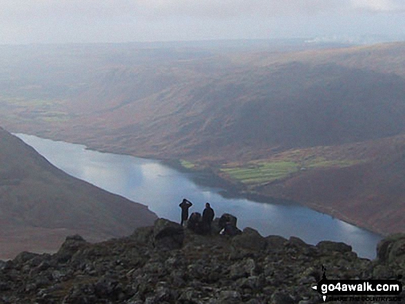
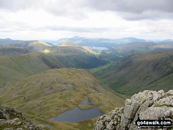
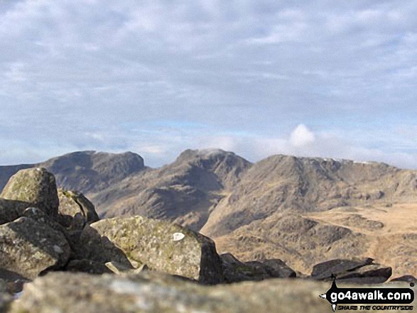
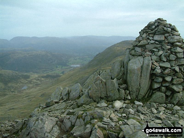
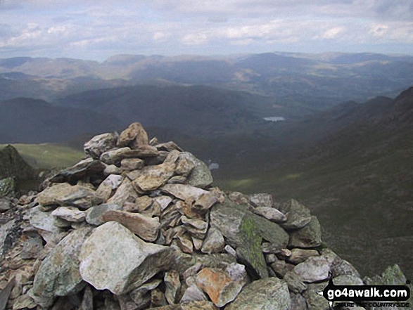
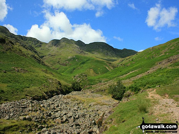
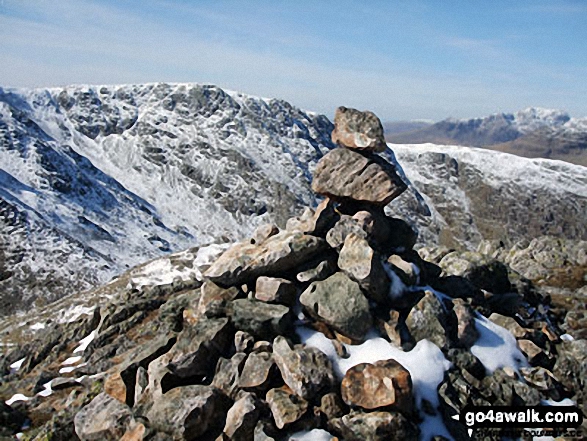
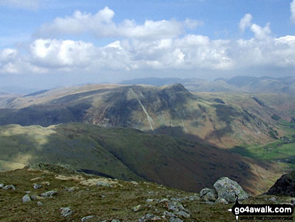
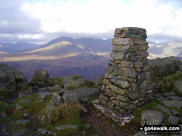
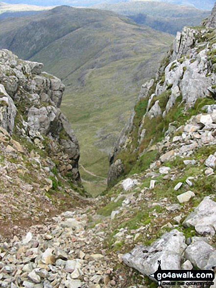
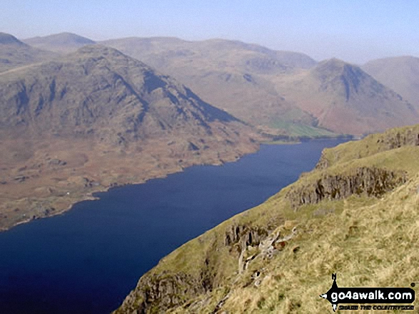
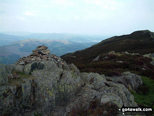
 The view from Scafell Pike in The Southern Fells area of The Lake District
Photo: David Cochrane
# Whether you print a copy or download it to your phone, this Peak Baggers' Map will prove incredibly useful if you want to know what's what when you are up in the mountains and cannot get a phone signal.
Is there a Mountain, Peak, Top or Hill missing from the above google map or list?
Let us know an we will add it to our database.

To contribute to go4awalk.com or to contact us about anything at all - see Talk To Us.
For help see Help.
go4awalk.com and go4awalk.co.uk are registered trademarks of TMDH Limited.
Copyright © 2000-2025 TMDH Limited. All rights reserved.
Copyright Terms & Conditions Privacy Statement
A - Z Walks Home Log On/Accounts Photo Gallery Walk Ideas and Collections Fell Facts Hill Skills Walking Questions and Answers Your Stories News Competitions Product Reviews/Gear Tests Walking Gear Guides Peaks and Mountains Peak Bagging Find New Walking Friends Camping GPS Waypoints for Walking Contents Walk Search Talk To Us go4awalk.com Help Free Example Walks Newsletter


