Interactive Peak Bagging and Mountain/Hill Tick Lists for Bannau Brycheiniog (The Brecon Beacons National Park)
![]()
Bannau Brycheiniog (The Brecon Beacons National Park) is located in South Wales covering part of the counties of Blaenau Gwent, Caerphilly, Carmarthenshire, Merthyr Tydfil, Monmouthshire, Powys, Rhondda Cynon Taf and Torfaen.
It includes mountains and moorland, standing stones and castles, lively waterfalls and unique geology over an area of 1344 sq km (519 sq miles).
The Brecon Beacons range of mountains, from which the park got its original name, comprise six mountains that form a long ridge in the central area of the park, just to the south of Brecon. These mountains were thought to have got their name from the lighting signal fires, or Beacons, on the summits to warn of imminent attack by invaders.
However, since there is no evidence that the lighting of these beacons ever actually happened, the park authorities felt the area warranted a title more in keeping with its Welsh heritage.
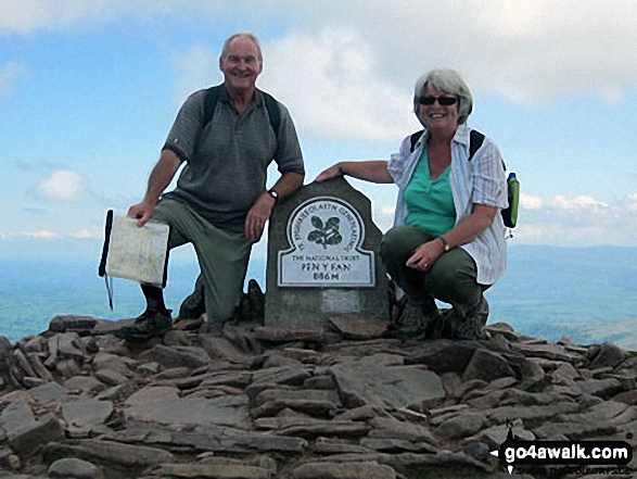 Bagging Pen y Fan in the Bannau Brycheiniog (The Brecon Beacons)
Photo: Terry Merrington
On the 17th April, 2023, to celebrate the 66th anniversary of the area's designation as a National Park, Brecon Beacons National Park officially changed its corporate identity to Bannau Brycheiniog.
Bannau Brycheiniog is pronounced Ban-eye Bruck-ein-iog and translates into english as 'The Peaks of Brychan's Kingdom'.
The main towns and villages to go walking from are: Abergavenny, Bethlehem, Brecon, Brynamman, Capel Gwynfe, Crai, Crickhowell, Defynnog, Hay-on-Wye, Llanddeusant, Llandeilo, Llandovery, Llangadog, Llangorse, Merthyr Tydfil, Myddfai, Pontneddfechan, Sennybridge, Talgarth, Talybont-on-Usk, Trap and Trecastle.
There are 100 classified Mountains, Fells, Peak, Tops and Hills that lie within the boundary of Bannau Brycheiniog (The Brecon Beacons National Park) National Park. All are within the capabilities of an averagely fit walker, hiker or rambler.
To make your peak bagging exploits easier to manage, we have divided Bannau Brycheiniog (The Brecon Beacons National Park) into two distinct areas which are listed below:
- The Brecon Beacons area of Bannau Brycheiniog
(The Brecon Beacons National Park)
61 tops including Pen y Fan, Fan Brycheiniog, Cribyn . . . - The Black Mountains area of Bannau Brycheiniog
(The Brecon Beacons National Park)
39 tops including Waun Fach, Black Mountain, Twmpa (Lord Hereford's Knob) . . . - The Whole of Bannau Brycheiniog
(The Brecon Beacons National Park)
100 tops including Pen y Fan, Fan Brycheiniog, Cribyn, Waun Fach, Black Mountain, Twmpa (Lord Hereford's Knob) . . .


