
![]()
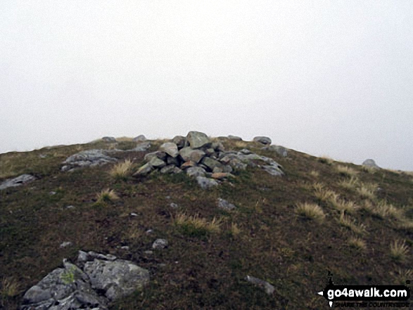
Round How (Scafell)
741m (2432ft)
The Southern Fells, The Lake District, Cumbria, England
Tap/mouse over a coloured circle (1-3 easy walks, 4-6 moderate walks, 7-9 hard walks) and click to select.
Not familiar with this top?
   |
|---|
Vital Statistics:
| Length: | 9.75ml (15.5km) |
|---|---|
| Ascent: | 5,140ft (1,567m) |
| Time: | 8.75hrs |
| Grade: |  (Hard) (Hard) |
Route Summary:
Wasdale Head - (National Trust Campsite) - Wast Water - Lingmell - Middleboot Knotts - Round How (Scafell) - Great End - Ill Crag - Broad Crag - Scafell Pike - Mickledore - Foxes Tarn - Symonds Knott - Sca Fell - Wast Water.
See Round How (Scafell) and the surrounding tops on our free-to-access 'Google Style' Peak Bagging Maps:
The Southern Fells of The Lake District National Park
Less data - quicker to download
The Whole of The Lake District National Park
More data - might take a little longer to download
See Round How (Scafell) and the surrounding tops on our downloadable Peak Bagging Maps in PDF format:

NB: Whether you print off a copy or download it to your phone, these PDF Peak Baggers' Maps might prove incredibly useful when your are up there on the tops and you cannot get a phone signal.
*This version is marked with the walk routes you need to follow to Walk all 214 Wainwrights in just 59 walks.
You can find Round How (Scafell) & all the walks that climb it on these unique free-to-access Interactive Walk Planning Maps:
1:25,000 scale OS Explorer Map (orange/yellow covers):
1:50,000 scale OS Landranger Maps (pink/magenta covers):
 Fellow go4awalkers who have already walked, climbed, summited & bagged Round How (Scafell)
Kevin Foster walked up Round How (Scafell) on May 19th, 2022 [from/via/route] National Trust car park, Brackenclose, Wasdale Head. [with] By myself. [weather] Early cloud on Scafells lifting by midday then sunny. - Another easy one to reach from the corridor route but I'm guessing the prominent cairn on this craggy top is rarely visited by the masses. I felt privileged to have the top to myself on such a sunny day with all the activity around me.
Mark Davidson has climbed Round How (Scafell) [with] Theresa [weather] Good as far as I can remember - Can't remember the date but would have been the late 1990's
Christine Shepherd bagged Round How (Scafell) on October 3rd, 2015 [from/via/route] Walked from Wasdale Head using some of route c271. [with] On my own [weather] Eerie by the time I got to this fell. I had been above the cloud in sunshine on Scafell Pike & Great End but as I left the crowds to bag this fell the sun went in & the mist was swirling round so this fell kept coming & going from view as I approached it. - It feels strange leaving the crowds to go on a very faint path down some scree before climbing this fell but it isn't long before you drop down to the corridor route near Pier's Gill & join a good path again.
Iain Taylor hiked Round How (Scafell) on August 22nd, 2010 [from/via/route] Seathwaite (NY 23591 12285)
To add (or remove) your name and experiences on this page - Log On and edit your Personal Mountain Bagging Record
Send us your photographs and pictures on, of, or from Round How (Scafell)
If you would like to add your walk photographs and pictures featuring views from, on or of Round How (Scafell) to this page, please send them as email attachments (configured for any computer) along with your name to:
and we shall do our best to publish them.
(Guide Resolution = 300dpi. At least = 660pixels (wide) x 440 pixels (high).)

You can also submit photos via our Facebook Page.
NB. Please indicate where each photo was taken and whether you wish us to credit your photos with a Username or your First Name/Last Name.
Not familiar with this top?


