
![]()
Illgill Head
609m (1997ft)
The Southern Fells, The Lake District, Cumbria, England

Not familiar with this top?
You can walk/hike to the top of Illgill Head by using any of these 3 easy‑to‑follow route maps:
Walk c440 Whin Rigg, Illgill Head and Boat How from Miterdale Bridge
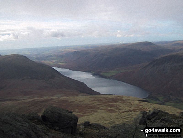
Superb views of Wast Water, the Scafell Massif and the southern fells
   |
|---|
Vital Statistics:
| Length: | 8.75ml (14km) |
|---|---|
| Ascent: | 2,347ft (715m) |
| Time: | 5½ hrs |
| Grade: |  (Moderate) (Moderate) |

Route Summary:
Miterdale Bridge - Porterthwaite - Miterdale Forest - Irton Fell - Greathall Gill - Whin Rigg - Illgill Head - Burnmoor Tarn - Burnmoor Lodge - Eskdale Moor - Ellerhow Moss - Boat How - Low Longrigg - River Mite - Low Place Farm - Miterdale Bridge
Walk c116 Illgill Head and Whin Rigg from Wasdale Head, Wast Water
Superb ridge walk above Lakeland's deepest lake
|
|---|
Vital Statistics:
| Length: | 9ml (14.5km) |
|---|---|
| Ascent: | 2,402ft (732m) |
| Time: | 5.75hrs |
| Grade: | (Moderate) |
Route Summary:
Wasdale Head - (National Trust Campsite) - Wast Water - Lingmell Gill - Illgill Head - Whin Rigg - Greathall Gill - Wasdale Hall Youth Hostel - Wast Water - Wasdale Head
Walk c423 The Wast Water Round from Wasdale Head, Wast Water
Testing hike around Lakeland's deepest lake
|
|---|
Vital Statistics:
| Length: | 15.25ml (24.5km) |
|---|---|
| Ascent: | 4,841ft (1,475m) |
| Time: | 10½ hrs |
| Grade: |  (Very Hard) (Very Hard) |

Route Summary:
Wasdale Head - (National Trust Campsite) - Wast Water - Lingmell Gill - Illgill Head - Whin Rigg - Greathall Gill - Low Wood - Lund Bridge - Woodhow Farm - Woodhow Tarn - Scale Farm - Tosh Tarn - Gill Farm - Gill Beck - Buckbarrow - Cold Well - Nether Wasdale Common - Seatallan - Windscale Hows - Middle Fell (Wasdale) - Greendale Farm - Nether Beck - Overbeck Bridge - Wasdale Head - Wast Water.
See Illgill Head and the surrounding tops on our free-to-access 'Google Style' Peak Bagging Maps:
The Southern Fells of The Lake District National Park
Less data - quicker to download
The Whole of The Lake District National Park
More data - might take a little longer to download
See Illgill Head and the surrounding tops on our unique, downloadable, PDF Peak Bagging Maps:

NB: Whether you print off a copy or download it to your phone, these PDF Peak Baggers' Maps might prove incredibly useful when your are up there on the tops and you cannot get a phone signal.
*This version is marked with the walk routes you need to follow to Walk all 214 Wainwrights in just 59 walks.
You can find Illgill Head & all the walks that climb it on these unique free-to-access Interactive Walk Planning Maps:
1:25,000 scale OS Explorer Map (orange/yellow covers):
1:50,000 scale OS Landranger Map (pink/magenta covers):
 Fellow go4awalkers who have already walked, climbed, scaled, summited, hiked & bagged Illgill Head
Caroline Winter walked up Illgill Head on October 13th, 2024 [from/via/route] Wasdale road, NT car park, Illgill head, Whinn Rigg, gill, river Irt, Wastwater [with] Solo [weather] Warm, wind 10mph, clear views over Soloway & Wasdale Fells - NT volunteers stopping walkers to Scafell Pike to check if correctly equipped & giving out maps of route as increase in Mountain Rescue call outs. Great views from tops of fells already bagged.
Geoff Hand climbed it on June 29th, 2024 [from/via/route] Walk C440 Whin Rigg, Illgill Head from Miterdale Bridge [with] Claire my daughter [weather] Cold claggy & wet - did the walk as part of the Wainwright Challenge 2024, which was to put someone on top of every Wainwright in one day. Unfortunately it was a wet & miserable day. We didn't get to see a thing. We missed our Boat How as it would have meant walking infront of Burnmoor Tarn which looked really wet & boggy.It is an outlying Wainwright in any case so wouldn't count.
Ian Ashton bagged it on March 29th, 2024 [with] Solo
Pete George hiked Illgill Head on December 13th, 2023 [from/via/route] Wasdale [with] Roco [weather] Quite pleasant
James Hughes summited on July 9th, 2023 [from/via/route] From Wasdale Head Inn through NT campsite over Illgill Head & Whinn Rigg, back up Miterdale. [with] Paul [weather] Beautiful day, some cloud to start with & that cleared & was warmer when dropped back into valley. - Couple of Ritson's & an underwhelming Pork Pie before a drive back over Hard Knott Pass - lovely weekend.
To add (or remove) your name and experiences on this page - Log On and edit your Personal Mountain Bagging Record
. . . [see more walk reports]
More Photographs & Pictures of views from, on, or of, Illgill Head
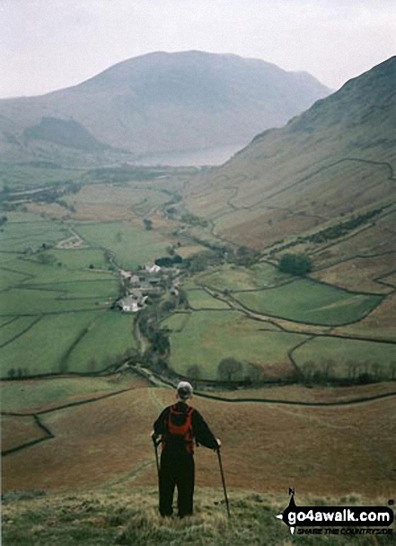

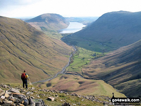
Wasdale featuring Lingmell (left), Illgill Head and Whin Rigg (left of centre in the distance), Wast Water (centre) and Yewbarrow (right) from Westmorland Cairn near the summit of Great Gable
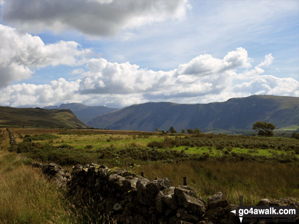
The Wasdale Screes below Illgill Head (centre) and Whin Rigg (right) from Ponsonby Fell
Illgill Head (left) Wasdale, Wast Water and Yewbarrow from Westmorland Cairn, Great Gable
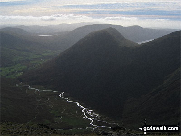
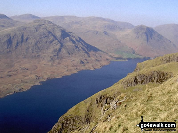
Wasdale Head (left), Burnmoor Tarn, Yewbarrow (front centre), Illgill Head (back) and Wast Water from Pillar

Illgill Head (left) and Whin Rigg (right) above the Wast Water screes from Buckbarrow

The Wasdale Valley featuring Lingmell (left), Illgill Head and Whin Rigg (left of centre in the distance), Wast Water (centre) and Yewbarrow (right) from near Westmorland Cairn on the summit of Great Gable

. . . see all 41 walk photographs & pictures of views from, on, or of, Illgill Head
Send us your photographs and pictures on, of, or from Illgill Head
If you would like to add your walk photographs and pictures to this page, please send them as email attachments (configured for any computer) along with your name to:
and we shall do our best to publish them.
(Guide Resolution = 300dpi. At least = 660pixels (wide) x 440 pixels (high).)

You can also submit photos via our Facebook Page.
NB. Please indicate where each photo was taken and whether you wish us to credit your photos with a Username or your First Name/Last Name.


