Peak Bagging the 74 Mountains, Tops, Peaks and Hills in Loch Lomond and The Trossachs National Park, Scotland
Loch Lomond and The Trossachs National Park is located in Central Scotland, covering parts of Argyll and Bute, Perth and Kinross, Stirlingshire and West Dumbartonshire.
There are 74 'tops' to walk up, bag and conquer, the highest point is Ben More (The Crianlarich Hills) and the area includes:
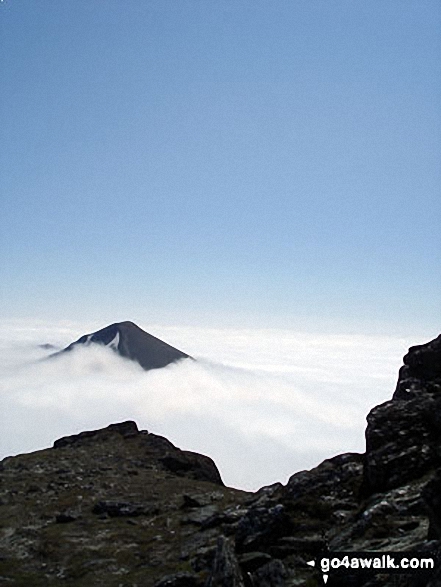
 Ben More (The Crianlarich Hills), the highest point in Loch Lomond and The Trossachs
Photo: Adam Shewry
| 21 | Munros | |
| 15 | Corbetts | |
| 19 | Grahams | |
| 0 | Donalds | |
| 26 | Murdos | |
| 64 | Marilyns | |
| 2 | Hills (aka Bridgets) and | |
| 18 | Mountains, Tops, Peaks or Hills with a Trig Point on or near the top |
View these Mountains, Peaks, Tops and Hills in Loch Lomond and The Trossachs:
- On an Interactive Google Map (loads faster)
- On an Interactive Google Map with a list of tops below it.
(makes it easier to locate a particular top) - On a Detailed List in:
Alphabetical Order | Height Order - On one page with 'yet-to-be-bagged' listed 1st & then 'already-bagged' tops listed 2nd in:
Alphabetical Order | Height Order - On one page with 'already-bagged' tops listed 1st & then 'yet-to-be-bagged' tops listed 2nd in:
Alphabetical Order | Height Order


