
![]()
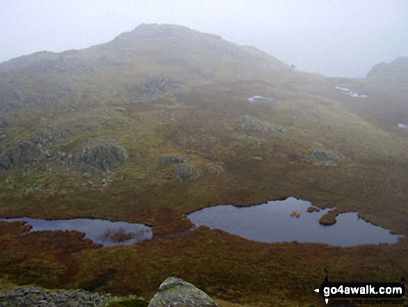
Combe Head
735m (2412ft)
The Southern Fells, The Lake District, Cumbria, England
Tap/mouse over a coloured circle (1-3 easy walks, 4-6 moderate walks, 7-9 hard walks) and click to select.

Not familiar with this top?
   |
|---|
Vital Statistics:
| Length: | 10.5ml (17km) |
|---|---|
| Ascent: | 3,407ft (1,038m) |
| Time: | 7.25hrs |
| Grade: |  (Hard) (Hard) |

Route Summary:
Seatoller - Big Stanger Gill - Hanging Haystack Crag - Alisongrass Crag - Rosthwaite Fell (Bessyboot) - Tarn At Leaves - Rosthwaite Cam (Rosthwaite Fell) - Dovenest Top - Combe Door Top - Combe Head - Glaramara - Looking Steads (Glaramara) - Red Beck Top - High House Tarn Top - Allen Crags - Sprinking Tarn - Seathwaite Fell (South Top) - Seathwaite Fell - Grains Gill - The Allerdale Ramble - Stockley Bridge - Seathwaite (Borrowdale) - Thornythwaite Farm - Strands Bridge - The River Derwent - Seatoller
|
|---|
Vital Statistics:
| Length: | 10.5ml (17km) |
|---|---|
| Ascent: | 3,384ft (1,031m) |
| Time: | 7.25hrs |
| Grade: | (Hard) |

Route Summary:
Stonethwaite - Big Stanger Gill - Hanging Haystack Crag - Alisongrass Crag - Rosthwaite Fell (Bessyboot) - Tarn At Leaves - Rosthwaite Cam (Rosthwaite Fell) - Dovenest Top - Combe Door Top - Combe Head - Glaramara - Looking Steads (Glaramara) - Red Beck Top - High House Tarn Top - Allen Crags - Esk Hause - Allencrags Gill - Langstrath - Stonethwaite
See Combe Head and the surrounding tops on our free-to-access 'Google Style' Peak Bagging Maps:
The Southern Fells of The Lake District National Park
Less data - quicker to download
The Whole of The Lake District National Park
More data - might take a little longer to download
See Combe Head and the surrounding tops on our downloadable Peak Bagging Maps in PDF format:

NB: Whether you print off a copy or download it to your phone, these PDF Peak Baggers' Maps might prove incredibly useful when your are up there on the tops and you cannot get a phone signal.
*This version is marked with the walk routes you need to follow to Walk all 214 Wainwrights in just 59 walks.
You can find Combe Head & all the walks that climb it on these unique free-to-access Interactive Walk Planning Maps:
1:25,000 scale OS Explorer Map (orange/yellow covers):
1:50,000 scale OS Landranger Maps (pink/magenta covers):
 Fellow go4awalkers who have already walked, climbed, summited & bagged Combe Head
John Ramsbottom walked up Combe Head on March 16th, 2025 [from/via/route] Dow Cragg, The Old Man of Coniston,Brim Fell,Swirl How, Great Carrs & Grey Friar. Start from Seatoller, Rosthwaite Fell, Glaramara, Allen Crags & Seathwaite Fell [with] Lola [weather] Fine, Odd shower, chilly wind - First one in a while. First of 2025. Felt hard
Paul Macey climbed it on June 22nd, 2021 [from/via/route] Walk 139 [with] Luke Macey [weather] Sunny
Darren Mortimer bagged it on June 7th, 2017 [with] Dermot Palmer [weather] Warm & sunny.
Caroline Winter hiked Combe Head on November 29th, 2022 [from/via/route] Seatoller CP, Strands bridge, Thornythwaite Fell, scramble up Combe gill, Combe Head, Dovenest Top, Tarn at Leaves, down the track to car [with] Alone [weather] Clear, sunny, & inverted cloud formations - Had planned to finish the HEWITTS in September & that was the official completion for me, but Combe Head had been added as a newer inclusion. Frustratingly, I had not included it in the Glaramara top. First time walked up Combe Gill route & the path was difficult to follow & due to excess rainfall, very slippery. Ended up scrambling up the hill to gain the top. Stunning scenery today. Way back, did Dove Nest crag a third time & decided against the steep short cut to Seathwaite, due to the we rocks.
Stephen Eddy summited on October 28th, 2022 [from/via/route] Seatoller [with] Sinead O'Callaghan, Martin & Tracey Bayliss [weather] Dry, very windy at summit
To add (or remove) your name and experiences on this page - Log On and edit your Personal Mountain Bagging Record
. . . [see more walk reports]
More Photographs & Pictures of views from, on or of Combe Head

Send us your photographs and pictures on, of, or from Combe Head
If you would like to add your walk photographs and pictures to this page, please send them as email attachments (configured for any computer) along with your name to:
and we shall do our best to publish them.
(Guide Resolution = 300dpi. At least = 660pixels (wide) x 440 pixels (high).)

You can also submit photos via our Facebook Page.
NB. Please indicate where each photo was taken and whether you wish us to credit your photos with a Username or your First Name/Last Name.


