
![]()
Lingmoor Fell
469m (1539ft)
The Southern Fells, The Lake District, Cumbria, England
Not familiar with this top?
   |
|---|
Vital Statistics:
| Length: | 7ml (11km) |
|---|---|
| Ascent: | 1,920ft (585m) |
| Time: | 4½ hrs |
| Grade: |  (Moderate) (Moderate) |

Route Summary:
Elterwater - Blea Tarn (Langdale) - Side Pike - Fat Man's Agony (or Fat Man's Struggle) - Lingmoor Fell - Dale End - Birk Howe - Slater Bridge - Little Langdale Tarn - Bridge End - Fell Foot Bridge - Castle Howe - Blea Tarn (Langdale) - Elterwater
|
|---|
Vital Statistics:
| Length: | 7ml (11km) |
|---|---|
| Ascent: | 1,976ft (602m) |
| Time: | 4½ hrs |
| Grade: | (Moderate) |
Route Summary:
Elterwater - Elterwater Bridge - Dale End - Lingmoor Fell - Fat Man's Agony (or Fat Man's Struggle) - Side Pike - Great Langdale - Side House Farm - The Cumbria Way - Oak Howe - Chapel Stile - Elterwater Bridge - Elterwater
See Lingmoor Fell and the surrounding tops on our free-to-access 'Google Style' Peak Bagging Maps:
The Southern Fells of The Lake District National Park
Less data - quicker to download
The Whole of The Lake District National Park
More data - might take a little longer to download
See Lingmoor Fell and the surrounding tops on our downloadable Peak Bagging Maps in PDF format:

NB: Whether you print off a copy or download it to your phone, these PDF Peak Baggers' Maps might prove incredibly useful when your are up there on the tops and you cannot get a phone signal.
*This version is marked with the walk routes you need to follow to Walk all 214 Wainwrights in just 59 walks.
You can find Lingmoor Fell & all the walks that climb it on these unique free-to-access Interactive Walk Planning Maps:
1:25,000 scale OS Explorer Maps (orange/yellow covers):
1:50,000 scale OS Landranger Map (pink/magenta covers):
 Fellow go4awalkers who have already walked, climbed, summited & bagged Lingmoor Fell
Nick Tippins walked up Lingmoor Fell on September 24th, 2025 [from/via/route] c238: Lingmoor Fell & Side Pike from Elterwater [with] Fran
Andrew Gayne climbed Lingmoor Fell on July 13th, 2025 [from/via/route] Elterwater [with] Becky Gayne [weather] 3rd heatwave of the year, boiling hot & breathless - Drove up to Elterwater & had a drink in the pub before setting off at 1.30pm. Despite being one of the smallest fells we found it very hard due to the weather. Up the fell & across the ridge with great views to Side Pike then dropped onto the road & walked back along the valley beneath the Langdale Pikes. Long & tiring
James Hughes bagged Lingmoor Fell on April 4th, 2025 [from/via/route] c238 Lingmoor Fell from Elterwater [weather] Glorious sunny day. - Walk from Wainwright Inn. Climb up to Dale End & then up to Lingmoor Fell summit cairn. Tricky descent in places due to path choice. Not enough time for Side Pike. Took route that joined Cumbria Way to return through campsite for pint at Wainwright Inn.
Claire Kirk hiked Lingmoor Fell on October 5th, 2024 [from/via/route] Elterwater [with] Gareth [weather] Warm & sunny
David Higginbottom summited Lingmoor Fell on October 6th, 2024 [from/via/route] From old dungeon in Langdale [with] Carolyn [weather] Misty - Nice walk
Pete George conquered Lingmoor Fell on December 12th, 2023 [from/via/route] Derwentwater car park [with] Roco [weather] Misty & damp
Tim Winn scaled Lingmoor Fell on September 29th, 2023 [with] Barry, Paul and Andy [weather] Cloudy
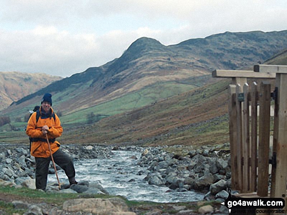
Christine Shepherd walked up Lingmoor Fell on April 10th, 2010 [from/via/route] Used walk c206 from Elterwater. Climbed again from the bottom of Side Pike 3.9.20 Climbed for a third time with six lovely walkers from Mountain Madness on 18.03.2023 from Elterwater, following the route of c238. [with] On my own [weather] Lovely - Was glad there was someone to help me with my rucksack through Fat Man's Struggle (a.k.a. Fat Man's Agony)!
Emma Simmonds climbed Lingmoor Fell on February 13th, 2018 [from/via/route] From Blea Tarn, onto Side Pike & via Fat Man's Agony into Lingmoor. [with] Kevin, Sam, Belle and the Martins. [weather] Dry, low cloud at the top, cool.
Stephen Batson bagged Lingmoor Fell on January 21st, 2023 [with] Clare [weather] Sunny
To add (or remove) your name and experiences on this page - Log On and edit your Personal Mountain Bagging Record
. . . [see more walk reports]
More Photographs & Pictures of views from, on or of Lingmoor Fell
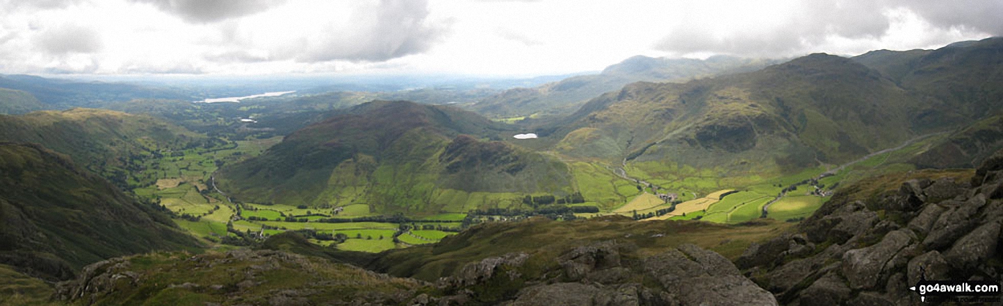
Blea Rigg, Castle How, Lang How and Silver How (far left) Great Langdale, Windermere and Elter Water (left), Lingmoor Fell and Side Pike (centre left), Blea Tarn and Little Langdale (centre right), Pike of Blisco (Pike o' Blisco) right and Crickle Crags (far right) from the summit of Harrison Stickle, The Langdale Pikes
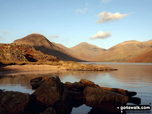
Yewbarrow (left), the shoulder of Kirk Fell, Great Gable (centre) and Lingmoor Fell (right) from Wast Water
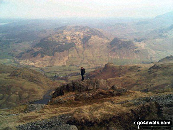
Great Langdale, Lingmoor Fell and Lake Windermere from the summit of Harrison Stickle
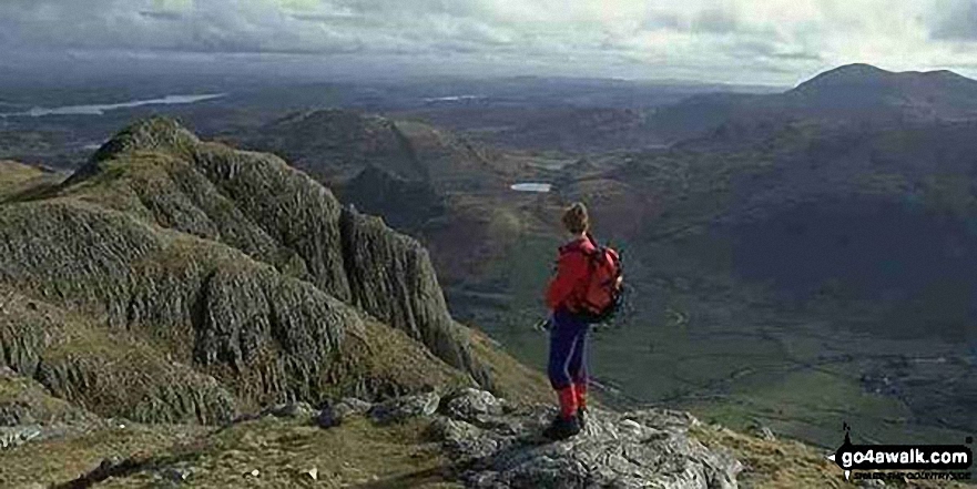
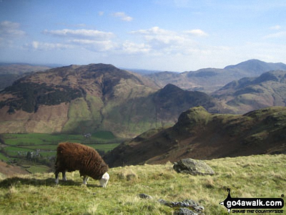
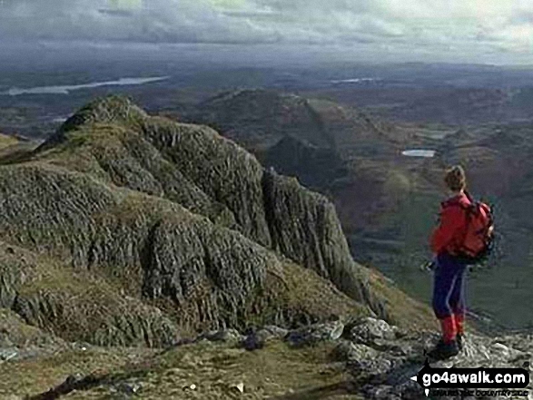
Me on the summit of Pike of Stickle, The Langdale Pikes with Windermere (far left), Loft Crag (near left), Lingmoor Fell (across Great Langdale), Blea Tarn (centre) and Pike of Blisco (right)
Me on Pavey Ark at the top of Jack's Rake, The Langdale Pikes with Lingmoor Fell across Great Langdale Valley in the background
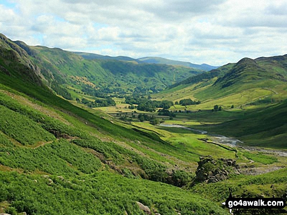
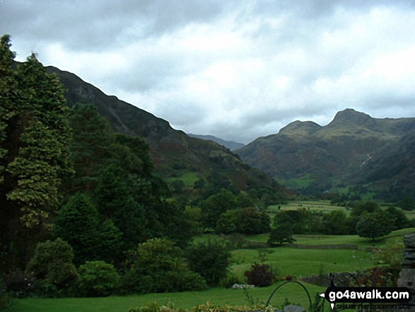
Great Langdale with Blea Rigg, Lang How and Silver How (left) and Lingmoor Fell (right) from the foot of Oxendale
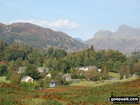
*The Langdale Pikes (left), Great Langdale (centre) and Side Pike and Lingmoor Fell (right) from Pike of Blisco (Pike o' Blisco)
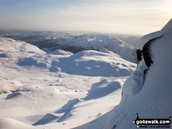
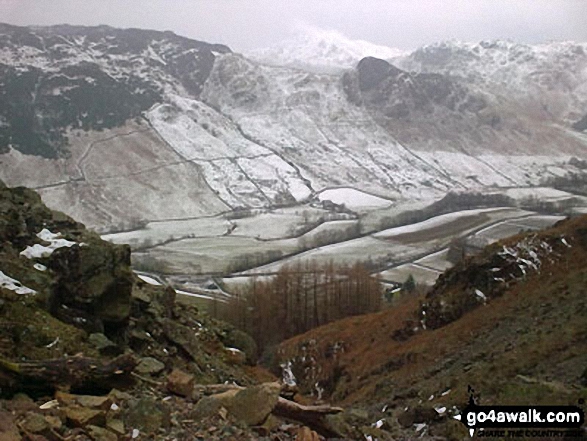
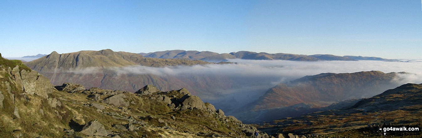
Looking down a very snowy Stickle Ghyll to Great Langdale with Lingmoor Fell beyond from Stickle Tarn
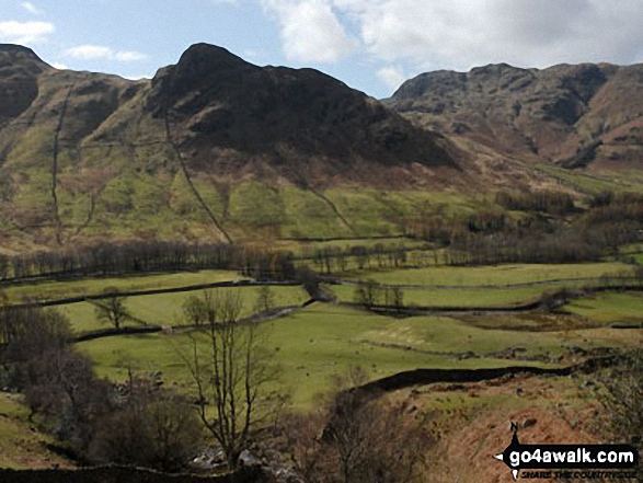
Looking across Great Langdale to Lingmoor Fell and Side Pike with Pike of Blisco (Pike o' Blisco) beyond from Stickle Ghyll below The Langdale Pikes
Looking across Great Langdale to Side Pike and Lingmoor Fell from Stickle Ghyll, The Langdale Pikes
Side Pike and Lingmoor Fell from Redacre Gill below Pike of Blisco (Pike o' Blisco)
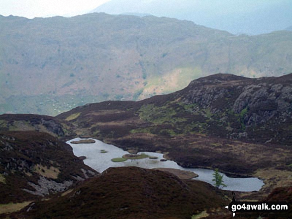
The view from Sergeant Man featuring Blea Rigg (centre left),Lingmoor Fell (distance centre), Stickle Tarn (partially hidden) and the shoulder of Pavey Ark (The Langdale Pikes) (right)
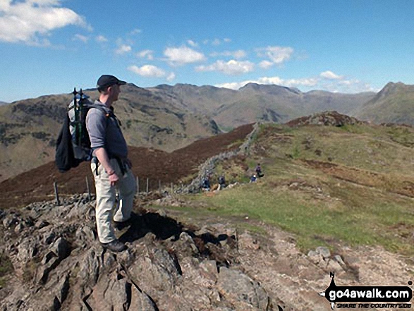
Me on the summit of Pike of Stickle, The Langdale Pikes with Windermere (far left), Loft Crag (near left), Lingmoor Fell (across Great Langdale) and Blea Tarn (right)
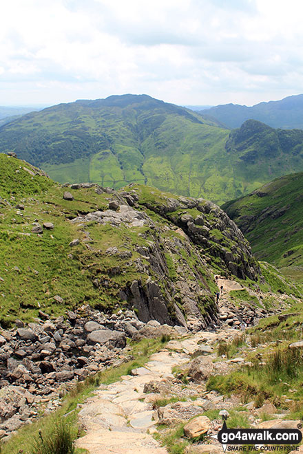
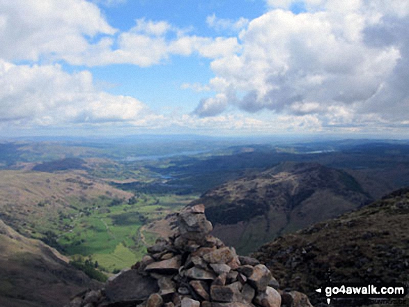
Looking back down the path up to Stickle Tarn with Lingmoor Fell in the background
. . . see all 22 walk photographs & pictures of views from, on or of Lingmoor Fell
Send us your photographs and pictures on, of, or from Lingmoor Fell
If you would like to add your walk photographs and pictures featuring views from, on or of Lingmoor Fell to this page, please send them as email attachments (configured for any computer) along with your name to:
and we shall do our best to publish them.
(Guide Resolution = 300dpi. At least = 660pixels (wide) x 440 pixels (high).)

You can also submit photos via our Facebook Page.
NB. Please indicate where each photo was taken and whether you wish us to credit your photos with a Username or your First Name/Last Name.
Not familiar with this top?


