All the Mountains, Peaks, Tops and Hills in Wales, Wales as a detailed list
Wales is defined as the whole of the principality of Wales which includes the National Parks of Snowdonia,
Bannau Brycheiniog (The Brecon Beacons) and The Pembrokeshire Coast as well as Mynyddoedd Cambria (The Cambrian Mountains), Radnor Forest, Anglesey, The Llynn Peninsula, The Preseli Mountains and The Gower Peninsula.
If you count only the Mountains (Hewitts) there are 136 tops to climb, bag & conquer and the highest point is Snowdon (Yr Wyddfa) at 1,085m (3,561ft).
When logged on, you can mark each Mountain, Peak, Top or Hill as 'bagged' by either:
- if you opt to display the tops in this area using a google map, click or tap on its symbol on the map below. This will open a text window. Click or tap on the 'Record [mountain name] as Bagged, Climbed & Conquered' link towards the bottom of the text window, or
- if you opt to display the tops in this area as a list, click or tap on the red 'not yet' symbol to the right of the name of each 'top'
Either method will open a new page where you can complete all your details such as:
- when you bagged the Mountain, Peak, Top or Hill;
- which route you took
- who you went with
- what the weather was like
- any other comment that will remind you of the day
Once you have completed your details and click or tap the submit button, you will automatically return to this page and the top you bagged will show with a green tick.
NB. None of the above fields are 'mandatory' - you can leave them blank if you wish.
NNB. You also have the option whether to display your peak bagging exploits to other users of this site or keep them private so only you can see them when you are logged on.
Furthermore, since you can also access your Personal Mountain & Hill Bagging Record via go4awalk Mobile you can quickly & easily record, edit and view your achievements - whether you are at home/work on your desktop computer or in the pub/at the top of a mountain with your Mobile Phone. (You can even download your Personal Mountain & Hill Bagging Record as a .csv file for importing into and saving with spreadsheet software like Excel or NeoOffice!)
This facility costs one credit to initially access your personal bagging record. Once accessed, all other interactions, such as recording other Mountains, Peaks, Tops and Hills as 'bagged' or altering an existing bagging record, are free.
Click REGISTER to register and purchase credits.
LOG ON and RELOAD this page to show which Mountains, Peaks, Tops and Hills you have already climbed, bagged & conquered. [ . . . remove this text]
Page 2 of 5 Go to page:
1 2 3 4 5 |
See this list in: Alphabetical Order
| Height Order‡
To reverse the order select the link again.
Mountain, Peak, Top or Hill:
Bagged
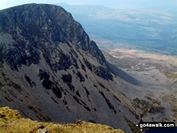
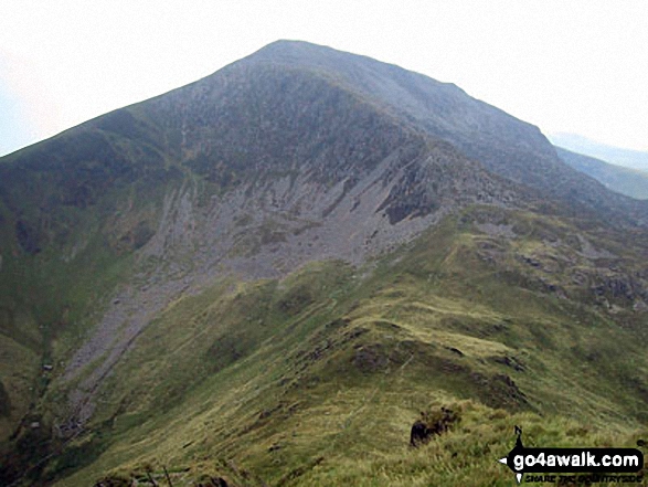
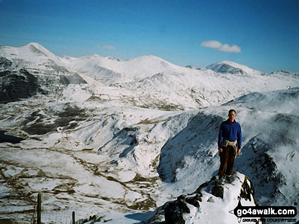
31. Cyfrwy
811m (2,662ft)
Mountain (31st in Wales, 68th in England & Wales)
Nuttall (39th in Wales, 82nd in England & Wales)
To walk, climb & bag Cyfrwy use any of these easy to follow walks:
See the location of Cyfrwy and walks up it on a google MapCyfrwy is on interactive maps:
OS Explorer (Orange Covers): OL23
OS Landranger (Pink Covers): 124
Cyfrwy is on downloadable PDF you can Print or Save to your Phone:
|
32. Waun Fach
811m (2,662ft)
Mountain (32nd in Wales, 69th in England & Wales)
Nuttall (40th in Wales, 83rd in England & Wales)
Marilyn (14th in Wales, 368th in GB)
OS Trig Point
To walk, climb & bag Waun Fach use either of these easy to follow walks:
See the location of Waun Fach and walks up it on a google MapWaun Fach is on interactive maps:
OS Explorer (Orange Covers): OL13
OS Landranger (Pink Covers): 161
Waun Fach is on downloadable PDF you can Print or Save to your Phone:
|
33. Y Foel Goch
805m (2,642ft)
Mountain (33rd in Wales, 72nd in England & Wales)
Nuttall (42nd in Wales, 87th in England & Wales)
To walk, climb & bag Y Foel Goch use either of these easy to follow walks:
See the location of Y Foel Goch and walks up it on a google MapY Foel Goch is on interactive maps:
OS Explorer (Orange Covers): OL17
OS Landranger (Pink Covers): 115
Y Foel Goch is on downloadable PDF you can Print or Save to your Phone:
|
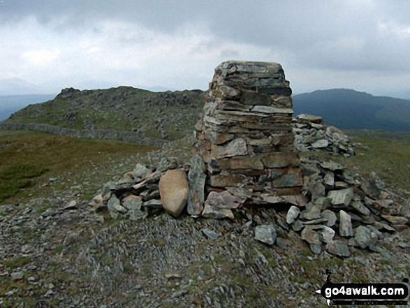
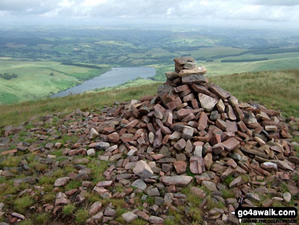
34. Fan Brycheiniog (Twr y Fan Foel)
802m (2,632ft)
Mountain (34th in Wales, 76th in England & Wales)
Nuttall (43rd in Wales, 91st in England & Wales)
Marilyn (15th in Wales, 390th in GB)
OS Trig Point
Fan Brycheiniog (Twr y Fan Foel) became the local Mountain (Hewitt) and 'Nuttall' after a survey found the top to be 0.75m higher than the Trig Point.
To walk, climb & bag Fan Brycheiniog (Twr y Fan Foel) use either of these easy to follow walks:
See the location of Fan Brycheiniog (Twr y Fan Foel) and walks up it on a google MapFan Brycheiniog (Twr y Fan Foel) is on interactive maps:
OS Explorer (Orange Covers): OL12
OS Landranger (Pink Covers): 160
Fan Brycheiniog (Twr y Fan Foel) is on downloadable PDF you can Print or Save to your Phone:
|
35. Pen y Gadair Fawr
800m (2,625ft)
Mountain (35th in Wales, 79th in England & Wales)
Nuttall (45th in Wales, 95th in England & Wales)
To walk, climb & bag Pen y Gadair Fawr use either of these easy to follow walks:
See the location of Pen y Gadair Fawr and walks up it on a google MapPen y Gadair Fawr is on interactive maps:
OS Explorer (Orange Covers): OL13
OS Landranger (Pink Covers): 161
Pen y Gadair Fawr is on downloadable PDF you can Print or Save to your Phone:
|
36. Pen Llithrig y Wrach
799m (2,622ft)
Mountain (36th in Wales, 80th in England & Wales)
Nuttall (46th in Wales, 96th in England & Wales)
Marilyn (16th in Wales, 395th in GB)
To walk, climb & bag Pen Llithrig y Wrach use any of these easy to follow walks:
See the location of Pen Llithrig y Wrach and walks up it on a google MapPen Llithrig y Wrach is on interactive maps:
OS Explorer (Orange Covers): OL17
OS Landranger (Pink Covers): 115
Pen Llithrig y Wrach is on downloadable PDF you can Print or Save to your Phone:
|
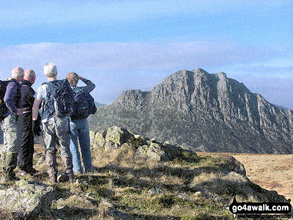
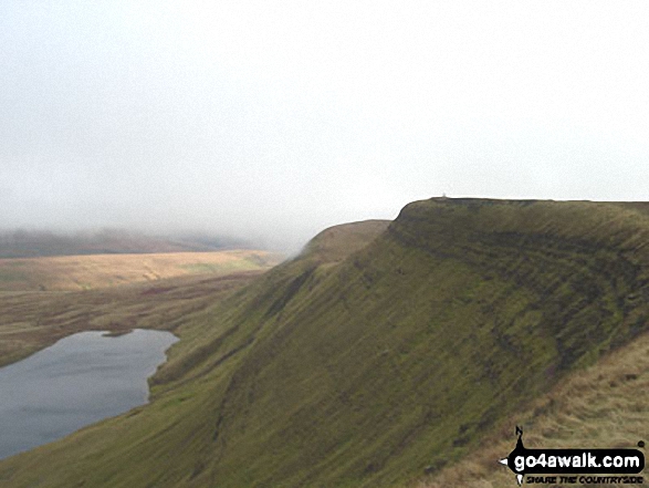
37. Cribyn
795m (2,609ft)
Mountain (37th in Wales, 82nd in England & Wales)
Nuttall (47th in Wales, 99th in England & Wales)
To walk, climb & bag Cribyn use any of these easy to follow walks:
See the location of Cribyn and walks up it on a google MapCribyn is on interactive maps:
OS Explorer (Orange Covers): OL12
OS Landranger (Pink Covers): 160
Cribyn is on downloadable PDF you can Print or Save to your Phone:
|
38. Craig Cwm Amarch
791m (2,596ft)
Mountain (38th in Wales, 86th in England & Wales)
Nuttall (49th in Wales, 105th in England & Wales)
To walk, climb & bag Craig Cwm Amarch use any of these easy to follow walks:
See the location of Craig Cwm Amarch and walks up it on a google MapCraig Cwm Amarch is on interactive maps:
OS Explorer (Orange Covers): OL23
OS Landranger (Pink Covers): 124
Craig Cwm Amarch is on downloadable PDF you can Print or Save to your Phone:
|
39. Cadair Bronwen
783m (2,570ft)
Mountain (39th in Wales, 92nd in England & Wales)
Nuttall (50th in Wales, 112th in England & Wales)
To walk, climb & bag Cadair Bronwen use any of these easy to follow walks:
See the location of Cadair Bronwen and walks up it on a google MapCadair Bronwen is on interactive maps:
OS Explorer (Orange Covers): 255
OS Landranger (Pink Covers): 125
Cadair Bronwen is on downloadable PDF you can Print or Save to your Phone:
|
40. Moel Hebog
783m (2,569ft)
Mountain (40th in Wales, 94th in England & Wales)
Nuttall (51st in Wales, 114th in England & Wales)
Marilyn (17th in Wales, 425th in GB)
OS Trig Point
To walk, climb & bag Moel Hebog use this easy to follow walk:
See the location of Moel Hebog and walks up it on a google MapMoel Hebog is on interactive maps:
OS Explorer (Orange Covers): OL17
OS Landranger (Pink Covers): 115
Moel Hebog is on downloadable PDF you can Print or Save to your Phone:
|
41. Glasgwm
779m (2,556ft)
Mountain (41st in Wales, 95th in England & Wales)
Nuttall (52nd in Wales, 117th in England & Wales)
Marilyn (18th in Wales, 432nd in GB)
To walk, climb & bag Glasgwm use this easy to follow walk:
See the location of Glasgwm and walks up it on a google MapGlasgwm is on interactive maps:
OS Explorer (Orange Covers): OL23
OS Landranger (Pink Covers): 124 and
125
Glasgwm is on downloadable PDF you can Print or Save to your Phone:
|
42. Drum (Carneddau)
771m (2,530ft)
Mountain (42nd in Wales, 102nd in England & Wales)
Nuttall (53rd in Wales, 126th in England & Wales)
To walk, climb & bag Drum (Carneddau) use any of these easy to follow walks:
See the location of Drum (Carneddau) and walks up it on a google MapDrum (Carneddau) is on interactive maps:
OS Explorer (Orange Covers): OL17
OS Landranger (Pink Covers): 115
Drum (Carneddau) is on downloadable PDF you can Print or Save to your Phone:
|
43. Moelwyn Mawr
770m (2,527ft)
Mountain (43rd in Wales, 103rd in England & Wales)
Nuttall (54th in Wales, 127th in England & Wales)
Marilyn (19th in Wales, 448th in GB)
OS Trig Point
To walk, climb & bag Moelwyn Mawr use any of these easy to follow walks:
See the location of Moelwyn Mawr and walks up it on a google MapMoelwyn Mawr is on interactive maps:
OS Explorer (Orange Covers): OL18
OS Landranger (Pink Covers): 124
Moelwyn Mawr is on downloadable PDF you can Print or Save to your Phone:
|
44. Waun Rydd
769m (2,524ft)
Mountain (44th in Wales, 105th in England & Wales)
Nuttall (55th in Wales, 129th in England & Wales)
Marilyn (20th in Wales, 452nd in GB)
OS Trig Point
To walk, climb & bag Waun Rydd use any of these easy to follow walks:
See the location of Waun Rydd and walks up it on a google MapWaun Rydd is on interactive maps:
OS Explorer (Orange Covers): OL12
OS Landranger (Pink Covers): 160
Waun Rydd is on downloadable PDF you can Print or Save to your Phone:
|
45. Gallt yr Ogof
763m (2,504ft)
Mountain (45th in Wales, 108th in England & Wales)
Nuttall (56th in Wales, 132nd in England & Wales)
To walk, climb & bag Gallt yr Ogof use either of these easy to follow walks:
See the location of Gallt yr Ogof and walks up it on a google MapGallt yr Ogof is on interactive maps:
OS Explorer (Orange Covers): OL17
OS Landranger (Pink Covers): 115
Gallt yr Ogof is on downloadable PDF you can Print or Save to your Phone:
|
46. Fan Hir
760m (2,494ft)
Mountain (46th in Wales, 112th in England & Wales)
Nuttall (57th in Wales, 136th in England & Wales)
To walk, climb & bag Fan Hir use either of these easy to follow walks:
See the location of Fan Hir and walks up it on a google MapFan Hir is on interactive maps:
OS Explorer (Orange Covers): OL12
OS Landranger (Pink Covers): 160
Fan Hir is on downloadable PDF you can Print or Save to your Phone:
|
47. Drosgl
758m (2,488ft)
Mountain (47th in Wales, 113th in England & Wales)
Nuttall (58th in Wales, 137th in England & Wales)
To walk, climb & bag Drosgl use either of these easy to follow walks:
See the location of Drosgl and walks up it on a google MapDrosgl is on interactive maps:
OS Explorer (Orange Covers): OL17
OS Landranger (Pink Covers): 115
Drosgl is on downloadable PDF you can Print or Save to your Phone:
|
48. Y Llethr
756m (2,481ft)
Mountain (48th in Wales, 115th in England & Wales)
Nuttall (59th in Wales, 141st in England & Wales)
Marilyn (21st in Wales, 475th in GB)
To walk, climb & bag Y Llethr use this easy to follow walk:
See the location of Y Llethr and walks up it on a google MapY Llethr is on interactive maps:
OS Explorer (Orange Covers): OL18
OS Landranger (Pink Covers): 124
Y Llethr is on downloadable PDF you can Print or Save to your Phone:
|
49. Pen Pumlumon Fawr (Plynlimon)
752m (2,468ft)
Mountain (49th in Wales, 118th in England & Wales)
Nuttall (61st in Wales, 145th in England & Wales)
Marilyn (22nd in Wales, 479th in GB)
OS Trig Point
Pen Pumlumon Fawr (Plynlimon) is the highest point in the county of Ceredigion.
To walk, climb & bag Pen Pumlumon Fawr (Plynlimon) use this easy to follow walk:
See the location of Pen Pumlumon Fawr (Plynlimon) and walks up it on a google MapPen Pumlumon Fawr (Plynlimon) is on interactive maps:
OS Explorer (Orange Covers): 213
OS Landranger (Pink Covers): 135
A downloadable go4awalk.com PDF Peak Bagging Map featuring Pen Pumlumon Fawr (Plynlimon) will be available soon. |
50. Moel Llyfnant
751m (2,465ft)
Mountain (50th in Wales, 119th in England & Wales)
Nuttall (62nd in Wales, 146th in England & Wales)
Marilyn (23rd in Wales, 480th in GB)
To walk, climb & bag Moel Llyfnant use either of these easy to follow walks:
See the location of Moel Llyfnant and walks up it on a google MapMoel Llyfnant is on interactive maps:
OS Explorer (Orange Covers): OL18 and
OL23
OS Landranger (Pink Covers): 124 and
125
Moel Llyfnant is on downloadable PDF you can Print or Save to your Phone:
|
51. Diffwys
750m (2,462ft)
Mountain (51st in Wales, 120th in England & Wales)
Nuttall (63rd in Wales, 147th in England & Wales)
OS Trig Point
To walk, climb & bag Diffwys use this easy to follow walk:
See the location of Diffwys and walks up it on a google MapDiffwys is on interactive maps:
OS Explorer (Orange Covers): OL18
OS Landranger (Pink Covers): 124
Diffwys is on downloadable PDF you can Print or Save to your Phone:
|
52. Picws Du (Bannau Sir Gaer)
749m (2,458ft)
Mountain (52nd in Wales, 121st in England & Wales)
Nuttall (64th in Wales, 148th in England & Wales)
To walk, climb & bag Picws Du (Bannau Sir Gaer) use any of these easy to follow walks:
See the location of Picws Du (Bannau Sir Gaer) and walks up it on a google MapPicws Du (Bannau Sir Gaer) is on interactive maps:
OS Explorer (Orange Covers): OL12
OS Landranger (Pink Covers): 160
Picws Du (Bannau Sir Gaer) is on downloadable PDF you can Print or Save to your Phone:
|
53. Yr Aran
747m (2,452ft)
Mountain (53rd in Wales, 124th in England & Wales)
Nuttall (65th in Wales, 151st in England & Wales)
Marilyn (24th in Wales, 489th in GB)
To walk, climb & bag Yr Aran use either of these easy to follow walks:
See the location of Yr Aran and walks up it on a google MapYr Aran is on interactive maps:
OS Explorer (Orange Covers): OL17
OS Landranger (Pink Covers): 115
Yr Aran is on downloadable PDF you can Print or Save to your Phone:
|
54. Pen Pumlumon Arwystli
741m (2,431ft)
Mountain (54th in Wales, 127th in England & Wales)
Nuttall (66th in Wales, 156th in England & Wales)
To walk, climb & bag Pen Pumlumon Arwystli use this easy to follow walk:
See the location of Pen Pumlumon Arwystli and walks up it on a google MapPen Pumlumon Arwystli is on interactive maps:
OS Explorer (Orange Covers): 213
OS Landranger (Pink Covers): 135
A downloadable go4awalk.com PDF Peak Bagging Map featuring Pen Pumlumon Arwystli will be available soon. |
55. Craig Cwm Silyn
734m (2,409ft)
Mountain (55th in Wales, 134th in England & Wales)
Nuttall (69th in Wales, 166th in England & Wales)
Marilyn (25th in Wales, 514th in GB)
To walk, climb & bag Craig Cwm Silyn use any of these easy to follow walks:
See the location of Craig Cwm Silyn and walks up it on a google MapCraig Cwm Silyn is on interactive maps:
OS Explorer (Orange Covers): OL17
OS Landranger (Pink Covers): 115
Craig Cwm Silyn is on downloadable PDF you can Print or Save to your Phone:
|
56. Fan Fawr
734m (2,409ft)
Mountain (56th in Wales, 135th in England & Wales)
Nuttall (70th in Wales, 167th in England & Wales)
Marilyn (26th in Wales, 517th in GB)
OS Trig Point
To walk, climb & bag Fan Fawr use either of these easy to follow walks:
See the location of Fan Fawr and walks up it on a google MapFan Fawr is on interactive maps:
OS Explorer (Orange Covers): OL12
OS Landranger (Pink Covers): 160
Fan Fawr is on downloadable PDF you can Print or Save to your Phone:
|
57. Rhobell Fawr
734m (2,408ft)
Mountain (57th in Wales, 137th in England & Wales)
Nuttall (71st in Wales, 169th in England & Wales)
Marilyn (27th in Wales, 518th in GB)
OS Trig Point
To walk, climb & bag Rhobell Fawr use this easy to follow walk:
See the location of Rhobell Fawr and walks up it on a google MapRhobell Fawr is on interactive maps:
OS Explorer (Orange Covers): OL23
OS Landranger (Pink Covers): 124
Rhobell Fawr is on downloadable PDF you can Print or Save to your Phone:
|
58. Pen Pumlumon Llygad-bychan
727m (2,386ft)
Mountain (58th in Wales, 140th in England & Wales)
Nuttall (72nd in Wales, 174th in England & Wales)
To walk, climb & bag Pen Pumlumon Llygad-bychan use this easy to follow walk:
See the location of Pen Pumlumon Llygad-bychan and walks up it on a google MapPen Pumlumon Llygad-bychan is on interactive maps:
OS Explorer (Orange Covers): 213
OS Landranger (Pink Covers): 135
A downloadable go4awalk.com PDF Peak Bagging Map featuring Pen Pumlumon Llygad-bychan will be available soon. |
59. Moel Eilio (Llanberis)
726m (2,383ft)
Mountain (59th in Wales, 142nd in England & Wales)
Nuttall (73rd in Wales, 176th in England & Wales)
Marilyn (28th in Wales, 535th in GB)
To walk, climb & bag Moel Eilio (Llanberis) use either of these easy to follow walks:
See the location of Moel Eilio (Llanberis) and walks up it on a google MapMoel Eilio (Llanberis) is on interactive maps:
OS Explorer (Orange Covers): OL17
OS Landranger (Pink Covers): 115
Moel Eilio (Llanberis) is on downloadable PDF you can Print or Save to your Phone:
|
60. Fan Gyhirych
725m (2,379ft)
Mountain (60th in Wales, 143rd in England & Wales)
Nuttall (74th in Wales, 177th in England & Wales)
Marilyn (29th in Wales, 538th in GB)
OS Trig Point
To walk, climb & bag Fan Gyhirych use either of these easy to follow walks:
See the location of Fan Gyhirych and walks up it on a google MapFan Gyhirych is on interactive maps:
OS Explorer (Orange Covers): OL12
OS Landranger (Pink Covers): 160
Fan Gyhirych is on downloadable PDF you can Print or Save to your Phone:
|
Page 2 of 5 Go to page:
1 2 3 4 5 |
Is there a Mountain, Peak, Top or Hill missing from the above google map or list?
Let us know an we will add it to our database.