Walk gw149 Glasgwm and Pen y Brynfforchog from Cwm Cywarch
This 7½ mile, Grade 6 (Moderate), easy-to-follow, hand-crafted walk, complete with GPS Waypoints, starts at Cwm Cywarch & will take about 5½ hrs to complete.
   |
Vital Statistics:
| Length: | 7½mls (12km) |
| Ascent: | 2,721ft (829m) |
| Time: | 5½hrs |
| Grade: |  |

Route outline for walk gw149:
Cwm Cywarch - Tai-newyddion - Blaencywarch - Llyn Bach - Glasgwm - Llyn y Fign - Pen y Brynfforchog - Nant y Craig-wen - Craig Cywarch - Y Gribin (Arans) - Cwm Yr Ychen - Cwm Cywarch
Peaks, Summits and Tops reached on this walk:
 3 Welsh Mountains |
 0 Wainwrights |
 3 Welsh Nuttalls |
 1 Welsh Dewey |
 0 Wainwright Outlying Fells |
 1 Welsh Marilyn |
 0 Bridgets |
Peak Bagging Statistics for this walk:
The highest point of this walk is Glasgwm at 779m (2556ft). Glasgwm is classified as a Welsh Mountain (Hewitt) (41st highest in Wales, 95th highest in England & Wales)
Glasgwm is also known as a Welsh Nuttall (52nd highest in Wales, 117th highest in England & Wales) and a Welsh Marilyn (18th highest in Wales, 432nd highest in the UK).
Completing this walk will also take you to the top of Pen y Brynfforchog at 685m (2247ft). Pen y Brynfforchog is classified as a Welsh Mountain (Hewitt) (77th highest in Wales, 190th highest in England & Wales)
Pen y Brynfforchog is also known as a Welsh Nuttall (101st highest in Wales, 248th highest in England & Wales).
You will also reach the summit of Pen y Brynfforchog at 685m (2247ft). Pen y Brynfforchog is classified as a Welsh Mountain (Hewitt) (77th highest in Wales, 190th highest in England & Wales)
Pen y Brynfforchog is also known as a Welsh Nuttall (101st highest in Wales, 248th highest in England & Wales).
Along the way you will also bag and tick-off:
- Y Gribin (Arans) at 602m (1975ft). Y Gribin (Arans) is classified as a Welsh Dewey (13th highest in Wales, 22nd highest in England & Wales). The summit of Y Gribin (Arans) is unmarked..
You can find this walk and other nearby walks on these unique Interactive Walk Planning Maps:
(worth a look if you're new to go4awalk.com & have never seen one of these before.)
1:25,000 scale OS Explorer Map (orange/yellow covers):
1:50,000 scale OS Landranger Maps (pink/magenta covers):
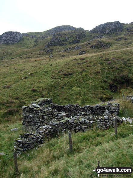
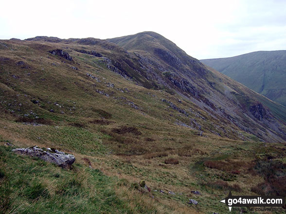
Some Photos and Pictures from Walk gw149 Glasgwm and Pen y Brynfforchog from Cwm Cywarch
In no particular order . . .
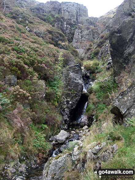
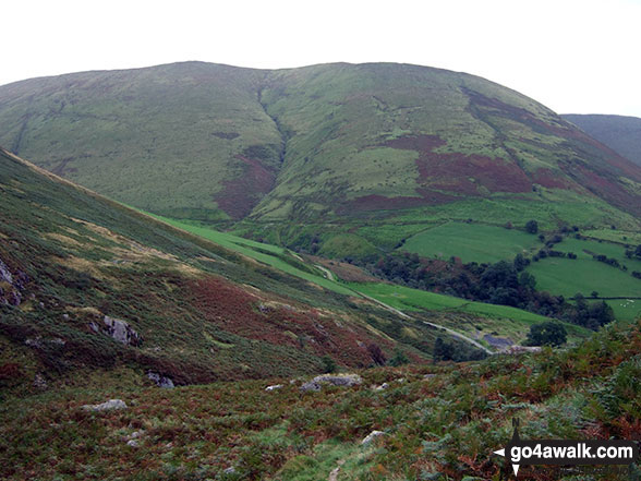
Following this unnamed stream up to the bwlch between Glasgwm and Gwaun y Llwyni
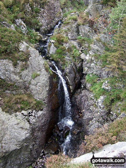
Waterfalls on the unnamed stream up to the bwlch between Glasgwm and Gwaun y Llwyni
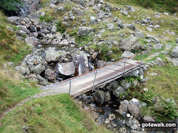
Footbridge on the approach to the bwlch between Glasgwm and Gwaun y Llwyni
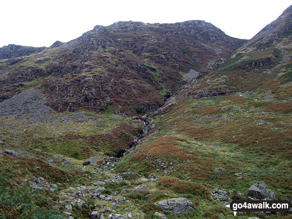

Following this unnamed stream up to the bwlch between Glasgwm and Gwaun y Llwyni
. . . load all 14 walk photos from Walk gw149 Glasgwm and Pen y Brynfforchog from Cwm Cywarch
Send us your photographs and pictures from your walks and hikes
We would love to see your photographs and pictures from walk gw149 Glasgwm and Pen y Brynfforchog from Cwm Cywarch. Send them in to us as email attachments (configured for any computer) along with your name and where the picture was taken to:
and we shall do our best to publish them.
(Guide Resolution = 300dpi. At least = 660 pixels (wide) x 440 pixels (high).)

You can also submit photos from walk gw149 Glasgwm and Pen y Brynfforchog from Cwm Cywarch via our Facebook Page.
NB. Please indicate where each photo was taken.
To contribute to go4awalk.com or to contact us about anything at all - see Talk To Us.
For help see Help.
go4awalk.com and go4awalk.co.uk are registered trademarks of TMDH Limited.
Copyright © 2000-2026 TMDH Limited. All rights reserved.
Copyright Terms & Conditions Privacy Statement
A - Z Walks Home Log On/Accounts Photo Gallery Walk Ideas and Collections Fell Facts Hill Skills Walking Questions and Answers Your Stories News Competitions Product Reviews/Gear Tests Walking Gear Guides Peaks and Mountains Peak Bagging Find New Walking Friends Camping GPS Waypoints for Walking Contents Walk Search Talk To Us go4awalk.com Help Free Example Walks Newsletter


