
![]()
Rhobell Fawr
734m (2408ft)
The Arenigs Area, Snowdonia, Gwynedd, Wales
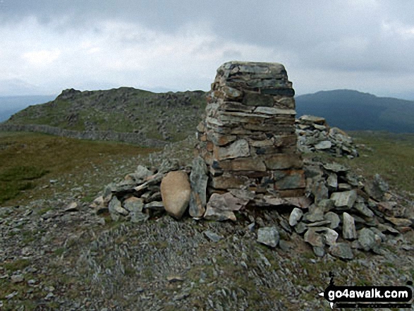
The summit of Rhobell Fawr is marked by an Ordnance Survey Trig Point.
Not familiar with this top?
You can walk/hike to the top of Rhobell Fawr by using this easy‑to‑follow route map:
Walk gw127 Dduallt and Rhobell Fawr from Cwm yr Allt-lwyd
Quiet, little visited hills with fine views
   |
|---|
Vital Statistics:
| Length: | 8.5ml (13.5km) |
|---|---|
| Ascent: | 2,493ft (760m) |
| Time: | 5½ hrs |
| Grade: |  (Moderate) (Moderate) |
Route Summary:
Cwm Yr Allt-lwyd - Afon Mawddach - Dduallt (Arenigs) - Bryn Melyn - Ty-newydd-y-mynydd - Rhobell Fawr - Cwm Yr Allt-lwyd
See Rhobell Fawr and the surrounding tops on our free-to-access 'Google Style' Peak Bagging Maps:
The Arenigs of Snowdonia National Park
Less data - quicker to download
The Whole of Snowdonia National Park
More data - might take a little longer to download
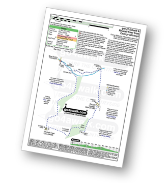
See Rhobell Fawr and the surrounding tops on our unique, downloadable, PDF Peak Bagging Map:

NB: Whether you print off a copy or download it to your phone, this PDF Peak Baggers' Map might prove incredibly useful when your are up there on the tops and you cannot get a phone signal.
You can find Rhobell Fawr & all the walks that climb it on these unique free-to-access Interactive Walk Planning Maps:
1:25,000 scale OS Explorer Map (orange/yellow covers):
1:50,000 scale OS Landranger Map (pink/magenta covers):
 Fellow go4awalkers who have already walked, climbed, scaled, summited, hiked & bagged Rhobell Fawr
Christina Lander walked up Rhobell Fawr on May 26th, 2023 [from/via/route] Llanfachreth -.Bwlch Goriwared - Rhobell Fawr - back the same way [with] Dick [weather] Hot & sunny
Stephanie Doyle climbed it on February 11th, 2023 [from/via/route] Above Rhydymain [with] Niece
Donovan Suddell bagged it on April 14th, 2022 [from/via/route] Cwm Yr Allt-Lwyd [with] Solo [weather] sunny day - Very boggy in places & steep climb
Wynne Roberts hiked Rhobell Fawr on August 13th, 2019 [from/via/route] From 'Cwm yr Allt Lwyd', over Dduallt & Rhoben Fawr & back to 'Cwm yr Allt Lwyd'. [with] On my own [weather] Sunny, warmish, slight wind (20mph) & very very clear - Took me 5 hours, stopped for half an hour for dinner, did 2 peaks over 2000ft, ground very boggy 75% of the way, maybe because of the recent heavy rain.
Anthony Scott summited on April 16th, 2019 [with] HF [weather] Low cloud, some rain
Mark Davidson conquered it on June 6th, 2009 [with] Mike [weather] Warm but a bit cloudy
Louis Smith, Linda Mckeogh, Louise Sandwith, Paul Booth, Trevor Williams, Stephen Millington and Kath Edwards have all walked, climbed & bagged Rhobell Fawr.
To add (or remove) your name and experiences on this page - Log On and edit your Personal Mountain Bagging Record
Send us your photographs and pictures on, of, or from Rhobell Fawr
If you would like to add your walk photographs and pictures to this page, please send them as email attachments (configured for any computer) along with your name to:
and we shall do our best to publish them.
(Guide Resolution = 300dpi. At least = 660pixels (wide) x 440 pixels (high).)

You can also submit photos via our Facebook Page.
NB. Please indicate where each photo was taken and whether you wish us to credit your photos with a Username or your First Name/Last Name.


