
![]()
Pen y Gadair Fawr
800m (2625ft)
The Black Mountains, The Brecon Beacons, Powys, Wales
Not familiar with this top?
You can walk/hike to the top of Pen y Gadair Fawr by using either of these 2 easy‑to‑follow route maps:
Walk po129 The Grwyne Fechan Round
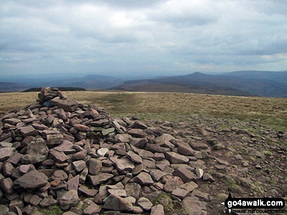
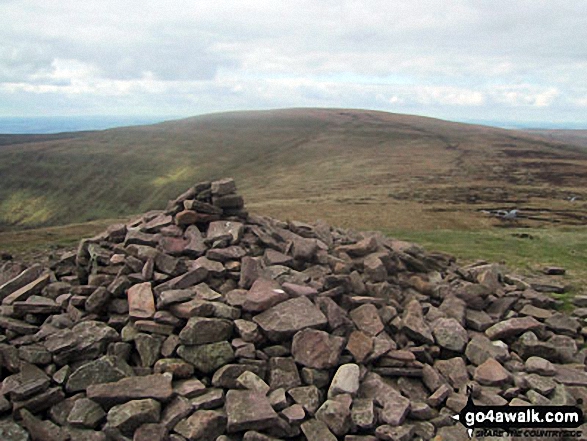
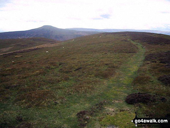
Fine high mountain views
   |
|---|
Vital Statistics:
| Length: | 12ml (19km) |
|---|---|
| Ascent: | 2,637ft (804m) |
| Time: | 7 hrs |
| Grade: |  (Hard) (Hard) |

Route Summary:
Nuadd-fawr - Llanbedr - Darren Fach - Pen Twyn Glas - Mynydd Llysiau - Pen Trumau - Waun Fach - Pen y Gadair Fawr - Pen Twyn Mawr - Pen Gwyllt Meirch - Nantyrychain - Cwm Farm - Nuadd-fawr
Walk po153 Pen Cerrig-calch and Waun Fach from Nuadd-fawr
Fine views in all directions
|
|---|
Vital Statistics:
| Length: | 13.5ml (21.5km) |
|---|---|
| Ascent: | 3,175ft (968m) |
| Time: | 8 hrs |
| Grade: |  (Hard) (Hard) |

Route Summary:
Nuadd-fawr - Llanbedr - Table Mountain (Pen Cerrig-calch) - Trwyn Ysgwrfa - Pen Cerrig-calch - Pen Allt-mawr - Pen Twyn Glas - Mynydd Llysiau - Pen Trumau - Waun Fach - Pen y Gadair Fawr - Pen Twyn Mawr - Pen Gwyllt Meirch - Nantyrychain - Cwm Farm - Nuadd-fawr
See Pen y Gadair Fawr and the surrounding tops on our free-to-access 'Google Style' Peak Bagging Maps:
The Black Mountains Area of Bannau Brycheiniog (The Brecon Beacons National Park)
Less data - quicker to download
The Whole of Bannau Brycheiniog (The Brecon Beacons National Park)
More data - might take a little longer to download
See Pen y Gadair Fawr and the surrounding tops on our unique, downloadable, PDF Peak Bagging Map:

NB: Whether you print off a copy or download it to your phone, this PDF Peak Baggers' Map might prove incredibly useful when your are up there on the tops and you cannot get a phone signal.
You can find Pen y Gadair Fawr & all the walks that climb it on these unique free-to-access Interactive Walk Planning Maps:
1:25,000 scale OS Explorer Map (orange/yellow covers):
1:50,000 scale OS Landranger Map (pink/magenta covers):
 Fellow go4awalkers who have already walked, climbed, scaled, summited, hiked & bagged Pen y Gadair Fawr
Paul Roddam walked up Pen y Gadair Fawr on October 13th, 2025 [with] solo [weather] misty but amazing cloud inversion in the morning after camping
Craig Barrell climbed it on October 5th, 2025 [from/via/route] Rhios dirion - Waun Fach to pen y gadair fawr & back [with] solo [weather] Windy & wet
Melfyn Parry bagged it on July 16th, 2024 [from/via/route] Followed go4awalk route PO153 - Pen Cerrig Calch & Waun Fach from Neuadd Fawr. Once on the ridge the walk is relatively easy, good paths. There are some areas that are quite boggy, so be prepared if following this route after lots of rain. The first peak was hard going, lots of tall bracken & bilberry bushes to fight your way through, I was so glad to reach the top of Pen Cerrig Calch. The final path from the cairn to the minor road leading back to the car park was also overgrown with bracken & the public footpath part was seriously neglected from a maintenance perspective, although the stiles looked almost new the path itself was overgrown with nettle, bramble & even more bracken making the last leg of the walk hard work. [with] On my own [weather] Sunny spells & generally dry. For a mid July walk it was quite cool at times. - Best to avoid this walk when the bracken is in season. If you have to walk in the summer months & especially after rain, waterproofs are a must as the grasses & bracken don't dry out at their base & you can get seriously wet even though you think it's a dry day.
Donovan Suddell hiked Pen y Gadair Fawr on April 23rd, 2023 [from/via/route] Gospel Pass [with] Wife [weather] Sunny until 16:00 then cloudy, rain at the very end - Very long circuit including traversing two steep valleys
Sion Britton summited on April 11th, 2021 [from/via/route] O Llanbedr. Horseshoe Route. [with] Solo [weather] Braf/ Cymylog
To add (or remove) your name and experiences on this page - Log On and edit your Personal Mountain Bagging Record
. . . [see more walk reports]
More Photographs & Pictures of views from, on, or of, Pen y Gadair Fawr
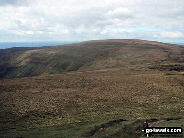

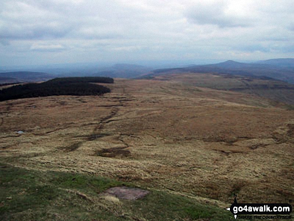
Descending in to the Grwyne Fawr Valley from Pen y Gadair Fawr in The Black Mountains

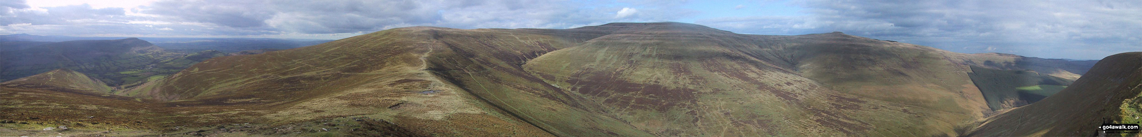
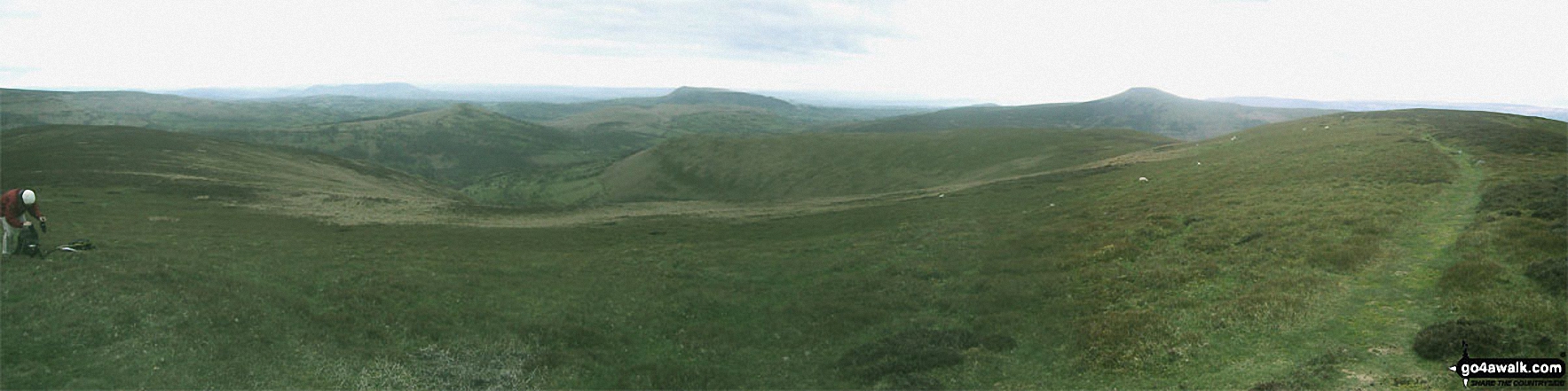
*270° Panorama featuring Pengenfford, Pen Trumau, Waun Fach, Pen y Gadair Fawr, Pen Twyn Mawr, Crug Mawr and the The Grwyne Fechan valley from Mynydd Llysiau
Send us your photographs and pictures on, of, or from Pen y Gadair Fawr
If you would like to add your walk photographs and pictures to this page, please send them as email attachments (configured for any computer) along with your name to:
and we shall do our best to publish them.
(Guide Resolution = 300dpi. At least = 660pixels (wide) x 440 pixels (high).)

You can also submit photos via our Facebook Page.
NB. Please indicate where each photo was taken and whether you wish us to credit your photos with a Username or your First Name/Last Name.


