Walk cw199 Carnedd Llewelyn, Foel Grach and Pen Llithrig y Wrach from Llyn Eigiau
This 11 mile, Grade 7 (Hard), easy-to-follow, hand-crafted walk, complete with GPS Waypoints, starts at Llyn Eigiau & will take about 7¾ hrs to complete.
   |
Vital Statistics:
| Length: | 11mls (17.5km) |
| Ascent: | 3,641ft (1,110m) |
| Time: | 7¾hrs |
| Grade: |  |

Route outline for walk cw199:
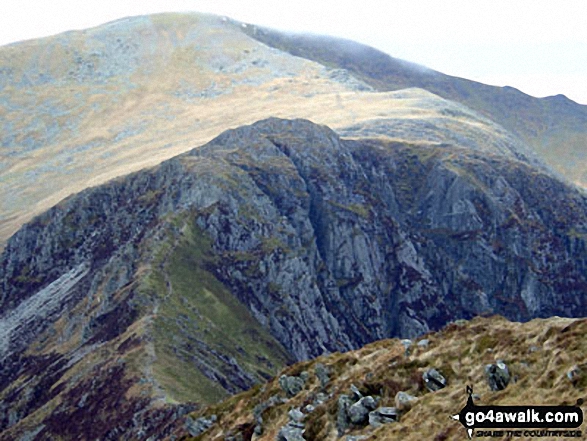
Llyn Eigiau - Craig Eigiau - Gwaun Y Garnedd - Foel Grach - Carnedd Llewelyn - Craig Yr Ysfa - Bwlch Eryl Farchog - Pen yr Helgi Du - Bwlch y Tri Marchog - Pen Llithrig y Wrach - Cedryn - Hafod-y-rhrw - Llyn Eigiau
Peaks, Summits and Tops reached on this walk:
 4 Welsh Mountains |
 0 Wainwrights |
 5 Welsh Nuttalls |
 0 Welsh Deweys |
 0 Wainwright Outlying Fells |
 2 Welsh Marilyns |
 0 Bridgets |
Peak Bagging Statistics for this walk:
The highest point of this walk is Carnedd Llewelyn at 1064m (3492ft). Carnedd Llewelyn is classified as a Welsh Mountain (Hewitt) (3rd highest in Wales, 3rd highest in England & Wales)
Carnedd Llewelyn is also known as a Welsh Nuttall (3rd highest in Wales, 3rd highest in England & Wales) and a Welsh Marilyn (2nd highest in Wales, 57th highest in the UK).
Carnedd Llewelyn means 'Llewelyn's Cairn' in Welsh and is pronounced 'kan-neth thl-oo-el-lin'.
The summit of Carnedd Llewelyn is marked by a cairn. Carnedd Llewelyn is the highest point in the county of Conwy.
Completing this walk will also take you to the top of Foel Grach at 976m (3203ft). Foel Grach is classified as a Welsh Mountain (Hewitt) (8th highest in Wales, 9th highest in England & Wales)
Foel Grach is also known as a Welsh Nuttall (8th highest in Wales, 9th highest in England & Wales). Foel Grach means 'Scabby Bare Hill' in Welsh and is pronounced 'foil grach'.
The summit of Foel Grach is marked by a cairn & a bothy.
You will also reach the summit of Pen yr Helgi Du at 833m (2734ft). Pen yr Helgi Du is classified as a Welsh Mountain (Hewitt) (26th highest in Wales, 57th highest in England & Wales)
Pen yr Helgi Du is also known as a Welsh Nuttall (30th highest in Wales, 66th highest in England & Wales). Pen yr Helgi Du means 'Hill of the Black Dog' in Welsh and is pronounced 'pen-ur-hell-gi-dee'.
The summit of Pen yr Helgi Du is marked by a beehive shaped cairn.
Along the way you will also bag and tick-off:
- Pen Llithrig y Wrach at 799m (2622ft). Pen Llithrig y Wrach is classified as a Welsh Mountain (Hewitt) (36th Wales, 80th Eng & Wal), a Welsh Nuttall (46th highest in Wales, 96th highest in England & Wales) and a Welsh Marilyn (16th Wales, 395th highest in the UK). Pen Llithrig y Wrach means 'Slippery Hill of the Witch' in Welsh and is pronounced 'Pen Thlith-rig ee racht'.
The summit of Pen Llithrig y Wrach is marked by a cairn.
- Craig Eigiau at 735m (2412ft). Craig Eigiau is known as a Welsh Nuttall (68th highest in Wales, 165th highest in England & Wales). Craig Eigiau means 'Fish Shoal Rock' in Welsh and is pronounced 'cry-gay-g-ee-eye'.
The summit of Craig Eigiau is marked by a rocky outcrop.
You can find this walk and other nearby walks on these unique Interactive Walk Planning Maps:
(worth a look if you're new to go4awalk.com & have never seen one of these before.)
1:25,000 scale OS Explorer Map (orange/yellow covers):
1:50,000 scale OS Landranger Map (pink/magenta covers):
Some Photos and Pictures from Walk cw199 Carnedd Llewelyn, Foel Grach and Pen Llithrig y Wrach from Llyn Eigiau
In no particular order . . .


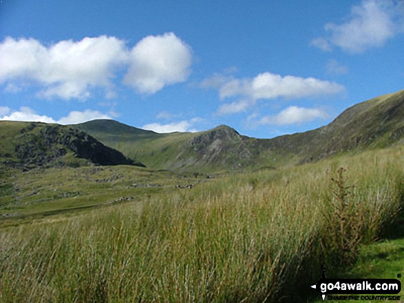


Tryfan and The Glyderau (Glyderau) from Cwm Tal-y-Braich below Pen Llithrig y Wrach

Glyder Fach (centre left), Glyder Fawr (centre) and Tryfan (centre right) from Pen Llithrig y Wrach

Send us your photographs and pictures from your walks and hikes
We would love to see your photographs and pictures from walk cw199 Carnedd Llewelyn, Foel Grach and Pen Llithrig y Wrach from Llyn Eigiau. Send them in to us as email attachments (configured for any computer) along with your name and where the picture was taken to:
and we shall do our best to publish them.
(Guide Resolution = 300dpi. At least = 660 pixels (wide) x 440 pixels (high).)

You can also submit photos from walk cw199 Carnedd Llewelyn, Foel Grach and Pen Llithrig y Wrach from Llyn Eigiau via our Facebook Page.
NB. Please indicate where each photo was taken.

To contribute to go4awalk.com or to contact us about anything at all - see Talk To Us.
For help see Help.
go4awalk.com and go4awalk.co.uk are registered trademarks of TMDH Limited.
Copyright © 2000-2026 TMDH Limited. All rights reserved.
Copyright Terms & Conditions Privacy Statement
A - Z Walks Home Log On/Accounts Photo Gallery Walk Ideas and Collections Fell Facts Hill Skills Walking Questions and Answers Your Stories News Competitions Product Reviews/Gear Tests Walking Gear Guides Peaks and Mountains Peak Bagging Find New Walking Friends Camping GPS Waypoints for Walking Contents Walk Search Talk To Us go4awalk.com Help Free Example Walks Newsletter


