
![]()
Drosgl
758m (2488ft)
The Carneddau, Snowdonia, Gwynedd, Wales
Drosgl means 'Rough Ground' in Welsh.
The summit of Drosgl is marked by a huge cairn.
Not familiar with this top?
   |
|---|
Vital Statistics:
| Length: | 8.25ml (13km) |
|---|---|
| Ascent: | 2,795ft (852m) |
| Time: | 5.75hrs |
| Grade: |  (Moderate) (Moderate) |
Route Summary:
Bont Newydd - Afon Rhaeadr-fawr - Aber Falls - Rhaeadr-fawr (Big waterall) - Afon Goch - Bera Mawr - Bera Bach - Drosgl - Gyrn Wigau - Rhaeadr-bach (Small waterfall) - Bont Newydd
|
|---|
Vital Statistics:
| Length: | 14.75ml (23.5km) |
|---|---|
| Ascent: | 3,890ft (1,186m) |
| Time: | 9.25hrs |
| Grade: |  (Hard) (Hard) |
Route Summary:
Bont Newydd - Afon Rhaeadr-fawr - Aber Falls (Rhaeadr-fawr) - Afon Gam - Gyrn Wigua - Drosgl - Bera Bach - Bera Mawr - Yr Aryg - Carnedd Gwenllian (Carnedd Uchaf) - Foel Grach - Foel-fras - Drum (Carneddau) - Carnedd y Ddelw - Yr Orsedd - Roman Road - Llyn Anafon Access Track - Bont Newydd
See Drosgl and the surrounding tops on our free-to-access 'Google Style' Peak Bagging Maps:
The Carneddau of Snowdonia National Park
Less data - quicker to download
The Whole of Snowdonia National Park
More data - might take a little longer to download
See Drosgl and the surrounding tops on our downloadable Peak Bagging Map in PDF format:

NB: Whether you print off a copy or download it to your phone, this PDF Peak Baggers' Map might prove incredibly useful when your are up there on the tops and you cannot get a phone signal.
You can find Drosgl & all the walks that climb it on these unique free-to-access Interactive Walk Planning Maps:
1:25,000 scale OS Explorer Map (orange/yellow covers):
1:50,000 scale OS Landranger Map (pink/magenta covers):
 Fellow go4awalkers who have already walked, climbed, summited & bagged Drosgl
Daniel Moran walked up Drosgl on December 5th, 2022 [from/via/route] Abber falls car park [with] Wardy lee henergon alex [weather] Steady
Donovan Suddell climbed Drosgl on August 15th, 2022 [from/via/route] Bont Newydd [with] Solo [weather] warm cloudy day
Melfyn Parry bagged Drosgl on February 26th, 2020 [from/via/route] Start of walk at free car park in Bethesda, took path up to Carneddi & then turned left towards Rachub, followed slate trail to Moel Faban, then skirted round towards Llefn. Stayed on west side of Bwlch ym Mhwll-le & once at head of this gulley turned left to ascend Llefn, continued along path to ascend Y Gyrn before turning right to go across moorland to ascend Drosgl. Lunch stop here before descending towards Gyrn Wigiau. Continued descent to back of Gerlan coming down via Ciltrefnus & Bont Uchaf before returning to car park. [with] CW & ChW [weather] Very windy & particularly cold on the summit of Drosgl with a thin layer of snow
Sion Britton hiked Drosgl on May 1st, 2021 [from/via/route] O Bethesda [with] Solo [weather] Braf
Andy Buxton summited Drosgl during April, 1991 [from/via/route] Aber Falls [weather] Fine but cold
Wynne Roberts conquered Drosgl on June 22nd, 2019 [from/via/route] From Aber Falls to Llyn Ogwen over the Carneddau [with] Gareth [weather] Sunny, warm, no wind & very clear - Took us 8 hours to do 8 peaks over 2000ft
Bleddyn Rhys scaled Drosgl on September 1st, 2018 [from/via/route] Cerdded fynnu o Bethesda [with] Gyda Siwan a Caradog [weather] Eithaf braf -haul gwan a chydig o wynt - 4 air copa diwrnod yma, route dau gyda'r plant, gally cadw'i traed yn sych!
Christina Lander walked up Drosgl on September 29th, 2018 [from/via/route] Bont Newydd (Abergwyngregin) - Drum - Foel Fras - Carnedd Gwenllian - Bera Bach - Drosgl - Aber Falls - Bont Newydd [with] Dick & Meg [weather] A fine, dry day but very windy on the tops. Plenty of sunny spells. - We struggled to find our way between Drosgl & Aber Falls. Crossing the river at the top of the falls was challenging!
Mark Davidson climbed Drosgl on August 6th, 2002 [with] Alone [weather] Warm with high cloud but a bit hazy - Route directions for this walk are excellent.
Gerald Murphy bagged Drosgl on July 24th, 2014 [from/via/route] Bethesda riverside car park, Gerlan, Gernydd, Gwaun-y-gwiail, cwm pen-llafar, Foel Fechan, Foel Ganol, Yr Elen, Carnedd Llywelyn, Foel Grach, Carnedd Gwenllian (formerly Carnedd Uchaf), Foel Fras, Yr Aryg, Bera Bach, Drosgl, Gyrn Wigau, Gallt y Mawn, Gwernydd, Gerlan, Bethesda riverside car park. [with] alone [weather] Sunny, occasional high cloud, quite windy higher up, reasonable visibility but some heat haze. - This walk includes 5 of the Welsh 3000s. It would not be an easy or safe walk in poor visibility or during/following a spell of wet weather. Where the ground is not boulder it can be very boggy. In some places it is featureless � eg atop Carnedd Llywelyn � and, in fog, even with a compass it would be hard to find your way from some places to your desired path. Much of the walk is basically pathless unless you can spot previously trodden paths across marshy ground.
To add (or remove) your name and experiences on this page - Log On and edit your Personal Mountain Bagging Record
. . . [see more walk reports]
More Photographs & Pictures of views from, on or of Drosgl
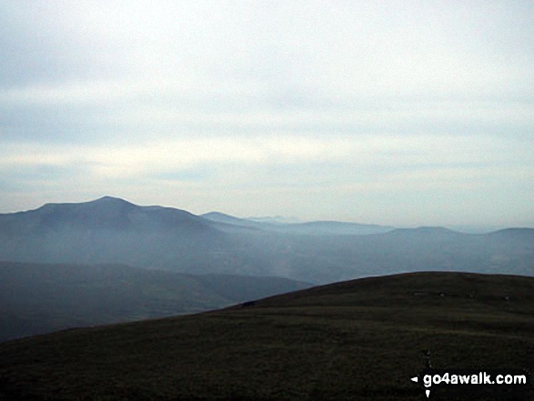
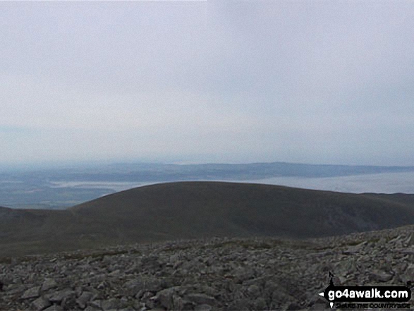
*Moel Wnion with Anglesey and Conwy Bay beyond from the summit of Drosgl
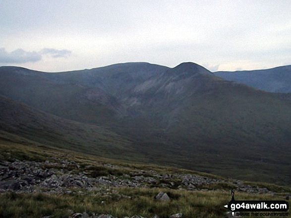
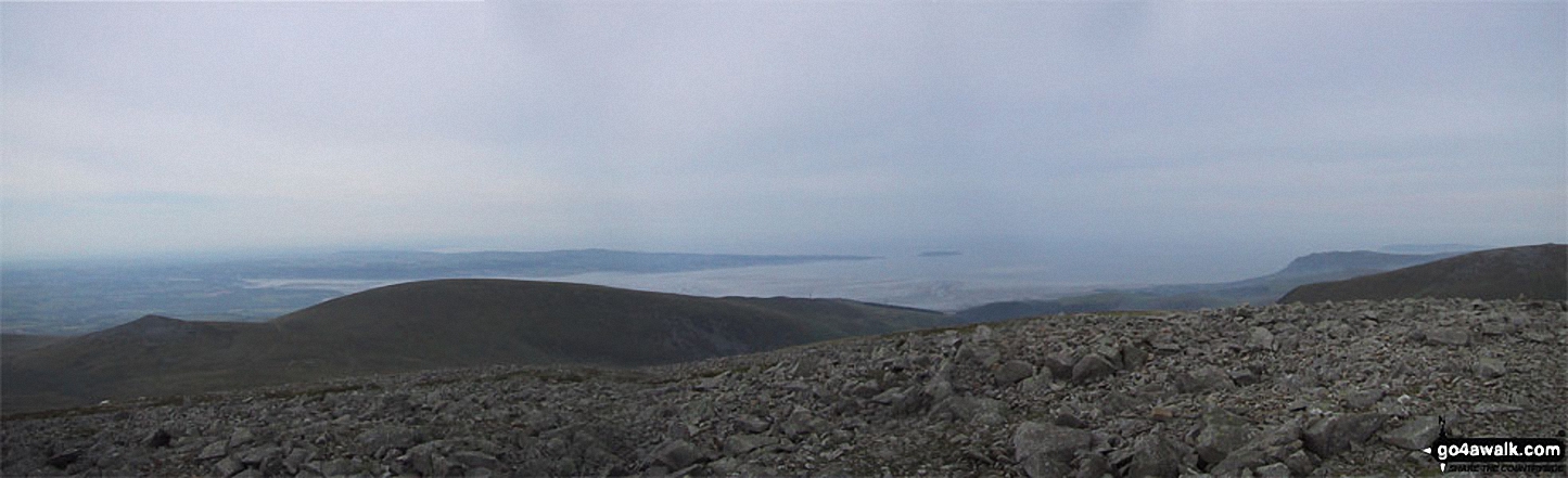
*Carnedd Gwenllian (Carnedd Uchaf), Foel Grach, Carnedd Llewelyn, Carnedd Dafydd, Yr Elen, Foel-goch, Elidir Fawr, Mynydd Perfedd and Carnedd y Filiast from Drosgl
Send us your photographs and pictures on, of, or from Drosgl
If you would like to add your walk photographs and pictures featuring views from, on or of Drosgl to this page, please send them as email attachments (configured for any computer) along with your name to:
and we shall do our best to publish them.
(Guide Resolution = 300dpi. At least = 660pixels (wide) x 440 pixels (high).)

You can also submit photos via our Facebook Page.
NB. Please indicate where each photo was taken and whether you wish us to credit your photos with a Username or your First Name/Last Name.
Not familiar with this top?


