The Peak District National Park - a fully detailed list of all the Mountains, Peaks, Tops and Hills (Page 1 of 4)
The Peak District National Park, Cheshire, Derbyshire, Greater Manchester, Staffordshire and West Yorkshire is the area contained within The Peak District National Park boundary. The Peak District National Park covers parts of Cheshire, Derbyshire, Staffordshire, South Yorkshire and West Yorkshire.
If you include all the Mountains (Hewitts), the Deweys, the Nuttalls, the Marilyns and the Bridgets (Hills) there are 104 tops to climb, bag & conquer and the highest point is Kinder Scout at 636m (2,087ft).
To see these Mountains, Peaks, Tops and Hills displayed in different ways - see the options in the left-hand column and towards the bottom of this page.
![]() Your Personal Bagging Record for The Peak District
Your Personal Bagging Record for The Peak District
LOG ON and RELOAD this page to show which Mountains, Peaks, Tops and Hills you have already climbed, bagged & conquered [. . . more details]
See this list in: Alphabetical Order
| Height Order‡
To reverse the order select the link again.
Mountain, Peak, Top or Hill:
Bagged

![]()
1. Thorpe Cloud
287m (941ft)
Thorpe Cloud is on interactive maps:
Thorpe Cloud is on downloadable PDF you can Print or Save to your Phone: |
![]()
2. Calton Pastures
289m (948ft)
Calton Pastures is on interactive maps:
Calton Pastures is on downloadable PDF you can Print or Save to your Phone: |
![]()
3. Anthony Hill
293m (961ft)
Anthony Hill is on interactive maps:
Anthony Hill is on downloadable PDF you can Print or Save to your Phone: |
![]()
4. Nelson's Monument (Birchen Edge)
302m (991ft)
Nelson's Monument (Birchen Edge) is on interactive maps:
Nelson's Monument (Birchen Edge) is on downloadable PDF you can Print or Save to your Phone: |
![]()
5. Stanton Moor
323m (1,060ft)
Stanton Moor is on interactive maps:
Stanton Moor is on downloadable PDF you can Print or Save to your Phone: |
![]()
6. Fin Cop
327m (1,073ft)
Fin Cop is on interactive maps:
Fin Cop is on downloadable PDF you can Print or Save to your Phone: |
![]()
7. Kenslow Knoll
337m (1,106ft)
Kenslow Knoll is on interactive maps:
Kenslow Knoll is on downloadable PDF you can Print or Save to your Phone: |
![]()
8. Parkhouse Hill
352m (1,155ft)
Parkhouse Hill is on interactive maps:
Parkhouse Hill is on downloadable PDF you can Print or Save to your Phone: |
![]()
9. Hitter Hill
362m (1,188ft)
Hitter Hill is on interactive maps:
Hitter Hill is on downloadable PDF you can Print or Save to your Phone: |
![]()
10. Gratton Hill
363m (1,191ft)
Gratton Hill is on interactive maps:
Gratton Hill is on downloadable PDF you can Print or Save to your Phone: |
![]()
11. White Edge (Big Moor)
366m (1,201ft)
White Edge (Big Moor) is on interactive maps:
White Edge (Big Moor) is on downloadable PDF you can Print or Save to your Phone: |
![]()
12. Narrowdale Hill
367m (1,204ft)
Narrowdale Hill is on interactive maps:
Narrowdale Hill is on downloadable PDF you can Print or Save to your Phone: |
![]()
13. Ecton Hill
369m (1,211ft)
Ecton Hill is on interactive maps:
Ecton Hill is on downloadable PDF you can Print or Save to your Phone: |
![]()
14. Wardlow Hay Cop
370m (1,214ft)
Wardlow Hay Cop is on interactive maps:
Wardlow Hay Cop is on downloadable PDF you can Print or Save to your Phone: |
![]()
15. Beeley Moor
371m (1,217ft)
Beeley Moor is on interactive maps:
Beeley Moor is on downloadable PDF you can Print or Save to your Phone: |
![]()
16. Wetton Hill
371m (1,217ft)
Wetton Hill is on interactive maps:
Wetton Hill is on downloadable PDF you can Print or Save to your Phone: |
![]()
17. Lantern Pike
373m (1,224ft)
Lantern Pike is on interactive maps:
Lantern Pike is on downloadable PDF you can Print or Save to your Phone: |
![]()
18. Grindon Moor (Grindon Moor)
377m (1,237ft)
Grindon Moor (Grindon Moor) is on interactive maps:
Grindon Moor (Grindon Moor) is on downloadable PDF you can Print or Save to your Phone: |
![]()
19. Carder Low
380m (1,247ft)
Carder Low is on interactive maps:
Carder Low is on downloadable PDF you can Print or Save to your Phone: |
![]()
20. Sheen Hill
380m (1,247ft)
Sheen Hill is on interactive maps:
Sheen Hill is on downloadable PDF you can Print or Save to your Phone: |
![]()
21. Crook Hill (Ladybower)
382m (1,254ft)
Crook Hill (Ladybower) is on interactive maps:
Crook Hill (Ladybower) is on downloadable PDF you can Print or Save to your Phone: |
![]()
22. Wincle Minn
384m (1,260ft)
Wincle Minn is on interactive maps:
Wincle Minn is on downloadable PDF you can Print or Save to your Phone: |

![]()
23. Gun (Staffordshire)
385m (1,264ft)
Gun (Staffordshire) is on interactive maps:
Gun (Staffordshire) is on downloadable PDF you can Print or Save to your Phone: |
![]()
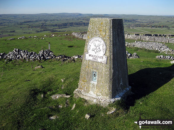
24. Wolfscote Hill
388m (1,273ft)
Wolfscote Hill is on interactive maps:
Wolfscote Hill is on downloadable PDF you can Print or Save to your Phone: |
![]()
25. Bridge-end Pasture
392m (1,287ft)
Bridge-end Pasture is on interactive maps:
Bridge-end Pasture is on downloadable PDF you can Print or Save to your Phone: |
![]()
26. Longstone Moor
395m (1,296ft)
Longstone Moor is on interactive maps:
Longstone Moor is on downloadable PDF you can Print or Save to your Phone: |
![]()
27. Onesmoor (Kirk Edge)
395m (1,296ft)
Onesmoor (Kirk Edge) is on interactive maps:
Onesmoor (Kirk Edge) is on downloadable PDF you can Print or Save to your Phone: |
![]()
28. Totley Moor
395m (1,296ft)
Totley Moor is on interactive maps:
Totley Moor is on downloadable PDF you can Print or Save to your Phone: |
![]()
29. Revidge
401m (1,316ft)
Revidge is on interactive maps:
Revidge is on downloadable PDF you can Print or Save to your Phone: |
![]()
30. Lodge Moor (Ughill Moors)
409m (1,342ft)
Lodge Moor (Ughill Moors) is on interactive maps:
Lodge Moor (Ughill Moors) is on downloadable PDF you can Print or Save to your Phone: |
View these 104 Mountains, Peaks, Tops and Hills:
- On Two Downloadable PDFs you can print or save to your phone covering:
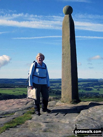
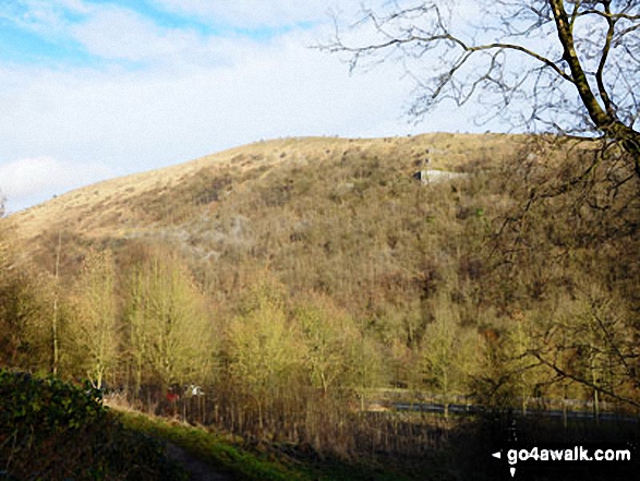
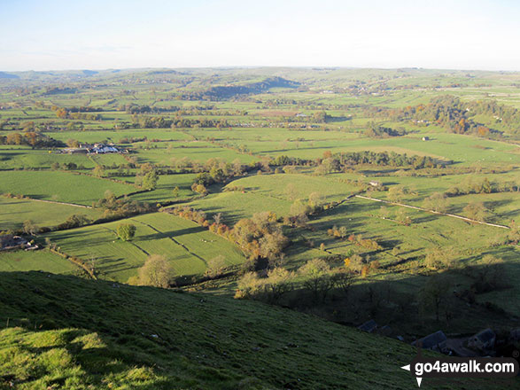
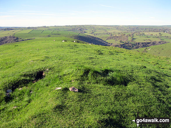
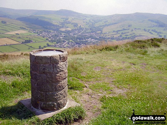
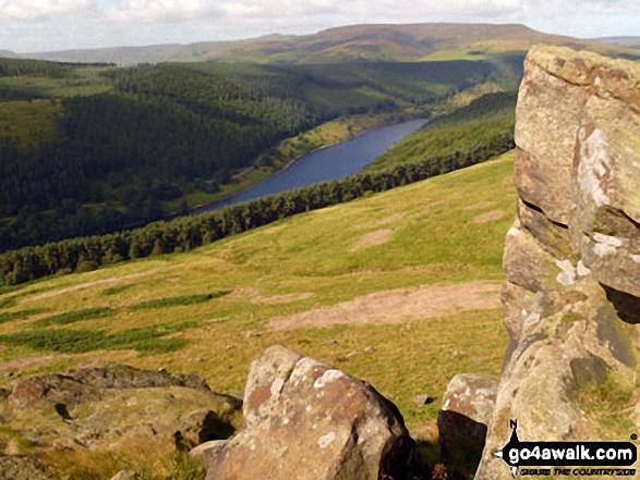
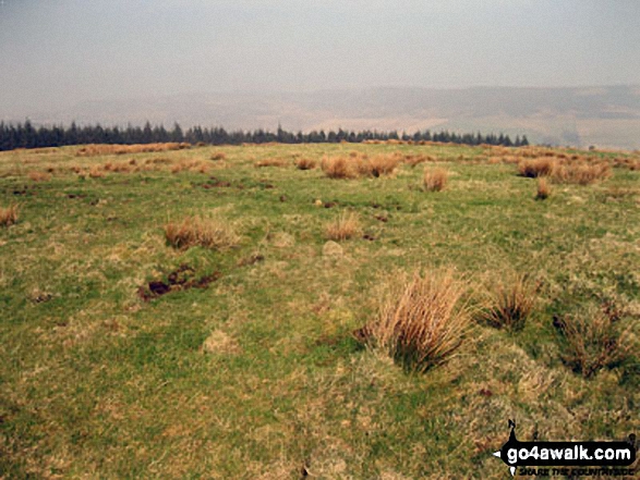
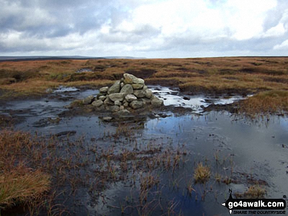 The summit of Kinder Scout, the highest point in The Dark Peak Area area of The Peak District
Photo: Ben Lockett
- On an Interactive Google Map (loads faster)
- On an Interactive Google Map with a list of tops below it.
(makes it easier to locate a particular top) - On a Detailed List in:
Alphabetical Order | Height Order - On one page with 'yet-to-be-bagged' listed 1st & then 'already-bagged' tops listed 2nd in:
Alphabetical Order | Height Order - On one page with 'already-bagged' tops listed 1st & then 'yet-to-be-bagged' tops listed 2nd in:
Alphabetical Order | Height Order
# Whether you print copies or download them to your phone, these Peak Baggers' Maps will prove incredibly useful if you want to know what's what when you are up in the mountains and cannot get a phone signal.
Is there a Mountain, Peak, Top or Hill missing from the above google map or list?
Let us know an we will add it to our database.
To contribute to go4awalk.com or to contact us about anything at all - see Talk To Us.
For help see Help.
go4awalk.com and go4awalk.co.uk are registered trademarks of TMDH Limited.
Copyright © 2000-2025 TMDH Limited. All rights reserved.
Copyright Terms & Conditions Privacy Statement
A - Z Walks Home Log On/Accounts Photo Gallery Walk Ideas and Collections Fell Facts Hill Skills Walking Questions and Answers Your Stories News Competitions Product Reviews/Gear Tests Walking Gear Guides Peaks and Mountains Peak Bagging Find New Walking Friends Camping GPS Waypoints for Walking Contents Walk Search Talk To Us go4awalk.com Help Free Example Walks Newsletter


