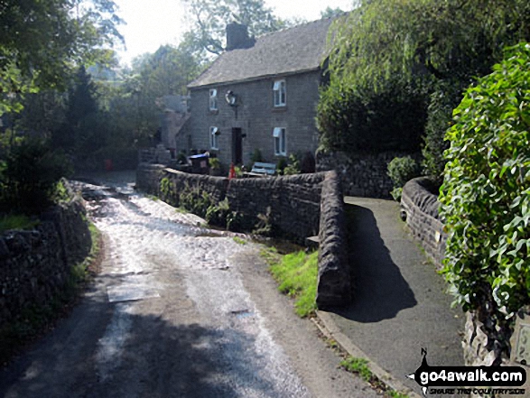
Walk s201 Grindon Moor, Grindon and Weag's Bridge from Butterton
This 8¾ mile, Grade 5 (Moderate), easy-to-follow, hand-crafted walk, complete with GPS Waypoints, starts at Butterton & will take about 5 hrs to complete.
   |
Vital Statistics:
| Length: | 8¾mls (14km) |
| Ascent: | 1,690ft (515m) |
| Time: | 5hrs |
| Grade: |  |
Route outline for walk s201:
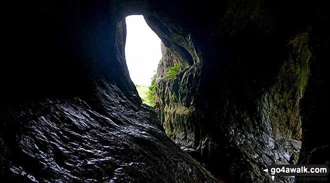
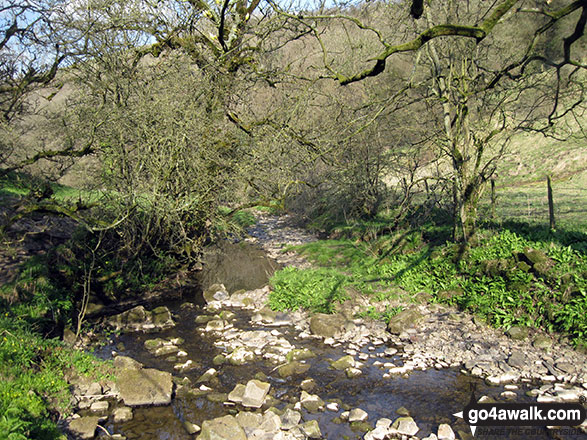
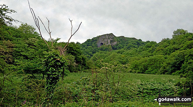
Butterton - Grindon Moor (Grindon Moor) - Ford - Ryebrook Farm - Grindon - Weag's Bridge - The Manifold Way - The River Manifold - Thor's Cave - Ladyside Wood - Dafar Bridge - Wettonmill - Hoo Brook - Butterton
Points of Interest/Notes on this walk:
Animal remains have been found in a cave near Wettonmill that date from the late glacial period - about 80,000BC.
Known as the Cathedral of the Peak, Grindon Church contains two Saxon Stone Coffins.
Peaks, Summits and Tops reached on this walk:
 0 English Mountains |
 0 Wainwrights |
 0 English Nuttalls |
 0 English Deweys |
 0 Wainwright Outlying Fells |
 0 Marilyns |
 1 Bridget |
Peak Bagging Statistics for this walk:
The highest point of this walk is Grindon Moor (Grindon Moor) at 377m (1237ft). Grindon Moor (Grindon Moor) is known as an English Bridget. The summit of Grindon Moor (Grindon Moor) is marked by an Ordnance Survey Trig Point.
National Trails & Long Paths included on this walk:
Part of this walk follows a section of The Manifold Way, a 13km (8 miles) linear footpath connecting Hulme End in Staffordshire, England with Waterhouses in Staffordshire, England. Originally a 2ft 6in (0.762m) gauge light railway for tourists the line was opened in 1904. Never a great success it was finally closed in 1934 and became a bridleway three years later. The Manifold Way is waymarked by named posts. For more walks that include a section of this trail see The Manifold Way.
You can find this walk and other nearby walks on these unique Interactive Walk Planning Maps:
(worth a look if you're new to go4awalk.com & have never seen one of these before.)
1:25,000 scale OS Explorer Map (orange/yellow covers):
1:50,000 scale OS Landranger Map (pink/magenta covers):
Some Photos and Pictures from Walk s201 Grindon Moor, Grindon and Weag's Bridge from Butterton
In no particular order . . .
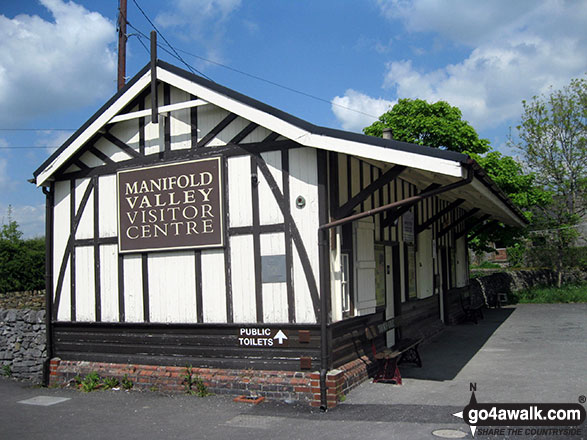
The former railway station at Hulme End - now The Manifold Valley Visitor Centre


. . . load all 36 walk photos from Walk s201 Grindon Moor, Grindon and Weag's Bridge from Butterton
Send us your photographs and pictures from your walks and hikes
We would love to see your photographs and pictures from walk s201 Grindon Moor, Grindon and Weag's Bridge from Butterton. Send them in to us as email attachments (configured for any computer) along with your name and where the picture was taken to:
and we shall do our best to publish them.
(Guide Resolution = 300dpi. At least = 660 pixels (wide) x 440 pixels (high).)

You can also submit photos from walk s201 Grindon Moor, Grindon and Weag's Bridge from Butterton via our Facebook Page.
NB. Please indicate where each photo was taken.

To contribute to go4awalk.com or to contact us about anything at all - see Talk To Us.
For help see Help.
go4awalk.com and go4awalk.co.uk are registered trademarks of TMDH Limited.
Copyright © 2000-2026 TMDH Limited. All rights reserved.
Copyright Terms & Conditions Privacy Statement
A - Z Walks Home Log On/Accounts Photo Gallery Walk Ideas and Collections Fell Facts Hill Skills Walking Questions and Answers Your Stories News Competitions Product Reviews/Gear Tests Walking Gear Guides Peaks and Mountains Peak Bagging Find New Walking Friends Camping GPS Waypoints for Walking Contents Walk Search Talk To Us go4awalk.com Help Free Example Walks Newsletter


