
![]()
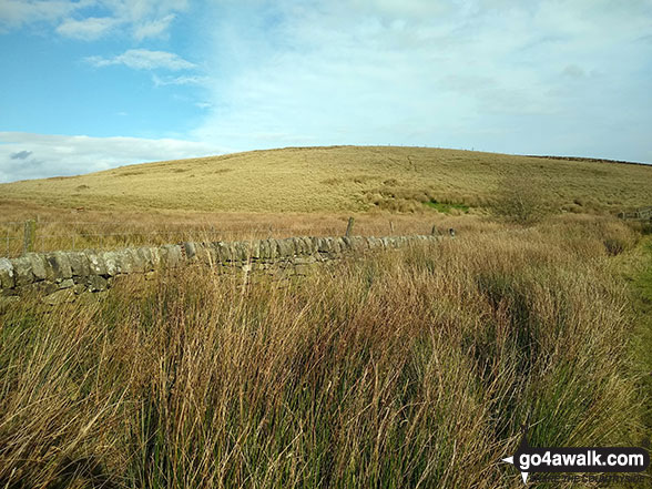
Lodge Moor (Ughill Moors)
409m (1342ft)
The Dark Peak Area, The Peak District, South Yorkshire, England
Not familiar with this top?
   |
|---|
Vital Statistics:
| Length: | 8.25mls (13km) |
|---|---|
| Ascent: | 1,362ft (415m) |
| Time: | 4.25hrs |
| Grade: |  (Moderate) (Moderate) |
Route Summary:
Strines Reservoir - Broggin Farm - Sheffield Country Walk - Lee Bank - Sugworth Delf - Sugworth Edge - Sugworth Hall - Moscar Cross Farm - Lodge Moor (Ughill Moors) - Stake Hill Road (track) - Wet Shaw Lane - Oaks Piece - Wragg House Plantation - Dale Dike Reservoir - Dale Dike - Upper Thornseat - Hallfield House - Stubbun Farm - Broggin Farm - Strines Reservoir
See Lodge Moor (Ughill Moors) and the surrounding tops on our free-to-access 'Google Style' Peak Bagging Maps:
The Dark Peak Area of The Peak District National Park
Less data - quicker to download
See Lodge Moor (Ughill Moors) and the surrounding tops on our downloadable Peak Bagging Map in PDF format:

NB: Whether you print off a copy or download it to your phone, this PDF Peak Baggers' Map might prove incredibly useful when your are up there on the tops and you cannot get a phone signal.
You can find Lodge Moor (Ughill Moors) & all the walks that climb it on these unique free-to-access Interactive Walk Planning Maps:
1:25,000 scale OS Explorer Map (orange/yellow covers):
1:50,000 scale OS Landranger Map (pink/magenta covers):
 Fellow go4awalkers who have already walked, climbed, summited & bagged Lodge Moor (Ughill Moors)
Mark Davidson walked up Lodge Moor (Ughill Moors) on October 20th, 2020 [from/via/route] Wals sy104 Lodge Moor (Ughill Moors) from Strines Reservoir [with] Theresa [weather] A bit of sunshine but mainly high white cloud. Warm for October though
John Gehrke climbed Lodge Moor (Ughill Moors) on October 20th, 2013 [from/via/route] from Low Bradfield [with] solo [weather] mostly fair with some occasional drizzle until the last 2 km of heavy rain - good lengthy night walk with easily discernable paths & enough natural & back-scattered light to need to use my torch for only the boggiest bits
To add (or remove) your name and experiences on this page - Log On and edit your Personal Mountain Bagging Record
More Photographs & Pictures of views from, on or of Lodge Moor (Ughill Moors)
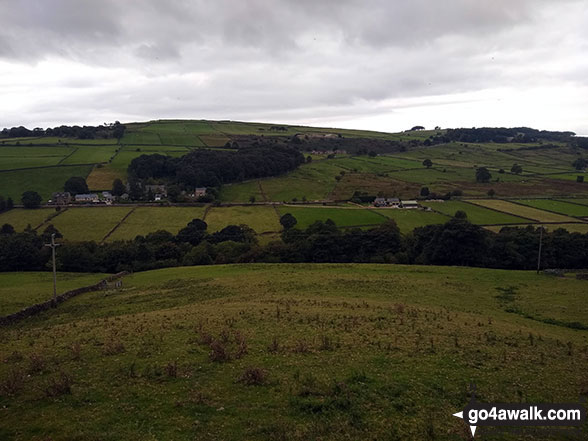
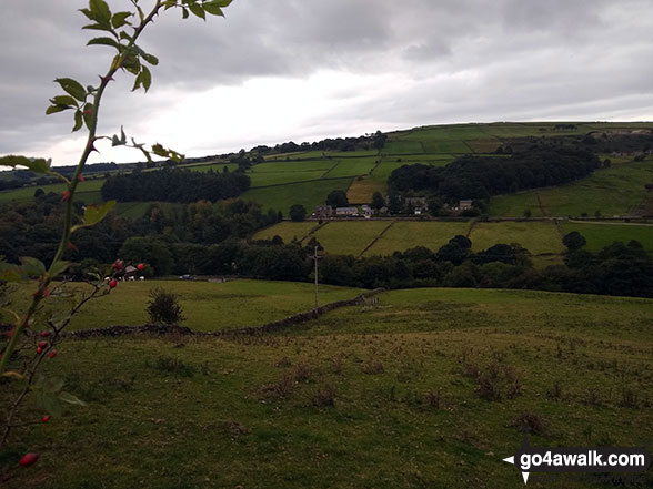
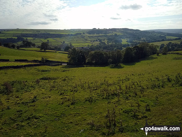
Lodge Moor (Ughill Moors) and Low Bradfield from High Bradfield Church
Send us your photographs and pictures on, of, or from Lodge Moor (Ughill Moors)
If you would like to add your walk photographs and pictures featuring views from, on or of Lodge Moor (Ughill Moors) to this page, please send them as email attachments (configured for any computer) along with your name to:
and we shall do our best to publish them.
(Guide Resolution = 300dpi. At least = 660pixels (wide) x 440 pixels (high).)

You can also submit photos via our Facebook Page.
NB. Please indicate where each photo was taken and whether you wish us to credit your photos with a Username or your First Name/Last Name.
Not familiar with this top?


