
![]()
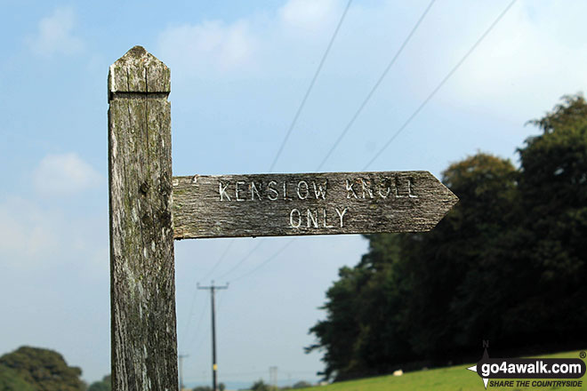
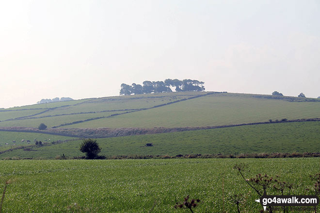
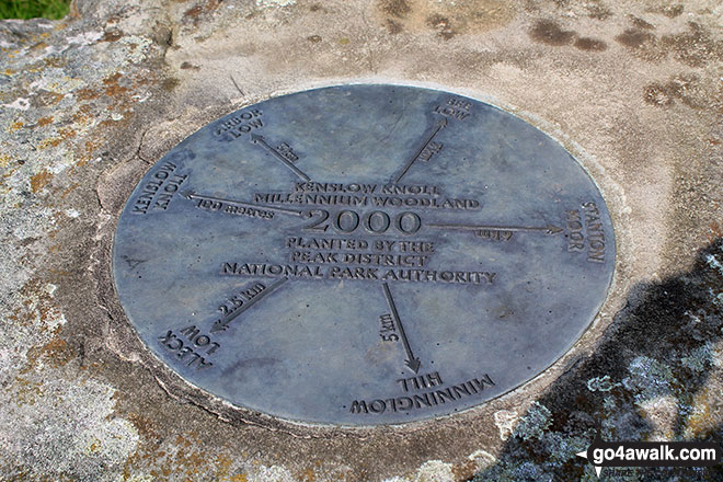
Kenslow Knoll
337m (1106ft)
The White Peak Area, The Peak District, Derbyshire, England
Not familiar with this top?
You can walk/hike to the top of Kenslow Knoll by using either of these 2 easy‑to‑follow route maps:
Walk d146 The High Peak Trail and Kenslow Knoll from Middleton-by-Youlgreave
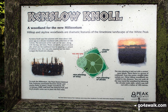
Fine views of Long Dale and from Kenslow Knoll
   |
|---|
Vital Statistics:
| Length: | 9.75ml (15.5km) |
|---|---|
| Ascent: | 1,240ft (378m) |
| Time: | 4.75hrs |
| Grade: |  (Moderate) (Moderate) |

Route Summary:
Middleton-by-Youlgreave - River Bradford - Rusden Wood - Gratton Moor - Long Dale - Bolderstone Plantation - Friden Station - The High Peak Trail - Green Lane (Friden) - Mere Farm - Ringham Low (Friden) - Kenslow Farm - Kenslow Knoll - Little Rockery Plantation - Rake Wood - Middleton-by-Youlgreave
Walk d152 Monyash, Youlgreave, Bradford Dale, Middleton-by-Youlgreave and Kenslow Knoll from Sparklow, Hurdlow
Long but lovely walk in the beautiful derbyshire dales
|
|---|
Vital Statistics:
| Length: | 15ml (24km) |
|---|---|
| Ascent: | 1,831ft (558m) |
| Time: | 7.25hrs |
| Grade: |  (Hard) (Hard) |
Route Summary:
Hurdlow - Sparklow - The High Peak Trail - Hutmoor Butts - The Limestone Way - Monyash - One Ash Grange Farm - Calling Low Farm - Cales Dale - Moor Lane - Youlgreave - Lomberdale Hall - Middleton-by-Youlgreave - Rake Wood - Little Rookery Plantation - Kenslow Farm - Kenslow Knoll - Ringham Low (Friden) - Mere Farm - Green Lane (Friden) - The High Peak Trail - Sparklow - Hurdlow
See Kenslow Knoll and the surrounding tops on our free-to-access 'Google Style' Peak Bagging Maps:
The White Peak Area of The Peak District National Park
Less data - quicker to download
See Kenslow Knoll and the surrounding tops on our unique, downloadable, PDF Peak Bagging Map:

NB: Whether you print off a copy or download it to your phone, this PDF Peak Baggers' Map might prove incredibly useful when your are up there on the tops and you cannot get a phone signal.
You can find Kenslow Knoll & all the walks that climb it on these unique free-to-access Interactive Walk Planning Maps:
1:25,000 scale OS Explorer Map (orange/yellow covers):
1:50,000 scale OS Landranger Map (pink/magenta covers):
 Fellow go4awalkers who have already walked, climbed, scaled, summited, hiked & bagged Kenslow Knoll
Mark Davidson walked up Kenslow Knoll on September 10th, 2014 [from/via/route] From Friden [with] Alone [weather] Hazy sunshine
To add (or remove) your name and experiences on this page - Log On and edit your Personal Mountain Bagging Record
More Photographs & Pictures of views from, on, or of, Kenslow Knoll


Send us your photographs and pictures on, of, or from Kenslow Knoll
If you would like to add your walk photographs and pictures to this page, please send them as email attachments (configured for any computer) along with your name to:
and we shall do our best to publish them.
(Guide Resolution = 300dpi. At least = 660pixels (wide) x 440 pixels (high).)

You can also submit photos via our Facebook Page.
NB. Please indicate where each photo was taken and whether you wish us to credit your photos with a Username or your First Name/Last Name.


