
![]()
Lantern Pike
373m (1224ft)
The Dark Peak Area, The Peak District, Derbyshire, England
Not familiar with this top?
You can walk/hike to the top of Lantern Pike by using any of these 3 easy‑to‑follow route maps:
Walk d112 Lantern Pike from Hayfield
A steady ascent to superb views
   |
|---|
Vital Statistics:
| Length: | 4.75ml (7.5km) |
|---|---|
| Ascent: | 899ft (274m) |
| Time: | 2.75hrs |
| Grade: |  (Easy) (Easy) |
Route Summary:
Hayfield - Sett Valley Trail - Birch Vale - The River Sett - The Pennine Bridleway - Lantern Pike - Hey Wood - Little Hayfield - Sett Valley Trail - Hayfield
Walk d321 Mill Hill and Middle Moor from Hayfield
Two ascents - Two superb view points
|
|---|
Vital Statistics:
| Length: | 9.5ml (15km) |
|---|---|
| Ascent: | 2,074ft (632m) |
| Time: | 5½ hrs |
| Grade: |  (Moderate) (Moderate) |

Route Summary:
Hayfield - Sett Valley Trail - Birch Vale - The River Sett - The Pennine Bridleway - Lantern Pike - Matley Moor - Burnt Hill - Mill Hill (Ashop Head) - The Pennine Way - William Clough - Kinder Reservoir - Snake Path - Middle Moor - Hayfield
Walk d171 Lantern Pike and Cown Edge Rocks from Hayfield
Two ascents - Two superb view points
|
|---|
Vital Statistics:
| Length: | 10.5ml (17km) |
|---|---|
| Ascent: | 2,055ft (626m) |
| Time: | 6 hrs |
| Grade: | (Moderate) |
Route Summary:
Hayfield - Sett Valley Trail - Birch Vale - The River Sett - The Pennine Bridleway - Lantern Pike - Rowarth - Cown Edge Rocks - Chunal Road (Glossop) - Hollingwood Clough - Middle Moor (Hayfield) - The Snake Path - Hayfield
See Lantern Pike and the surrounding tops on our free-to-access 'Google Style' Peak Bagging Maps:
The Dark Peak Area of The Peak District National Park
Less data - quicker to download
See Lantern Pike and the surrounding tops on our unique, downloadable, PDF Peak Bagging Map:

NB: Whether you print off a copy or download it to your phone, this PDF Peak Baggers' Map might prove incredibly useful when your are up there on the tops and you cannot get a phone signal.
You can find Lantern Pike & all the walks that climb it on these unique free-to-access Interactive Walk Planning Maps:
1:25,000 scale OS Explorer Map (orange/yellow covers):
1:50,000 scale OS Landranger Map (pink/magenta covers):
 Fellow go4awalkers who have already walked, climbed, scaled, summited, hiked & bagged Lantern Pike
Dave Gay walked up Lantern Pike on November 7th, 2017 [from/via/route] Circular walk from Rowarth, out via Harthill, return via Wethercotes & Laneside. [with] Nathaniel
Gill Bates climbed it on July 25th, 2018 [from/via/route] from Hayfield
Charles Wrigley Wrigley bagged it during April, 2018 [from/via/route] first half 2018 - did with R first day & A second day
Margaret Richards hiked Lantern Pike on August 10th, 2012 [from/via/route] Lantern Pike & Cown Edge Rocks from Hayfield (11miles, grade 6, d171) [with] Don
Nicola Parkinson summited on July 19th, 2015 [with] Stu
Eric Perry conquered it on September 7th, 2014 [from/via/route] Hayfield [with] Eric [weather] Glorious sunshine
Joanne Mcgawley scaled it on June 1st, 2013 [from/via/route] Hayfied [with] Rich and Burkie [weather] Warm & dry but cold in the wind - 11.2 miles
Andrew Joss walked up Lantern Pike on October 21st, 2012 [from/via/route] Hayfield [with] Barbara [weather] Sunny
Mark Davidson climbed it on July 12th, 2005 [weather] Hot - I mean really, really hot
Louise Sandwith, Simon Atherfold and Geoffrey Robertshaw have all walked, climbed & bagged Lantern Pike.
To add (or remove) your name and experiences on this page - Log On and edit your Personal Mountain Bagging Record
More Photographs & Pictures of views from, on, or of, Lantern Pike
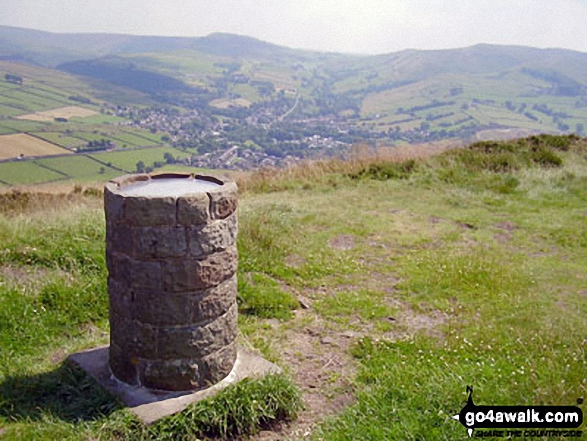
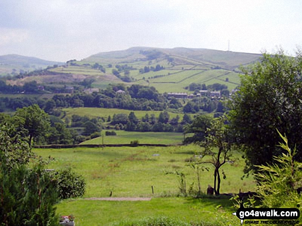
Mill Hill (Ashop Head), Kinder Scout and Chinley Churn with Hayfield nestling below from Lantern Pike
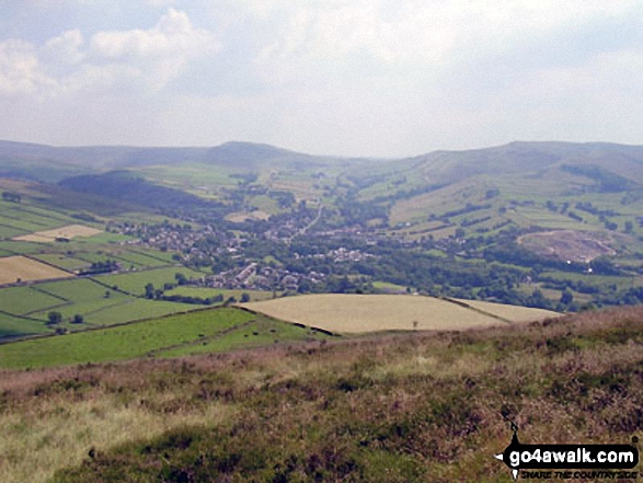
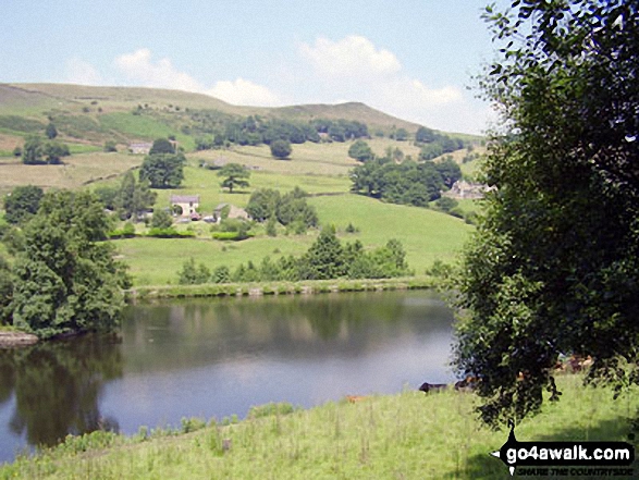
Chinley Churn above Birch Vale and The Sett Valley Trail from
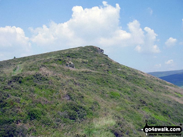
The Pennine Bridleway on the lower slopes of Lantern Pike


. . . see all 10 walk photographs & pictures of views from, on, or of, Lantern Pike
Send us your photographs and pictures on, of, or from Lantern Pike
If you would like to add your walk photographs and pictures to this page, please send them as email attachments (configured for any computer) along with your name to:
and we shall do our best to publish them.
(Guide Resolution = 300dpi. At least = 660pixels (wide) x 440 pixels (high).)

You can also submit photos via our Facebook Page.
NB. Please indicate where each photo was taken and whether you wish us to credit your photos with a Username or your First Name/Last Name.


