
![]()
Onesmoor (Kirk Edge)
395m (1296ft)
The Dark Peak Area, The Peak District, South Yorkshire, England
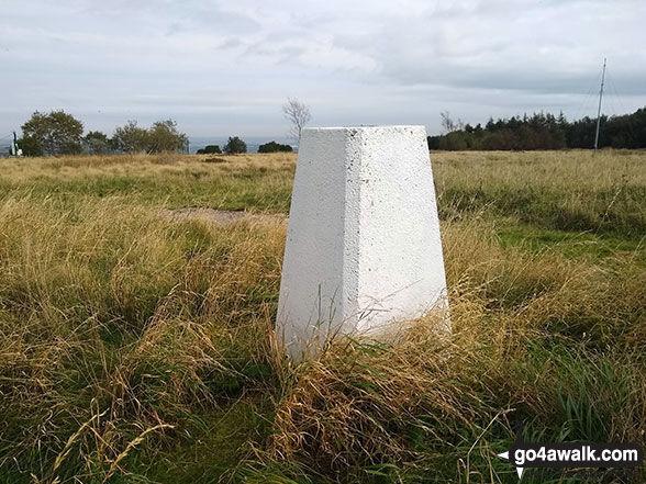
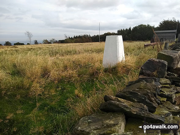
The summit of Onesmoor (Kirk Edge) is marked by an Ordnance Survey Trig Point.
Not familiar with this top?
   |
|---|
Vital Statistics:
| Length: | 5mls (8km) |
|---|---|
| Ascent: | 827ft (252m) |
| Time: | 2½ hrs |
| Grade: |  (Easy) (Easy) |
Route Summary:
Low Bradfield - Mill Farm - Peck Hall - Sheffield Country Walk - Cliffe House Farm - Primrose Cottage Farm - Onesmoor (Kirk Edge) - High Bradfield - Sheffield Country Walk - Low Bradfield
See Onesmoor (Kirk Edge) and the surrounding tops on our free-to-access 'Google Style' Peak Bagging Maps:
The Dark Peak Area of The Peak District National Park
Less data - quicker to download
See Onesmoor (Kirk Edge) and the surrounding tops on our downloadable Peak Bagging Map in PDF format:

NB: Whether you print off a copy or download it to your phone, this PDF Peak Baggers' Map might prove incredibly useful when your are up there on the tops and you cannot get a phone signal.
You can find Onesmoor (Kirk Edge) & all the walks that climb it on these unique free-to-access Interactive Walk Planning Maps:
1:25,000 scale OS Explorer Map (orange/yellow covers):
1:50,000 scale OS Landranger Map (pink/magenta covers):
 Fellow go4awalkers who have already walked, climbed, summited & bagged Onesmoor (Kirk Edge)
Mark Davidson walked up Onesmoor (Kirk Edge) on September 28th, 2020 [from/via/route] Walk sy101 Onesmoor (Kirk Edge) from Low Bradfield [with] Theresa [weather] Started off dull & cloudy but brightened up in the afternoon
John Gehrke climbed Onesmoor (Kirk Edge) on October 20th, 2013 [from/via/route] from High Bradfield [with] solo [weather] mostly fair
To add (or remove) your name and experiences on this page - Log On and edit your Personal Mountain Bagging Record
More Photographs & Pictures of views from, on or of Onesmoor (Kirk Edge)
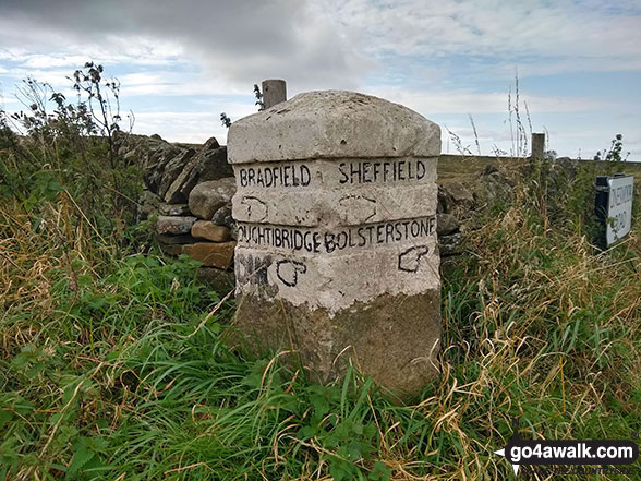
Old sign post on the crossroads near the summit of Onesmoor (Kirk Edge)
Send us your photographs and pictures on, of, or from Onesmoor (Kirk Edge)
If you would like to add your walk photographs and pictures featuring views from, on or of Onesmoor (Kirk Edge) to this page, please send them as email attachments (configured for any computer) along with your name to:
and we shall do our best to publish them.
(Guide Resolution = 300dpi. At least = 660pixels (wide) x 440 pixels (high).)

You can also submit photos via our Facebook Page.
NB. Please indicate where each photo was taken and whether you wish us to credit your photos with a Username or your First Name/Last Name.
Not familiar with this top?


