Wales - a fully detailed list of all the Mountains, Peaks, Tops and Hills (Page 2 of 5)
Wales is defined as the whole of the principality of Wales which includes the National Parks of Snowdonia,
Bannau Brycheiniog (The Brecon Beacons) and The Pembrokeshire Coast as well as Mynyddoedd Cambria (The Cambrian Mountains), Radnor Forest, Anglesey, The Llynn Peninsula, The Preseli Mountains and The Gower Peninsula.
If you count only the Mountains (Hewitts) there are 136 tops to climb, bag & conquer and the highest point is Snowdon (Yr Wyddfa) at 1,085m (3,561ft).
To see these Mountains, Peaks, Tops and Hills displayed in different ways - see the options in the left-hand column and towards the bottom of this page.
LOG ON and RELOAD this page to show which Mountains, Peaks, Tops and Hills you have already climbed, bagged & conquered [. . . more details]
Page 2 of 5 Go to page:
1 2 3 4 5 |
See this list in: Alphabetical Order‡
| Height Order
To reverse the order select the link again.
Mountain, Peak, Top or Hill:
Bagged
31. Dduallt (Arenigs)
662m (2,172ft)
Mountain (97th in Wales, 232nd in England & Wales)
Nuttall (126th in Wales, 305th in England & Wales)
To walk, climb & bag Dduallt (Arenigs) use this easy-to-follow walk:
See the location of Dduallt (Arenigs) and walks up it on a google MapDduallt (Arenigs) is on interactive maps:
OS Explorer (Orange Covers): OL23
OS Landranger (Pink Covers): 124 and
125
Dduallt (Arenigs) is on downloadable PDF you can Print or Save to your Phone:
|
32. Diffwys
750m (2,462ft)
Mountain (51st in Wales, 120th in England & Wales)
Nuttall (63rd in Wales, 147th in England & Wales)
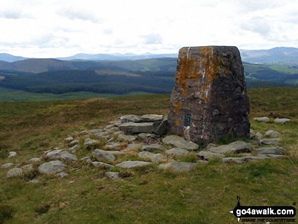
OS Trig Point
To walk, climb & bag Diffwys use this easy-to-follow walk:
See the location of Diffwys and walks up it on a google MapDiffwys is on interactive maps:
OS Explorer (Orange Covers): OL18
OS Landranger (Pink Covers): 124
Diffwys is on downloadable PDF you can Print or Save to your Phone:
|
33. Drosgl
758m (2,488ft)
Mountain (47th in Wales, 113th in England & Wales)
Nuttall (58th in Wales, 137th in England & Wales)
To walk, climb & bag Drosgl use either of these easy-to-follow walks:
See the location of Drosgl and walks up it on a google MapDrosgl is on interactive maps:
OS Explorer (Orange Covers): OL17
OS Landranger (Pink Covers): 115
Drosgl is on downloadable PDF you can Print or Save to your Phone:
|
34. Drum (Carneddau)
771m (2,530ft)
Mountain (42nd in Wales, 102nd in England & Wales)
Nuttall (53rd in Wales, 126th in England & Wales)
To walk, climb & bag Drum (Carneddau) use any of these easy-to-follow walks:
See the location of Drum (Carneddau) and walks up it on a google MapDrum (Carneddau) is on interactive maps:
OS Explorer (Orange Covers): OL17
OS Landranger (Pink Covers): 115
Drum (Carneddau) is on downloadable PDF you can Print or Save to your Phone:
|
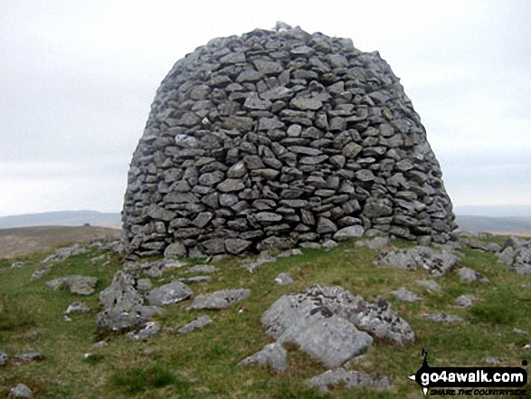
35. Drygarn Fawr
645m (2,116ft)
Mountain (106th in Wales, 256th in England & Wales)
Nuttall (145th in Wales, 341st in England & Wales)
Marilyn (47th in Wales, 702nd in GB)
OS Trig Point
To walk, climb & bag Drygarn Fawr use this easy-to-follow walk:
See the location of Drygarn Fawr and walks up it on a google MapDrygarn Fawr is on interactive maps:
OS Explorer (Orange Covers): 200 and
187
OS Landranger (Pink Covers): 147
A downloadable go4awalk.com PDF Peak Bagging Map featuring Drygarn Fawr will be available soon. |
36. Elidir Fawr
924m (3,033ft)
Mountain (13th in Wales, 19th in England & Wales)
Nuttall (14th in Wales, 22nd in England & Wales)
Marilyn (5th in Wales, 201st in GB)
To walk, climb & bag Elidir Fawr use either of these easy-to-follow walks:
See the location of Elidir Fawr and walks up it on a google MapElidir Fawr is on interactive maps:
OS Explorer (Orange Covers): OL17
OS Landranger (Pink Covers): 115
Elidir Fawr is on downloadable PDF you can Print or Save to your Phone:
|
37. Erw y Ddafad-ddu
872m (2,861ft)
Mountain (22nd in Wales, 37th in England & Wales)
Nuttall (24th in Wales, 42nd in England & Wales)
To walk, climb & bag Erw y Ddafad-ddu use either of these easy-to-follow walks:
See the location of Erw y Ddafad-ddu and walks up it on a google MapErw y Ddafad-ddu is on interactive maps:
OS Explorer (Orange Covers): OL23
OS Landranger (Pink Covers): 124
Erw y Ddafad-ddu is on downloadable PDF you can Print or Save to your Phone:
|
38. Esgeiriau Gwynion
671m (2,202ft)
Mountain (85th in Wales, 213th in England & Wales)
Nuttall (115th in Wales, 284th in England & Wales)
Marilyn (40th in Wales, 650th in GB)
To walk, climb & bag Esgeiriau Gwynion use this easy-to-follow walk:
See the location of Esgeiriau Gwynion and walks up it on a google MapEsgeiriau Gwynion is on interactive maps:
OS Explorer (Orange Covers): OL23
OS Landranger (Pink Covers): 124
Esgeiriau Gwynion is on downloadable PDF you can Print or Save to your Phone:
|
39. Fan Brycheiniog (Twr y Fan Foel)
802m (2,632ft)
Mountain (34th in Wales, 76th in England & Wales)
Nuttall (43rd in Wales, 91st in England & Wales)
Marilyn (15th in Wales, 390th in GB)
OS Trig Point
Fan Brycheiniog (Twr y Fan Foel) became the local Mountain (Hewitt) and 'Nuttall' after a survey found the top to be 0.75m higher than the Trig Point.
To walk, climb & bag Fan Brycheiniog (Twr y Fan Foel) use either of these easy-to-follow walks:
See the location of Fan Brycheiniog (Twr y Fan Foel) and walks up it on a google MapFan Brycheiniog (Twr y Fan Foel) is on interactive maps:
OS Explorer (Orange Covers): OL12
OS Landranger (Pink Covers): 160
Fan Brycheiniog (Twr y Fan Foel) is on downloadable PDF you can Print or Save to your Phone:
|
40. Fan Fawr
734m (2,409ft)
Mountain (56th in Wales, 135th in England & Wales)
Nuttall (70th in Wales, 167th in England & Wales)
Marilyn (26th in Wales, 517th in GB)
OS Trig Point
To walk, climb & bag Fan Fawr use either of these easy-to-follow walks:
See the location of Fan Fawr and walks up it on a google MapFan Fawr is on interactive maps:
OS Explorer (Orange Covers): OL12
OS Landranger (Pink Covers): 160
Fan Fawr is on downloadable PDF you can Print or Save to your Phone:
|
41. Fan Frynych
628m (2,062ft)
Mountain (115th in Wales, 276th in England & Wales)
Nuttall (162nd in Wales, 377th in England & Wales)
OS Trig Point
To walk, climb & bag Fan Frynych use any of these easy-to-follow walks:
See the location of Fan Frynych and walks up it on a google MapFan Frynych is on interactive maps:
OS Explorer (Orange Covers): OL12
OS Landranger (Pink Covers): 160
Fan Frynych is on downloadable PDF you can Print or Save to your Phone:
|
42. Fan Gyhirych
725m (2,379ft)
Mountain (60th in Wales, 143rd in England & Wales)
Nuttall (74th in Wales, 177th in England & Wales)
Marilyn (29th in Wales, 538th in GB)
OS Trig Point
To walk, climb & bag Fan Gyhirych use either of these easy-to-follow walks:
See the location of Fan Gyhirych and walks up it on a google MapFan Gyhirych is on interactive maps:
OS Explorer (Orange Covers): OL12
OS Landranger (Pink Covers): 160
Fan Gyhirych is on downloadable PDF you can Print or Save to your Phone:
|
43. Fan Hir
760m (2,494ft)
Mountain (46th in Wales, 112th in England & Wales)
Nuttall (57th in Wales, 136th in England & Wales)
To walk, climb & bag Fan Hir use either of these easy-to-follow walks:
See the location of Fan Hir and walks up it on a google MapFan Hir is on interactive maps:
OS Explorer (Orange Covers): OL12
OS Landranger (Pink Covers): 160
Fan Hir is on downloadable PDF you can Print or Save to your Phone:
|
44. Fan Llia
631m (2,073ft)
Mountain (112th in Wales, 272nd in England & Wales)
Nuttall (154th in Wales, 368th in England & Wales)
To walk, climb & bag Fan Llia use any of these easy-to-follow walks:
See the location of Fan Llia and walks up it on a google MapFan Llia is on interactive maps:
OS Explorer (Orange Covers): OL12
OS Landranger (Pink Covers): 160
Fan Llia is on downloadable PDF you can Print or Save to your Phone:
|
45. Fan Nedd
663m (2,175ft)
Mountain (93rd in Wales, 226th in England & Wales)
Nuttall (124th in Wales, 302nd in England & Wales)
Marilyn (44th in Wales, 670th in GB)
OS Trig Point
To walk, climb & bag Fan Nedd use this easy-to-follow walk:
See the location of Fan Nedd and walks up it on a google MapFan Nedd is on interactive maps:
OS Explorer (Orange Covers): OL12
OS Landranger (Pink Covers): 160
Fan Nedd is on downloadable PDF you can Print or Save to your Phone:
|
46. Foel Cedig
668m (2,192ft)
Mountain (90th in Wales, 219th in England & Wales)
Nuttall (120th in Wales, 291st in England & Wales)
Marilyn (42nd in Wales, 656th in GB)
Foel Cedig became a Welsh Mountain (Hewitt), a 'Nuttall' and a 'Marilyn' in 2018 when it was found to be slightly higher that Cyrniau Nod 800m to the SE.
To walk, climb & bag Foel Cedig use either of these easy-to-follow walks:
See the location of Foel Cedig and walks up it on a google MapFoel Cedig is on interactive maps:
OS Explorer (Orange Covers): 239 and
255
OS Landranger (Pink Covers): 125
Foel Cedig is on downloadable PDF you can Print or Save to your Phone:
|
47. Foel Cwm-Sian Llwyd
648m (2,127ft)
Mountain (104th in Wales, 251st in England & Wales)
Nuttall (141st in Wales, 335th in England & Wales)
OS Trig Point
To walk, climb & bag Foel Cwm-Sian Llwyd use either of these easy-to-follow walks:
See the location of Foel Cwm-Sian Llwyd and walks up it on a google MapFoel Cwm-Sian Llwyd is on interactive maps:
OS Explorer (Orange Covers): 255
OS Landranger (Pink Covers): 125
Foel Cwm-Sian Llwyd is on downloadable PDF you can Print or Save to your Phone:
|
48. Foel Goch (Arenigs)
611m (2,005ft)
Mountain (132nd in Wales, 310th in England & Wales)
Nuttall (184th in Wales, 433rd in England & Wales)
Marilyn (52nd in Wales, 748th in GB)
OS Trig Point
We hope to have walks that climb & bag Foel Goch (Arenigs) very soon
See the location of Foel Goch (Arenigs) and walks up it on a google MapFoel Goch (Arenigs) is on interactive maps:
OS Explorer (Orange Covers): OL18
OS Landranger (Pink Covers): 124 and
125
Foel Goch (Arenigs) is on downloadable PDF you can Print or Save to your Phone:
|
49. Foel Goch (Berwyns)
612m (2,010ft)
Mountain (130th in Wales, 307th in England & Wales)
Nuttall (182nd in Wales, 427th in England & Wales)
To walk, climb & bag Foel Goch (Berwyns) use either of these easy-to-follow walks:
See the location of Foel Goch (Berwyns) and walks up it on a google MapFoel Goch (Berwyns) is on interactive maps:
OS Explorer (Orange Covers): OL23
OS Landranger (Pink Covers): 125
Foel Goch (Berwyns) is on downloadable PDF you can Print or Save to your Phone:
|
50. Foel Grach
976m (3,203ft)
Mountain (8th in Wales, 9th in England & Wales)
Nuttall (8th in Wales, 9th in England & Wales)
To walk, climb & bag Foel Grach use this easy-to-follow walk:
See the location of Foel Grach and walks up it on a google MapFoel Grach is on interactive maps:
OS Explorer (Orange Covers): OL17
OS Landranger (Pink Covers): 115
Foel Grach is on downloadable PDF you can Print or Save to your Phone:
|
51. Foel Gron
629m (2,064ft)
Mountain (116th in Wales, 277th in England & Wales)
Nuttall (160th in Wales, 375th in England & Wales)
To walk, climb & bag Foel Gron use either of these easy-to-follow walks:
See the location of Foel Gron and walks up it on a google MapFoel Gron is on interactive maps:
OS Explorer (Orange Covers): OL17
OS Landranger (Pink Covers): 115
Foel Gron is on downloadable PDF you can Print or Save to your Phone:
|
52. Foel Hafod-fynydd
689m (2,260ft)
Mountain (75th in Wales, 186th in England & Wales)
Nuttall (97th in Wales, 242nd in England & Wales)
To walk, climb & bag Foel Hafod-fynydd use this easy-to-follow walk:
See the location of Foel Hafod-fynydd and walks up it on a google MapFoel Hafod-fynydd is on interactive maps:
OS Explorer (Orange Covers): OL23
OS Landranger (Pink Covers): 124
Foel Hafod-fynydd is on downloadable PDF you can Print or Save to your Phone:
|
53. Foel Penolau
614m (2,016ft)
Mountain (128th in Wales, 304th in England & Wales)
Nuttall (178th in Wales, 421st in England & Wales)
Foel Penolau was upgraded to a Welsh Mountain (Hewiit) in December, 2018
To walk, climb & bag Foel Penolau use this easy-to-follow walk:
See the location of Foel Penolau and walks up it on a google MapFoel Penolau is on interactive maps:
OS Explorer (Orange Covers): OL18
OS Landranger (Pink Covers): 124
Foel Penolau is on downloadable PDF you can Print or Save to your Phone:
|
54. Foel Wen
691m (2,267ft)
Mountain (71st in Wales, 181st in England & Wales)
Nuttall (92nd in Wales, 235th in England & Wales)
To walk, climb & bag Foel Wen use this easy-to-follow walk:
See the location of Foel Wen and walks up it on a google MapFoel Wen is on interactive maps:
OS Explorer (Orange Covers): 255
OS Landranger (Pink Covers): 125
Foel Wen is on downloadable PDF you can Print or Save to your Phone:
|
55. Foel y Geifr (Berwyns)
626m (2,055ft)
Mountain (119th in Wales, 283rd in England & Wales)
Nuttall (164th in Wales, 385th in England & Wales)
OS Trig Point
To walk, climb & bag Foel y Geifr (Berwyns) use either of these easy-to-follow walks:
See the location of Foel y Geifr (Berwyns) and walks up it on a google MapFoel y Geifr (Berwyns) is on interactive maps:
OS Explorer (Orange Covers): OL23
OS Landranger (Pink Covers): 125
Foel y Geifr (Berwyns) is on downloadable PDF you can Print or Save to your Phone:
|
56. Foel-fras (Carneddau)
942m (3,091ft)
Mountain (11th in Wales, 14th in England & Wales)
Nuttall (12th in Wales, 16th in England & Wales)
OS Trig Point
We hope to have walks that climb & bag Foel-fras (Carneddau) very soon
See the location of Foel-fras (Carneddau) and walks up it on a google MapFoel-fras (Carneddau) is on interactive maps:
OS Explorer (Orange Covers): OL17
OS Landranger (Pink Covers): 115
Foel-fras (Carneddau) is on downloadable PDF you can Print or Save to your Phone:
|
57. Foel-goch
831m (2,727ft)
Mountain (28th in Wales, 59th in England & Wales)
Nuttall (32nd in Wales, 68th in England & Wales)
To walk, climb & bag Foel-goch use either of these easy-to-follow walks:
See the location of Foel-goch and walks up it on a google MapFoel-goch is on interactive maps:
OS Explorer (Orange Covers): OL17
OS Landranger (Pink Covers): 115
Foel-goch is on downloadable PDF you can Print or Save to your Phone:
|
58. Gallt y Daren
619m (2,032ft)
Mountain (125th in Wales, 295th in England & Wales)
Nuttall (172nd in Wales, 407th in England & Wales)
To walk, climb & bag Gallt y Daren use either of these easy-to-follow walks:
See the location of Gallt y Daren and walks up it on a google MapGallt y Daren is on interactive maps:
OS Explorer (Orange Covers): OL18 and
OL23
OS Landranger (Pink Covers): 124
Gallt y Daren is on downloadable PDF you can Print or Save to your Phone:
|
59. Gallt yr Ogof
763m (2,504ft)
Mountain (45th in Wales, 108th in England & Wales)
Nuttall (56th in Wales, 132nd in England & Wales)
To walk, climb & bag Gallt yr Ogof use either of these easy-to-follow walks:
See the location of Gallt yr Ogof and walks up it on a google MapGallt yr Ogof is on interactive maps:
OS Explorer (Orange Covers): OL17
OS Landranger (Pink Covers): 115
Gallt yr Ogof is on downloadable PDF you can Print or Save to your Phone:
|
60. Garnedd Ugain (Crib y Ddysgl)
1,066m (3,499ft)
Mountain (2nd in Wales, 2nd in England & Wales)
Nuttall (2nd in Wales, 2nd in England & Wales)
OS Trig Point
To walk, climb & bag Garnedd Ugain (Crib y Ddysgl) use any of these easy-to-follow walks:
See the location of Garnedd Ugain (Crib y Ddysgl) and walks up it on a google MapGarnedd Ugain (Crib y Ddysgl) is on interactive maps:
OS Explorer (Orange Covers): OL17
OS Landranger (Pink Covers): 115
Garnedd Ugain (Crib y Ddysgl) is on downloadable PDF you can Print or Save to your Phone:
|
Page 2 of 5 Go to page:
1 2 3 4 5 |
View these 136 Mountains, Peaks, Tops and Hills:
Is there a Mountain, Peak, Top or Hill missing from the above google map or list?
Let us know an we will add it to our database.

 Snowdon (Yr Wyddfa) in The Snowdon AreaWales


