   |
Vital Statistics:
| Length: | 11mls (17.5km) |
| Ascent: | 2,839ft (865m) |
| Time: | 6¾hrs |
| Grade: |  |
Route outline for walk gw157:
Bwlch y Groes - Gwaun Yr Hen-Luest - Clipiau-Duon - Llechwedd Du (Arans) - Afon Twrch - Foel Rhudd - Esgeiriau Gwynion - Bwlch Sirddyn - Foel Hafod-fynydd - Creiglyn Dyfi - Llaethnant - Ceunant y Briddell - Pen y Craig - Natn Llewlyn-goch - Blaen-pennant - Afon Rhiwlech - Foel y Groes - Moel y Cerrig Duon - Bwlch y Groes
Peaks, Summits and Tops reached on this walk:
 4 Welsh Mountains |
 0 Wainwrights |
 5 Welsh Nuttalls |
 0 Welsh Deweys |
 0 Wainwright Outlying Fells |
 1 Welsh Marilyn |
 0 Bridgets |
Peak Bagging Statistics for this walk:
The highest point of this walk is Foel Hafod-fynydd at 689m (2260ft). Foel Hafod-fynydd is classified as a Welsh Mountain (Hewitt) (75th highest in Wales, 186th highest in England & Wales)
Foel Hafod-fynydd is also known as a Welsh Nuttall (97th highest in Wales, 242nd highest in England & Wales).
Completing this walk will also take you to the top of Esgeiriau Gwynion at 671m (2202ft). Esgeiriau Gwynion is classified as a Welsh Mountain (Hewitt) (85th highest in Wales, 213th highest in England & Wales)
Esgeiriau Gwynion is also known as a Welsh Nuttall (115th highest in Wales, 284th highest in England & Wales) and a Welsh Marilyn (40th highest in Wales, 650th highest in the UK).
You will also reach the summit of Foel Rhudd at 659m (2163ft). Foel Rhudd is also known as a Welsh Nuttall (130th highest in Wales, 311th highest in England & Wales).
Along the way you will also bag:
- Moel y Cerrig Duon at 625m (2051ft). Moel y Cerrig Duon is classified as a Welsh Mountain (Hewitt) (120th Wales, 284th Eng & Wal) and a Welsh Nuttall (165th highest in Wales, 386th highest in England & Wales).
- Llechwedd Du (Arans) at 614m (2015ft). Llechwedd Du (Arans) is classified as a Welsh Mountain (Hewitt) (129th Wales, 305th Eng & Wal) and a Welsh Nuttall (180th highest in Wales, 424th highest in England & Wales).
You can find this walk and other nearby walks on these unique free-to-access Interactive Walk Planning Maps:
1:25,000 scale OS Explorer Map (orange/yellow covers):
1:50,000 scale OS Landranger Map (pink/magenta covers):
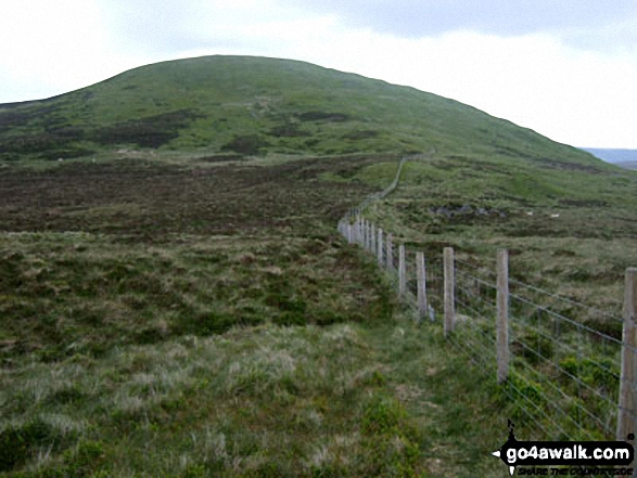
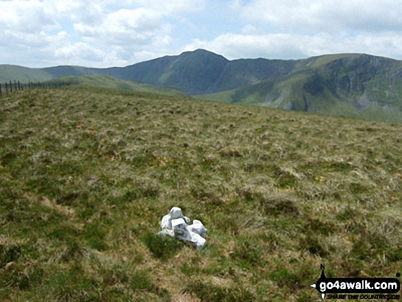
Some Photos and Pictures from Walk gw157 Llechwedd Du, Esgeiriau Gwynion, Foel Hafod-fynydd and Moel y Cerrig Duon from Bwlch y Groes
In no particular order . . .
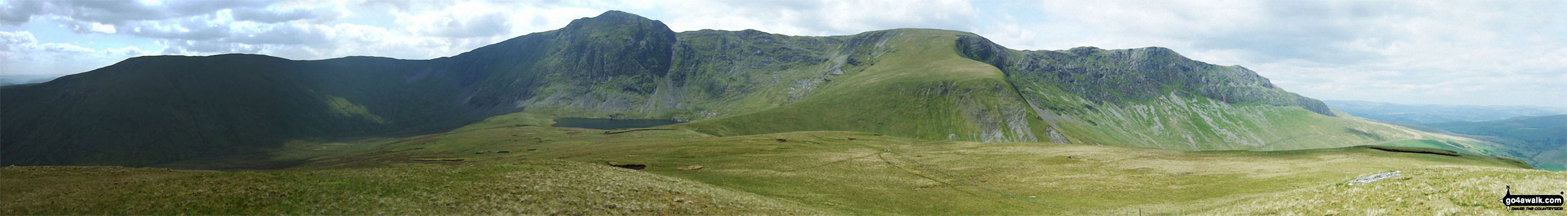
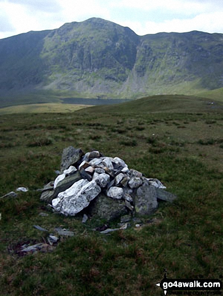
The Aran Fawddwy Ridge - Drysgol (left) Drws Bach, Aran Fawddwy, Erw y Ddafad-ddu & Aran Benllyn from Foel Hafod-fynydd
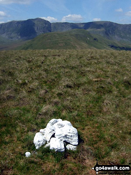
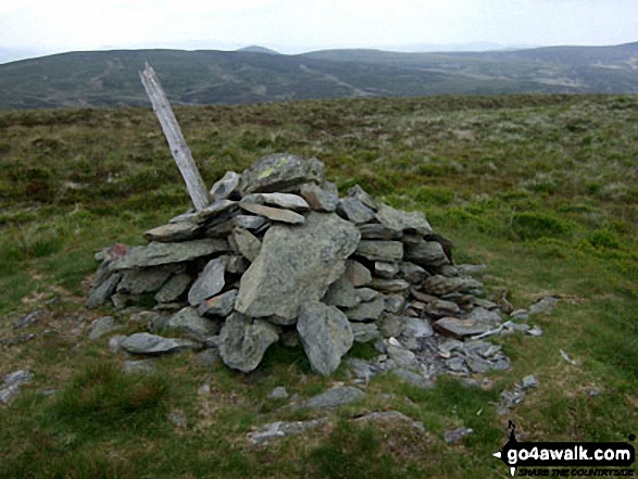
Lechwedd Du summit cairn with the Aran Fawddwy ridge (Aran Fawddwy, Erw y Ddafad-ddu & Aran Benllyn) in the background
Send us your photographs and pictures from your walks and hikes
We would love to see your photographs and pictures from walk gw157 Llechwedd Du, Esgeiriau Gwynion, Foel Hafod-fynydd and Moel y Cerrig Duon from Bwlch y Groes. Send them in to us as email attachments (configured for any computer) along with your name and where the picture was taken to:
and we shall do our best to publish them.
(Guide Resolution = 300dpi. At least = 660 pixels (wide) x 440 pixels (high).)

You can also submit photos from walk gw157 Llechwedd Du, Esgeiriau Gwynion, Foel Hafod-fynydd and Moel y Cerrig Duon from Bwlch y Groes via our Facebook Page.
NB. Please indicate where each photo was taken.


