   |
Vital Statistics:
| Length: | 7¾mls (12.5km) |
| Ascent: | 1,661ft (506m) |
| Time: | 4½hrs |
| Grade: |  |
Route outline for walk dn106:
Cwm Pennant - Ffridd Ddu - Bryniau Gleision - Cwm Sian Llwyd - Foel Cwm-Sian Llwyd - Trwyn Swch - Nant Llwyn-gwerh - Nant Ceunant-bach - Milltir Gerrig - Nant Cwm Pydew - Blaen-y-cwm - Cwm Pennant
Points of Interest/Notes on this walk:
The descent from Craig Cwm Silyn into Cwm Pennant is down very steep grass and only recommended in good, dry weather. Further more the climb back out of Cwm Pennant involves over 700ft of ascent across rough grass.
Peaks, Summits and Tops reached on this walk:
 1 Welsh Mountain |
 0 Wainwrights |
 1 Welsh Nuttall |
 0 Welsh Deweys |
 0 Wainwright Outlying Fells |
 0 Welsh Marilyns |
 0 Bridgets |
Peak Bagging Statistics for this walk:
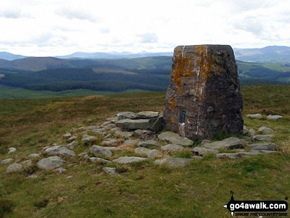
The highest point of this walk is Foel Cwm-Sian Llwyd at 648m (2127ft). Foel Cwm-Sian Llwyd is classified as a Welsh Mountain (Hewitt) (104th highest in Wales, 251st highest in England & Wales)
Foel Cwm-Sian Llwyd is also known as a Welsh Nuttall (141st highest in Wales, 335th highest in England & Wales). The summit of Foel Cwm-Sian Llwyd is marked by an Ordnance Survey Trig Point.
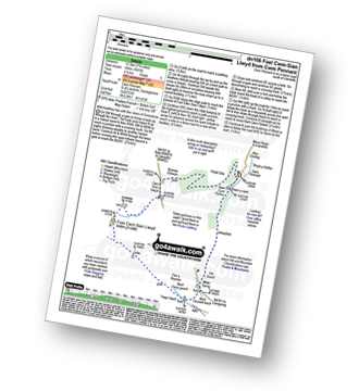
You can find this walk and other nearby walks on these unique free-to-access Interactive Walk Planning Maps:
1:25,000 scale OS Explorer Map (orange/yellow covers):
1:50,000 scale OS Landranger Map (pink/magenta covers):
Some Photos and Pictures from Walk dn106 Foel Cwm-Sian Llwyd from Cwm Pennant
In no particular order . . .
Send us your photographs and pictures from your walks and hikes
We would love to see your photographs and pictures from walk dn106 Foel Cwm-Sian Llwyd from Cwm Pennant. Send them in to us as email attachments (configured for any computer) along with your name and where the picture was taken to:
and we shall do our best to publish them.
(Guide Resolution = 300dpi. At least = 660 pixels (wide) x 440 pixels (high).)

You can also submit photos from walk dn106 Foel Cwm-Sian Llwyd from Cwm Pennant via our Facebook Page.
NB. Please indicate where each photo was taken.


