
![]()
Foel Penolau
614m (2016ft)
The Rhinogs, Snowdonia, Gwynedd, Wales
Foel Penolau was upgraded to a Welsh Mountain (Hewiit) in December, 2018
Not familiar with this top?
   |
|---|
Vital Statistics:
| Length: | 6.5mls (10.5km) |
|---|---|
| Ascent: | 1,664ft (507m) |
| Time: | 4.25hrs |
| Grade: |  (Moderate) (Moderate) |
Route Summary:
Moel-y-geifr - Llyn Eiddew-bach - Llyn Du - Moel Ysgyfarnogod - Foel Penolau - Llyn Dywarchen - Llyn Eiddew-bach - Moel-y-geifr
See Foel Penolau and the surrounding tops on our free-to-access 'Google Style' Peak Bagging Maps:
The Rhinogs of Snowdonia National Park
Less data - quicker to download
The Whole of Snowdonia National Park
More data - might take a little longer to download
See Foel Penolau and the surrounding tops on our downloadable Peak Bagging Map in PDF format:

NB: Whether you print off a copy or download it to your phone, this PDF Peak Baggers' Map might prove incredibly useful when your are up there on the tops and you cannot get a phone signal.
You can find Foel Penolau & all the walks that climb it on these unique free-to-access Interactive Walk Planning Maps:
1:25,000 scale OS Explorer Map (orange/yellow covers):
1:50,000 scale OS Landranger Map (pink/magenta covers):
 Fellow go4awalkers who have already walked, climbed, summited & bagged Foel Penolau
Melfyn Parry walked up Foel Penolau on May 7th, 2024 [from/via/route] Followed go4awalk route gw150, very good guidance & notes. [with] With my 4 legged pal Harri [weather] Overcast to start, but great for the dog. Sun appeared after lunch which meant it got a bit warm on the way down. - Note, from the post at SH637342 to junction at SH650347 the path can be quite boggy, otherwise good paths mainly. Also, when you reach the gulley in note 5, there is a cairn on both summits & OS states they have the same height, so to bag the peak you'll need to scramble up both. The peak on the right is a spectacular flat platform of rock once you're up the 10m scramble.
Christina Lander climbed Foel Penolau on September 2nd, 2023 [from/via/route] Llyn Tecwyn Isaf - Bryn Cader Faner - Moel Ysgyfarnogod - Foel Penolau - Moel y Gyrafolen - Cwm Moch - Llyn Tecwyn Isaf [with] Dick [weather] Sunny day
Donovan Suddell bagged Foel Penolau on September 17th, 2022 [from/via/route] Moel y Geifr [with] Wife [weather] Sunny day
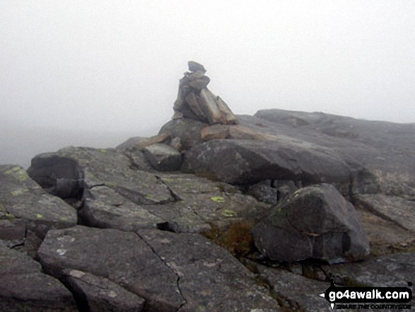
Mark Davidson hiked Foel Penolau on June 1st, 2010 [from/via/route] Walk gw150 Moel Ysgyfarnogod & Foel Penolau from Moel-y-geifr [with] Alone [weather] Low cloud & mist - disappointing
Mark Smith summited Foel Penolau on March 13th, 2011 [weather] cold but sunny
Bleddyn Rhys conquered Foel Penolau on August 27th, 2016 [from/via/route] Cerdded drosodd o llyn Traws, ar hyd y ridge, ac i lawr heibio Bryn Cader Faner i Ship aground yn Talsarnau [with] Diwrnod allan gyda Kevin a Ken [weather] Eithaf braf gyda cymylau ond sych a dim llawer o wynt mond ar y top - Diwrnod da! Eithaf hir, Ken yn ara deg. Bryn Cader Faner yn underwhelming chydig! Anodd ei ffeindio. Penglin Ken yn brifo ar y ffordd allan, Dad yn dod i'n cyfarfod yn capel Llandecwyn a mynd a ni i'r pub. Ceri ddim yn hapus!
Patrick Rogozinski, Trevor Williams and Paul Booth have all walked, climbed & bagged Foel Penolau.
To add (or remove) your name and experiences on this page - Log On and edit your Personal Mountain Bagging Record
More Photographs & Pictures of views from, on or of Foel Penolau
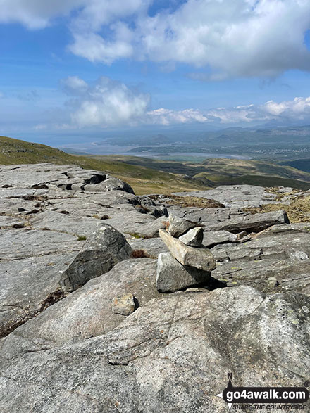
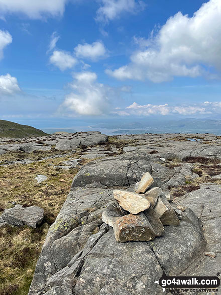
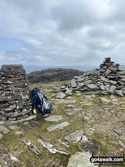
The cairn on the East summit of Foel Penolau looking towards Portmeirion and Porthmadog
Send us your photographs and pictures on, of, or from Foel Penolau
If you would like to add your walk photographs and pictures featuring views from, on or of Foel Penolau to this page, please send them as email attachments (configured for any computer) along with your name to:
and we shall do our best to publish them.
(Guide Resolution = 300dpi. At least = 660pixels (wide) x 440 pixels (high).)

You can also submit photos via our Facebook Page.
NB. Please indicate where each photo was taken and whether you wish us to credit your photos with a Username or your First Name/Last Name.
Not familiar with this top?


