The Yorkshire region of England - a fully detailed list of all the Mountains, Peaks, Tops and Hills (Page of 2)
The Yorkshire region of England comprises the traditional counties of East Riding of Yorkshire, North Yorkshire, South Yorkshire and West Yorkshire.
If you include all the Mountains (Hewitts), the Deweys, the Nuttalls, the Marilyns, the Bridgets (Hills) and all the Mountains, Tops, Peaks and Hills with a Trig Point on them there are 117 tops to climb, bag & conquer and the highest point is Whernside at 736m (2,416ft).
To see these Mountains, Peaks, Tops and Hills displayed in different ways - see the options in the left-hand column and towards the bottom of this page.
LOG ON and RELOAD this page to show which Mountains, Peaks, Tops and Hills you have already climbed, bagged & conquered [. . . more details]
Page 1 of 2 Go to page:
1 2 |
See this list in: Alphabetical Order
| Height Order‡
To reverse the order select the link again.
Mountain, Peak, Top or Hill:
Bagged
1. Oliver's Mount
155m (508ft)
Bridget
We hope to have walks that climb & bag Oliver's Mount very soon
See the location of Oliver's Mount and walks up it on a google MapOliver's Mount is on interactive maps:
OS Explorer (Orange Covers): OL27 and
301
OS Landranger (Pink Covers): 101
|
2. Great Wold
164m (538ft)
Bridget
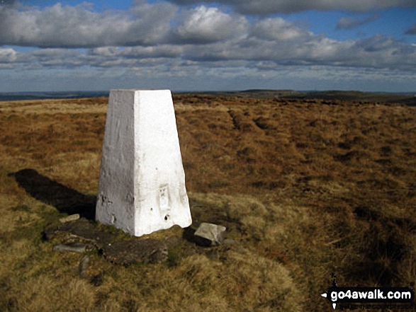
OS Trig Point
We hope to have walks that climb & bag Great Wold very soon
See the location of Great Wold and walks up it on a google MapGreat Wold is on interactive maps:
OS Explorer (Orange Covers): 293
OS Landranger (Pink Covers): 106
|
3. Yearsley Cross
174m (571ft)
Bridget
OS Trig Point
We hope to have walks that climb & bag Yearsley Cross very soon
See the location of Yearsley Cross and walks up it on a google MapYearsley Cross is on interactive maps:
OS Explorer (Orange Covers): 300
OS Landranger (Pink Covers): 100
|
4. Seamer Beacon
189m (620ft)
Bridget
We hope to have walks that climb & bag Seamer Beacon very soon
See the location of Seamer Beacon and walks up it on a google MapSeamer Beacon is on interactive maps:
OS Explorer (Orange Covers): OL27 and
301
OS Landranger (Pink Covers): 101
|
5. Barns Cliff End
229m (751ft)
Bridget
We hope to have walks that climb & bag Barns Cliff End very soon
See the location of Barns Cliff End and walks up it on a google MapBarns Cliff End is on interactive maps:
OS Explorer (Orange Covers): OL27
OS Landranger (Pink Covers): 94 and
101
|
6. Eston Nab (Eston Beacon)
242m (794ft)
Bridget
OS Trig Point
We hope to have walks that climb & bag Eston Nab (Eston Beacon) very soon
See the location of Eston Nab (Eston Beacon) and walks up it on a google MapEston Nab (Eston Beacon) is on interactive maps:
OS Explorer (Orange Covers): OL26
OS Landranger (Pink Covers): 93
|
7. Lindley Moor
245m (804ft)
Bridget
OS Trig Point
We hope to have walks that climb & bag Lindley Moor very soon
See the location of Lindley Moor and walks up it on a google MapLindley Moor is on interactive maps:
OS Explorer (Orange Covers): 297
OS Landranger (Pink Covers): 104
Lindley Moor is on downloadable PDF you can Print or Save to your Phone:
|
8. Bishop Wilton Wold (South Wold)
246m (807ft)
Marilyn (157th in England, 1475th in GB)
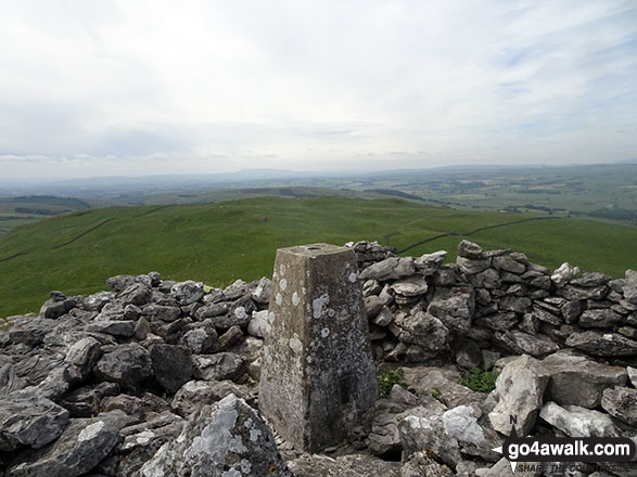
OS Trig Point
Bishop Wilton Wold (South Wold) is the highest point in The East Riding of Yorkshire.
We hope to have walks that climb & bag Bishop Wilton Wold (South Wold) very soon
See the location of Bishop Wilton Wold (South Wold) and walks up it on a google MapBishop Wilton Wold (South Wold) is on interactive maps:
OS Explorer (Orange Covers): 294
OS Landranger (Pink Covers): 106
|
9. Brow Moor
266m (873ft)
Bridget
OS Trig Point
We hope to have walks that climb & bag Brow Moor very soon
See the location of Brow Moor and walks up it on a google MapBrow Moor is on interactive maps:
OS Explorer (Orange Covers): OL27
OS Landranger (Pink Covers): 94
|
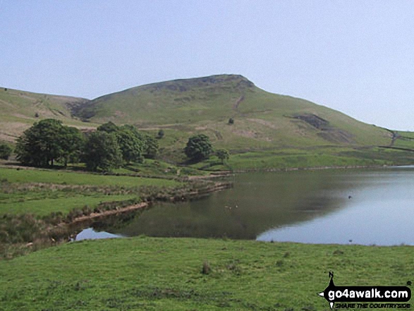
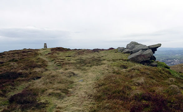
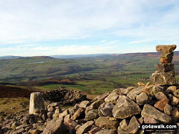
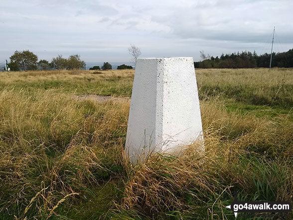
10. The Chevin (Otley Chevin)
282m (925ft)
Bridget
OS Trig Point
We hope to have walks that climb & bag The Chevin (Otley Chevin) very soon
See the location of The Chevin (Otley Chevin) and walks up it on a google MapThe Chevin (Otley Chevin) is on interactive maps:
OS Explorer (Orange Covers): 297
OS Landranger (Pink Covers): 104
The Chevin (Otley Chevin) is on downloadable PDF you can Print or Save to your Phone:
|
11. Stony Leas (Louven Howe)
299m (981ft)
Bridget
OS Trig Point
We hope to have walks that climb & bag Stony Leas (Louven Howe) very soon
See the location of Stony Leas (Louven Howe) and walks up it on a google MapStony Leas (Louven Howe) is on interactive maps:
OS Explorer (Orange Covers): OL27
OS Landranger (Pink Covers): 94 and
101
|
12. Wharncliffe Chase
317m (1,040ft)
Bridget
We hope to have walks that climb & bag Wharncliffe Chase very soon
See the location of Wharncliffe Chase and walks up it on a google MapWharncliffe Chase is on interactive maps:
OS Explorer (Orange Covers): OL1 and
278
OS Landranger (Pink Covers): 110 and
111
|
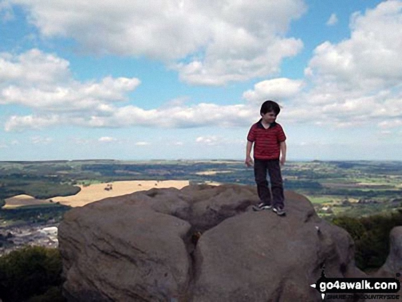
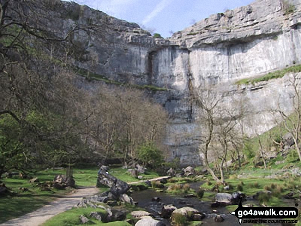
13. Malham Cove
319m (1,047ft)
Bridget
To walk, climb & bag Malham Cove use any of these easy-to-follow walks:
See the location of Malham Cove and walks up it on a google MapMalham Cove is on interactive maps:
OS Explorer (Orange Covers): OL2
OS Landranger (Pink Covers): 98
Malham Cove is on downloadable PDF you can Print or Save to your Phone:
|
14. Roseberry Topping
320m (1,050ft)
Bridget
OS Trig Point
We hope to have walks that climb & bag Roseberry Topping very soon
See the location of Roseberry Topping and walks up it on a google MapRoseberry Topping is on interactive maps:
OS Explorer (Orange Covers): OL26
OS Landranger (Pink Covers): 93
A downloadable go4awalk.com PDF Peak Bagging Map featuring Roseberry Topping will be available soon. |
15. Gisborough Moor
328m (1,076ft)
Marilyn (119th in England, 1334th in GB)
Gisborough Moor is the highest point in the county of Redcar and Cleveland.
We hope to have walks that climb & bag Gisborough Moor very soon
See the location of Gisborough Moor and walks up it on a google MapGisborough Moor is on interactive maps:
OS Explorer (Orange Covers): OL26
OS Landranger (Pink Covers): 94
A downloadable go4awalk.com PDF Peak Bagging Map featuring Gisborough Moor will be available soon. |
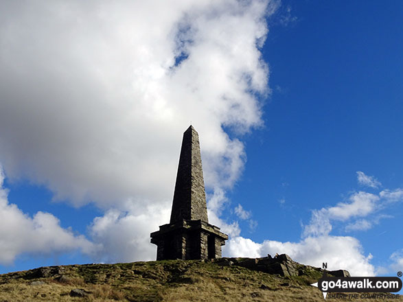
16. Earl Crag (Wainman's Pinnacle)
353m (1,159ft)
Bridget
We hope to have walks that climb & bag Earl Crag (Wainman's Pinnacle) very soon
See the location of Earl Crag (Wainman's Pinnacle) and walks up it on a google MapEarl Crag (Wainman's Pinnacle) is on interactive maps:
OS Explorer (Orange Covers): OL21
OS Landranger (Pink Covers): 103
Earl Crag (Wainman's Pinnacle) is on downloadable PDF you can Print or Save to your Phone:
|
17. Sharp Haw
357m (1,171ft)
Marilyn (107th in England, 1291st in GB)
OS Trig Point
To walk, climb & bag Sharp Haw use this easy-to-follow walk:
See the location of Sharp Haw and walks up it on a google MapSharp Haw is on interactive maps:
OS Explorer (Orange Covers): OL2
OS Landranger (Pink Covers): 103
Sharp Haw is on downloadable PDF you can Print or Save to your Phone:
|
18. Smearsett Scar
363m (1,191ft)
Bridget
OS Trig Point
We hope to have walks that climb & bag Smearsett Scar very soon
See the location of Smearsett Scar and walks up it on a google MapSmearsett Scar is on interactive maps:
OS Explorer (Orange Covers): OL2
OS Landranger (Pink Covers): 98
Smearsett Scar is on downloadable PDF you can Print or Save to your Phone:
|
19. Hartcliff Hill
364m (1,194ft)
Bridget
We hope to have walks that climb & bag Hartcliff Hill very soon
See the location of Hartcliff Hill and walks up it on a google MapHartcliff Hill is on interactive maps:
OS Explorer (Orange Covers): OL1
OS Landranger (Pink Covers): 110
Hartcliff Hill is on downloadable PDF you can Print or Save to your Phone:
|
20. Embsay Crag
371m (1,217ft)
Bridget
To walk, climb & bag Embsay Crag use this easy-to-follow walk:
See the location of Embsay Crag and walks up it on a google MapEmbsay Crag is on interactive maps:
OS Explorer (Orange Covers): OL2
OS Landranger (Pink Covers): 104
Embsay Crag is on downloadable PDF you can Print or Save to your Phone:
|
21. Skipton Moor
373m (1,224ft)
Bridget
OS Trig Point
We hope to have walks that climb & bag Skipton Moor very soon
See the location of Skipton Moor and walks up it on a google MapSkipton Moor is on interactive maps:
OS Explorer (Orange Covers): OL2
OS Landranger (Pink Covers): 104
|
22. Elslack Moor (Pinhaw Beacon)
388m (1,273ft)
Bridget
OS Trig Point
We hope to have walks that climb & bag Elslack Moor (Pinhaw Beacon) very soon
See the location of Elslack Moor (Pinhaw Beacon) and walks up it on a google MapElslack Moor (Pinhaw Beacon) is on interactive maps:
OS Explorer (Orange Covers): OL21
OS Landranger (Pink Covers): 103
Elslack Moor (Pinhaw Beacon) is on downloadable PDF you can Print or Save to your Phone:
|
23. Beamsley Beacon (Howber Hill)
393m (1,290ft)
Bridget
OS Trig Point
We hope to have walks that climb & bag Beamsley Beacon (Howber Hill) very soon
See the location of Beamsley Beacon (Howber Hill) and walks up it on a google MapBeamsley Beacon (Howber Hill) is on interactive maps:
OS Explorer (Orange Covers): OL2
OS Landranger (Pink Covers): 104
Beamsley Beacon (Howber Hill) is on downloadable PDF you can Print or Save to your Phone:
|
24. Onesmoor (Kirk Edge)
395m (1,296ft)
Bridget
OS Trig Point
To walk, climb & bag Onesmoor (Kirk Edge) use this easy-to-follow walk:
See the location of Onesmoor (Kirk Edge) and walks up it on a google MapOnesmoor (Kirk Edge) is on interactive maps:
OS Explorer (Orange Covers): OL1
OS Landranger (Pink Covers): 110
Onesmoor (Kirk Edge) is on downloadable PDF you can Print or Save to your Phone:
|
25. Black Hambleton
400m (1,312ft)
Bridget
OS Trig Point
We hope to have walks that climb & bag Black Hambleton very soon
See the location of Black Hambleton and walks up it on a google MapBlack Hambleton is on interactive maps:
OS Explorer (Orange Covers): OL26
OS Landranger (Pink Covers): 100
|
26. Stoodley Pike
401m (1,316ft)
Bridget
To walk, climb & bag Stoodley Pike use any of these easy-to-follow walks:
See the location of Stoodley Pike and walks up it on a google MapStoodley Pike is on interactive maps:
OS Explorer (Orange Covers): OL21
OS Landranger (Pink Covers): 103
Stoodley Pike is on downloadable PDF you can Print or Save to your Phone:
|
27. Rombalds Moor (Ilkley Moor)
402m (1,319ft)
Marilyn (97th in England, 1203rd in GB)
OS Trig Point
To walk, climb & bag Rombalds Moor (Ilkley Moor) use either of these easy-to-follow walks:
See the location of Rombalds Moor (Ilkley Moor) and walks up it on a google MapRombalds Moor (Ilkley Moor) is on interactive maps:
OS Explorer (Orange Covers): 297
OS Landranger (Pink Covers): 104
Rombalds Moor (Ilkley Moor) is on downloadable PDF you can Print or Save to your Phone:
|
28. Whorlton Moor (Carlton Bank)
408m (1,339ft)
Bridget
OS Trig Point
We hope to have walks that climb & bag Whorlton Moor (Carlton Bank) very soon
See the location of Whorlton Moor (Carlton Bank) and walks up it on a google MapWhorlton Moor (Carlton Bank) is on interactive maps:
OS Explorer (Orange Covers): OL26
OS Landranger (Pink Covers): 93
A downloadable go4awalk.com PDF Peak Bagging Map featuring Whorlton Moor (Carlton Bank) will be available soon. |
29. Lodge Moor (Ughill Moors)
409m (1,342ft)
Bridget
To walk, climb & bag Lodge Moor (Ughill Moors) use this easy-to-follow walk:
See the location of Lodge Moor (Ughill Moors) and walks up it on a google MapLodge Moor (Ughill Moors) is on interactive maps:
OS Explorer (Orange Covers): OL1
OS Landranger (Pink Covers): 110
Lodge Moor (Ughill Moors) is on downloadable PDF you can Print or Save to your Phone:
|
30. Round Hill (Bramberry Hill)
409m (1,342ft)
Bridget
We hope to have walks that climb & bag Round Hill (Bramberry Hill) very soon
See the location of Round Hill (Bramberry Hill) and walks up it on a google MapRound Hill (Bramberry Hill) is on interactive maps:
OS Explorer (Orange Covers): OL2
OS Landranger (Pink Covers): 104
Round Hill (Bramberry Hill) is on downloadable PDF you can Print or Save to your Phone:
|
31. Rylstone Fell
410m (1,345ft)
Bridget
To walk, climb & bag Rylstone Fell use any of these easy-to-follow walks:
See the location of Rylstone Fell and walks up it on a google MapRylstone Fell is on interactive maps:
OS Explorer (Orange Covers): OL2
OS Landranger (Pink Covers): 103
Rylstone Fell is on downloadable PDF you can Print or Save to your Phone:
|
32. Brown Bank Head
412m (1,352ft)
Bridget
We hope to have walks that climb & bag Brown Bank Head very soon
See the location of Brown Bank Head and walks up it on a google MapBrown Bank Head is on interactive maps:
OS Explorer (Orange Covers): OL2
OS Landranger (Pink Covers): 104
Brown Bank Head is on downloadable PDF you can Print or Save to your Phone:
|
33. Crookrise Crag Top
415m (1,362ft)
Bridget
OS Trig Point
To walk, climb & bag Crookrise Crag Top use any of these easy-to-follow walks:
See the location of Crookrise Crag Top and walks up it on a google MapCrookrise Crag Top is on interactive maps:
OS Explorer (Orange Covers): OL2
OS Landranger (Pink Covers): 103
Crookrise Crag Top is on downloadable PDF you can Print or Save to your Phone:
|
34. Manshead End (Soyland Moor)
417m (1,369ft)
Bridget
OS Trig Point
We hope to have walks that climb & bag Manshead End (Soyland Moor) very soon
See the location of Manshead End (Soyland Moor) and walks up it on a google MapManshead End (Soyland Moor) is on interactive maps:
OS Explorer (Orange Covers): OL41
OS Landranger (Pink Covers): 103
Manshead End (Soyland Moor) is on downloadable PDF you can Print or Save to your Phone:
|
35. Burbage Rocks
429m (1,408ft)
Bridget
To walk, climb & bag Burbage Rocks use either of these easy-to-follow walks:
See the location of Burbage Rocks and walks up it on a google MapBurbage Rocks is on interactive maps:
OS Explorer (Orange Covers): OL1
OS Landranger (Pink Covers): 110
Burbage Rocks is on downloadable PDF you can Print or Save to your Phone:
|
36. Cringle Moor (Drake Howe)
434m (1,424ft)
Marilyn (91st in England, 1138th in GB)
We hope to have walks that climb & bag Cringle Moor (Drake Howe) very soon
See the location of Cringle Moor (Drake Howe) and walks up it on a google MapCringle Moor (Drake Howe) is on interactive maps:
OS Explorer (Orange Covers): OL26
OS Landranger (Pink Covers): 93
A downloadable go4awalk.com PDF Peak Bagging Map featuring Cringle Moor (Drake Howe) will be available soon. |
37. Dog Hill (Rishworth Moor)
435m (1,428ft)
Bridget
OS Trig Point
To walk, climb & bag Dog Hill (Rishworth Moor) use either of these easy-to-follow walks:
See the location of Dog Hill (Rishworth Moor) and walks up it on a google MapDog Hill (Rishworth Moor) is on interactive maps:
OS Explorer (Orange Covers): OL21
OS Landranger (Pink Covers): 110
|
38. Langcliffe
440m (1,444ft)
Bridget
OS Trig Point
To walk, climb & bag Langcliffe use this easy-to-follow walk:
See the location of Langcliffe and walks up it on a google MapLangcliffe is on interactive maps:
OS Explorer (Orange Covers): OL2
OS Landranger (Pink Covers): 98
Langcliffe is on downloadable PDF you can Print or Save to your Phone:
|
39. White Hill (Midgley Moor)
446m (1,464ft)
Bridget
We hope to have walks that climb & bag White Hill (Midgley Moor) very soon
See the location of White Hill (Midgley Moor) and walks up it on a google MapWhite Hill (Midgley Moor) is on interactive maps:
OS Explorer (Orange Covers): OL21
OS Landranger (Pink Covers): 104
White Hill (Midgley Moor) is on downloadable PDF you can Print or Save to your Phone:
|
40. Carncliff Top (Earl Seat)
449m (1,473ft)
Bridget
To walk, climb & bag Carncliff Top (Earl Seat) use this easy-to-follow walk:
See the location of Carncliff Top (Earl Seat) and walks up it on a google MapCarncliff Top (Earl Seat) is on interactive maps:
OS Explorer (Orange Covers): OL2
OS Landranger (Pink Covers): 104
Carncliff Top (Earl Seat) is on downloadable PDF you can Print or Save to your Phone:
|
41. Kilnsey Moor
450m (1,477ft)
OS Trig Point
We hope to have walks that climb & bag Kilnsey Moor very soon
See the location of Kilnsey Moor and walks up it on a google MapKilnsey Moor is on interactive maps:
OS Explorer (Orange Covers): OL2
OS Landranger (Pink Covers): 98
Kilnsey Moor is on downloadable PDF you can Print or Save to your Phone:
|
42. Hollin Hill (Oxenhope Moor)
451m (1,480ft)
Bridget
OS Trig Point
To walk, climb & bag Hollin Hill (Oxenhope Moor) use this easy-to-follow walk:
See the location of Hollin Hill (Oxenhope Moor) and walks up it on a google MapHollin Hill (Oxenhope Moor) is on interactive maps:
OS Explorer (Orange Covers): OL21
OS Landranger (Pink Covers): 104
Hollin Hill (Oxenhope Moor) is on downloadable PDF you can Print or Save to your Phone:
|
43. Rain Stang
453m (1,487ft)
Bridget
OS Trig Point
To walk, climb & bag Rain Stang use this easy-to-follow walk:
See the location of Rain Stang and walks up it on a google MapRain Stang is on interactive maps:
OS Explorer (Orange Covers): OL30
OS Landranger (Pink Covers): 99
Rain Stang is on downloadable PDF you can Print or Save to your Phone:
|
44. Urra Moor (Round Hill)
454m (1,490ft)
Marilyn (87th in England, 1097th in GB)
OS Trig Point
We hope to have walks that climb & bag Urra Moor (Round Hill) very soon
See the location of Urra Moor (Round Hill) and walks up it on a google MapUrra Moor (Round Hill) is on interactive maps:
OS Explorer (Orange Covers): OL26
OS Landranger (Pink Covers): 93
A downloadable go4awalk.com PDF Peak Bagging Map featuring Urra Moor (Round Hill) will be available soon. |
45. Withins Height
457m (1,500ft)
Bridget
OS Trig Point
We hope to have walks that climb & bag Withins Height very soon
See the location of Withins Height and walks up it on a google MapWithins Height is on interactive maps:
OS Explorer (Orange Covers): OL41
OS Landranger (Pink Covers): 103
Withins Height is on downloadable PDF you can Print or Save to your Phone:
|
46. Fremington Edge
473m (1,552ft)
Bridget
To walk, climb & bag Fremington Edge use any of these easy-to-follow walks:
See the location of Fremington Edge and walks up it on a google MapFremington Edge is on interactive maps:
OS Explorer (Orange Covers): OL30
OS Landranger (Pink Covers): 92
Fremington Edge is on downloadable PDF you can Print or Save to your Phone:
|
47. Snailsden
475m (1,559ft)
Bridget
OS Trig Point
To walk, climb & bag Snailsden use either of these easy-to-follow walks:
See the location of Snailsden and walks up it on a google MapSnailsden is on interactive maps:
OS Explorer (Orange Covers): OL1
OS Landranger (Pink Covers): 110
Snailsden is on downloadable PDF you can Print or Save to your Phone:
|
48. Addlebrough
477m (1,565ft)
Bridget
OS Trig Point
To walk, climb & bag Addlebrough use any of these easy-to-follow walks:
See the location of Addlebrough and walks up it on a google MapAddlebrough is on interactive maps:
OS Explorer (Orange Covers): OL30
OS Landranger (Pink Covers): 98
A downloadable go4awalk.com PDF Peak Bagging Map featuring Addlebrough will be available soon. |
49. Pike Lowe
478m (1,569ft)
Bridget
To walk, climb & bag Pike Lowe use this easy-to-follow walk:
See the location of Pike Lowe and walks up it on a google MapPike Lowe is on interactive maps:
OS Explorer (Orange Covers): OL1
OS Landranger (Pink Covers): 110
Pike Lowe is on downloadable PDF you can Print or Save to your Phone:
|
50. Way Stone Edge (Moss Moor)
482m (1,581ft)
Bridget
We hope to have walks that climb & bag Way Stone Edge (Moss Moor) very soon
See the location of Way Stone Edge (Moss Moor) and walks up it on a google MapWay Stone Edge (Moss Moor) is on interactive maps:
OS Explorer (Orange Covers): OL21
OS Landranger (Pink Covers): 110
Way Stone Edge (Moss Moor) is on downloadable PDF you can Print or Save to your Phone:
|
51. Simon's Seat (Wharfedale)
485m (1,591ft)
Bridget
OS Trig Point
To walk, climb & bag Simon's Seat (Wharfedale) use this easy-to-follow walk:
See the location of Simon's Seat (Wharfedale) and walks up it on a google MapSimon's Seat (Wharfedale) is on interactive maps:
OS Explorer (Orange Covers): OL2
OS Landranger (Pink Covers): 104
Simon's Seat (Wharfedale) is on downloadable PDF you can Print or Save to your Phone:
|
52. Calver Hill
487m (1,598ft)
Bridget
OS Trig Point
To walk, climb & bag Calver Hill use this easy-to-follow walk:
See the location of Calver Hill and walks up it on a google MapCalver Hill is on interactive maps:
OS Explorer (Orange Covers): OL30
OS Landranger (Pink Covers): 92
Calver Hill is on downloadable PDF you can Print or Save to your Phone:
|
53. Kisdon
499m (1,638ft)
Marilyn (79th in England, 986th in GB)
To walk, climb & bag Kisdon use this easy-to-follow walk:
See the location of Kisdon and walks up it on a google MapKisdon is on interactive maps:
OS Explorer (Orange Covers): OL30
OS Landranger (Pink Covers): 98
Kisdon is on downloadable PDF you can Print or Save to your Phone:
|
54. West Nab
500m (1,641ft)
Dewey (180th in England, 420th in England & Wales)
OS Trig Point
To walk, climb & bag West Nab use this easy-to-follow walk:
See the location of West Nab and walks up it on a google MapWest Nab is on interactive maps:
OS Explorer (Orange Covers): OL1
OS Landranger (Pink Covers): 110
West Nab is on downloadable PDF you can Print or Save to your Phone:
|
55. Cam Rakes (Oughtershaw Moss)
501m (1,644ft)
Dewey (178th in England, 417th in England & Wales)
OS Trig Point
We hope to have walks that climb & bag Cam Rakes (Oughtershaw Moss) very soon
See the location of Cam Rakes (Oughtershaw Moss) and walks up it on a google MapCam Rakes (Oughtershaw Moss) is on interactive maps:
OS Explorer (Orange Covers): OL2
OS Landranger (Pink Covers): 98
Cam Rakes (Oughtershaw Moss) is on downloadable PDF you can Print or Save to your Phone:
|
56. Thorpe Fell Top
506m (1,660ft)
Bridget
OS Trig Point
To walk, climb & bag Thorpe Fell Top use this easy-to-follow walk:
See the location of Thorpe Fell Top and walks up it on a google MapThorpe Fell Top is on interactive maps:
OS Explorer (Orange Covers): OL2
OS Landranger (Pink Covers): 104
Thorpe Fell Top is on downloadable PDF you can Print or Save to your Phone:
|
57. Cracoe Fell
507m (1,663ft)
Dewey (168th in England, 390th in England & Wales)
Marilyn (76th in England, 977th in GB)
OS Trig Point
To walk, climb & bag Cracoe Fell use this easy-to-follow walk:
See the location of Cracoe Fell and walks up it on a google MapCracoe Fell is on interactive maps:
OS Explorer (Orange Covers): OL2
OS Landranger (Pink Covers): 103
Cracoe Fell is on downloadable PDF you can Print or Save to your Phone:
|
58. Blaydike Moss
510m (1,674ft)
Dewey (159th in England, 367th in England & Wales)
We hope to have walks that climb & bag Blaydike Moss very soon
See the location of Blaydike Moss and walks up it on a google MapBlaydike Moss is on interactive maps:
OS Explorer (Orange Covers): OL2 and
OL30
OS Landranger (Pink Covers): 98
Blaydike Moss is on downloadable PDF you can Print or Save to your Phone:
|
59. Cleasby Hill
511m (1,677ft)
Bridget
We hope to have walks that climb & bag Cleasby Hill very soon
See the location of Cleasby Hill and walks up it on a google MapCleasby Hill is on interactive maps:
OS Explorer (Orange Covers): OL30
OS Landranger (Pink Covers): 92
Cleasby Hill is on downloadable PDF you can Print or Save to your Phone:
|
60. Conistone Moor (Great Whernside)
513m (1,683ft)
Bridget
OS Trig Point
We hope to have walks that climb & bag Conistone Moor (Great Whernside) very soon
See the location of Conistone Moor (Great Whernside) and walks up it on a google MapConistone Moor (Great Whernside) is on interactive maps:
OS Explorer (Orange Covers): OL30
OS Landranger (Pink Covers): 98
|
Page 1 of 2 Go to page:
1 2 |
View these 117 Mountains, Peaks, Tops and Hills:
Is there a Mountain, Peak, Top or Hill missing from the above google map or list?
Let us know an we will add it to our database.


 Whernside in The Northern Dales Area of The Yorkshire Dales


