The North East region of England - a fully detailed list of all the Mountains, Peaks, Tops and Hills (Page of 2)
The North East region of England comprises the traditional counties of County Durham, Tyne and Wear and Northumberland and includes most of Northumberland National Park and The Northern Pennines.
If you include all the Mountains (Hewitts), the Deweys, the Nuttalls, the Marilyns, the Bridgets (Hills) and all the Mountains, Tops, Peaks and Hills with a Trig Point on them there are 85 tops to climb, bag & conquer and the highest point is The Cheviot at 815m (2,674ft).
To see these Mountains, Peaks, Tops and Hills displayed in different ways - see the options in the left-hand column and towards the bottom of this page.
LOG ON and RELOAD this page to show which Mountains, Peaks, Tops and Hills you have already climbed, bagged & conquered [. . . more details]
Page 1 of 2 Go to page:
1 2 |
See this list in: Alphabetical Order
| Height Order‡
To reverse the order select the link again.
Mountain, Peak, Top or Hill:
Bagged
1. Strawberry Hill
193m (633ft)
Bridget
OS Trig Point
We hope to have walks that climb & bag Strawberry Hill very soon
See the location of Strawberry Hill and walks up it on a google MapStrawberry Hill is on interactive maps:
OS Explorer (Orange Covers): 305 and
308
OS Landranger (Pink Covers): 93
|
2. Dod Law (Doddington Moor)
200m (656ft)
Bridget
OS Trig Point
To walk, climb & bag Dod Law (Doddington Moor) use this easy-to-follow walk:
See the location of Dod Law (Doddington Moor) and walks up it on a google MapDod Law (Doddington Moor) is on interactive maps:
OS Explorer (Orange Covers): 340
OS Landranger (Pink Covers): 75
|
3. Titlington Pike
233m (764ft)
Bridget
OS Trig Point
We hope to have walks that climb & bag Titlington Pike very soon
See the location of Titlington Pike and walks up it on a google MapTitlington Pike is on interactive maps:
OS Explorer (Orange Covers): 332
OS Landranger (Pink Covers): 81
|
4. Moneylaws Hill
246m (807ft)
Bridget
OS Trig Point
We hope to have walks that climb & bag Moneylaws Hill very soon
See the location of Moneylaws Hill and walks up it on a google MapMoneylaws Hill is on interactive maps:
OS Explorer (Orange Covers): 339
OS Landranger (Pink Covers): 74
|
5. The Bell
247m (810ft)
Bridget
We hope to have walks that climb & bag The Bell very soon
See the location of The Bell and walks up it on a google MapThe Bell is on interactive maps:
OS Explorer (Orange Covers): OL16
OS Landranger (Pink Covers): 74 and
75
|
6. Currock Hill
259m (850ft)
Bridget
We hope to have walks that climb & bag Currock Hill very soon
See the location of Currock Hill and walks up it on a google MapCurrock Hill is on interactive maps:
OS Explorer (Orange Covers): 307
OS Landranger (Pink Covers): 88
|
7. Housedon Hill
266m (873ft)
Marilyn (150th in England, 1439th in GB)
We hope to have walks that climb & bag Housedon Hill very soon
See the location of Housedon Hill and walks up it on a google MapHousedon Hill is on interactive maps:
OS Explorer (Orange Covers): 339
OS Landranger (Pink Covers): 74 and
75
|
8. Whittington Fell
268m (879ft)
Bridget
OS Trig Point
We hope to have walks that climb & bag Whittington Fell very soon
See the location of Whittington Fell and walks up it on a google MapWhittington Fell is on interactive maps:
OS Explorer (Orange Covers): OL43
OS Landranger (Pink Covers): 87
|
9. Pontop Pike
312m (1,023ft)
Bridget
OS Trig Point
We hope to have walks that climb & bag Pontop Pike very soon
See the location of Pontop Pike and walks up it on a google MapPontop Pike is on interactive maps:
OS Explorer (Orange Covers): 307
OS Landranger (Pink Covers): 88
|
10. Ros Castle (Ross Castle)
315m (1,033ft)
Marilyn (127th in England, 1355th in GB)
OS Trig Point
To walk, climb & bag Ros Castle (Ross Castle) use this easy-to-follow walk:
See the location of Ros Castle (Ross Castle) and walks up it on a google MapRos Castle (Ross Castle) is on interactive maps:
OS Explorer (Orange Covers): 340
OS Landranger (Pink Covers): 75
|
11. Long Crag
319m (1,046ft)
Marilyn (124th in England, 1350th in GB)
OS Trig Point
To walk, climb & bag Long Crag use this easy-to-follow walk:
See the location of Long Crag and walks up it on a google MapLong Crag is on interactive maps:
OS Explorer (Orange Covers): 332
OS Landranger (Pink Covers): 81
|
12. Great Hetha
343m (1,125ft)
Bridget
We hope to have walks that climb & bag Great Hetha very soon
See the location of Great Hetha and walks up it on a google MapGreat Hetha is on interactive maps:
OS Explorer (Orange Covers): OL16
OS Landranger (Pink Covers): 74
|
13. Winshield Crags
345m (1,132ft)
Bridget
OS Trig Point
We hope to have walks that climb & bag Winshield Crags very soon
See the location of Winshield Crags and walks up it on a google MapWinshield Crags is on interactive maps:
OS Explorer (Orange Covers): OL43
OS Landranger (Pink Covers): 86 and
87
|
14. Steppleknoll
365m (1,197ft)
Bridget
We hope to have walks that climb & bag Steppleknoll very soon
See the location of Steppleknoll and walks up it on a google MapSteppleknoll is on interactive maps:
OS Explorer (Orange Covers): 201
OS Landranger (Pink Covers): 137
Steppleknoll is on downloadable PDF you can Print or Save to your Phone:
|
15. Catterick Moss
426m (1,398ft)
Bridget
OS Trig Point
We hope to have walks that climb & bag Catterick Moss very soon
See the location of Catterick Moss and walks up it on a google MapCatterick Moss is on interactive maps:
OS Explorer (Orange Covers): OL31
OS Landranger (Pink Covers): 92
Catterick Moss is on downloadable PDF you can Print or Save to your Phone:
|
16. Bulbeck Common
427m (1,401ft)
Bridget
OS Trig Point
We hope to have walks that climb & bag Bulbeck Common very soon
See the location of Bulbeck Common and walks up it on a google MapBulbeck Common is on interactive maps:
OS Explorer (Orange Covers): OL43
OS Landranger (Pink Covers): 87
Bulbeck Common is on downloadable PDF you can Print or Save to your Phone:
|
17. Tosson Hill
440m (1,444ft)
Marilyn (90th in England, 1127th in GB)
OS Trig Point
We hope to have walks that climb & bag Tosson Hill very soon
See the location of Tosson Hill and walks up it on a google MapTosson Hill is on interactive maps:
OS Explorer (Orange Covers): OL42
OS Landranger (Pink Covers): 81
A downloadable go4awalk.com PDF Peak Bagging Map featuring Tosson Hill will be available soon. |
18. Shacklesborough
454m (1,490ft)
Bridget
OS Trig Point
We hope to have walks that climb & bag Shacklesborough very soon
See the location of Shacklesborough and walks up it on a google MapShacklesborough is on interactive maps:
OS Explorer (Orange Covers): OL31
OS Landranger (Pink Covers): 92
Shacklesborough is on downloadable PDF you can Print or Save to your Phone:
|
19. Grey Carrs (Eggleston Moor)
461m (1,513ft)
Bridget
OS Trig Point
We hope to have walks that climb & bag Grey Carrs (Eggleston Moor) very soon
See the location of Grey Carrs (Eggleston Moor) and walks up it on a google MapGrey Carrs (Eggleston Moor) is on interactive maps:
OS Explorer (Orange Covers): OL31
OS Landranger (Pink Covers): 92
Grey Carrs (Eggleston Moor) is on downloadable PDF you can Print or Save to your Phone:
|
20. Five Pikes
478m (1,568ft)
Bridget
OS Trig Point
We hope to have walks that climb & bag Five Pikes very soon
See the location of Five Pikes and walks up it on a google MapFive Pikes is on interactive maps:
OS Explorer (Orange Covers): OL31
OS Landranger (Pink Covers): 92
Five Pikes is on downloadable PDF you can Print or Save to your Phone:
|
21. Eggleston Common
488m (1,601ft)
Bridget
We hope to have walks that climb & bag Eggleston Common very soon
See the location of Eggleston Common and walks up it on a google MapEggleston Common is on interactive maps:
OS Explorer (Orange Covers): OL31
OS Landranger (Pink Covers): 92
Eggleston Common is on downloadable PDF you can Print or Save to your Phone:
|
22. Islington Hill
492m (1,614ft)
Bridget
We hope to have walks that climb & bag Islington Hill very soon
See the location of Islington Hill and walks up it on a google MapIslington Hill is on interactive maps:
OS Explorer (Orange Covers): OL31
OS Landranger (Pink Covers): 92
Islington Hill is on downloadable PDF you can Print or Save to your Phone:
|
23. Hungry Law
501m (1,644ft)
Dewey (179th in England, 418th in England & Wales)
OS Trig Point
We hope to have walks that climb & bag Hungry Law very soon
See the location of Hungry Law and walks up it on a google MapHungry Law is on interactive maps:
OS Explorer (Orange Covers): OL16
OS Landranger (Pink Covers): 80
A downloadable go4awalk.com PDF Peak Bagging Map featuring Hungry Law will be available soon. |
24. Shillhope Law
501m (1,644ft)
Dewey (176th in England, 415th in England & Wales)
Marilyn (78th in England, 985th in GB)
OS Trig Point
We hope to have walks that climb & bag Shillhope Law very soon
See the location of Shillhope Law and walks up it on a google MapShillhope Law is on interactive maps:
OS Explorer (Orange Covers): OL16
OS Landranger (Pink Covers): 80
A downloadable go4awalk.com PDF Peak Bagging Map featuring Shillhope Law will be available soon. |
25. Harwood Side
502m (1,647ft)
Bridget
OS Trig Point
The Trig Point is 1km to the NNW of the highest point.
We hope to have walks that climb & bag Harwood Side very soon
See the location of Harwood Side and walks up it on a google MapHarwood Side is on interactive maps:
OS Explorer (Orange Covers): OL43
OS Landranger (Pink Covers): 87
Harwood Side is on downloadable PDF you can Print or Save to your Phone:
|
26. Birnie Brae
508m (1,667ft)
Dewey (166th in England, 385th in England & Wales)
To walk, climb & bag Birnie Brae use either of these easy-to-follow walks:
See the location of Birnie Brae and walks up it on a google MapBirnie Brae is on interactive maps:
OS Explorer (Orange Covers): OL16
OS Landranger (Pink Covers): 74 and
75
A downloadable go4awalk.com PDF Peak Bagging Map featuring Birnie Brae will be available soon. |
27. Brownhart Law
508m (1,667ft)
Dewey (167th in England, 386th in England & Wales)
We hope to have walks that climb & bag Brownhart Law very soon
See the location of Brownhart Law and walks up it on a google MapBrownhart Law is on interactive maps:
OS Explorer (Orange Covers): OL16
OS Landranger (Pink Covers): 80
A downloadable go4awalk.com PDF Peak Bagging Map featuring Brownhart Law will be available soon. |
28. Lint Lands
510m (1,673ft)
Dewey (160th in England, 369th in England & Wales)
We hope to have walks that climb & bag Lint Lands very soon
See the location of Lint Lands and walks up it on a google MapLint Lands is on interactive maps:
OS Explorer (Orange Covers): OL16
OS Landranger (Pink Covers): 80
A downloadable go4awalk.com PDF Peak Bagging Map featuring Lint Lands will be available soon. |
29. Lamb Hill
511m (1,677ft)
Bridget
OS Trig Point
We hope to have walks that climb & bag Lamb Hill very soon
See the location of Lamb Hill and walks up it on a google MapLamb Hill is on interactive maps:
OS Explorer (Orange Covers): OL16
OS Landranger (Pink Covers): 80
|
30. Monkside
513m (1,683ft)
Dewey (155th in England, 356th in England & Wales)
OS Trig Point
We hope to have walks that climb & bag Monkside very soon
See the location of Monkside and walks up it on a google MapMonkside is on interactive maps:
OS Explorer (Orange Covers): OL42
OS Landranger (Pink Covers): 80
A downloadable go4awalk.com PDF Peak Bagging Map featuring Monkside will be available soon. |
31. Glendhu Hill
514m (1,686ft)
Dewey (153rd in England, 352nd in England & Wales)
OS Trig Point
We hope to have walks that climb & bag Glendhu Hill very soon
See the location of Glendhu Hill and walks up it on a google MapGlendhu Hill is on interactive maps:
OS Explorer (Orange Covers): OL42 and
324
OS Landranger (Pink Covers): 80
A downloadable go4awalk.com PDF Peak Bagging Map featuring Glendhu Hill will be available soon. |
32. The Grun (Grey Mares Knowe)
516m (1,693ft)
Bridget
OS Trig Point
We hope to have walks that climb & bag The Grun (Grey Mares Knowe) very soon
See the location of The Grun (Grey Mares Knowe) and walks up it on a google MapThe Grun (Grey Mares Knowe) is on interactive maps:
OS Explorer (Orange Covers): OL42
OS Landranger (Pink Covers): 80
|
33. Broadhope Hill
517m (1,696ft)
Dewey (146th in England, 335th in England & Wales)
To walk, climb & bag Broadhope Hill use this easy-to-follow walk:
See the location of Broadhope Hill and walks up it on a google MapBroadhope Hill is on interactive maps:
OS Explorer (Orange Covers): OL16
OS Landranger (Pink Covers): 74 and
75
A downloadable go4awalk.com PDF Peak Bagging Map featuring Broadhope Hill will be available soon. |
34. Collier Law
517m (1,697ft)
Dewey (144th in England, 333rd in England & Wales)
OS Trig Point
To walk, climb & bag Collier Law use this easy-to-follow walk:
See the location of Collier Law and walks up it on a google MapCollier Law is on interactive maps:
OS Explorer (Orange Covers): 307
OS Landranger (Pink Covers): 87
Collier Law is on downloadable PDF you can Print or Save to your Phone:
|
35. Horseshoe Hill
519m (1,703ft)
Dewey (142nd in England, 323rd in England & Wales)
OS Trig Point
We hope to have walks that climb & bag Horseshoe Hill very soon
See the location of Horseshoe Hill and walks up it on a google MapHorseshoe Hill is on interactive maps:
OS Explorer (Orange Covers): 305
OS Landranger (Pink Covers): 87
Horseshoe Hill is on downloadable PDF you can Print or Save to your Phone:
|
36. Sighty Crag
520m (1,706ft)
Dewey (139th in England, 318th in England & Wales)
Marilyn (71st in England, 938th in GB)
OS Trig Point
We hope to have walks that climb & bag Sighty Crag very soon
See the location of Sighty Crag and walks up it on a google MapSighty Crag is on interactive maps:
OS Explorer (Orange Covers): OL42
OS Landranger (Pink Covers): 80
A downloadable go4awalk.com PDF Peak Bagging Map featuring Sighty Crag will be available soon. |
37. Raven Hills (Monk's Moor)
522m (1,713ft)
Bridget
OS Trig Point
We hope to have walks that climb & bag Raven Hills (Monk's Moor) very soon
See the location of Raven Hills (Monk's Moor) and walks up it on a google MapRaven Hills (Monk's Moor) is on interactive maps:
OS Explorer (Orange Covers): OL31
OS Landranger (Pink Covers): 91
|
38. Ayle Common
524m (1,720ft)
Dewey (130th in England, 296th in England & Wales)
We hope to have walks that climb & bag Ayle Common very soon
See the location of Ayle Common and walks up it on a google MapAyle Common is on interactive maps:
OS Explorer (Orange Covers): OL31
OS Landranger (Pink Covers): 86
Ayle Common is on downloadable PDF you can Print or Save to your Phone:
|
39. Pike Rigg (Whitfield Common)
525m (1,723ft)
Dewey (128th in England, 292nd in England & Wales)
OS Trig Point
We hope to have walks that climb & bag Pike Rigg (Whitfield Common) very soon
See the location of Pike Rigg (Whitfield Common) and walks up it on a google MapPike Rigg (Whitfield Common) is on interactive maps:
OS Explorer (Orange Covers): OL43
OS Landranger (Pink Covers): 86 and
87
Pike Rigg (Whitfield Common) is on downloadable PDF you can Print or Save to your Phone:
|
40. Preston Hill
526m (1,726ft)
Dewey (124th in England, 287th in England & Wales)
We hope to have walks that climb & bag Preston Hill very soon
See the location of Preston Hill and walks up it on a google MapPreston Hill is on interactive maps:
OS Explorer (Orange Covers): OL16
OS Landranger (Pink Covers): 74 and
75
A downloadable go4awalk.com PDF Peak Bagging Map featuring Preston Hill will be available soon. |
41. Ravens Knowe
527m (1,729ft)
Dewey (120th in England, 280th in England & Wales)
We hope to have walks that climb & bag Ravens Knowe very soon
See the location of Ravens Knowe and walks up it on a google MapRavens Knowe is on interactive maps:
OS Explorer (Orange Covers): OL16
OS Landranger (Pink Covers): 80
A downloadable go4awalk.com PDF Peak Bagging Map featuring Ravens Knowe will be available soon. |
42. Shill Moor
528m (1,732ft)
Dewey (118th in England, 275th in England & Wales)
OS Trig Point
To walk, climb & bag Shill Moor use this easy-to-follow walk:
See the location of Shill Moor and walks up it on a google MapShill Moor is on interactive maps:
OS Explorer (Orange Covers): OL16
OS Landranger (Pink Covers): 80
A downloadable go4awalk.com PDF Peak Bagging Map featuring Shill Moor will be available soon. |
43. King's Seat
532m (1,746ft)
Bridget
OS Trig Point
We hope to have walks that climb & bag King's Seat very soon
See the location of King's Seat and walks up it on a google MapKing's Seat is on interactive maps:
OS Explorer (Orange Covers): OL16
OS Landranger (Pink Covers): 80
|
44. Brownley Hill (Kevelin Moor)
533m (1,749ft)
Dewey (107th in England, 249th in England & Wales)
OS Trig Point
We hope to have walks that climb & bag Brownley Hill (Kevelin Moor) very soon
See the location of Brownley Hill (Kevelin Moor) and walks up it on a google MapBrownley Hill (Kevelin Moor) is on interactive maps:
OS Explorer (Orange Covers): OL31
OS Landranger (Pink Covers): 86 and
87
Brownley Hill (Kevelin Moor) is on downloadable PDF you can Print or Save to your Phone:
|
45. White Crags (Girdle Fell)
536m (1,759ft)
OS Trig Point
We hope to have walks that climb & bag White Crags (Girdle Fell) very soon
See the location of White Crags (Girdle Fell) and walks up it on a google MapWhite Crags (Girdle Fell) is on interactive maps:
OS Explorer (Orange Covers): OL16
OS Landranger (Pink Covers): 80
A downloadable go4awalk.com PDF Peak Bagging Map featuring White Crags (Girdle Fell) will be available soon. |
46. Newton Tors
537m (1,762ft)
Dewey (100th in England, 233rd in England & Wales)
OS Trig Point
We hope to have walks that climb & bag Newton Tors very soon
See the location of Newton Tors and walks up it on a google MapNewton Tors is on interactive maps:
OS Explorer (Orange Covers): OL16
OS Landranger (Pink Covers): 74 and
75
A downloadable go4awalk.com PDF Peak Bagging Map featuring Newton Tors will be available soon. |
47. Bollihope Carrs
541m (1,775ft)
Bridget
OS Trig Point
We hope to have walks that climb & bag Bollihope Carrs very soon
See the location of Bollihope Carrs and walks up it on a google MapBollihope Carrs is on interactive maps:
OS Explorer (Orange Covers): OL31
OS Landranger (Pink Covers): 91 or
92
|
48. Bolt's Law (Hunstanworth)
541m (1,776ft)
Dewey (91st in England, 208th in England & Wales)
OS Trig Point
To walk, climb & bag Bolt's Law (Hunstanworth) use this easy-to-follow walk:
See the location of Bolt's Law (Hunstanworth) and walks up it on a google MapBolt's Law (Hunstanworth) is on interactive maps:
OS Explorer (Orange Covers): 307
OS Landranger (Pink Covers): 87
Bolt's Law (Hunstanworth) is on downloadable PDF you can Print or Save to your Phone:
|
49. Yarnspath Law
543m (1,782ft)
Dewey (88th in England, 202nd in England & Wales)
We hope to have walks that climb & bag Yarnspath Law very soon
See the location of Yarnspath Law and walks up it on a google MapYarnspath Law is on interactive maps:
OS Explorer (Orange Covers): OL16
OS Landranger (Pink Covers): 80
A downloadable go4awalk.com PDF Peak Bagging Map featuring Yarnspath Law will be available soon. |
50. Black Hag (Hethpool)
549m (1,801ft)
Dewey (73rd in England, 169th in England & Wales)
To walk, climb & bag Black Hag (Hethpool) use this easy-to-follow walk:
See the location of Black Hag (Hethpool) and walks up it on a google MapBlack Hag (Hethpool) is on interactive maps:
OS Explorer (Orange Covers): OL16
OS Landranger (Pink Covers): 74
A downloadable go4awalk.com PDF Peak Bagging Map featuring Black Hag (Hethpool) will be available soon. |
51. Wool Meath
552m (1,811ft)
Dewey (67th in England, 155th in England & Wales)
We hope to have walks that climb & bag Wool Meath very soon
See the location of Wool Meath and walks up it on a google MapWool Meath is on interactive maps:
OS Explorer (Orange Covers): OL42
OS Landranger (Pink Covers): 80
A downloadable go4awalk.com PDF Peak Bagging Map featuring Wool Meath will be available soon. |
52. Windy Hill (Lintzgarth Common)
554m (1,818ft)
Bridget
OS Trig Point
We hope to have walks that climb & bag Windy Hill (Lintzgarth Common) very soon
See the location of Windy Hill (Lintzgarth Common) and walks up it on a google MapWindy Hill (Lintzgarth Common) is on interactive maps:
OS Explorer (Orange Covers): OL31
OS Landranger (Pink Covers): 87
|
53. Thirl Moor
558m (1,831ft)
Dewey (57th in England, 133rd in England & Wales)
OS Trig Point
We hope to have walks that climb & bag Thirl Moor very soon
See the location of Thirl Moor and walks up it on a google MapThirl Moor is on interactive maps:
OS Explorer (Orange Covers): OL16
OS Landranger (Pink Covers): 80
A downloadable go4awalk.com PDF Peak Bagging Map featuring Thirl Moor will be available soon. |
54. Blackhill Edge (Westernhope Moor)
559m (1,834ft)
Bridget
OS Trig Point
We hope to have walks that climb & bag Blackhill Edge (Westernhope Moor) very soon
See the location of Blackhill Edge (Westernhope Moor) and walks up it on a google MapBlackhill Edge (Westernhope Moor) is on interactive maps:
OS Explorer (Orange Covers): OL31
OS Landranger (Pink Covers): 91 or
92
|
55. Beefstand Hill
562m (1,844ft)
Dewey (51st in England, 119th in England & Wales)
Beefstand Hill was reinstated as a Dewey in 2019
We hope to have walks that climb & bag Beefstand Hill very soon
See the location of Beefstand Hill and walks up it on a google MapBeefstand Hill is on interactive maps:
OS Explorer (Orange Covers): OL16
OS Landranger (Pink Covers): 80
A downloadable go4awalk.com PDF Peak Bagging Map featuring Beefstand Hill will be available soon. |
56. Wether Cairn (Wholhope Hill)
563m (1,847ft)
Dewey (50th in England, 115th in England & Wales)
OS Trig Point
We hope to have walks that climb & bag Wether Cairn (Wholhope Hill) very soon
See the location of Wether Cairn (Wholhope Hill) and walks up it on a google MapWether Cairn (Wholhope Hill) is on interactive maps:
OS Explorer (Orange Covers): OL16
OS Landranger (Pink Covers): 80
A downloadable go4awalk.com PDF Peak Bagging Map featuring Wether Cairn (Wholhope Hill) will be available soon. |
57. Monk's Moor
565m (1,854ft)
Bridget
We hope to have walks that climb & bag Monk's Moor very soon
See the location of Monk's Moor and walks up it on a google MapMonk's Moor is on interactive maps:
OS Explorer (Orange Covers): OL31
OS Landranger (Pink Covers): 91 or
92
Monk's Moor is on downloadable PDF you can Print or Save to your Phone:
|
58. Dry Rigg (Redburn Common)
566m (1,857ft)
Dewey (46th in England, 102nd in England & Wales)
OS Trig Point
We hope to have walks that climb & bag Dry Rigg (Redburn Common) very soon
See the location of Dry Rigg (Redburn Common) and walks up it on a google MapDry Rigg (Redburn Common) is on interactive maps:
OS Explorer (Orange Covers): 307
OS Landranger (Pink Covers): 87
Dry Rigg (Redburn Common) is on downloadable PDF you can Print or Save to your Phone:
|
59. Deadwater Fell
569m (1,867ft)
Dewey (42nd in England, 93rd in England & Wales)
OS Trig Point
We hope to have walks that climb & bag Deadwater Fell very soon
See the location of Deadwater Fell and walks up it on a google MapDeadwater Fell is on interactive maps:
OS Explorer (Orange Covers): OL42
OS Landranger (Pink Covers): 80
A downloadable go4awalk.com PDF Peak Bagging Map featuring Deadwater Fell will be available soon. |
60. Dunmoor Hill
569m (1,867ft)
Dewey (43rd in England, 94th in England & Wales)
We hope to have walks that climb & bag Dunmoor Hill very soon
See the location of Dunmoor Hill and walks up it on a google MapDunmoor Hill is on interactive maps:
OS Explorer (Orange Covers): OL16
OS Landranger (Pink Covers): 81
A downloadable go4awalk.com PDF Peak Bagging Map featuring Dunmoor Hill will be available soon. |
Page 1 of 2 Go to page:
1 2 |
View these 85 Mountains, Peaks, Tops and Hills:
Is there a Mountain, Peak, Top or Hill missing from the above google map or list?
Let us know an we will add it to our database.


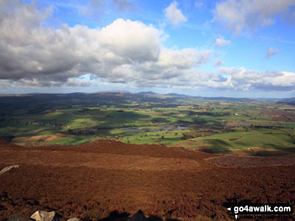
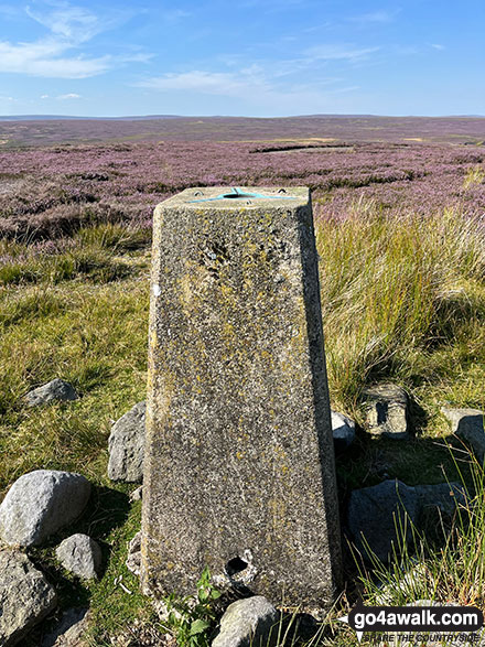


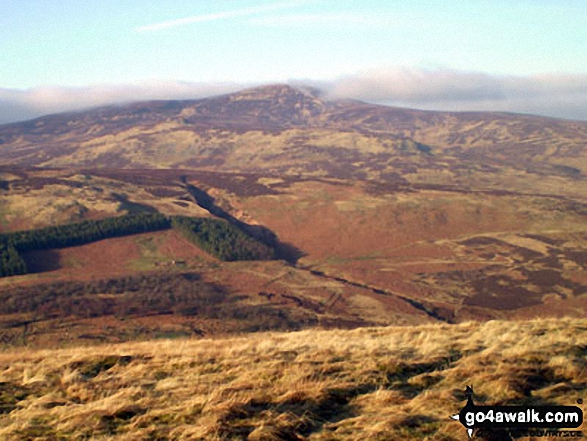

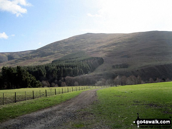
 The summit of The Cheviot in


