
![]()
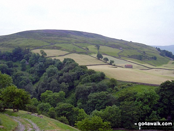
Kisdon
499m (1638ft)
The Northern Dales Area, The Yorkshire Dales, North Yorkshire, England

Not familiar with this top?
You can walk/hike to the top of Kisdon by using this easy‑to‑follow route map:
Walk ny248 Kisdon and Keld from Muker
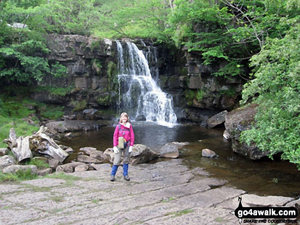
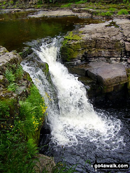
Moorland and gorge, with stunning waterfalls
   |
|---|
Vital Statistics:
| Length: | 7ml (11km) |
|---|---|
| Ascent: | 1,345ft (410m) |
| Time: | 3.75hrs |
| Grade: |  (Moderate) (Moderate) |

Route Summary:
Muker - Kisdon - Hooker Mill Scar - Swallow Hole Farm - Keld - The Herriot Way - The Pennine Way - The River Swale - Wainwright's Coast to Coast Walk - Kisdon Force - East Gill Force - Crackpot Hall - Swinner Gill - Arngill Wood - Swaledale - Ramps Holme Bridge - Muker
See Kisdon and the surrounding tops on our free-to-access 'Google Style' Peak Bagging Maps:
The Northern Dales Area of The Yorkshire Dales National Park
Less data - quicker to download
The Whole of The Yorkshire Dales National Park
More data - might take a little longer to download
See Kisdon and the surrounding tops on our unique, downloadable, PDF Peak Bagging Map:

NB: Whether you print off a copy or download it to your phone, this PDF Peak Baggers' Map might prove incredibly useful when your are up there on the tops and you cannot get a phone signal.
You can find Kisdon & all the walks that climb it on these unique free-to-access Interactive Walk Planning Maps:
1:25,000 scale OS Explorer Map (orange/yellow covers):
1:50,000 scale OS Landranger Map (pink/magenta covers):
 Fellow go4awalkers who have already walked, climbed, scaled, summited, hiked & bagged Kisdon
Mark Davidson walked up Kisdon on September 24th, 2008 [with] Mike and Theresa [weather] Cloudy at first but cleared up in the afternoon into a lovely sunny day
Tony Rogerson climbed it on October 20th, 2016 [from/via/route] Muker Swinner Gill Kisdon Force Kisdon Thwaite Muker [with] John Ray Floss [weather] Cloudy with odd showers & sunny spells
Peter Newman bagged it on July 14th, 2013 [from/via/route] Muker [with] Donnas, Jill, Steve and Gromit [weather] Warm sunshine
Lynn Symonds hiked Kisdon during August, 2010 [from/via/route] muker [with] Sharon Haynes [weather] Sunny
Patrick Rogozinski has walked, climbed & bagged Kisdon.
To add (or remove) your name and experiences on this page - Log On and edit your Personal Mountain Bagging Record
More Photographs & Pictures of views from, on, or of, Kisdon


Send us your photographs and pictures on, of, or from Kisdon
If you would like to add your walk photographs and pictures to this page, please send them as email attachments (configured for any computer) along with your name to:
and we shall do our best to publish them.
(Guide Resolution = 300dpi. At least = 660pixels (wide) x 440 pixels (high).)

You can also submit photos via our Facebook Page.
NB. Please indicate where each photo was taken and whether you wish us to credit your photos with a Username or your First Name/Last Name.


