
![]()
Thorpe Fell Top
506m (1660ft)
The Southern Dales Area, The Yorkshire Dales, North Yorkshire, England
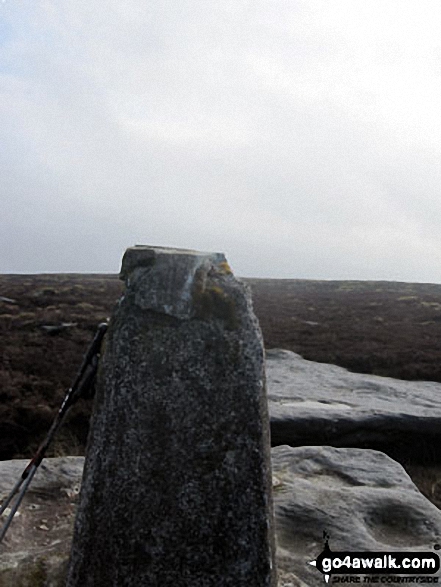
The summit of Thorpe Fell Top is marked by an Ordnance Survey Trig Point.
Not familiar with this top?
You can walk/hike to the top of Thorpe Fell Top by using this easy‑to‑follow route map:
Walk ny124 Rylstone Fell, Cracoe Fell, Thorpe Fell Top and Embsay Moor from Embsay
Superb views - if you pick a clear day
   |
|---|
Vital Statistics:
| Length: | 12ml (19km) |
|---|---|
| Ascent: | 2,099ft (640m) |
| Time: | 6½ hrs |
| Grade: |  (Moderate) (Moderate) |

Route Summary:
Embsay - Embsay Reservoir - Embsay Moor - Crookrise Crag Top - Waterfall Gill Beck - Rylstone Fell - Rylstone Cross - Watt Crag - Cracoe Fell - Cracoe War Memorial Cross Obelisk - Thorpe Fell Top - Upper Barden Reservoir - Embsay
See Thorpe Fell Top and the surrounding tops on our free-to-access 'Google Style' Peak Bagging Maps:
The Southern Dales Area of The Yorkshire Dales National Park
Less data - quicker to download
The Whole of The Yorkshire Dales National Park
More data - might take a little longer to download
See Thorpe Fell Top and the surrounding tops on our unique, downloadable, PDF Peak Bagging Map:

NB: Whether you print off a copy or download it to your phone, this PDF Peak Baggers' Map might prove incredibly useful when your are up there on the tops and you cannot get a phone signal.
Free-to-access Interactive Walk Planning Maps:
1:25,000 scale OS Explorer Map (orange/yellow covers):
1:50,000 scale OS Landranger Map (pink/magenta covers):
An Interactive Walk Planning Map for OS Landranger 104 Leeds & Bradford, Harrogate & Ilkley is not currently available
 Fellow go4awalkers who have already walked, climbed, scaled, summited, hiked & bagged Thorpe Fell Top
Mark Davidson walked up Thorpe Fell Top on June 7th, 2005 [with] Alone [weather] Lovely & sunny - fantastic day.
David Congreave climbed it on March 8th, 2014 [from/via/route] Embsay, via Crookrise Crag Top [with] Nephew (Jordan) [weather] Overcast, but dry & cool. - Have to veer off the path for a couple of hundred yards to find this one & then it suddenly appears out of nowhere. Would have found this one much harder to find without my GPS.
Christine Shepherd bagged it on March 9th, 2014 [from/via/route] Walked from Embsay using walk ny124 [with] On my own [weather] A pleasant spring day - Unless you specifically want to bag this peak there isn't a lot to be gained from leaving the main path. The walk instructions give a grid reference for leaving the path to reach the trig point. Without a GPS it would be difficult to judge this exactly. If you want to reach the summit, leave the main path when you spot the bothy & be careful not to turn your ankles in the heather.
Chris Lund hiked Thorpe Fell Top on August 29th, 2013 [from/via/route] route ny124, Thorpe Fell from Embsay [with] Sophie [weather] Sunny day, very warm below low cloud cover - Pub in Embsay shuts at 3 mid-week, beware, only just got there at 2.50pm
Paul Booth has walked, climbed & bagged Thorpe Fell Top.
To add (or remove) your name and experiences on this page - Log On and edit your Personal Mountain Bagging Record
Send us your photographs and pictures on, of, or from Thorpe Fell Top
If you would like to add your walk photographs and pictures to this page, please send them as email attachments (configured for any computer) along with your name to:
and we shall do our best to publish them.
(Guide Resolution = 300dpi. At least = 660pixels (wide) x 440 pixels (high).)

You can also submit photos via our Facebook Page.
NB. Please indicate where each photo was taken and whether you wish us to credit your photos with a Username or your First Name/Last Name.


