
![]()
Fremington Edge
473m (1552ft)
The Northern Dales Area, The Yorkshire Dales, North Yorkshire, England
Not familiar with this top?
   |
|---|
Vital Statistics:
| Length: | 7ml (11km) |
|---|---|
| Ascent: | 1,674ft (411m) |
| Time: | 4 hrs |
| Grade: |  (Moderate) (Moderate) |
Route Summary:
Reeth - Wainwright's Coast to Coast Walk - Arkle Beck - High Fremington - White House Farm - Fremington Edge - Fremington Edge Top - Fell End Lead Mine - Storthwaite Hall - Arkengarthdale - Castle Farm House - Cuckoo Hill - The Herriot Way - Reeth
|
|---|
Vital Statistics:
| Length: | 9ml (14.5km) |
|---|---|
| Ascent: | 1,674ft (510m) |
| Time: | 5 hrs |
| Grade: | (Moderate) |
Route Summary:
Reeth - Wainwright's Coast to Coast Walk - Arkle Beck - High Fremington - White House Farm - Fremington Edge - Fremington Edge Top - Fell End Lead Mine - Storthwaite Hall - Arkengarthdale - Langthwaite - Castle Farm House - Cuckoo Hill - The Herriot Way - Reeth
|
|---|
Vital Statistics:
| Length: | 8.75ml (14km) |
|---|---|
| Ascent: | 1,870ft (570m) |
| Time: | 5 hrs |
| Grade: |  (Moderate) (Moderate) |
Route Summary:
Reeth - Arkle Beck - High Fremington - White House Farm - Fremington Edge - Fremington Edge Top - Fell End Lead Mine - Storthwaite Hall - Arkengarthdale - Langthwaite - Arken Town - Calver Hill - Riddings Farm - Skelgate Lane - Wainwright's Coast to Coast Walk - The Herriot Way - Reeth
See Fremington Edge and the surrounding tops on our free-to-access 'Google Style' Peak Bagging Maps:
The Northern Dales Area of The Yorkshire Dales National Park
Less data - quicker to download
The Whole of The Yorkshire Dales National Park
More data - might take a little longer to download
See Fremington Edge and the surrounding tops on our downloadable Peak Bagging Map in PDF format:

NB: Whether you print off a copy or download it to your phone, this PDF Peak Baggers' Map might prove incredibly useful when your are up there on the tops and you cannot get a phone signal.
You can find Fremington Edge & all the walks that climb it on these unique free-to-access Interactive Walk Planning Maps:
1:25,000 scale OS Explorer Map (orange/yellow covers):
1:50,000 scale OS Landranger Map (pink/magenta covers):
 Fellow go4awalkers who have already walked, climbed, summited & bagged Fremington Edge
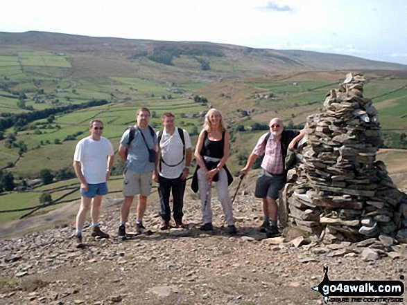
Mark Davidson walked up Fremington Edge on September 26th, 2008 [with] Theresa [weather] Lovely & sunny
Tony Rogerson climbed Fremington Edge on September 22nd, 2016 [from/via/route] Reeth Fremmington Edge Hurst Fell End Calver Hill Reeth [with] Darren Floss Robbie Ruby [weather] Sunny spells - Added interest of the "Scott Trial" taking place
Patrick Rogozinski has walked, climbed & bagged Fremington Edge.
To add (or remove) your name and experiences on this page - Log On and edit your Personal Mountain Bagging Record
More Photographs & Pictures of views from, on or of Fremington Edge
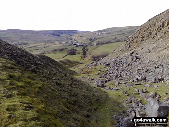
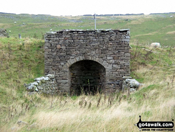
Down through the spoil heaps of Fell End Lead Mine at the NW end of Fremington Edge
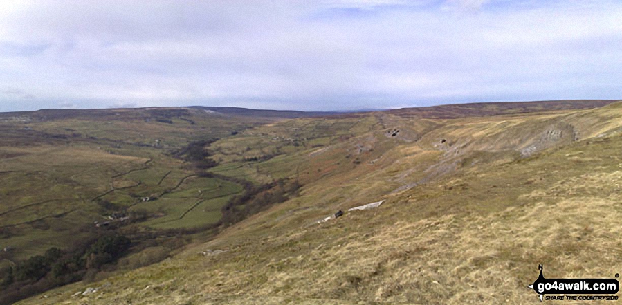
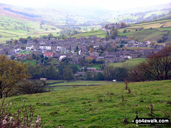
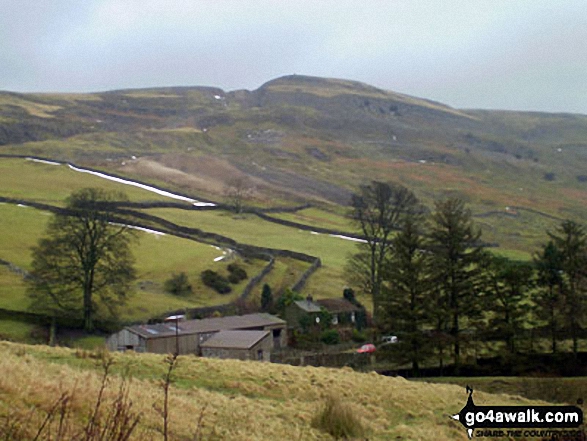
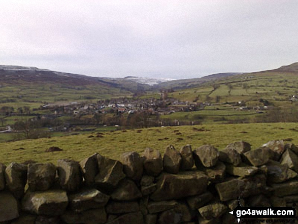
Gibbon Hill and Harkerside Moor with Reeth in the valley below from Fremington Edge
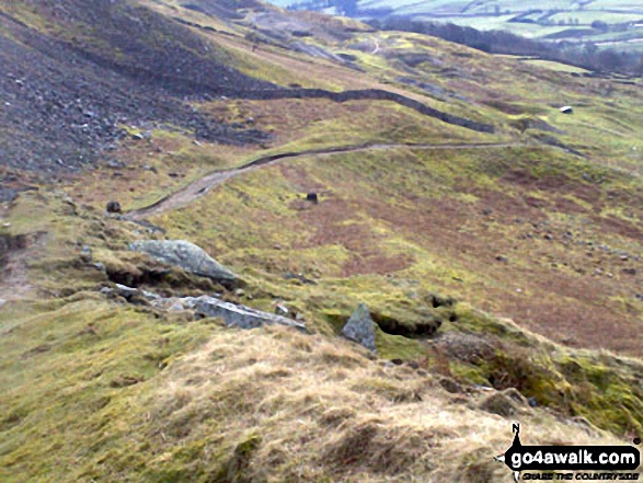
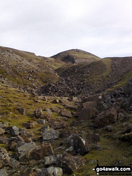
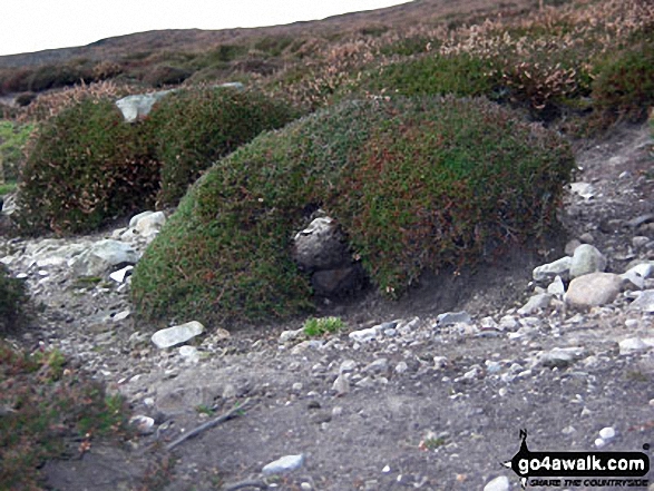
A 'Moonscape' - looking back up through the spoil heaps of Fell End Lead Mine at the NW end of Fremington Edge

. . . see all 20 walk photographs & pictures of views from, on or of Fremington Edge
Send us your photographs and pictures on, of, or from Fremington Edge
If you would like to add your walk photographs and pictures featuring views from, on or of Fremington Edge to this page, please send them as email attachments (configured for any computer) along with your name to:
and we shall do our best to publish them.
(Guide Resolution = 300dpi. At least = 660pixels (wide) x 440 pixels (high).)

You can also submit photos via our Facebook Page.
NB. Please indicate where each photo was taken and whether you wish us to credit your photos with a Username or your First Name/Last Name.
Not familiar with this top?


