
![]()
Dog Hill (Rishworth Moor)
435m (1428ft)
The South Pennines and The Forest of Bowland, West Yorkshire, England
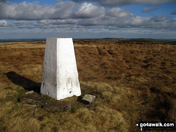
The summit of Dog Hill (Rishworth Moor) is marked by an Ordnance Survey Trig Point.
Not familiar with this top?
You can walk/hike to the top of Dog Hill (Rishworth Moor) by using either of these 2 easy‑to‑follow route maps:
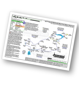
Walk wy171 Dog Hill (Rishworth Moor) from Ryburn Reservoir
Rugged gritstone country and wild moors
   |
|---|
Vital Statistics:
| Length: | 7.5mls (12km) |
|---|---|
| Ascent: | 1,241ft (378m) |
| Time: | 4 hrs |
| Grade: |  (Moderate) (Moderate) |
Route Summary:
Ryburn Reservoir - River Ryburn - Higher Wormaid - Grey Stone Height - Cat Moss - Rishworth Moor - Warm Withens Hill - Rishworth Drain - Sam Hill - Green Withens Reservoir - Green Withens Moss - Dog Hill (Rishworth Moor) - Blackwood Edge - Blackwood Farm - Hutch Brook - Ryburn Reservoir
Walk wy139 Blackstone Edge and Dog Hill (Rishworth Moor) from Ryburn Reservoir
Rugged gritstone country and wild moors
|
|---|
Vital Statistics:
| Length: | 11.25ml (18km) |
|---|---|
| Ascent: | 1,631ft (497m) |
| Time: | 5.75hrs |
| Grade: |  (Moderate) (Moderate) |

Route Summary:
Ryburn Reservoir - River Ryburn - Higher Wormaid - Grey Stone Height - Cat Moss - Rishworth Moor - Warm Withens Hill - Rishworth Drain - Rag Sapling Clough - Blackstone Edge Moor - Old Packhorse Road - Dick Slack - The Aiggin Stone - The Pennine Way - Blackstone Edge - Robin Hoods Bed - Sun End - Redmires - White Isles - Lads Grave - M62 - Green Withens Reservoir - Green Withens Edge - Dog Hill (Rishworth Moor) - Blackwood Edge - Blackwood Farm - Hutch Brook - Ryburn Reservoir
See Dog Hill (Rishworth Moor) and the surrounding tops on our free-to-access 'Google Style' Peak Bagging Map:
The Forest of Bowland and The South Pennines
Less data - quicker to download
See Dog Hill (Rishworth Moor) and the surrounding tops on our unique, downloadable, PDF Peak Bagging Map:

NB: Whether you print off a copy or download it to your phone, this PDF Peak Baggers' Map might prove incredibly useful when your are up there on the tops and you cannot get a phone signal.
You can find Dog Hill (Rishworth Moor) & all the walks that climb it on this unique free-to-access Interactive Walk Planning Map:
1:50,000 scale OS Landranger Map (pink/magenta covers):
 Fellow go4awalkers who have already walked, climbed, scaled, summited, hiked & bagged Dog Hill (Rishworth Moor)
To add (or remove) your name and experiences on this page - Log On and edit your Personal Mountain Bagging Record
Send us your photographs and pictures on, of, or from Dog Hill (Rishworth Moor)
If you would like to add your walk photographs and pictures to this page, please send them as email attachments (configured for any computer) along with your name to:
and we shall do our best to publish them.
(Guide Resolution = 300dpi. At least = 660pixels (wide) x 440 pixels (high).)

You can also submit photos via our Facebook Page.
NB. Please indicate where each photo was taken and whether you wish us to credit your photos with a Username or your First Name/Last Name.


