All the Mountains, Peaks, Tops and Hills in England, England as a detailed list

England is defined as the whole of the country of England which includes the National Parks of Dartmoor, Exmoor, The Lake District, The Peak District, The North York Moors, Northumberland, The South Downs and The Yorkshire Dales, as well as The Chilterns, The Cotswolds, The Forest of Bowland, The North Peninnes, The Shropshire Hills and The South Peninnes.


If you count only the Mountains (Hewitts) there are 180 tops to climb, bag & conquer and the highest point is Scafell Pike at 978m (3,210ft).

Wainwright
214/0
Wainwrights

Hewitt
180/0
English
Mountains

Dewey
180/0
English
Deweys

nuttall
254/0
English
Nuttalls

Wainwright Outlying Fell
116/0
Wainwright
Outlying Fells

marilyn
174/0
English
Marilyns

Bridget
534/0
English
Bridgets

Trig Point
487/0
Trig
Points


To see all Mountains, Peaks, Tops and Hills displayed in different ways - see the options in the left-hand column and towards the bottom of this page.


LOG ON and RELOAD this page to show which Mountains, Peaks, Tops and Hills you have already climbed, bagged & conquered [. . . more]


Page 2 of 6    Go to page: 1 2 3 4 5 6


See this list in: Alphabetical Order | Height Order
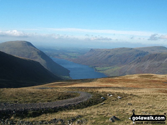
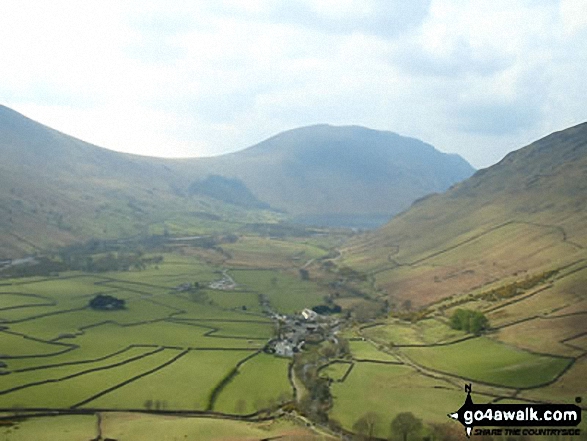
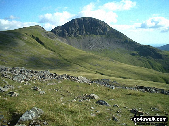
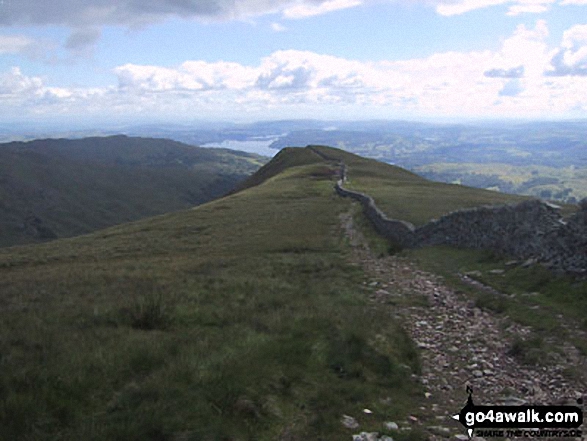
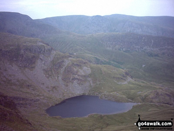
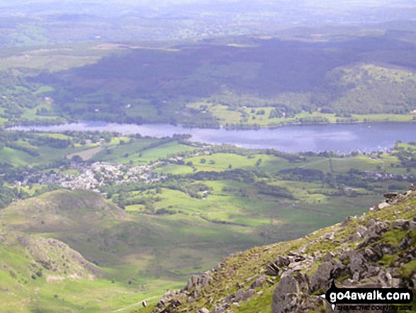
To reverse the order select the link again.


Mountain, Peak, Top or Hill:

Bagged


31. Black Crag (Pillar)

828m (2,717ft)

  • Mountain (31st in England, 60th in England & Wales)
  • Nuttall (37th in England, 69th in England & Wales)

  • To walk, climb & bag Black Crag (Pillar) use any of these easy to follow walks:

    Google Maps Icon
    See the location of Black Crag (Pillar) and walks up it on a google Map

    Black Crag (Pillar) is on interactive maps:

  • OS Explorer (Orange Covers): OL4
  • OS Landranger (Pink Covers): 89 and 90

  • Black Crag (Pillar) is on Peak Bagging Map and Hill Tick List:

    *Version including the walk routes marked on it that you need to follow to Walk all 214 Wainwrights in just 59 walks.


    32. High Street

    828m (2,717ft)

  • Wainwright (No. 25)
  • Mountain (32nd in England, 61st in England & Wales)
  • Nuttall (38th in England, 70th in England & Wales)
  • Marilyn (11th in England, 345th in GB)
  • OS Trig Point

  • To walk, climb & bag High Street use any of these easy to follow walks:

    Google Maps Icon
    See the location of High Street and walks up it on a google Map

    High Street is on interactive maps:

  • OS Explorer (Orange Covers): OL5
  • OS Landranger (Pink Covers): 90

  • High Street is on Peak Bagging Map and Hill Tick List:

    *Version including the walk routes marked on it that you need to follow to Walk all 214 Wainwrights in just 59 walks.


    33. Red Pike (Wasdale)

    826m (2,711ft)

  • Wainwright (No. 26)
  • Mountain (33rd in England, 63rd in England & Wales)
  • Nuttall (39th in England, 73rd in England & Wales)

  • To walk, climb & bag Red Pike (Wasdale) use any of these easy to follow walks:

    Google Maps Icon
    See the location of Red Pike (Wasdale) and walks up it on a google Map

    Red Pike (Wasdale) is on interactive maps:

  • OS Explorer (Orange Covers): OL4
  • OS Landranger (Pink Covers): 89

  • Red Pike (Wasdale) is on Peak Bagging Map and Hill Tick List:

    *Version including the walk routes marked on it that you need to follow to Walk all 214 Wainwrights in just 59 walks.


    34. Hart Crag

    822m (2,698ft)

  • Wainwright (No. 27)
  • Mountain (34th in England, 65th in England & Wales)
  • Nuttall (40th in England, 76th in England & Wales)

  • To walk, climb & bag Hart Crag use any of these easy to follow walks:

    Google Maps Icon
    See the location of Hart Crag and walks up it on a google Map

    Hart Crag is on interactive maps:

  • OS Explorer (Orange Covers): OL5
  • OS Landranger (Pink Covers): 90

  • Hart Crag is on Peak Bagging Map and Hill Tick List:

    *Version including the walk routes marked on it that you need to follow to Walk all 214 Wainwrights in just 59 walks.


    35. Shelter Crags

    815m (2,675ft)

  • Mountain (35th in England, 66th in England & Wales)
  • Nuttall (42nd in England, 79th in England & Wales)

  • To walk, climb & bag Shelter Crags use any of these easy to follow walks:

    Google Maps Icon
    See the location of Shelter Crags and walks up it on a google Map

    Shelter Crags is on interactive maps:

  • OS Explorer (Orange Covers): OL6
  • OS Landranger (Pink Covers): 89 and 90

  • Shelter Crags is on Peak Bagging Map and Hill Tick List:

    *Version including the walk routes marked on it that you need to follow to Walk all 214 Wainwrights in just 59 walks.


    36. The Cheviot

    815m (2,674ft)

  • Mountain (36th in England, 67th in England & Wales)
  • Nuttall (43rd in England, 80th in England & Wales)
  • Marilyn (12th in England, 360th in GB)
  • OS Trig Point
  • The Cheviot is the highest point in the county of Northumberland.


    To walk, climb & bag The Cheviot use any of these easy to follow walks:

    Google Maps Icon
    See the location of The Cheviot and walks up it on a google Map

    The Cheviot is on interactive maps:

  • OS Explorer (Orange Covers): OL16
  • OS Landranger (Pink Covers): 74 and 75

  • A go4awalk.com Peak Bagging Map and Hill Tick List featuring The Cheviot will be available soon.


    37. Lingmell

    807m (2,648ft)

  • Wainwright (No. 35)
  • Mountain (37th in England, 70th in England & Wales)
  • Nuttall (44th in England, 85th in England & Wales)

  • To walk, climb & bag Lingmell use any of these easy to follow walks:

    Google Maps Icon
    See the location of Lingmell and walks up it on a google Map

    Lingmell is on interactive maps:

  • OS Explorer (Orange Covers): OL6
  • OS Landranger (Pink Covers): 89 and 90

  • Lingmell is on Peak Bagging Map and Hill Tick List:

    *Version including the walk routes marked on it that you need to follow to Walk all 214 Wainwrights in just 59 walks.


    38. High Stile

    807m (2,646ft)

  • Wainwright (No. 29)
  • Mountain (38th in England, 71st in England & Wales)
  • Nuttall (45th in England, 86th in England & Wales)
  • Marilyn (13th in England, 378th in GB)

  • To walk, climb & bag High Stile use any of these easy to follow walks:

    Google Maps Icon
    See the location of High Stile and walks up it on a google Map

    High Stile is on interactive maps:

  • OS Explorer (Orange Covers): OL4
  • OS Landranger (Pink Covers): 89

  • High Stile is on Peak Bagging Map and Hill Tick List:

    *Version including the walk routes marked on it that you need to follow to Walk all 214 Wainwrights in just 59 walks.


    39. High Raise (Mardale)

    804m (2,636ft)

  • Wainwright (No. 31)
  • Mountain (39th in England, 73rd in England & Wales)
  • Nuttall (46th in England, 88th in England & Wales)

  • To walk, climb & bag High Raise (Mardale) use any of these easy to follow walks:

    Google Maps Icon
    See the location of High Raise (Mardale) and walks up it on a google Map

    High Raise (Mardale) is on interactive maps:

  • OS Explorer (Orange Covers): OL5
  • OS Landranger (Pink Covers): 90

  • High Raise (Mardale) is on Peak Bagging Map and Hill Tick List:

    *Version including the walk routes marked on it that you need to follow to Walk all 214 Wainwrights in just 59 walks.


    40. Swirl How

    802m (2,633ft)

  • Wainwright (No. 32)
  • Mountain (40th in England, 74th in England & Wales)
  • Nuttall (47th in England, 89th in England & Wales)

  • To walk, climb & bag Swirl How use any of these easy to follow walks:

    Google Maps Icon
    See the location of Swirl How and walks up it on a google Map

    Swirl How is on interactive maps:

  • OS Explorer (Orange Covers): OL6
  • OS Landranger (Pink Covers): 89 and 90

  • Swirl How is on Peak Bagging Map and Hill Tick List:

    *Version including the walk routes marked on it that you need to follow to Walk all 214 Wainwrights in just 59 walks.


    41. The Old Man of Coniston

    802m (2,633ft)

  • Wainwright (No. 30)
  • Mountain (41st in England, 75th in England & Wales)
  • Nuttall (48th in England, 90th in England & Wales)
  • Marilyn (14th in England, 387th in GB)
  • OS Trig Point

  • To walk, climb & bag The Old Man of Coniston use any of these easy to follow walks:

    Google Maps Icon
    See the location of The Old Man of Coniston and walks up it on a google Map

    The Old Man of Coniston is on interactive maps:

  • OS Explorer (Orange Covers): OL6
  • OS Landranger (Pink Covers): 96 and 97

  • The Old Man of Coniston is on Peak Bagging Map and Hill Tick List:

    *Version including the walk routes marked on it that you need to follow to Walk all 214 Wainwrights in just 59 walks.


    42. Kirk Fell

    802m (2,631ft)

  • Wainwright (No. 33)
  • Mountain (42nd in England, 77th in England & Wales)
  • Nuttall (49th in England, 92nd in England & Wales)
  • Marilyn (15th in England, 391st in GB)

  • To walk, climb & bag Kirk Fell use any of these easy to follow walks:

    Google Maps Icon
    See the location of Kirk Fell and walks up it on a google Map

    Kirk Fell is on interactive maps:

  • OS Explorer (Orange Covers): OL4
  • OS Landranger (Pink Covers): 89 and 90

  • Kirk Fell is on Peak Bagging Map and Hill Tick List:

    *Version including the walk routes marked on it that you need to follow to Walk all 214 Wainwrights in just 59 walks.


    43. Green Gable

    801m (2,629ft)

  • Wainwright (No. 34)
  • Mountain (43rd in England, 78th in England & Wales)
  • Nuttall (50th in England, 93rd in England & Wales)

  • To walk, climb & bag Green Gable use any of these easy to follow walks:

    Google Maps Icon
    See the location of Green Gable and walks up it on a google Map

    Green Gable is on interactive maps:

  • OS Explorer (Orange Covers): OL4
  • OS Landranger (Pink Covers): 89 and 90

  • Green Gable is on Peak Bagging Map and Hill Tick List:

    *Version including the walk routes marked on it that you need to follow to Walk all 214 Wainwrights in just 59 walks.


    44. Haycock

    797m (2,616ft)

  • Wainwright (No. 36)
  • Mountain (44th in England, 81st in England & Wales)
  • Nuttall (51st in England, 97th in England & Wales)

  • To walk, climb & bag Haycock use any of these easy to follow walks:

    Google Maps Icon
    See the location of Haycock and walks up it on a google Map

    Haycock is on interactive maps:

  • OS Explorer (Orange Covers): OL4
  • OS Landranger (Pink Covers): 89

  • Haycock is on Peak Bagging Map and Hill Tick List:

    *Version including the walk routes marked on it that you need to follow to Walk all 214 Wainwrights in just 59 walks.


    45. Knock Fell

    794m (2,606ft)

  • Mountain (45th in England, 83rd in England & Wales)
  • Nuttall (54th in England, 101st in England & Wales)

  • To walk, climb & bag Knock Fell use this easy to follow walk:

    Google Maps Icon
    See the location of Knock Fell and walks up it on a google Map

    Knock Fell is on interactive maps:

  • OS Explorer (Orange Covers): OL31
  • OS Landranger (Pink Covers): 91

  • Knock Fell is on Peak Bagging Map and Hill Tick List:


    46. Rampsgill Head

    792m (2,600ft)

  • Wainwright (No. 39)
  • Mountain (46th in England, 84th in England & Wales)
  • Nuttall (55th in England, 103rd in England & Wales)

  • To walk, climb & bag Rampsgill Head use any of these easy to follow walks:

    Google Maps Icon
    See the location of Rampsgill Head and walks up it on a google Map

    Rampsgill Head is on interactive maps:

  • OS Explorer (Orange Covers): OL5
  • OS Landranger (Pink Covers): 90

  • Rampsgill Head is on Peak Bagging Map and Hill Tick List:

    *Version including the walk routes marked on it that you need to follow to Walk all 214 Wainwrights in just 59 walks.


    47. Dove Crag

    792m (2,599ft)

  • Wainwright (No. 38)
  • Mountain (47th in England, 85th in England & Wales)
  • Nuttall (56th in England, 104th in England & Wales)

  • To walk, climb & bag Dove Crag use any of these easy to follow walks:

    Google Maps Icon
    See the location of Dove Crag and walks up it on a google Map

    Dove Crag is on interactive maps:

  • OS Explorer (Orange Covers): OL5 and OL7
  • OS Landranger (Pink Covers): 90

  • Dove Crag is on Peak Bagging Map and Hill Tick List:

    *Version including the walk routes marked on it that you need to follow to Walk all 214 Wainwrights in just 59 walks.


    48. Grisedale Pike

    791m (2,596ft)

  • Wainwright (No. 40)
  • Mountain (48th in England, 87th in England & Wales)
  • Nuttall (57th in England, 106th in England & Wales)
  • Marilyn (16th in England, 410th in GB)
  • OS Trig Point

  • To walk, climb & bag Grisedale Pike use any of these easy to follow walks:

    Google Maps Icon
    See the location of Grisedale Pike and walks up it on a google Map

    Grisedale Pike is on interactive maps:

  • OS Explorer (Orange Covers): OL4
  • OS Landranger (Pink Covers): 89 and 90

  • Grisedale Pike is on Peak Bagging Map and Hill Tick List:

    *Version including the walk routes marked on it that you need to follow to Walk all 214 Wainwrights in just 59 walks.


    49. Mickle Fell

    788m (2,586ft)

  • Mountain (49th in England, 88th in England & Wales)
  • Nuttall (58th in England, 107th in England & Wales)
  • Marilyn (17th in England, 414th in GB)
  • Mickle Fell is the highest point in the county of County Durham.

    Mickle Fell is inside the Warcop Army Training Area. For safety reasons public access is restricted to public rights of way during non-firing days only. Access is only permitted on 12 weekends per year, which are publicly notified 12 months in advance. Information these weekends can be obtained by calling 0800 783 5181. For more details see: Walking on Mickle Fell.


    To walk, climb & bag Mickle Fell use this easy to follow walk:

    Google Maps Icon
    See the location of Mickle Fell and walks up it on a google Map

    Mickle Fell is on interactive maps:

  • OS Explorer (Orange Covers): OL19
  • OS Landranger (Pink Covers): 91 and 92

  • Mickle Fell is on Peak Bagging Map and Hill Tick List:


    50. Kirk Fell (East Top)

    787m (2,583ft)

  • Mountain (50th in England, 89th in England & Wales)
  • Nuttall (59th in England, 108th in England & Wales)

  • To walk, climb & bag Kirk Fell (East Top) use any of these easy to follow walks:

    Google Maps Icon
    See the location of Kirk Fell (East Top) and walks up it on a google Map

    Kirk Fell (East Top) is on interactive maps:

  • OS Explorer (Orange Covers): OL4
  • OS Landranger (Pink Covers): 89 and 90

  • Kirk Fell (East Top) is on Peak Bagging Map and Hill Tick List:

    *Version including the walk routes marked on it that you need to follow to Walk all 214 Wainwrights in just 59 walks.


    51. Allen Crags

    785m (2,576ft)

  • Wainwright (No. 42)
  • Mountain (51st in England, 90th in England & Wales)
  • Nuttall (60th in England, 109th in England & Wales)

  • To walk, climb & bag Allen Crags use any of these easy to follow walks:

    Google Maps Icon
    See the location of Allen Crags and walks up it on a google Map

    Allen Crags is on interactive maps:

  • OS Explorer (Orange Covers): OL6
  • OS Landranger (Pink Covers): 89 and 90

  • Allen Crags is on Peak Bagging Map and Hill Tick List:

    *Version including the walk routes marked on it that you need to follow to Walk all 214 Wainwrights in just 59 walks.


    52. Thornthwaite Crag

    784m (2,573ft)

  • Wainwright (No. 44)
  • Mountain (52nd in England, 91st in England & Wales)
  • Nuttall (62nd in England, 111th in England & Wales)

  • To walk, climb & bag Thornthwaite Crag use any of these easy to follow walks:

    Google Maps Icon
    See the location of Thornthwaite Crag and walks up it on a google Map

    Thornthwaite Crag is on interactive maps:

  • OS Explorer (Orange Covers): OL5 and OL7
  • OS Landranger (Pink Covers): 90

  • Thornthwaite Crag is on Peak Bagging Map and Hill Tick List:

    *Version including the walk routes marked on it that you need to follow to Walk all 214 Wainwrights in just 59 walks.


    53. Glaramara

    783m (2,569ft)

  • Wainwright (No. 45)
  • Mountain (53rd in England, 93rd in England & Wales)
  • Nuttall (63rd in England, 113th in England & Wales)

  • To walk, climb & bag Glaramara use any of these easy to follow walks:

    Google Maps Icon
    See the location of Glaramara and walks up it on a google Map

    Glaramara is on interactive maps:

  • OS Explorer (Orange Covers): OL6
  • OS Landranger (Pink Covers): 89 and 90

  • Glaramara is on Peak Bagging Map and Hill Tick List:

    *Version including the walk routes marked on it that you need to follow to Walk all 214 Wainwrights in just 59 walks.


    54. Harter Fell (Mardale)

    779m (2,556ft)

  • Wainwright (No. 47)
  • Mountain (54th in England, 96th in England & Wales)
  • Nuttall (66th in England, 118th in England & Wales)

  • To walk, climb & bag Harter Fell (Mardale) use any of these easy to follow walks:

    Google Maps Icon
    See the location of Harter Fell (Mardale) and walks up it on a google Map

    Harter Fell (Mardale) is on interactive maps:

  • OS Explorer (Orange Covers): OL5 and OL7
  • OS Landranger (Pink Covers): 90

  • Harter Fell (Mardale) is on Peak Bagging Map and Hill Tick List:

    *Version including the walk routes marked on it that you need to follow to Walk all 214 Wainwrights in just 59 walks.


    55. Dow Crag

    778m (2,553ft)

  • Wainwright (No. 48)
  • Mountain (55th in England, 97th in England & Wales)
  • Nuttall (67th in England, 119th in England & Wales)

  • To walk, climb & bag Dow Crag use either of these easy to follow walks:

    Google Maps Icon
    See the location of Dow Crag and walks up it on a google Map

    Dow Crag is on interactive maps:

  • OS Explorer (Orange Covers): OL6
  • OS Landranger (Pink Covers): 96 and 97

  • Dow Crag is on Peak Bagging Map and Hill Tick List:

    *Version including the walk routes marked on it that you need to follow to Walk all 214 Wainwrights in just 59 walks.


    56. Red Screes

    776m (2,547ft)

  • Wainwright (No. 49)
  • Mountain (56th in England, 98th in England & Wales)
  • Nuttall (68th in England, 120th in England & Wales)
  • Marilyn (18th in England, 437th in GB)
  • OS Trig Point

  • To walk, climb & bag Red Screes use any of these easy to follow walks:

    Google Maps Icon
    See the location of Red Screes and walks up it on a google Map

    Red Screes is on interactive maps:

  • OS Explorer (Orange Covers): OL7
  • OS Landranger (Pink Covers): 90

  • Red Screes is on Peak Bagging Map and Hill Tick List:

    *Version including the walk routes marked on it that you need to follow to Walk all 214 Wainwrights in just 59 walks.


    57. Wandope

    773m (2,539ft)

  • Wainwright (No. 51)
  • Mountain (57th in England, 99th in England & Wales)
  • Nuttall (71st in England, 123rd in England & Wales)

  • To walk, climb & bag Wandope use any of these easy to follow walks:

    Google Maps Icon
    See the location of Wandope and walks up it on a google Map

    Wandope is on interactive maps:

  • OS Explorer (Orange Covers): OL4
  • OS Landranger (Pink Covers): 89 and 90

  • Wandope is on Peak Bagging Map and Hill Tick List:

    *Version including the walk routes marked on it that you need to follow to Walk all 214 Wainwrights in just 59 walks.


    58. Grey Friar

    773m (2,536ft)

  • Wainwright (No. 53)
  • Mountain (58th in England, 100th in England & Wales)
  • Nuttall (72nd in England, 124th in England & Wales)

  • To walk, climb & bag Grey Friar use either of these easy to follow walks:

    Google Maps Icon
    See the location of Grey Friar and walks up it on a google Map

    Grey Friar is on interactive maps:

  • OS Explorer (Orange Covers): OL6
  • OS Landranger (Pink Covers): 89 and 90

  • Grey Friar is on Peak Bagging Map and Hill Tick List:

    *Version including the walk routes marked on it that you need to follow to Walk all 214 Wainwrights in just 59 walks.


    59. Sail (Derwent Fells)

    773m (2,536ft)

  • Wainwright (No. 50)
  • Mountain (59th in England, 101st in England & Wales)
  • Nuttall (73rd in England, 125th in England & Wales)

  • To walk, climb & bag Sail (Derwent Fells) use any of these easy to follow walks:

    Google Maps Icon
    See the location of Sail (Derwent Fells) and walks up it on a google Map

    Sail (Derwent Fells) is on interactive maps:

  • OS Explorer (Orange Covers): OL4
  • OS Landranger (Pink Covers): 89 and 90

  • Sail (Derwent Fells) is on Peak Bagging Map and Hill Tick List:

    *Version including the walk routes marked on it that you need to follow to Walk all 214 Wainwrights in just 59 walks.


    60. Hopegill Head

    770m (2,525ft)

  • Wainwright (No. 52)
  • Mountain (60th in England, 104th in England & Wales)
  • Nuttall (74th in England, 128th in England & Wales)

  • To walk, climb & bag Hopegill Head use any of these easy to follow walks:

    Google Maps Icon
    See the location of Hopegill Head and walks up it on a google Map

    Hopegill Head is on interactive maps:

  • OS Explorer (Orange Covers): OL4
  • OS Landranger (Pink Covers): 89 and 90

  • Hopegill Head is on Peak Bagging Map and Hill Tick List:

    *Version including the walk routes marked on it that you need to follow to Walk all 214 Wainwrights in just 59 walks.


    Page 2 of 6    Go to page: 1 2 3 4 5 6


    View all 1233 Mountains, Peaks, Tops and Hills in EnglandThe Lake District:


    Is there a Mountain, Peak, Top or Hill missing from the above google map or list?

    Let us know an we will add it to our database.


    Follow go4awalk.com on Twitter Follow go4awalk.com on Facebook


    Home


    Find new Friends to go walking with

    Walk all 214 Wainwrights in just 59 Walks. Download GPS Waypoints - Great Walks you must not miss!

    Walk The Yorkshire Three Peaks Challenge Walk - All the Latest Route Information, GPS Waypoints and Split Times to keep you on Schedule

    Walk The British Three Peaks Challenge Walk - All the Latest Route Information and GPS Waypoints

    See our pick of The Best Walks in The Lake District - Great Walks you must not miss!

    Walk our pick of the Best Lake District Ridge Walks - Great Walks you must not miss!

    Walk our pick of the Best Lake District Walks to do in the rain - Great Walks you must not miss!

    Walk our pick of The Best Walks in Snowdonia - Great Walks you must not miss!

    Walk our pick of The Best Ridge Walks in Wales - Walks you must not miss!

    Walk our pick of The Best Walks in The Brecon Beacons - Great Walks you must not miss!

    Walk our pick of The Best Walks in The Yorkshire Dales - Walks you must not miss!

    Walk our pick of The Best Walks in The Peak District - Walks you must not miss!

    Walk our pick of The Best Walks in The Forest of Bowland - Walks you must not miss!

    Walk our pick of The Best Walks in Shropshire - Walks you must not miss!

    Walk our pick of The Best Walks in Cheshire - Walks you must not miss!

    Walk our pick of The Best Walks in Lancashire - Walks you must not miss!

    Not sure where to walk next? Try Peak Bagging - Great Walks you must not miss!

    Not sure where to walk next? Walk part of a National Trail - Great Walks you must not miss!

    Walks with Downloadable and Uploadable GPS Waypoint Data

    Walking Kit and Gear Tested by Walkers

    Full Site Search