
![]()
High Street
828m (2717ft)
The Far Eastern Fells, The Lake District, Cumbria, England
The summit of High Street is marked by an Ordnance Survey Trig Point.

Not familiar with this top?
You can walk/hike to the top of High Street by using any of these 7 easy‑to‑follow route maps:
Walk c341 High Street via Rough Crag (Riggindale) from Mardale Head
An easy scramble to unsurpassed views
   |
|---|
Vital Statistics:
| Length: | 6ml (9.5km) |
|---|---|
| Ascent: | 2,202ft (671m) |
| Time: | 4½ hrs |
| Grade: |  (Moderate) (Moderate) |

Route Summary:
Mardale Head - Haweswater Reservoir - The Rigg - Swine Crag (Riggindale) - Heron Crag (Riggindale) - Eagle Crag (Riggindale) - Rough Crag (Riggindale) - Caspel Gate - Riggindale Crag - Long Stile - High Street - Rough Crag (Riggindale) - Eagle Crag (Riggindale) - Heron Crag (Riggindale) - Swine Crag (Riggindale) - Dudderwick - The Rigg - Mardale Head
Walk c276 High Street and Harter Fell from Mardale Head
An easy scramble to unsurpassed views
|
|---|
Vital Statistics:
| Length: | 7.25ml (11.5km) |
|---|---|
| Ascent: | 2,745ft (837m) |
| Time: | 5½ hrs |
| Grade: |  (Hard) (Hard) |

Route Summary:
Mardale Head - Haweswater Reservoir - The Rigg - Dudderwick - Swine Crag (Riggindale) - Heron Crag (Riggindale) - Rough Crag (Riggindale) - Caspel Gate - Riggindale Crag - Long Stile - High Street - Mardale Ill Bell - Nan Bield Pass - Harter Fell (Mardale) - Adam Seat - Gatescarth Pass - Mardale Head
Walk c362 Branstree and High Street from Mardale Head
Stunning Haweswater
|
|---|
Vital Statistics:
| Length: | 11.25ml (18km) |
|---|---|
| Ascent: | 3,436ft (1,047m) |
| Time: | 7½ hrs |
| Grade: | (Hard) |

Route Summary:
Mardale Head - Haweswater Reservoir - Rowantreethwaite Beck - Old Corpse Road - Selside Pike - Branstree (North East Top) - Branstree (Artlecrag Pike) - Gatescarth Pass - Adam Seat - Harter Fell (Mardale) - Nan Bield Pass - Mardale Ill Bell - High Street - Riggindale Crag - Caspel Gate - Rough Crag (Riggindale) - Eagle Crag (Riggindale) - Heron Crag (Riggindale) - Swine Crag (Riggindale) - Dudderwick - The Rigg - Mardale Head
Walk c128 The Hayswater Round from Hartsop
Popular mountain walk
|
|---|
Vital Statistics:
| Length: | 11.25ml (18km) |
|---|---|
| Ascent: | 3,843ft (1,171m) |
| Time: | 8 hrs |
| Grade: |  (Hard) (Hard) |

Route Summary:
Cow Bridge - Brothers Water - Hartsop - Hartsop Dodd - Caudale Moor - Stony Cove Pike (Caudale Moor) - Caudale Head - Stony Cove Pike - Threshthwaite Mouth - Thornthwaite Crag - High Street - Straits of Riggindale - Rampsgill Head - Kidsty Pike - High Raise (Mardale) - The Knott - Hayeswater Reservoir - Hayeswater Gill - Hartsop - Cow Bridge - Brothers Water.
Walk c251 The Mardale Head Horizon from Mardale Head
Stunning Haweswater
|
|---|
Vital Statistics:
| Length: | 12.5ml (20km) |
|---|---|
| Ascent: | 3,814ft (1,162m) |
| Time: | 8½ hrs |
| Grade: | (Hard) |

Route Summary:
Mardale Head - Haweswater - Rowantreethwaite Beck - Old Corpse Road - Selside Pike - Branstree (North East Top) - Branstree (Artlecrag Pike) - Gatescarth Pass - Adam Seat - Harter Fell (Mardale) - Nan Bield Pass - Mardale Ill Bell - High Street - Riggindale - Rampsgill Head - Wainwright's Coast to Coast Walk - Kidsty Pike - Kidsty Howes - Bowderthaite Bridge - The Rigg - Mardale Head
Walk c272 High Street and Angletarn Pikes from Brothers Water
Fantastic high level ridge walk
|
|---|
Vital Statistics:
| Length: | 12.5ml (20km) |
|---|---|
| Ascent: | 3,889ft (1,185m) |
| Time: | 8½ hrs |
| Grade: | (Hard) |
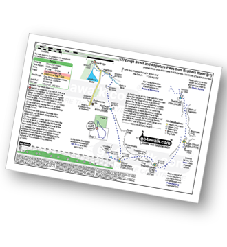
Route Summary:
Cow Bridge - Brothers Water - Hartsop - Hartsop Dodd - Stony Cove Pike - Caudale Head - Caudale Moor - Stony Cove Pike (Caudale Moor) - Threshthwaite Mouth - Thornthwaite Crag - High Street - Straits of Riggindale - The Knott - Angle Tarn (Martindale) - Angletarn Pikes - Boredale Hause - Patterdale
Walk c114 High Street from Mardale Head
Superb high level route with great views
|
|---|
Vital Statistics:
| Length: | 14.5ml (23km) |
|---|---|
| Ascent: | 3,364ft (1,025m) |
| Time: | 8½ hrs |
| Grade: | (Hard) |
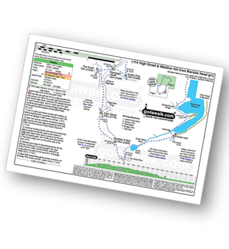
Route Summary:
Mardale Head (Haweswater Reservoir) - Small Water - Nan Bield Pass - Mardale Ill Bell - High Street - Straits of Riggindale - The Knott - Rampsgill Head - Kidsty Pike - High Raise (Mardale) - Raven Howe - Red Crag - Keasgill Head - Wether Hill (South Top) - Wether Hill - Bampton Common - Low Kop - Measand Beck - Haweswater Reservoir - Wainwright's Coast to Coast Walk - Bowderthwaite Bridge - The Rigg - Mardale Head
See High Street and the surrounding tops on our free-to-access 'Google Style' Peak Bagging Maps:
The Far Eastern Fells of The Lake District National Park
Less data - quicker to download
The Whole of The Lake District National Park
More data - might take a little longer to download
See High Street and the surrounding tops on our unique, downloadable, PDF Peak Bagging Maps:

NB: Whether you print off a copy or download it to your phone, these PDF Peak Baggers' Maps might prove incredibly useful when your are up there on the tops and you cannot get a phone signal.
*This version is marked with the walk routes you need to follow to Walk all 214 Wainwrights in just 59 walks.
You can find High Street & all the walks that climb it on these unique free-to-access Interactive Walk Planning Maps:
1:25,000 scale OS Explorer Map (orange/yellow covers):
1:50,000 scale OS Landranger Map (pink/magenta covers):
 Fellow go4awalkers who have already walked, climbed, scaled, summited, hiked & bagged High Street
Pete George walked up High Street on September 27th, 2025 [from/via/route] Mardale [with] Roco [weather] Chilly & foggy on tops, pleasant down below
Mark Davidson climbed it on March 26th, 2003 [with] Alone [weather] Warm & sunny with huge views - just fantastic - Climbed again on March 6th, 2005 in the snow.
Richard Holmes bagged it on April 7th, 2025 [from/via/route] Troutbeck [with] Myself. [weather] Hot, not a cloud in the sky. Got sunburnt!
Sarah Moore hiked High Street on June 9th, 2024 [from/via/route] 5 Valleys From Ambleside >> Troutbeck >> up & over to Hayeswater [with] 599 other nutters [weather] Great conditions - clear for the most & dry but cool - No food inside me because of nerves & have never been so ill on a mountain nor felt so dizzy & want to sleep. Stopped at first checkpoint but will go again. Incredible views from this one!
James Hughes summited on September 18th, 2024 [from/via/route] c251 The Mardale Head Horizon from Mardale Head [weather] Beautiful clear warm day. - Walked in reverse. Climbed from Kidsty Pike. Tired after walk preceding day. Included Adam's Seat. Descent from Selside Pike boggy on Old Corpse Road. Poor expensive pint of Mary Jane at Haweswater Hotel.
To add (or remove) your name and experiences on this page - Log On and edit your Personal Mountain Bagging Record
. . . [see more walk reports]
More Photographs & Pictures of views from, on, or of, High Street

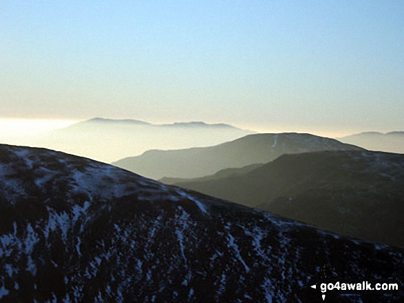
High Street (left), Kidsty Pike (centre), High Raise (Mardale) and Raven Howe on the horizon with Riggindale Crag in the mid-distance from Branstree (Artlecrag Pike)

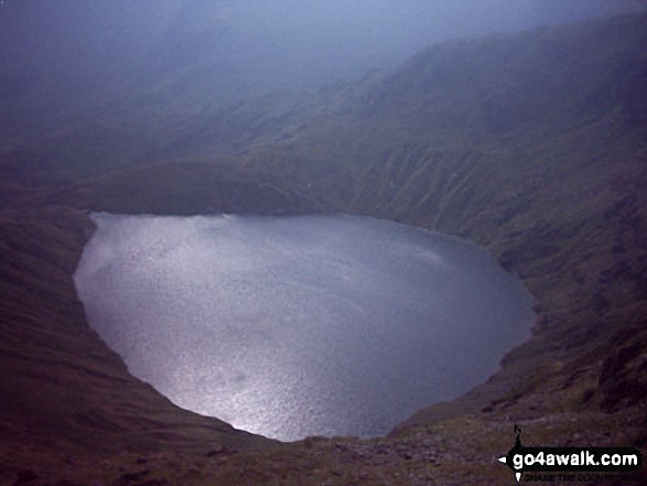
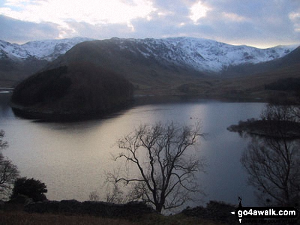
Nan Bield Pass and Small Water with Rough Crag and High Street beyond from Harter Fell (Mardale)
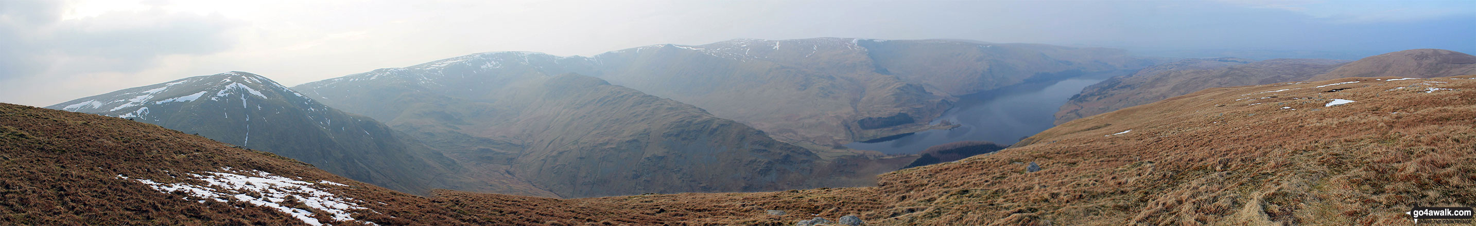
Harter Fell (Mardale) (left), High Street, Kidsty Pike, High Raise (Mardale), Haweswater Reservoir and Selside Pike (far right) from Branstree (Artlecrag Pike)
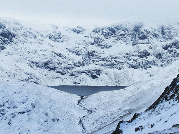

High Street, The Rigg and Rough Crag (Riggindale) across Haweswater Reservoir


. . . see all 42 walk photographs & pictures of views from, on, or of, High Street
Send us your photographs and pictures on, of, or from High Street
If you would like to add your walk photographs and pictures to this page, please send them as email attachments (configured for any computer) along with your name to:
and we shall do our best to publish them.
(Guide Resolution = 300dpi. At least = 660pixels (wide) x 440 pixels (high).)

You can also submit photos via our Facebook Page.
NB. Please indicate where each photo was taken and whether you wish us to credit your photos with a Username or your First Name/Last Name.


