England - a fully detailed list of all the Mountains, Peaks, Tops and Hills (Page 1 of 6)
England is defined as the whole of the country of England which includes the National Parks of Dartmoor, Exmoor, The Lake District, The Peak District, The North York Moors, Northumberland, The South Downs and The Yorkshire Dales, as well as The Chilterns, The Cotswolds, The Forest of Bowland, The North Peninnes, The Shropshire Hills and The South Peninnes.
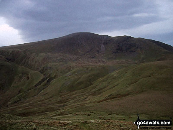
If you count only the Mountains (Hewitts) there are 180 tops to climb, bag & conquer and the highest point is Scafell Pike at 978m (3,210ft).
To see these Mountains, Peaks, Tops and Hills displayed in different ways - see the options in the left-hand column and towards the bottom of this page.
LOG ON and RELOAD this page to show which Mountains, Peaks, Tops and Hills you have already climbed, bagged & conquered [. . . more details]
Page 1 of 6 Go to page:
1 2 3 4 5 6 |
See this list in: Alphabetical Order
| Height Order‡
To reverse the order select the link again.
Mountain, Peak, Top or Hill:
Bagged
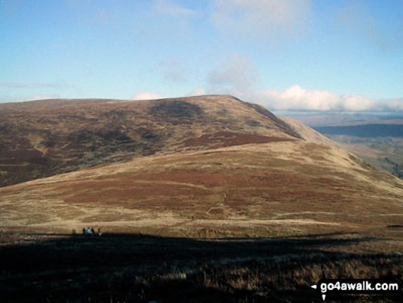
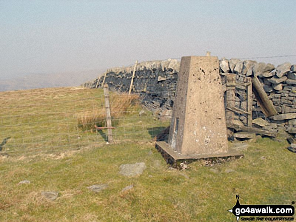
1. Calf Top
609m (2,000ft)
Mountain (180th in England, 317th in England & Wales)
Nuttall (253rd in England, 441st in England & Wales)
Marilyn (51st in England, 752nd in GB)
OS Trig Point
Calf Top was reclassified from a 'Dewey' to a Mountain (Hewitt) and 'Nuttall' in September 2016. Formerly thought to be fractionally under the 609.6m (2000ft) required for mountain status, the Ordnance Survey recalculated the height of the mountain using the OSTN15/OSGM15 transformation to a height of 609.606m (2000ft and 1/4 inch).
To walk, climb & bag Calf Top use this easy-to-follow walk:
See the location of Calf Top and walks up it on a google MapCalf Top is on interactive maps:
OS Explorer (Orange Covers): OL2
OS Landranger (Pink Covers): 98
Calf Top is on downloadable PDF you can Print or Save to your Phone:
|
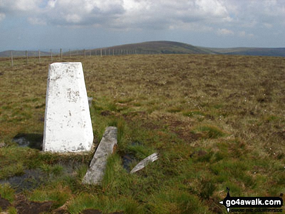
2. Renwick Fell (Thack Moor)
609m (2,000ft)
Mountain (179th in England, 316th in England & Wales)
Nuttall (254th in England, 443rd in England & Wales)
OS Trig Point
Renwick Fell (Thack Moor) was reclassified from a 'Dewey' to a Mountain (Hewitt) and 'Nuttall' in April 2013. Formerly thought to be fractionally under the 609.6m (2000ft) required for mountain status, the Ordnance Survey has confirmed the height to be 609.62m (2000ft and 3/4 inch).
To walk, climb & bag Renwick Fell (Thack Moor) use either of these easy-to-follow walks:
See the location of Renwick Fell (Thack Moor) and walks up it on a google MapRenwick Fell (Thack Moor) is on interactive maps:
OS Explorer (Orange Covers): OL43
OS Landranger (Pink Covers): 86
Renwick Fell (Thack Moor) is on downloadable PDF you can Print or Save to your Phone:
|
3. Bloodybush Edge
610m (2,001ft)
Mountain (178th in England, 313th in England & Wales)
Nuttall (250th in England, 438th in England & Wales)
OS Trig Point
To walk, climb & bag Bloodybush Edge use this easy-to-follow walk:
See the location of Bloodybush Edge and walks up it on a google MapBloodybush Edge is on interactive maps:
OS Explorer (Orange Covers): OL16
OS Landranger (Pink Covers): 80
A downloadable go4awalk.com PDF Peak Bagging Map featuring Bloodybush Edge will be available soon. |
4. Birks Fell
610m (2,002ft)
Mountain (177th in England, 312th in England & Wales)
Nuttall (249th in England, 435th in England & Wales)
Marilyn (50th in England, 749th in GB)
To walk, climb & bag Birks Fell use this easy-to-follow walk:
See the location of Birks Fell and walks up it on a google MapBirks Fell is on interactive maps:
OS Explorer (Orange Covers): OL30
OS Landranger (Pink Covers): 98
Birks Fell is on downloadable PDF you can Print or Save to your Phone:
|
5. Middlehope Moor
612m (2,008ft)
Mountain (176th in England, 309th in England & Wales)
Nuttall (247th in England, 431st in England & Wales)
OS Trig Point
To walk, climb & bag Middlehope Moor use this easy-to-follow walk:
See the location of Middlehope Moor and walks up it on a google MapMiddlehope Moor is on interactive maps:
OS Explorer (Orange Covers): OL31
OS Landranger (Pink Covers): 87
Middlehope Moor is on downloadable PDF you can Print or Save to your Phone:
|
6. Drumaldrace (Wether Fell)
614m (2,015ft)
Mountain (174th in England, 303rd in England & Wales)
Nuttall (243rd in England, 423rd in England & Wales)
To walk, climb & bag Drumaldrace (Wether Fell) use this easy-to-follow walk:
See the location of Drumaldrace (Wether Fell) and walks up it on a google MapDrumaldrace (Wether Fell) is on interactive maps:
OS Explorer (Orange Covers): OL2 and
OL30
OS Landranger (Pink Covers): 98
Drumaldrace (Wether Fell) is on downloadable PDF you can Print or Save to your Phone:
|
7. The Dodd
614m (2,015ft)
Mountain (175th in England, 306th in England & Wales)
Nuttall (244th in England, 425th in England & Wales)
We hope to have walks that climb & bag The Dodd very soon
See the location of The Dodd and walks up it on a google MapThe Dodd is on interactive maps:
OS Explorer (Orange Covers): OL31
OS Landranger (Pink Covers): 86 and
87
The Dodd is on downloadable PDF you can Print or Save to your Phone:
|
8. Flinty Fell
614m (2,016ft)
Mountain (173rd in England, 302nd in England & Wales)
Nuttall (242nd in England, 420th in England & Wales)
OS Trig Point
To walk, climb & bag Flinty Fell use this easy-to-follow walk:
See the location of Flinty Fell and walks up it on a google MapFlinty Fell is on interactive maps:
OS Explorer (Orange Covers): OL31
OS Landranger (Pink Covers): 86 and
87
Flinty Fell is on downloadable PDF you can Print or Save to your Phone:
|
9. Great Borne
616m (2,021ft)
Wainwright (No. 127)
Mountain (172nd in England, 300th in England & Wales)
Nuttall (241st in England, 417th in England & Wales)
OS Trig Point
To walk, climb & bag Great Borne use any of these easy-to-follow walks:
See the location of Great Borne and walks up it on a google MapGreat Borne is on interactive maps:
OS Explorer (Orange Covers): OL4
OS Landranger (Pink Covers): 89
Great Borne is on downloadable PDF you can Print or Save to your Phone:
*Version including the walk routes marked on it that you need to follow to Walk all 214 Wainwrights in just 59 walks. |
10. Cushat Law
616m (2,022ft)
Mountain (171st in England, 299th in England & Wales)
Nuttall (239th in England, 415th in England & Wales)
To walk, climb & bag Cushat Law use this easy-to-follow walk:
See the location of Cushat Law and walks up it on a google MapCushat Law is on interactive maps:
OS Explorer (Orange Covers): OL16
OS Landranger (Pink Covers): 80
A downloadable go4awalk.com PDF Peak Bagging Map featuring Cushat Law will be available soon. |
11. Yewbarrow (North Top)
616m (2,023ft)
Mountain (170th in England, 298th in England & Wales)
Nuttall (238th in England, 414th in England & Wales)
To walk, climb & bag Yewbarrow (North Top) use any of these easy-to-follow walks:
See the location of Yewbarrow (North Top) and walks up it on a google MapYewbarrow (North Top) is on interactive maps:
OS Explorer (Orange Covers): OL6
OS Landranger (Pink Covers): 89
Yewbarrow (North Top) is on downloadable PDF you can Print or Save to your Phone:
*Version including the walk routes marked on it that you need to follow to Walk all 214 Wainwrights in just 59 walks. |
12. Windy Gyle
619m (2,031ft)
Mountain (169th in England, 296th in England & Wales)
Nuttall (236th in England, 411th in England & Wales)
Donald (85th)
OS Trig Point
Since Windy Gyle lies on the border between England & Scotland it has the distinction of being classified as an English Mountain (Hewitt), an English Nuttall and a Scottish Donald.
To walk, climb & bag Windy Gyle use any of these easy-to-follow walks:
See the location of Windy Gyle and walks up it on a google MapWindy Gyle is on interactive maps:
OS Explorer (Orange Covers): OL16
OS Landranger (Pink Covers): 80
A downloadable go4awalk.com PDF Peak Bagging Map featuring Windy Gyle will be available soon. |
13. Bink Moss
619m (2,032ft)
Mountain (168th in England, 294th in England & Wales)
Nuttall (234th in England, 406th in England & Wales)
To walk, climb & bag Bink Moss use this easy-to-follow walk:
See the location of Bink Moss and walks up it on a google MapBink Moss is on interactive maps:
OS Explorer (Orange Covers): OL19
OS Landranger (Pink Covers): 91 and
92
Bink Moss is on downloadable PDF you can Print or Save to your Phone:
|
14. Cold Fell Pike (Geltsdale)
621m (2,038ft)
Mountain (167th in England, 290th in England & Wales)
Nuttall (230th in England, 400th in England & Wales)
Marilyn (48th in England, 725th in GB)
OS Trig Point
To walk, climb & bag Cold Fell Pike (Geltsdale) use either of these easy-to-follow walks:
See the location of Cold Fell Pike (Geltsdale) and walks up it on a google MapCold Fell Pike (Geltsdale) is on interactive maps:
OS Explorer (Orange Covers): OL31
OS Landranger (Pink Covers): 86
Cold Fell Pike (Geltsdale) is on downloadable PDF you can Print or Save to your Phone:
|
15. High Willhays
622m (2,041ft)
Mountain (166th in England, 289th in England & Wales)
Nuttall (228th in England, 397th in England & Wales)
Marilyn (49th in England, 727th in GB)
High Willhays is the highest point in Dartmoor National Park and and the highest point in the county of Devon.
To walk, climb & bag High Willhays use any of these easy-to-follow walks:
See the location of High Willhays and walks up it on a google MapHigh Willhays is on interactive maps:
OS Explorer (Orange Covers): OL28
OS Landranger (Pink Covers): 191
High Willhays is on downloadable PDF you can Print or Save to your Phone:
|
16. Darnbrook Fell
624m (2,047ft)
Mountain (164th in England, 285th in England & Wales)
Nuttall (223rd in England, 388th in England & Wales)
OS Trig Point
To walk, climb & bag Darnbrook Fell use this easy-to-follow walk:
See the location of Darnbrook Fell and walks up it on a google MapDarnbrook Fell is on interactive maps:
OS Explorer (Orange Covers): OL30
OS Landranger (Pink Covers): 98
Darnbrook Fell is on downloadable PDF you can Print or Save to your Phone:
|
17. Randygill Top
624m (2,047ft)
Mountain (165th in England, 286th in England & Wales)
Nuttall (224th in England, 389th in England & Wales)
To walk, climb & bag Randygill Top use any of these easy-to-follow walks:
See the location of Randygill Top and walks up it on a google MapRandygill Top is on interactive maps:
OS Explorer (Orange Covers): OL19
OS Landranger (Pink Covers): 91
Randygill Top is on downloadable PDF you can Print or Save to your Phone:
|
18. Gragareth
628m (2,060ft)
Mountain (162nd in England, 281st in England & Wales)
Nuttall (218th in England, 381st in England & Wales)
OS Trig Point
Gragareth is the highest point in the county of Lancashire.
To walk, climb & bag Gragareth use any of these easy-to-follow walks:
See the location of Gragareth and walks up it on a google MapGragareth is on interactive maps:
OS Explorer (Orange Covers): OL2
OS Landranger (Pink Covers): 98
Gragareth is on downloadable PDF you can Print or Save to your Phone:
|
19. Rough Crag (Riggindale)
628m (2,060ft)
Mountain (163rd in England, 282nd in England & Wales)
Nuttall (219th in England, 382nd in England & Wales)
To walk, climb & bag Rough Crag (Riggindale) use any of these easy-to-follow walks:
See the location of Rough Crag (Riggindale) and walks up it on a google MapRough Crag (Riggindale) is on interactive maps:
OS Explorer (Orange Covers): OL5
OS Landranger (Pink Covers): 90
Rough Crag (Riggindale) is on downloadable PDF you can Print or Save to your Phone:
*Version including the walk routes marked on it that you need to follow to Walk all 214 Wainwrights in just 59 walks. |
20. Yewbarrow
628m (2,062ft)
Wainwright (No. 124)
Mountain (161st in England, 279th in England & Wales)
Nuttall (216th in England, 378th in England & Wales)
To walk, climb & bag Yewbarrow use any of these easy-to-follow walks:
See the location of Yewbarrow and walks up it on a google MapYewbarrow is on interactive maps:
OS Explorer (Orange Covers): OL6
OS Landranger (Pink Covers): 89
Yewbarrow is on downloadable PDF you can Print or Save to your Phone:
*Version including the walk routes marked on it that you need to follow to Walk all 214 Wainwrights in just 59 walks. |
21. Seathwaite Fell
632m (2,074ft)
Wainwright (No. 123)
Mountain (160th in England, 273rd in England & Wales)
Nuttall (214th in England, 367th in England & Wales)
To walk, climb & bag Seathwaite Fell use this easy-to-follow walk:
See the location of Seathwaite Fell and walks up it on a google MapSeathwaite Fell is on interactive maps:
OS Explorer (Orange Covers): OL6
OS Landranger (Pink Covers): 89 and
90
Seathwaite Fell is on downloadable PDF you can Print or Save to your Phone:
*Version including the walk routes marked on it that you need to follow to Walk all 214 Wainwrights in just 59 walks. |
22. Bleaklow Head (Bleaklow Hill)
633m (2,077ft)
Mountain (159th in England, 271st in England & Wales)
Nuttall (212th in England, 364th in England & Wales)
To walk, climb & bag Bleaklow Head (Bleaklow Hill) use any of these easy-to-follow walks:
See the location of Bleaklow Head (Bleaklow Hill) and walks up it on a google MapBleaklow Head (Bleaklow Hill) is on interactive maps:
OS Explorer (Orange Covers): OL1
OS Landranger (Pink Covers): 110
Bleaklow Head (Bleaklow Hill) is on downloadable PDF you can Print or Save to your Phone:
|
23. Starling Dodd
633m (2,077ft)
Wainwright (No. 122)
Mountain (158th in England, 270th in England & Wales)
Nuttall (213th in England, 365th in England & Wales)
To walk, climb & bag Starling Dodd use any of these easy-to-follow walks:
See the location of Starling Dodd and walks up it on a google MapStarling Dodd is on interactive maps:
OS Explorer (Orange Covers): OL4
OS Landranger (Pink Covers): 89
Starling Dodd is on downloadable PDF you can Print or Save to your Phone:
*Version including the walk routes marked on it that you need to follow to Walk all 214 Wainwrights in just 59 walks. |
24. Dovenest Top
633m (2,078ft)
Mountain (157th in England, 269th in England & Wales)
Nuttall (211th in England, 362nd in England & Wales)
To walk, climb & bag Dovenest Top use either of these easy-to-follow walks:
See the location of Dovenest Top and walks up it on a google MapDovenest Top is on interactive maps:
OS Explorer (Orange Covers): OL6
OS Landranger (Pink Covers): 89 and
90
Dovenest Top is on downloadable PDF you can Print or Save to your Phone:
*Version including the walk routes marked on it that you need to follow to Walk all 214 Wainwrights in just 59 walks. |
25. Kinder Scout
636m (2,087ft)
Mountain (156th in England, 265th in England & Wales)
Nuttall (207th in England, 356th in England & Wales)
Marilyn (47th in England, 710th in GB)
Kinder Scout is the highest point in The Peak District National Park and the highest point in the county of Derbyshire.
To walk, climb & bag Kinder Scout use any of these easy-to-follow walks:
See the location of Kinder Scout and walks up it on a google MapKinder Scout is on interactive maps:
OS Explorer (Orange Covers): OL1
OS Landranger (Pink Covers): 110
Kinder Scout is on downloadable PDF you can Print or Save to your Phone:
|
26. Causey Pike
637m (2,091ft)
Wainwright (No. 120)
Mountain (154th in England, 263rd in England & Wales)
Nuttall (203rd in England, 352nd in England & Wales)
To walk, climb & bag Causey Pike use any of these easy-to-follow walks:
See the location of Causey Pike and walks up it on a google MapCausey Pike is on interactive maps:
OS Explorer (Orange Covers): OL4
OS Landranger (Pink Covers): 89 and
90
Causey Pike is on downloadable PDF you can Print or Save to your Phone:
*Version including the walk routes marked on it that you need to follow to Walk all 214 Wainwrights in just 59 walks. |
27. Little Hart Crag
637m (2,091ft)
Wainwright (No. 119)
Mountain (155th in England, 264th in England & Wales)
Nuttall (205th in England, 354th in England & Wales)
To walk, climb & bag Little Hart Crag use any of these easy-to-follow walks:
See the location of Little Hart Crag and walks up it on a google MapLittle Hart Crag is on interactive maps:
OS Explorer (Orange Covers): OL5 and
OL7
OS Landranger (Pink Covers): 90
Little Hart Crag is on downloadable PDF you can Print or Save to your Phone:
*Version including the walk routes marked on it that you need to follow to Walk all 214 Wainwrights in just 59 walks. |
28. Grey Crag (Sleddale)
638m (2,094ft)
Wainwright (No. 118)
Mountain (153rd in England, 261st in England & Wales)
Nuttall (202nd in England, 350th in England & Wales)
To walk, climb & bag Grey Crag (Sleddale) use either of these easy-to-follow walks:
See the location of Grey Crag (Sleddale) and walks up it on a google MapGrey Crag (Sleddale) is on interactive maps:
OS Explorer (Orange Covers): OL7
OS Landranger (Pink Covers): 90
Grey Crag (Sleddale) is on downloadable PDF you can Print or Save to your Phone:
*Version including the walk routes marked on it that you need to follow to Walk all 214 Wainwrights in just 59 walks. |
29. Yarlside
639m (2,097ft)
Mountain (152nd in England, 260th in England & Wales)
Nuttall (201st in England, 349th in England & Wales)
Marilyn (46th in England, 704th in GB)
To walk, climb & bag Yarlside use any of these easy-to-follow walks:
See the location of Yarlside and walks up it on a google MapYarlside is on interactive maps:
OS Explorer (Orange Covers): OL19
OS Landranger (Pink Covers): 98
Yarlside is on downloadable PDF you can Print or Save to your Phone:
|
30. Fell Head (Howgills)
640m (2,100ft)
Mountain (150th in England, 257th in England & Wales)
Nuttall (199th in England, 347th in England & Wales)
To walk, climb & bag Fell Head (Howgills) use any of these easy-to-follow walks:
See the location of Fell Head (Howgills) and walks up it on a google MapFell Head (Howgills) is on interactive maps:
OS Explorer (Orange Covers): OL19
OS Landranger (Pink Covers): 97
Fell Head (Howgills) is on downloadable PDF you can Print or Save to your Phone:
|
Page 1 of 6 Go to page:
1 2 3 4 5 6 |
View these 180 Mountains, Peaks, Tops and Hills:
Is there a Mountain, Peak, Top or Hill missing from the above google map or list?
Let us know an we will add it to our database.

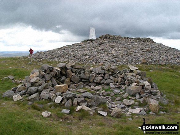
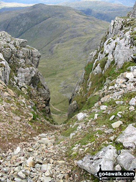
 The view from Scafell Pike in England


