Wandope
773m (2539ft)
The North Western Fells, The Lake District, Cumbria, England
Not familiar with this top?
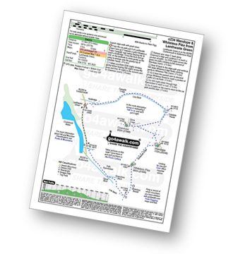
You can walk/hike to the top of Wandope by using any of these 5 easy‑to‑follow route maps:
See Wandope and the surrounding tops on our free-to-access 'Google Style' Peak Bagging Maps:
The North Western Fells of The Lake District National Park
Less data - quicker to download
The Whole of The Lake District National Park
More data - might take a little longer to download
See Wandope and the surrounding tops on our unique, downloadable, PDF Peak Bagging Maps:
NB: Whether you print off a copy or download it to your phone, these PDF Peak Baggers' Maps might prove incredibly useful when your are up there on the tops and you cannot get a phone signal.
*This version is marked with the walk routes you need to follow to Walk all 214 Wainwrights in just 59 walks.
You can find Wandope & all the walks that climb it on these unique free-to-access Interactive Walk Planning Maps:
1:25,000 scale OS Explorer Map (orange/yellow covers):
1:50,000 scale OS Landranger Maps (pink/magenta covers):
 Fellow go4awalkers who have already walked, climbed, scaled, summited, hiked & bagged Wandope
Pete George walked up Wandope on August 30th, 2025 [from/via/route] Crummock Water [with] Roco [weather] Chilly on tops & slight rain
Christine Shepherd climbed it on October 25th, 2007 [from/via/route] Walked from Lanthwaite green using walk c256 [with] On my own [weather] Hazy with Autumn sunshine peeping through late afternoon. - A very quiet walk; hardly saw anyone else all day. Climbed again with Jenny, 22.5.18.Climbed this for a third time as part of the 10 in 10 challenge on 22.6.2019 . Climbed for a fourth time on 14.8.25 on a very hot day. Did a straight up & down from the NT Car park in Buttermere before having a cooling swim in the lake.
James Hughes bagged it on July 12th, 2025 [from/via/route] c196 Grasnoor & Rannerdale Knotts from Lanthwaite Green. [weather] Boi-ling... Got hotter as day progressed. Clear skies with big yellow disc. - Epic day. Started early (8amish). Steep ascent up Whiteside & pleasant ridge walk to Hopegill Head. Familiar descent off Sand Hill due to last walk before stopping & cooling in Liza Beck. Brief ascent to Grasmoor, stunning views both of Whiteside & towards Red Pike range. Direct down & up to Wandope. Impressive drop off. Returned to main path to Whiteless Pike & beginning to feel the heat. Tricky, steep & draining descent over Whiteless Breast for final climb of Rannerdale Knotts. Completely spent at this point & needed to summon all energy to climb & descend Rannerdale Knotts to edge of Crummock water. Hot but easier road walk with break in the shade. Finished with dip in beck near footbridge at start. Pint of Buttermere Beauty Lager at Kirkstile Inn.
Martin Hartshorne hiked Wandope on March 21st, 2025 [from/via/route] Rannerdale parking area [with] finley [weather] Started warm & sunny, then strong winds clouded over quite cold
Ian Ashton summited on April 27th, 2024 [with] Solo - Ì
To add (or remove) your name and experiences on this page - Log On and edit your Personal Mountain Bagging Record
. . . [see more walk reports]
More Photographs & Pictures of views from, on, or of, Wandope
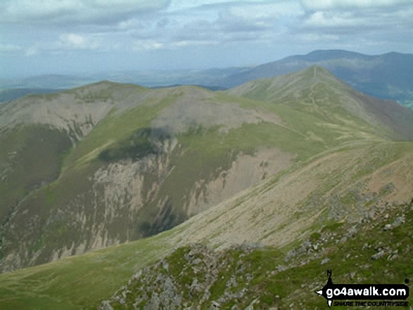
Grasmoor, Crag Hill (Eel Crag), Sail, Ard Crags and Knott Rigg from the summit of Wandope
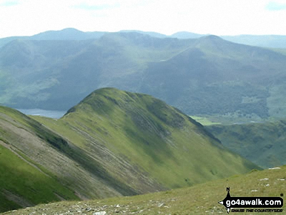
Looking down over Whiteless Pike and Rannerdale Knotts to Crummock Water from Wandope
The summit shelter, Mellbreak, Rannerdale Knotts, Buttermere, Grasmoor, Whiteless Pike, Wandope, Crag Hill (Eel Crag), Sail and Knott Rigg from the summit of Robinson
. . . see all 21 walk photographs & pictures of views from, on, or of, Wandope
Send us your photographs and pictures on, of, or from Wandope
If you would like to add your walk photographs and pictures to this page, please send them as email attachments (configured for any computer) along with your name to:
and we shall do our best to publish them.
(Guide Resolution = 300dpi. At least = 660pixels (wide) x 440 pixels (high).)
You can also submit photos via our Facebook Page.
NB. Please indicate where each photo was taken and whether you wish us to credit your photos with a Username or your First Name/Last Name.
 (Moderate)
 (Hard)

 (Very Hard)
