The West Midlands region of England - a fully detailed list of all the Mountains, Peaks, Tops and Hills (Page 2 of 3)
The West Midlands region of England comprises the traditional counties of Herefordshire, Shropshire, Staffordshire, Warwickshire, West Midlands, Worcestershire and parts of the Peak District National Park.
If you include all the Mountains (Hewitts), the Deweys, the Nuttalls, the Marilyns, the Bridgets (Hills) and all the Mountains, Tops, Peaks and Hills with a Trig Point on them there are 176 tops to climb, bag & conquer and the highest point is Black Hill (Craswall) at 641m (2,103ft).
To see these Mountains, Peaks, Tops and Hills displayed in different ways - see the options in the left-hand column and towards the bottom of this page.
LOG ON and RELOAD this page to show which Mountains, Peaks, Tops and Hills you have already climbed, bagged & conquered [. . . more details]
Page 2 of 3 Go to page:
1 2 3 |
See this list in: Alphabetical Order
| Height Order‡
To reverse the order select the link again.
Mountain, Peak, Top or Hill:
Bagged
31. Radnor Wood
325m (1,066ft)
Bridget
We hope to have walks that climb & bag Radnor Wood very soon
See the location of Radnor Wood and walks up it on a google MapRadnor Wood is on interactive maps:
OS Explorer (Orange Covers): 201
OS Landranger (Pink Covers): 137
Radnor Wood is on downloadable PDF you can Print or Save to your Phone:
|
32. Shobdon Hill
326m (1,069ft)
Marilyn (120th in England, 1339th in GB)
OS Trig Point
We hope to have walks that climb & bag Shobdon Hill very soon
See the location of Shobdon Hill and walks up it on a google MapShobdon Hill is on interactive maps:
OS Explorer (Orange Covers): 201
OS Landranger (Pink Covers): 137 and
148 and
149
|
33. Cobden Edge
327m (1,073ft)
Bridget
OS Trig Point
To walk, climb & bag Cobden Edge use this easy-to-follow walk:
See the location of Cobden Edge and walks up it on a google MapCobden Edge is on interactive maps:
OS Explorer (Orange Covers): OL1
OS Landranger (Pink Covers): 109
Cobden Edge is on downloadable PDF you can Print or Save to your Phone:
|
34. Fin Cop
327m (1,073ft)
Bridget
To walk, climb & bag Fin Cop use this easy-to-follow walk:
See the location of Fin Cop and walks up it on a google MapFin Cop is on interactive maps:
OS Explorer (Orange Covers): OL24
OS Landranger (Pink Covers): 119
Fin Cop is on downloadable PDF you can Print or Save to your Phone:
|
35. Huglith Hill
328m (1,076ft)
Bridget
We hope to have walks that climb & bag Huglith Hill very soon
See the location of Huglith Hill and walks up it on a google MapHuglith Hill is on interactive maps:
OS Explorer (Orange Covers): 241
OS Landranger (Pink Covers): 126
Huglith Hill is on downloadable PDF you can Print or Save to your Phone:
|
36. Wapley Hill
329m (1,079ft)
Marilyn (118th in England, 1332nd in GB)
We hope to have walks that climb & bag Wapley Hill very soon
See the location of Wapley Hill and walks up it on a google MapWapley Hill is on interactive maps:
OS Explorer (Orange Covers): 201
OS Landranger (Pink Covers): 137 and
148 and
149
|
37. Callow Hill (Little Stretton)
336m (1,102ft)
Marilyn (112th in England, 1319th in GB)
OS Trig Point
To walk, climb & bag Callow Hill (Little Stretton) use either of these easy-to-follow walks:
See the location of Callow Hill (Little Stretton) and walks up it on a google MapCallow Hill (Little Stretton) is on interactive maps:
OS Explorer (Orange Covers): 217
OS Landranger (Pink Covers): 137 and
138
Callow Hill (Little Stretton) is on downloadable PDF you can Print or Save to your Phone:
|
38. High Bent (Biddulph Moor)
336m (1,102ft)
Bridget
OS Trig Point
We hope to have walks that climb & bag High Bent (Biddulph Moor) very soon
See the location of High Bent (Biddulph Moor) and walks up it on a google MapHigh Bent (Biddulph Moor) is on interactive maps:
OS Explorer (Orange Covers): OL24
OS Landranger (Pink Covers): 118
High Bent (Biddulph Moor) is on downloadable PDF you can Print or Save to your Phone:
|
39. Kenslow Knoll
337m (1,106ft)
Bridget
To walk, climb & bag Kenslow Knoll use either of these easy-to-follow walks:
See the location of Kenslow Knoll and walks up it on a google MapKenslow Knoll is on interactive maps:
OS Explorer (Orange Covers): OL24
OS Landranger (Pink Covers): 119
Kenslow Knoll is on downloadable PDF you can Print or Save to your Phone:
|
40. Gatley Hill
338m (1,109ft)
Bridget
We hope to have walks that climb & bag Gatley Hill very soon
See the location of Gatley Hill and walks up it on a google MapGatley Hill is on interactive maps:
OS Explorer (Orange Covers): 203
OS Landranger (Pink Covers): 137 and
148
|
41. Herefordshire Beacon
338m (1,109ft)
Bridget
We hope to have walks that climb & bag Herefordshire Beacon very soon
See the location of Herefordshire Beacon and walks up it on a google MapHerefordshire Beacon is on interactive maps:
OS Explorer (Orange Covers): 190
OS Landranger (Pink Covers): 150
|
42. Masson Hill (Heights of Abraham)
338m (1,109ft)
Bridget
OS Trig Point
We hope to have walks that climb & bag Masson Hill (Heights of Abraham) very soon
See the location of Masson Hill (Heights of Abraham) and walks up it on a google MapMasson Hill (Heights of Abraham) is on interactive maps:
OS Explorer (Orange Covers): OL24
OS Landranger (Pink Covers): 119
Masson Hill (Heights of Abraham) is on downloadable PDF you can Print or Save to your Phone:
|
43. Helmeth Hill
344m (1,129ft)
Bridget
We hope to have walks that climb & bag Helmeth Hill very soon
See the location of Helmeth Hill and walks up it on a google MapHelmeth Hill is on interactive maps:
OS Explorer (Orange Covers): 241
OS Landranger (Pink Covers): 137
Helmeth Hill is on downloadable PDF you can Print or Save to your Phone:
|
44. Buxton Wood
345m (1,132ft)
Bridget
We hope to have walks that climb & bag Buxton Wood very soon
See the location of Buxton Wood and walks up it on a google MapBuxton Wood is on interactive maps:
OS Explorer (Orange Covers): 216
OS Landranger (Pink Covers): 126
Buxton Wood is on downloadable PDF you can Print or Save to your Phone:
|
45. Hazler Hill
347m (1,138ft)
Bridget
OS Trig Point
We hope to have walks that climb & bag Hazler Hill very soon
See the location of Hazler Hill and walks up it on a google MapHazler Hill is on interactive maps:
OS Explorer (Orange Covers): 241
OS Landranger (Pink Covers): 137
Hazler Hill is on downloadable PDF you can Print or Save to your Phone:
|
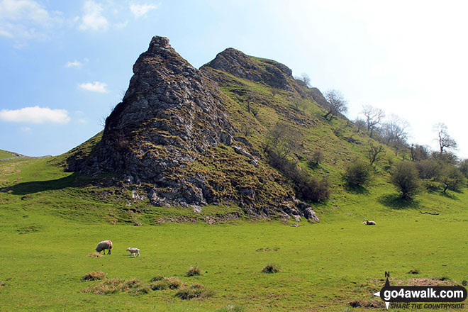
46. Parkhouse Hill
352m (1,155ft)
Bridget
To walk, climb & bag Parkhouse Hill use any of these easy-to-follow walks:
See the location of Parkhouse Hill and walks up it on a google MapParkhouse Hill is on interactive maps:
OS Explorer (Orange Covers): OL24
OS Landranger (Pink Covers): 119
Parkhouse Hill is on downloadable PDF you can Print or Save to your Phone:
|
47. Burrow (Shropshire)
358m (1,174ft)
Marilyn (105th in England, 1284th in GB)
We hope to have walks that climb & bag Burrow (Shropshire) very soon
See the location of Burrow (Shropshire) and walks up it on a google MapBurrow (Shropshire) is on interactive maps:
OS Explorer (Orange Covers): 216 and
217
OS Landranger (Pink Covers): 137
Burrow (Shropshire) is on downloadable PDF you can Print or Save to your Phone:
|
48. Bucknell Hill
361m (1,184ft)
Bridget
We hope to have walks that climb & bag Bucknell Hill very soon
See the location of Bucknell Hill and walks up it on a google MapBucknell Hill is on interactive maps:
OS Explorer (Orange Covers): 201
OS Landranger (Pink Covers): 137
Bucknell Hill is on downloadable PDF you can Print or Save to your Phone:
|
49. Craig-y-rhiw
362m (1,188ft)
Bridget
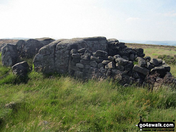
The summit appears to be a ruined building inside a military firing range.
We hope to have walks that climb & bag Craig-y-rhiw very soon
See the location of Craig-y-rhiw and walks up it on a google MapCraig-y-rhiw is on interactive maps:
OS Explorer (Orange Covers): 240
OS Landranger (Pink Covers): 126
Craig-y-rhiw is on downloadable PDF you can Print or Save to your Phone:
|
50. Hitter Hill
362m (1,188ft)
Bridget
To walk, climb & bag Hitter Hill use any of these easy-to-follow walks:
See the location of Hitter Hill and walks up it on a google MapHitter Hill is on interactive maps:
OS Explorer (Orange Covers): OL24
OS Landranger (Pink Covers): 119
Hitter Hill is on downloadable PDF you can Print or Save to your Phone:
|
51. Bringewood
363m (1,191ft)
Bridget
OS Trig Point
We hope to have walks that climb & bag Bringewood very soon
See the location of Bringewood and walks up it on a google MapBringewood is on interactive maps:
OS Explorer (Orange Covers): 203
OS Landranger (Pink Covers): 137 and
138 and
148
|
52. Gratton Hill
363m (1,191ft)
Bridget
To walk, climb & bag Gratton Hill use this easy-to-follow walk:
See the location of Gratton Hill and walks up it on a google MapGratton Hill is on interactive maps:
OS Explorer (Orange Covers): OL24
OS Landranger (Pink Covers): 119
Gratton Hill is on downloadable PDF you can Print or Save to your Phone:
|
53. Lordshill
364m (1,194ft)
Bridget
We hope to have walks that climb & bag Lordshill very soon
See the location of Lordshill and walks up it on a google MapLordshill is on interactive maps:
OS Explorer (Orange Covers): 216
OS Landranger (Pink Covers): 126
Lordshill is on downloadable PDF you can Print or Save to your Phone:
|
54. White Edge (Big Moor) (South East Top)
365m (1,197ft)
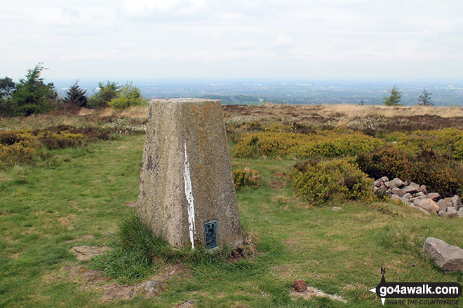
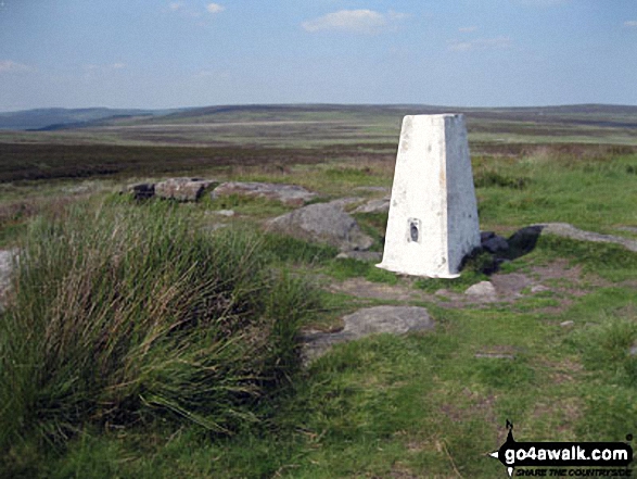
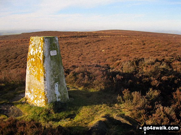
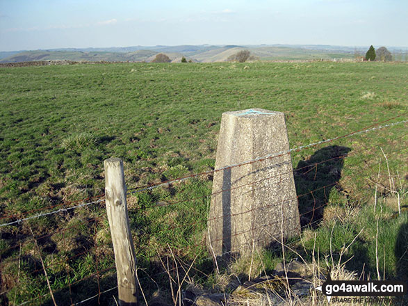
OS Trig Point
To walk, climb & bag White Edge (Big Moor) (South East Top) use either of these easy-to-follow walks:
See the location of White Edge (Big Moor) (South East Top) and walks up it on a google MapWhite Edge (Big Moor) (South East Top) is on interactive maps:
OS Explorer (Orange Covers): OL24
OS Landranger (Pink Covers): 119
White Edge (Big Moor) (South East Top) is on downloadable PDF you can Print or Save to your Phone:
|
55. Garway Hill
366m (1,201ft)
Marilyn (104th in England, 1275th in GB)
OS Trig Point
We hope to have walks that climb & bag Garway Hill very soon
See the location of Garway Hill and walks up it on a google MapGarway Hill is on interactive maps:
OS Explorer (Orange Covers): 189
OS Landranger (Pink Covers): 161
|
56. White Edge (Big Moor)
366m (1,201ft)
Bridget
OS Trig Point
To walk, climb & bag White Edge (Big Moor) use either of these easy-to-follow walks:
See the location of White Edge (Big Moor) and walks up it on a google MapWhite Edge (Big Moor) is on interactive maps:
OS Explorer (Orange Covers): OL24
OS Landranger (Pink Covers): 119
White Edge (Big Moor) is on downloadable PDF you can Print or Save to your Phone:
|
57. Beeley Moor (South East Top)
367m (1,204ft)
OS Trig Point
To walk, climb & bag Beeley Moor (South East Top) use either of these easy-to-follow walks:
See the location of Beeley Moor (South East Top) and walks up it on a google MapBeeley Moor (South East Top) is on interactive maps:
OS Explorer (Orange Covers): OL24
OS Landranger (Pink Covers): 119
Beeley Moor (South East Top) is on downloadable PDF you can Print or Save to your Phone:
|
58. Narrowdale Hill
367m (1,204ft)
Bridget
To walk, climb & bag Narrowdale Hill use this easy-to-follow walk:
See the location of Narrowdale Hill and walks up it on a google MapNarrowdale Hill is on interactive maps:
OS Explorer (Orange Covers): OL24
OS Landranger (Pink Covers): 119
Narrowdale Hill is on downloadable PDF you can Print or Save to your Phone:
|
59. Adstone Hill
369m (1,211ft)
Bridget
We hope to have walks that climb & bag Adstone Hill very soon
See the location of Adstone Hill and walks up it on a google MapAdstone Hill is on interactive maps:
OS Explorer (Orange Covers): 216
OS Landranger (Pink Covers): 137
Adstone Hill is on downloadable PDF you can Print or Save to your Phone:
|
60. Ecton Hill
369m (1,211ft)
Bridget
OS Trig Point
To walk, climb & bag Ecton Hill use any of these easy-to-follow walks:
See the location of Ecton Hill and walks up it on a google MapEcton Hill is on interactive maps:
OS Explorer (Orange Covers): OL1
OS Landranger (Pink Covers): 119
Ecton Hill is on downloadable PDF you can Print or Save to your Phone:
|
61. Eccles Pike
370m (1,214ft)
Bridget
We hope to have walks that climb & bag Eccles Pike very soon
See the location of Eccles Pike and walks up it on a google MapEccles Pike is on interactive maps:
OS Explorer (Orange Covers): OL1
OS Landranger (Pink Covers): 110
Eccles Pike is on downloadable PDF you can Print or Save to your Phone:
|
62. Wardlow Hay Cop
370m (1,214ft)
Bridget
OS Trig Point
To walk, climb & bag Wardlow Hay Cop use this easy-to-follow walk:
See the location of Wardlow Hay Cop and walks up it on a google MapWardlow Hay Cop is on interactive maps:
OS Explorer (Orange Covers): OL24
OS Landranger (Pink Covers): 119
Wardlow Hay Cop is on downloadable PDF you can Print or Save to your Phone:
|
63. Beeley Moor
371m (1,217ft)
Bridget
To walk, climb & bag Beeley Moor use either of these easy-to-follow walks:
See the location of Beeley Moor and walks up it on a google MapBeeley Moor is on interactive maps:
OS Explorer (Orange Covers): OL24
OS Landranger (Pink Covers): 119
Beeley Moor is on downloadable PDF you can Print or Save to your Phone:
|
64. Graig Hill
371m (1,217ft)
Bridget
We hope to have walks that climb & bag Graig Hill very soon
See the location of Graig Hill and walks up it on a google MapGraig Hill is on interactive maps:
OS Explorer (Orange Covers): 216
OS Landranger (Pink Covers): 137
|
65. Mucklewick Hill
371m (1,217ft)
Bridget
We hope to have walks that climb & bag Mucklewick Hill very soon
See the location of Mucklewick Hill and walks up it on a google MapMucklewick Hill is on interactive maps:
OS Explorer (Orange Covers): 216
OS Landranger (Pink Covers): 137
Mucklewick Hill is on downloadable PDF you can Print or Save to your Phone:
|
66. Wetton Hill
371m (1,217ft)
Bridget
To walk, climb & bag Wetton Hill use any of these easy-to-follow walks:
See the location of Wetton Hill and walks up it on a google MapWetton Hill is on interactive maps:
OS Explorer (Orange Covers): OL24
OS Landranger (Pink Covers): 119
Wetton Hill is on downloadable PDF you can Print or Save to your Phone:
|
67. Switchback Hill
373m (1,224ft)
Bridget
We hope to have walks that climb & bag Switchback Hill very soon
See the location of Switchback Hill and walks up it on a google MapSwitchback Hill is on interactive maps:
OS Explorer (Orange Covers): 216
OS Landranger (Pink Covers): 137
Switchback Hill is on downloadable PDF you can Print or Save to your Phone:
|
68. Nick Knolls
374m (1,227ft)
Bridget
We hope to have walks that climb & bag Nick Knolls very soon
See the location of Nick Knolls and walks up it on a google MapNick Knolls is on interactive maps:
OS Explorer (Orange Covers): 216
OS Landranger (Pink Covers): 126
Nick Knolls is on downloadable PDF you can Print or Save to your Phone:
|
69. High Vinnalls
375m (1,230ft)
Marilyn (103rd in England, 1258th in GB)
We hope to have walks that climb & bag High Vinnalls very soon
See the location of High Vinnalls and walks up it on a google MapHigh Vinnalls is on interactive maps:
OS Explorer (Orange Covers): 203
OS Landranger (Pink Covers): 137 and
138 and
148
|
70. Grindon Moor (Grindon Moor)
377m (1,237ft)
Bridget
OS Trig Point
To walk, climb & bag Grindon Moor (Grindon Moor) use any of these easy-to-follow walks:
See the location of Grindon Moor (Grindon Moor) and walks up it on a google MapGrindon Moor (Grindon Moor) is on interactive maps:
OS Explorer (Orange Covers): OL24
OS Landranger (Pink Covers): 119
Grindon Moor (Grindon Moor) is on downloadable PDF you can Print or Save to your Phone:
|
71. The Lawley
377m (1,237ft)
Bridget
To walk, climb & bag The Lawley use either of these easy-to-follow walks:
See the location of The Lawley and walks up it on a google MapThe Lawley is on interactive maps:
OS Explorer (Orange Covers): 217
OS Landranger (Pink Covers): 137 and
138
The Lawley is on downloadable PDF you can Print or Save to your Phone:
|
72. Harboro' Rocks
379m (1,243ft)
Bridget
OS Trig Point
To walk, climb & bag Harboro' Rocks use this easy-to-follow walk:
See the location of Harboro' Rocks and walks up it on a google MapHarboro' Rocks is on interactive maps:
OS Explorer (Orange Covers): OL24
OS Landranger (Pink Covers): 119
Harboro' Rocks is on downloadable PDF you can Print or Save to your Phone:
|
73. Carder Low
380m (1,247ft)
Bridget
To walk, climb & bag Carder Low use either of these easy-to-follow walks:
See the location of Carder Low and walks up it on a google MapCarder Low is on interactive maps:
OS Explorer (Orange Covers): OL24
OS Landranger (Pink Covers): 119
Carder Low is on downloadable PDF you can Print or Save to your Phone:
|
74. Sheen Hill
380m (1,247ft)
Bridget
OS Trig Point
Sheen Hill is on private farmland. However, the kind owners seem not to mind visitors to the summit Trig Point providing they stay away from the farmhouse.
To walk, climb & bag Sheen Hill use this easy-to-follow walk:
See the location of Sheen Hill and walks up it on a google MapSheen Hill is on interactive maps:
OS Explorer (Orange Covers): OL24
OS Landranger (Pink Covers): 119
Sheen Hill is on downloadable PDF you can Print or Save to your Phone:
|
75. Shelve Hill
381m (1,250ft)
Bridget
We hope to have walks that climb & bag Shelve Hill very soon
See the location of Shelve Hill and walks up it on a google MapShelve Hill is on interactive maps:
OS Explorer (Orange Covers): 216
OS Landranger (Pink Covers): 137
Shelve Hill is on downloadable PDF you can Print or Save to your Phone:
|
76. Gun (Staffordshire)
385m (1,264ft)
Marilyn (102nd in England, 1232nd in GB)
OS Trig Point
To walk, climb & bag Gun (Staffordshire) use any of these easy-to-follow walks:
See the location of Gun (Staffordshire) and walks up it on a google MapGun (Staffordshire) is on interactive maps:
OS Explorer (Orange Covers): OL24
OS Landranger (Pink Covers): 118
Gun (Staffordshire) is on downloadable PDF you can Print or Save to your Phone:
|
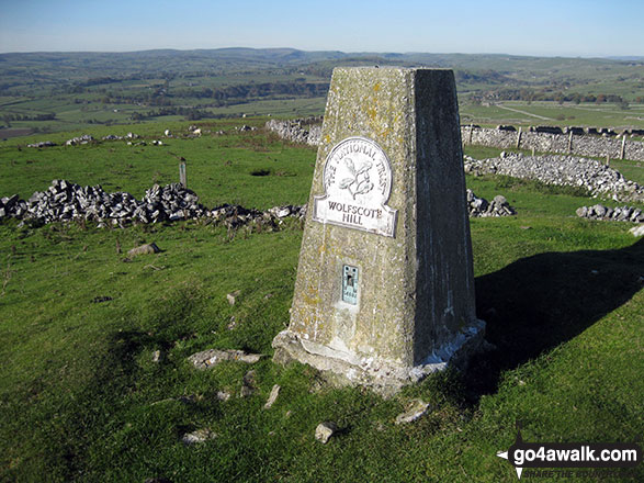
77. Wolfscote Hill
388m (1,273ft)
Bridget
OS Trig Point
To walk, climb & bag Wolfscote Hill use this easy-to-follow walk:
See the location of Wolfscote Hill and walks up it on a google MapWolfscote Hill is on interactive maps:
OS Explorer (Orange Covers): OL24
OS Landranger (Pink Covers): 119
Wolfscote Hill is on downloadable PDF you can Print or Save to your Phone:
|
78. Bradnor Hill
391m (1,283ft)
Marilyn (99th in England, 1225th in GB)
We hope to have walks that climb & bag Bradnor Hill very soon
See the location of Bradnor Hill and walks up it on a google MapBradnor Hill is on interactive maps:
OS Explorer (Orange Covers): 201
OS Landranger (Pink Covers): 148
|
79. Sunnyhill
393m (1,289ft)
Bridget
We hope to have walks that climb & bag Sunnyhill very soon
See the location of Sunnyhill and walks up it on a google MapSunnyhill is on interactive maps:
OS Explorer (Orange Covers): 203 and
216
OS Landranger (Pink Covers): 137
Sunnyhill is on downloadable PDF you can Print or Save to your Phone:
|
80. Bucknell Wood
394m (1,293ft)
Bridget
We hope to have walks that climb & bag Bucknell Wood very soon
See the location of Bucknell Wood and walks up it on a google MapBucknell Wood is on interactive maps:
OS Explorer (Orange Covers): 201
OS Landranger (Pink Covers): 137
Bucknell Wood is on downloadable PDF you can Print or Save to your Phone:
|
81. Clun Hill
394m (1,293ft)
Bridget
We hope to have walks that climb & bag Clun Hill very soon
See the location of Clun Hill and walks up it on a google MapClun Hill is on interactive maps:
OS Explorer (Orange Covers): 201
OS Landranger (Pink Covers): 137
Clun Hill is on downloadable PDF you can Print or Save to your Phone:
|
82. Longstone Moor
395m (1,296ft)
Bridget
To walk, climb & bag Longstone Moor use either of these easy-to-follow walks:
See the location of Longstone Moor and walks up it on a google MapLongstone Moor is on interactive maps:
OS Explorer (Orange Covers): OL24
OS Landranger (Pink Covers): 119
Longstone Moor is on downloadable PDF you can Print or Save to your Phone:
|
83. Totley Moor
395m (1,296ft)
Bridget
OS Trig Point
To walk, climb & bag Totley Moor use this easy-to-follow walk:
See the location of Totley Moor and walks up it on a google MapTotley Moor is on interactive maps:
OS Explorer (Orange Covers): OL24
OS Landranger (Pink Covers): 119
Totley Moor is on downloadable PDF you can Print or Save to your Phone:
|
84. Hopton Titterhill
397m (1,302ft)
Bridget
We hope to have walks that climb & bag Hopton Titterhill very soon
See the location of Hopton Titterhill and walks up it on a google MapHopton Titterhill is on interactive maps:
OS Explorer (Orange Covers): 201
OS Landranger (Pink Covers): 137
Hopton Titterhill is on downloadable PDF you can Print or Save to your Phone:
|
85. Ragleth Hill
398m (1,306ft)
Bridget
To walk, climb & bag Ragleth Hill use any of these easy-to-follow walks:
See the location of Ragleth Hill and walks up it on a google MapRagleth Hill is on interactive maps:
OS Explorer (Orange Covers): 217
OS Landranger (Pink Covers): 137 and
138
Ragleth Hill is on downloadable PDF you can Print or Save to your Phone:
|
86. Caer Caradoc (Knighton)
399m (1,309ft)
Bridget
We hope to have walks that climb & bag Caer Caradoc (Knighton) very soon
See the location of Caer Caradoc (Knighton) and walks up it on a google MapCaer Caradoc (Knighton) is on interactive maps:
OS Explorer (Orange Covers): 201
OS Landranger (Pink Covers): 137 and
148
Caer Caradoc (Knighton) is on downloadable PDF you can Print or Save to your Phone:
|
87. Black Rhadley Hill
401m (1,316ft)
Bridget
We hope to have walks that climb & bag Black Rhadley Hill very soon
See the location of Black Rhadley Hill and walks up it on a google MapBlack Rhadley Hill is on interactive maps:
OS Explorer (Orange Covers): 216
OS Landranger (Pink Covers): 137
Black Rhadley Hill is on downloadable PDF you can Print or Save to your Phone:
|
88. Revidge
401m (1,316ft)
Bridget
OS Trig Point
To walk, climb & bag Revidge use this easy-to-follow walk:
See the location of Revidge and walks up it on a google MapRevidge is on interactive maps:
OS Explorer (Orange Covers): OL24
OS Landranger (Pink Covers): 119
Revidge is on downloadable PDF you can Print or Save to your Phone:
|
89. Cefn Gunthly
402m (1,319ft)
Bridget
We hope to have walks that climb & bag Cefn Gunthly very soon
See the location of Cefn Gunthly and walks up it on a google MapCefn Gunthly is on interactive maps:
OS Explorer (Orange Covers): 216
OS Landranger (Pink Covers): 137
Cefn Gunthly is on downloadable PDF you can Print or Save to your Phone:
|
90. Stapeley Hill
403m (1,322ft)
Bridget
We hope to have walks that climb & bag Stapeley Hill very soon
See the location of Stapeley Hill and walks up it on a google MapStapeley Hill is on interactive maps:
OS Explorer (Orange Covers): 216
OS Landranger (Pink Covers): 137
Stapeley Hill is on downloadable PDF you can Print or Save to your Phone:
|
Page 2 of 3 Go to page:
1 2 3 |
View these 176 Mountains, Peaks, Tops and Hills:
Is there a Mountain, Peak, Top or Hill missing from the above google map or list?
Let us know an we will add it to our database.


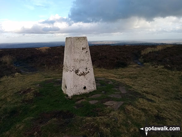
 The summit of Brown Clee Hill (Abdon Burf) in The Shropshire Hills


