The West Midlands region of England - a fully detailed list of all the Mountains, Peaks, Tops and Hills (Page 3 of 3)
The West Midlands region of England comprises the traditional counties of Herefordshire, Shropshire, Staffordshire, Warwickshire, West Midlands, Worcestershire and parts of the Peak District National Park.
If you include all the Mountains (Hewitts), the Deweys, the Nuttalls, the Marilyns, the Bridgets (Hills) and all the Mountains, Tops, Peaks and Hills with a Trig Point on them there are 176 tops to climb, bag & conquer and the highest point is Black Hill (Craswall) at 641m (2,103ft).
To see these Mountains, Peaks, Tops and Hills displayed in different ways - see the options in the left-hand column and towards the bottom of this page.
LOG ON and RELOAD this page to show which Mountains, Peaks, Tops and Hills you have already climbed, bagged & conquered [. . . more details]
Page 3 of 3 Go to page:
1 2 3 |
See this list in: Alphabetical Order‡
| Height Order
To reverse the order select the link again.
Mountain, Peak, Top or Hill:
Bagged
61. Craig-y-rhiw
362m (1,188ft)
Bridget
The summit appears to be a ruined building inside a military firing range.
We hope to have walks that climb & bag Craig-y-rhiw very soon
See the location of Craig-y-rhiw and walks up it on a google MapCraig-y-rhiw is on interactive maps:
OS Explorer (Orange Covers): 240
OS Landranger (Pink Covers): 126
Craig-y-rhiw is on downloadable PDF you can Print or Save to your Phone:
|
62. Coxall Knoll
262m (859ft)
Bridget
We hope to have walks that climb & bag Coxall Knoll very soon
See the location of Coxall Knoll and walks up it on a google MapCoxall Knoll is on interactive maps:
OS Explorer (Orange Covers): 201
OS Landranger (Pink Covers): 137 and
148
Coxall Knoll is on downloadable PDF you can Print or Save to your Phone:
|
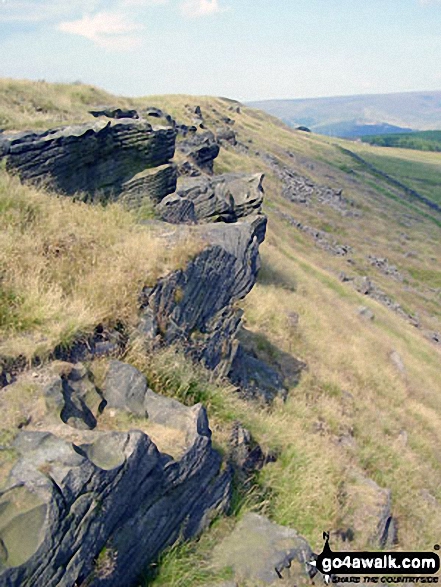
63. Cown Edge Rocks
410m (1,345ft)
Bridget
OS Trig Point
To walk, climb & bag Cown Edge Rocks use this easy-to-follow walk:
See the location of Cown Edge Rocks and walks up it on a google MapCown Edge Rocks is on interactive maps:
OS Explorer (Orange Covers): OL1
OS Landranger (Pink Covers): 109
Cown Edge Rocks is on downloadable PDF you can Print or Save to your Phone:
|
64. Cothercott Hill
442m (1,450ft)
Bridget
We hope to have walks that climb & bag Cothercott Hill very soon
See the location of Cothercott Hill and walks up it on a google MapCothercott Hill is on interactive maps:
OS Explorer (Orange Covers): 241
OS Landranger (Pink Covers): 137
Cothercott Hill is on downloadable PDF you can Print or Save to your Phone:
|
65. Coppet Hill
200m (656ft)
Bridget
OS Trig Point
We hope to have walks that climb & bag Coppet Hill very soon
See the location of Coppet Hill and walks up it on a google MapCoppet Hill is on interactive maps:
OS Explorer (Orange Covers): 189
OS Landranger (Pink Covers): 162
|
66. Combs Head (Combs Moss)
503m (1,650ft)
Dewey (174th in England, 407th in England & Wales)
To walk, climb & bag Combs Head (Combs Moss) use this easy-to-follow walk:
See the location of Combs Head (Combs Moss) and walks up it on a google MapCombs Head (Combs Moss) is on interactive maps:
OS Explorer (Orange Covers): OL24
OS Landranger (Pink Covers): 119
Combs Head (Combs Moss) is on downloadable PDF you can Print or Save to your Phone:
|
67. Colebatch Hill
416m (1,365ft)
Bridget
OS Trig Point
We hope to have walks that climb & bag Colebatch Hill very soon
See the location of Colebatch Hill and walks up it on a google MapColebatch Hill is on interactive maps:
OS Explorer (Orange Covers): 216
OS Landranger (Pink Covers): 137
Colebatch Hill is on downloadable PDF you can Print or Save to your Phone:
|
68. Cold Overton Park
197m (646ft)
Bridget
OS Trig Point
Cold Overton Park is the highest point in the county of Rutland
We hope to have walks that climb & bag Cold Overton Park very soon
See the location of Cold Overton Park and walks up it on a google MapCold Overton Park is on interactive maps:
OS Explorer (Orange Covers): 234
OS Landranger (Pink Covers): 141
|
69. Cobden Edge
327m (1,073ft)
Bridget
OS Trig Point
To walk, climb & bag Cobden Edge use this easy-to-follow walk:
See the location of Cobden Edge and walks up it on a google MapCobden Edge is on interactive maps:
OS Explorer (Orange Covers): OL1
OS Landranger (Pink Covers): 109
Cobden Edge is on downloadable PDF you can Print or Save to your Phone:
|
70. Clunbury Hill
304m (997ft)
Bridget
We hope to have walks that climb & bag Clunbury Hill very soon
See the location of Clunbury Hill and walks up it on a google MapClunbury Hill is on interactive maps:
OS Explorer (Orange Covers): 201
OS Landranger (Pink Covers): 137 and
148
|
71. Clun Hill
394m (1,293ft)
Bridget
We hope to have walks that climb & bag Clun Hill very soon
See the location of Clun Hill and walks up it on a google MapClun Hill is on interactive maps:
OS Explorer (Orange Covers): 201
OS Landranger (Pink Covers): 137
Clun Hill is on downloadable PDF you can Print or Save to your Phone:
|
72. Chrome Hill
423m (1,388ft)
Bridget
To walk, climb & bag Chrome Hill use this easy-to-follow walk:
See the location of Chrome Hill and walks up it on a google MapChrome Hill is on interactive maps:
OS Explorer (Orange Covers): OL24
OS Landranger (Pink Covers): 119
Chrome Hill is on downloadable PDF you can Print or Save to your Phone:
|
73. Chinley Churn
451m (1,480ft)
Bridget
OS Trig Point
Please Note: The Trig Point on Chinley Churn is on private land and not accessible to the public.
To walk, climb & bag Chinley Churn use either of these easy-to-follow walks:
See the location of Chinley Churn and walks up it on a google MapChinley Churn is on interactive maps:
OS Explorer (Orange Covers): OL1
OS Landranger (Pink Covers): 109
|
74. Cheeks Hill
520m (1,707ft)
Bridget
Cheeks Hill is the highest point in the county of Staffordshire.
We hope to have walks that climb & bag Cheeks Hill very soon
See the location of Cheeks Hill and walks up it on a google MapCheeks Hill is on interactive maps:
OS Explorer (Orange Covers): OL24
OS Landranger (Pink Covers): 119
Cheeks Hill is on downloadable PDF you can Print or Save to your Phone:
|
75. Chase Hill
203m (666ft)
Bridget
OS Trig Point
We hope to have walks that climb & bag Chase Hill very soon
See the location of Chase Hill and walks up it on a google MapChase Hill is on interactive maps:
OS Explorer (Orange Covers): OL14 and
189
OS Landranger (Pink Covers): 162
|
76. Cefn Hepreas
412m (1,352ft)
Bridget
We hope to have walks that climb & bag Cefn Hepreas very soon
See the location of Cefn Hepreas and walks up it on a google MapCefn Hepreas is on interactive maps:
OS Explorer (Orange Covers): 201
OS Landranger (Pink Covers): 137
Cefn Hepreas is on downloadable PDF you can Print or Save to your Phone:
|
77. Cefn Gunthly
402m (1,319ft)
Bridget
We hope to have walks that climb & bag Cefn Gunthly very soon
See the location of Cefn Gunthly and walks up it on a google MapCefn Gunthly is on interactive maps:
OS Explorer (Orange Covers): 216
OS Landranger (Pink Covers): 137
Cefn Gunthly is on downloadable PDF you can Print or Save to your Phone:
|
78. Carder Low
380m (1,247ft)
Bridget
To walk, climb & bag Carder Low use either of these easy-to-follow walks:
See the location of Carder Low and walks up it on a google MapCarder Low is on interactive maps:
OS Explorer (Orange Covers): OL24
OS Landranger (Pink Covers): 119
Carder Low is on downloadable PDF you can Print or Save to your Phone:
|
79. Calton Pastures
289m (948ft)
Bridget
OS Trig Point
To walk, climb & bag Calton Pastures use this easy-to-follow walk:
See the location of Calton Pastures and walks up it on a google MapCalton Pastures is on interactive maps:
OS Explorer (Orange Covers): OL24
OS Landranger (Pink Covers): 119
Calton Pastures is on downloadable PDF you can Print or Save to your Phone:
|
80. Callow Hill (Little Stretton)
336m (1,102ft)
Marilyn (112th in England, 1319th in GB)
OS Trig Point
To walk, climb & bag Callow Hill (Little Stretton) use either of these easy-to-follow walks:
See the location of Callow Hill (Little Stretton) and walks up it on a google MapCallow Hill (Little Stretton) is on interactive maps:
OS Explorer (Orange Covers): 217
OS Landranger (Pink Covers): 137 and
138
Callow Hill (Little Stretton) is on downloadable PDF you can Print or Save to your Phone:
|
81. Callow
411m (1,348ft)
Bridget
We hope to have walks that climb & bag Callow very soon
See the location of Callow and walks up it on a google MapCallow is on interactive maps:
OS Explorer (Orange Covers): 241
OS Landranger (Pink Covers): 137
Callow is on downloadable PDF you can Print or Save to your Phone:
|
82. Caer Caradoc Hill
459m (1,506ft)
Marilyn (84th in England, 1083rd in GB)
To walk, climb & bag Caer Caradoc Hill use any of these easy-to-follow walks:
See the location of Caer Caradoc Hill and walks up it on a google MapCaer Caradoc Hill is on interactive maps:
OS Explorer (Orange Covers): 217
OS Landranger (Pink Covers): 137 and
138
Caer Caradoc Hill is on downloadable PDF you can Print or Save to your Phone:
|
83. Caer Caradoc (Knighton)
399m (1,309ft)
Bridget
We hope to have walks that climb & bag Caer Caradoc (Knighton) very soon
See the location of Caer Caradoc (Knighton) and walks up it on a google MapCaer Caradoc (Knighton) is on interactive maps:
OS Explorer (Orange Covers): 201
OS Landranger (Pink Covers): 137 and
148
Caer Caradoc (Knighton) is on downloadable PDF you can Print or Save to your Phone:
|
84. Buxton Wood
345m (1,132ft)
Bridget
We hope to have walks that climb & bag Buxton Wood very soon
See the location of Buxton Wood and walks up it on a google MapBuxton Wood is on interactive maps:
OS Explorer (Orange Covers): 216
OS Landranger (Pink Covers): 126
Buxton Wood is on downloadable PDF you can Print or Save to your Phone:
|
85. Burton Hill
294m (964ft)
Marilyn (136th in England, 1389th in GB)
OS Trig Point
We hope to have walks that climb & bag Burton Hill very soon
See the location of Burton Hill and walks up it on a google MapBurton Hill is on interactive maps:
OS Explorer (Orange Covers): 201
OS Landranger (Pink Covers): 148 and
149
|
86. Burrow (Shropshire)
358m (1,174ft)
Marilyn (105th in England, 1284th in GB)
We hope to have walks that climb & bag Burrow (Shropshire) very soon
See the location of Burrow (Shropshire) and walks up it on a google MapBurrow (Shropshire) is on interactive maps:
OS Explorer (Orange Covers): 216 and
217
OS Landranger (Pink Covers): 137
Burrow (Shropshire) is on downloadable PDF you can Print or Save to your Phone:
|
87. Burbage Edge
500m (1,641ft)
Bridget
OS Trig Point
To walk, climb & bag Burbage Edge use either of these easy-to-follow walks:
See the location of Burbage Edge and walks up it on a google MapBurbage Edge is on interactive maps:
OS Explorer (Orange Covers): OL24
OS Landranger (Pink Covers): 119
Burbage Edge is on downloadable PDF you can Print or Save to your Phone:
|
88. Bucknell Wood
394m (1,293ft)
Bridget
We hope to have walks that climb & bag Bucknell Wood very soon
See the location of Bucknell Wood and walks up it on a google MapBucknell Wood is on interactive maps:
OS Explorer (Orange Covers): 201
OS Landranger (Pink Covers): 137
Bucknell Wood is on downloadable PDF you can Print or Save to your Phone:
|
89. Bucknell Hill
361m (1,184ft)
Bridget
We hope to have walks that climb & bag Bucknell Hill very soon
See the location of Bucknell Hill and walks up it on a google MapBucknell Hill is on interactive maps:
OS Explorer (Orange Covers): 201
OS Landranger (Pink Covers): 137
Bucknell Hill is on downloadable PDF you can Print or Save to your Phone:
|
90. Bryn Hill
408m (1,339ft)
Bridget
We hope to have walks that climb & bag Bryn Hill very soon
See the location of Bryn Hill and walks up it on a google MapBryn Hill is on interactive maps:
OS Explorer (Orange Covers): 216
OS Landranger (Pink Covers): 137
Bryn Hill is on downloadable PDF you can Print or Save to your Phone:
|
91. Brown Knoll (Edale)
569m (1,867ft)
Dewey (41st in England, 91st in England & Wales)
OS Trig Point
To walk, climb & bag Brown Knoll (Edale) use any of these easy-to-follow walks:
See the location of Brown Knoll (Edale) and walks up it on a google MapBrown Knoll (Edale) is on interactive maps:
OS Explorer (Orange Covers): OL1
OS Landranger (Pink Covers): 110
Brown Knoll (Edale) is on downloadable PDF you can Print or Save to your Phone:
|
92. Brown Clee Hill (Clee Burf)
508m (1,667ft)
Dewey (165th in England, 381st in England & Wales)
To walk, climb & bag Brown Clee Hill (Clee Burf) use this easy-to-follow walk:
See the location of Brown Clee Hill (Clee Burf) and walks up it on a google MapBrown Clee Hill (Clee Burf) is on interactive maps:
OS Explorer (Orange Covers): 217
OS Landranger (Pink Covers): 137
Brown Clee Hill (Clee Burf) is on downloadable PDF you can Print or Save to your Phone:
|
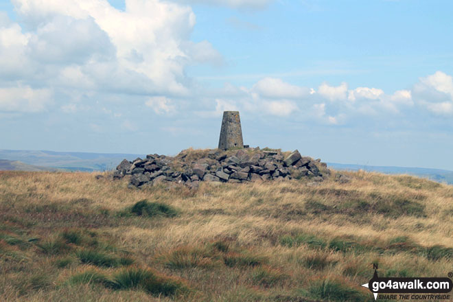
93. Brown Clee Hill (Abdon Burf)
540m (1,772ft)
Dewey (93rd in England, 212th in England & Wales)
Marilyn (66th in England, 895th in GB)
OS Trig Point
Brown Clee Hill (Abdon Burf) is the highest point in the county of Shropshire
To walk, climb & bag Brown Clee Hill (Abdon Burf) use this easy-to-follow walk:
See the location of Brown Clee Hill (Abdon Burf) and walks up it on a google MapBrown Clee Hill (Abdon Burf) is on interactive maps:
OS Explorer (Orange Covers): 217
OS Landranger (Pink Covers): 137 and
138
Brown Clee Hill (Abdon Burf) is on downloadable PDF you can Print or Save to your Phone:
|
94. Broad Heath
245m (804ft)
Bridget
OS Trig Point
We hope to have walks that climb & bag Broad Heath very soon
See the location of Broad Heath and walks up it on a google MapBroad Heath is on interactive maps:
OS Explorer (Orange Covers): 203
OS Landranger (Pink Covers): 138 and
149
|
95. Bringewood
363m (1,191ft)
Bridget
OS Trig Point
We hope to have walks that climb & bag Bringewood very soon
See the location of Bringewood and walks up it on a google MapBringewood is on interactive maps:
OS Explorer (Orange Covers): 203
OS Landranger (Pink Covers): 137 and
138 and
148
|
96. Bredon Hill
299m (981ft)
Marilyn (131st in England, 1378th in GB)
We hope to have walks that climb & bag Bredon Hill very soon
See the location of Bredon Hill and walks up it on a google MapBredon Hill is on interactive maps:
OS Explorer (Orange Covers): 190
OS Landranger (Pink Covers): 150
|
97. Bradwell Moor
471m (1,545ft)
Bridget
OS Trig Point
To walk, climb & bag Bradwell Moor use either of these easy-to-follow walks:
See the location of Bradwell Moor and walks up it on a google MapBradwell Moor is on interactive maps:
OS Explorer (Orange Covers): OL1
OS Landranger (Pink Covers): 110
Bradwell Moor is on downloadable PDF you can Print or Save to your Phone:
|
98. Bradnor Hill
391m (1,283ft)
Marilyn (99th in England, 1225th in GB)
We hope to have walks that climb & bag Bradnor Hill very soon
See the location of Bradnor Hill and walks up it on a google MapBradnor Hill is on interactive maps:
OS Explorer (Orange Covers): 201
OS Landranger (Pink Covers): 148
|
99. Bradlow Knoll
237m (777ft)
Bridget
We hope to have walks that climb & bag Bradlow Knoll very soon
See the location of Bradlow Knoll and walks up it on a google MapBradlow Knoll is on interactive maps:
OS Explorer (Orange Covers): 190
OS Landranger (Pink Covers): 149
|
100. Bolehill (Wirksworth)
322m (1,056ft)
Bridget
OS Trig Point
We hope to have walks that climb & bag Bolehill (Wirksworth) very soon
See the location of Bolehill (Wirksworth) and walks up it on a google MapBolehill (Wirksworth) is on interactive maps:
OS Explorer (Orange Covers): OL24
OS Landranger (Pink Covers): 119
Bolehill (Wirksworth) is on downloadable PDF you can Print or Save to your Phone:
|
101. Bleaklow Head (Bleaklow Hill)
633m (2,077ft)
Mountain (159th in England, 271st in England & Wales)
Nuttall (212th in England, 364th in England & Wales)
To walk, climb & bag Bleaklow Head (Bleaklow Hill) use any of these easy-to-follow walks:
See the location of Bleaklow Head (Bleaklow Hill) and walks up it on a google MapBleaklow Head (Bleaklow Hill) is on interactive maps:
OS Explorer (Orange Covers): OL1
OS Landranger (Pink Covers): 110
Bleaklow Head (Bleaklow Hill) is on downloadable PDF you can Print or Save to your Phone:
|
102. Blake Mere (Merryton Low)
489m (1,604ft)
Bridget
OS Trig Point
To walk, climb & bag Blake Mere (Merryton Low) use this easy-to-follow walk:
See the location of Blake Mere (Merryton Low) and walks up it on a google MapBlake Mere (Merryton Low) is on interactive maps:
OS Explorer (Orange Covers): OL24
OS Landranger (Pink Covers): 118
Blake Mere (Merryton Low) is on downloadable PDF you can Print or Save to your Phone:
|
103. Black Rhadley Hill
401m (1,316ft)
Bridget
We hope to have walks that climb & bag Black Rhadley Hill very soon
See the location of Black Rhadley Hill and walks up it on a google MapBlack Rhadley Hill is on interactive maps:
OS Explorer (Orange Covers): 216
OS Landranger (Pink Covers): 137
Black Rhadley Hill is on downloadable PDF you can Print or Save to your Phone:
|
104. Black Hill (Craswall)
641m (2,103ft)
Bridget
OS Trig Point
We hope to have walks that climb & bag Black Hill (Craswall) very soon
See the location of Black Hill (Craswall) and walks up it on a google MapBlack Hill (Craswall) is on interactive maps:
OS Explorer (Orange Covers): OL13
OS Landranger (Pink Covers): 161
|
105. Black Hill (Clun)
441m (1,447ft)
Bridget
OS Trig Point
We hope to have walks that climb & bag Black Hill (Clun) very soon
See the location of Black Hill (Clun) and walks up it on a google MapBlack Hill (Clun) is on interactive maps:
OS Explorer (Orange Covers): 201
OS Landranger (Pink Covers): 137
Black Hill (Clun) is on downloadable PDF you can Print or Save to your Phone:
|
106. Black Edge (Combs Moss)
507m (1,663ft)
Dewey (169th in England, 391st in England & Wales)
OS Trig Point
To walk, climb & bag Black Edge (Combs Moss) use this easy-to-follow walk:
See the location of Black Edge (Combs Moss) and walks up it on a google MapBlack Edge (Combs Moss) is on interactive maps:
OS Explorer (Orange Covers): OL24
OS Landranger (Pink Covers): 119
Black Edge (Combs Moss) is on downloadable PDF you can Print or Save to your Phone:
|
107. Birley Hill
236m (774ft)
Bridget
OS Trig Point
We hope to have walks that climb & bag Birley Hill very soon
See the location of Birley Hill and walks up it on a google MapBirley Hill is on interactive maps:
OS Explorer (Orange Covers): 202
OS Landranger (Pink Covers): 148 and
149
|
108. Berrow Hill
178m (584ft)
Bridget
OS Trig Point
We hope to have walks that climb & bag Berrow Hill very soon
See the location of Berrow Hill and walks up it on a google MapBerrow Hill is on interactive maps:
OS Explorer (Orange Covers): 204
OS Landranger (Pink Covers): 150
|
109. Beeley Moor (South East Top)
367m (1,204ft)
OS Trig Point
To walk, climb & bag Beeley Moor (South East Top) use either of these easy-to-follow walks:
See the location of Beeley Moor (South East Top) and walks up it on a google MapBeeley Moor (South East Top) is on interactive maps:
OS Explorer (Orange Covers): OL24
OS Landranger (Pink Covers): 119
Beeley Moor (South East Top) is on downloadable PDF you can Print or Save to your Phone:
|
110. Beeley Moor
371m (1,217ft)
Bridget
To walk, climb & bag Beeley Moor use either of these easy-to-follow walks:
See the location of Beeley Moor and walks up it on a google MapBeeley Moor is on interactive maps:
OS Explorer (Orange Covers): OL24
OS Landranger (Pink Covers): 119
Beeley Moor is on downloadable PDF you can Print or Save to your Phone:
|
111. Axe Edge (Axe Edge Moor)
551m (1,808ft)
Dewey (69th in England, 159th in England & Wales)
OS Trig Point
To walk, climb & bag Axe Edge (Axe Edge Moor) use this easy-to-follow walk:
See the location of Axe Edge (Axe Edge Moor) and walks up it on a google MapAxe Edge (Axe Edge Moor) is on interactive maps:
OS Explorer (Orange Covers): OL24
OS Landranger (Pink Covers): 119
Axe Edge (Axe Edge Moor) is on downloadable PDF you can Print or Save to your Phone:
|
112. Anthony Hill
293m (961ft)
Bridget
To walk, climb & bag Anthony Hill use any of these easy-to-follow walks:
See the location of Anthony Hill and walks up it on a google MapAnthony Hill is on interactive maps:
OS Explorer (Orange Covers): OL24
OS Landranger (Pink Covers): 119
Anthony Hill is on downloadable PDF you can Print or Save to your Phone:
|
113. Alport Height
314m (1,030ft)
Bridget
OS Trig Point
We hope to have walks that climb & bag Alport Height very soon
See the location of Alport Height and walks up it on a google MapAlport Height is on interactive maps:
OS Explorer (Orange Covers): OL24
OS Landranger (Pink Covers): 119
Alport Height is on downloadable PDF you can Print or Save to your Phone:
|
114. Adstone Hill
369m (1,211ft)
Bridget
We hope to have walks that climb & bag Adstone Hill very soon
See the location of Adstone Hill and walks up it on a google MapAdstone Hill is on interactive maps:
OS Explorer (Orange Covers): 216
OS Landranger (Pink Covers): 137
Adstone Hill is on downloadable PDF you can Print or Save to your Phone:
|
115. Aconbury Hill (Aconbury Camp)
276m (905ft)
Marilyn (143rd in England, 1424th in GB)
OS Trig Point
We hope to have walks that climb & bag Aconbury Hill (Aconbury Camp) very soon
See the location of Aconbury Hill (Aconbury Camp) and walks up it on a google MapAconbury Hill (Aconbury Camp) is on interactive maps:
OS Explorer (Orange Covers): 189
OS Landranger (Pink Covers): 149
|
116. Abberley Hill (Flagstaff Wood)
285m (935ft)
Bridget
OS Trig Point
Abberley Hill (Flagstaff Wood) was promoted to Marilyn status in 1997 but demoted again in 1999.
We hope to have walks that climb & bag Abberley Hill (Flagstaff Wood) very soon
See the location of Abberley Hill (Flagstaff Wood) and walks up it on a google MapAbberley Hill (Flagstaff Wood) is on interactive maps:
OS Explorer (Orange Covers): 204
OS Landranger (Pink Covers): 138 and
150
|
Page 3 of 3 Go to page:
1 2 3 |
View these 176 Mountains, Peaks, Tops and Hills:
Is there a Mountain, Peak, Top or Hill missing from the above google map or list?
Let us know an we will add it to our database.


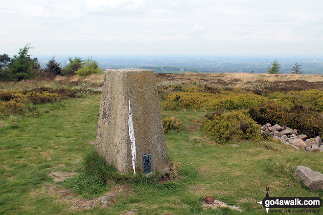

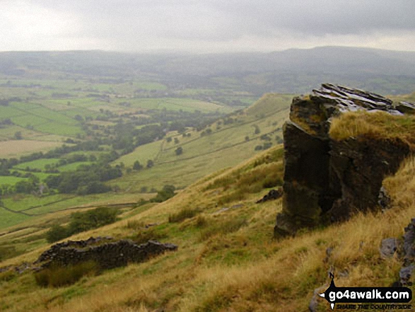

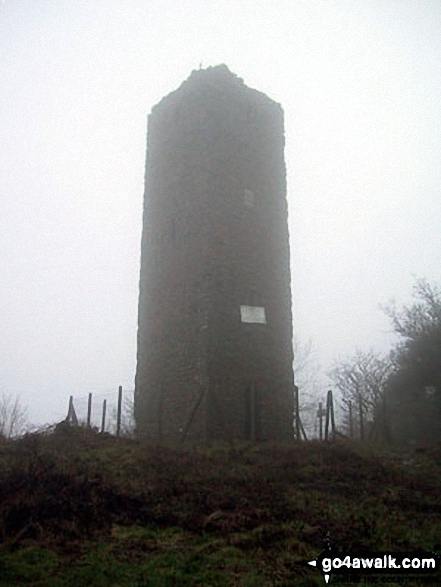


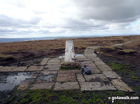


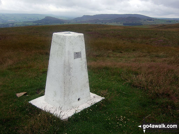

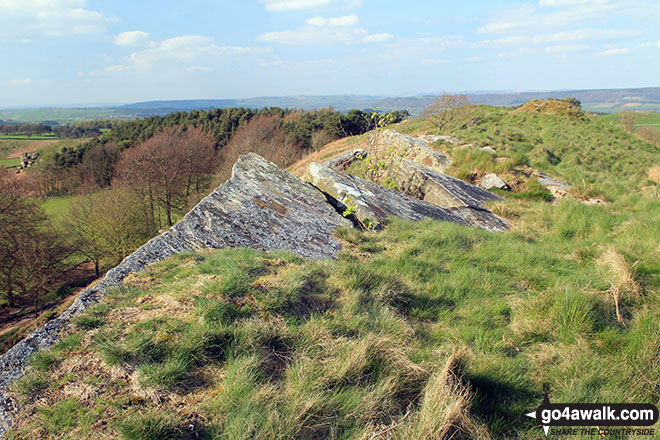
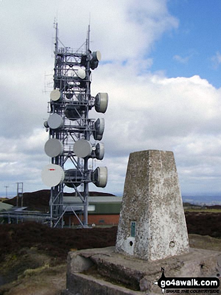 The summit of Brown Clee Hill (Abdon Burf) in The Shropshire Hills


