
![]()
Axe Edge (Axe Edge Moor)
551m (1808ft)
The White Peak Area, The Peak District, Derbyshire, England
Tap/mouse over a coloured circle (1-3 easy walks, 4-6 moderate walks, 7-9 hard walks) and click to select.
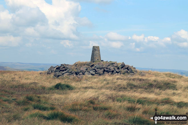
The summit of Axe Edge (Axe Edge Moor) is marked by an Ordnance Survey Trig Point.
Not familiar with this top?
   |
|---|
Vital Statistics:
| Length: | 8.25ml (13km) |
|---|---|
| Ascent: | 1,247ft (380m) |
| Time: | 4.25hrs |
| Grade: |  (Moderate) (Moderate) |
Route Summary:
Cat and Fiddle - A537 Goyt's Moss - Whetstone Ridge - Danebower Hollow - A54 - Danebower Quarries - The River Dane - The Dane Valley Way - Orchard Farm - Three Shires Head - Panniers Pool - Cheeks Hill - Dane Head - Axe Edge (Axe Edge Moor) - A54 - Cat and Fiddle
See Axe Edge (Axe Edge Moor) and the surrounding tops on our free-to-access 'Google Style' Peak Bagging Maps:
The White Peak Area of The Peak District National Park
Less data - quicker to download
See Axe Edge (Axe Edge Moor) and the surrounding tops on our downloadable Peak Bagging Map in PDF format:

NB: Whether you print off a copy or download it to your phone, this PDF Peak Baggers' Map might prove incredibly useful when your are up there on the tops and you cannot get a phone signal.
You can find Axe Edge (Axe Edge Moor) & all the walks that climb it on these unique free-to-access Interactive Walk Planning Maps:
1:25,000 scale OS Explorer Map (orange/yellow covers):
1:50,000 scale OS Landranger Map (pink/magenta covers):
 Fellow go4awalkers who have already walked, climbed, summited & bagged Axe Edge (Axe Edge Moor)
Steve Lockett walked up Axe Edge (Axe Edge Moor) on August 31st, 2020 [from/via/route] Tyn-y-Fridd
Neall Garrad climbed Axe Edge (Axe Edge Moor) on January 26th, 2019 [from/via/route] From Gradbach, via Shutlingsloe & Shining Tor & back to Gradbach. [with] WWESU Explorers [weather] Mixed
Mark Davidson bagged Axe Edge (Axe Edge Moor) on August 10th, 2017 [with] Theresa [weather] Lovely & sunny with a gentle breeze
Andrew Joss hiked Axe Edge (Axe Edge Moor) on November 9th, 2014 [from/via/route] Derbyshire Bridge car park [weather] Cloudy but dry - Good views from the trig point
Louise Sandwith has walked, climbed & bagged Axe Edge (Axe Edge Moor).
To add (or remove) your name and experiences on this page - Log On and edit your Personal Mountain Bagging Record
More Photographs & Pictures of views from, on or of Axe Edge (Axe Edge Moor)
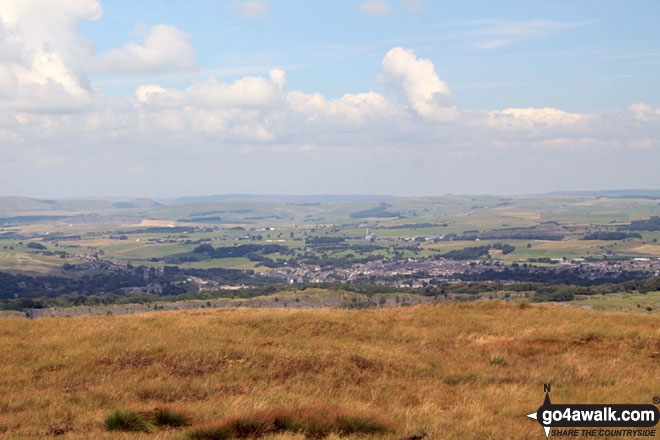
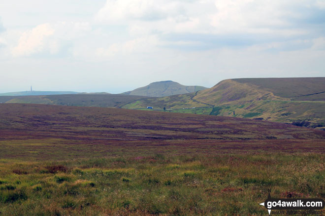
Croker Hill (mast far left), Shutlingsloe (centre right) and Whetstone Edge (right) from Axe Edge (Axe Edge Moor)
Send us your photographs and pictures on, of, or from Axe Edge (Axe Edge Moor)
If you would like to add your walk photographs and pictures featuring views from, on or of Axe Edge (Axe Edge Moor) to this page, please send them as email attachments (configured for any computer) along with your name to:
and we shall do our best to publish them.
(Guide Resolution = 300dpi. At least = 660pixels (wide) x 440 pixels (high).)

You can also submit photos via our Facebook Page.
NB. Please indicate where each photo was taken and whether you wish us to credit your photos with a Username or your First Name/Last Name.
Not familiar with this top?


