
![]()
Chrome Hill
423m (1388ft)
The White Peak Area, The Peak District, Derbyshire, England

Not familiar with this top?
   |
|---|
Vital Statistics:
| Length: | 6mls (9.5km) |
|---|---|
| Ascent: | 1,237ft (377m) |
| Time: | 3½ hrs |
| Grade: |  (Moderate) (Moderate) |
Route Summary:
Hollinsclough - Swallow Brook - Parkhouse Hill - Chrome Hill - Stoop Farm - High Edge - Booth Farm - Hollins Hill - Hollinsclough
See Chrome Hill and the surrounding tops on our free-to-access 'Google Style' Peak Bagging Maps:
The White Peak Area of The Peak District National Park
Less data - quicker to download
See Chrome Hill and the surrounding tops on our downloadable Peak Bagging Map in PDF format:

NB: Whether you print off a copy or download it to your phone, this PDF Peak Baggers' Map might prove incredibly useful when your are up there on the tops and you cannot get a phone signal.
You can find Chrome Hill & all the walks that climb it on these unique free-to-access Interactive Walk Planning Maps:
1:25,000 scale OS Explorer Map (orange/yellow covers):
1:50,000 scale OS Landranger Map (pink/magenta covers):
 Fellow go4awalkers who have already walked, climbed, summited & bagged Chrome Hill
Mark Davidson walked up Chrome Hill on April 21st, 2015 [from/via/route] Combination of walk d349 Hatch-a-way, Dowel Dale, Hollinsclough & Parkhouse Hill from Earl Sterndale & my own [with] Alone [weather] Lovely & sunny - One of the White Peak Alps / Staffordshire Alps
Sharron Barker climbed Chrome Hill on July 15th, 2018 [weather] SUN/CLOUD
Margaret Richards bagged Chrome Hill on February 19th, 2013 [from/via/route] Chrome Hill from Longnor [with] Don [weather] sunny - 11 mile walk
Lucy Perchard hiked Chrome Hill on November 12th, 2017 [from/via/route] From Earl Sterndale, along High Edge, up Hollins Hill & then along the Chrome & Parkhouse Hill ridges before finishing with a climb up High Wheeldon [with] Tony [weather] Blue skies but surpringly windy on the ridges when elsewhere was quite calm - Fantastic walk
Andrew Joss summited Chrome Hill on April 7th, 2013 [from/via/route] Longnor [with] Barbara, Mick, Pippa and Benson [weather] Pleasant
Louise Sandwith, Patrick Rogozinski, Alya Hazell, Steve Lockett, Kevin Russell and Stephen Millington have all walked, climbed & bagged Chrome Hill.
To add (or remove) your name and experiences on this page - Log On and edit your Personal Mountain Bagging Record
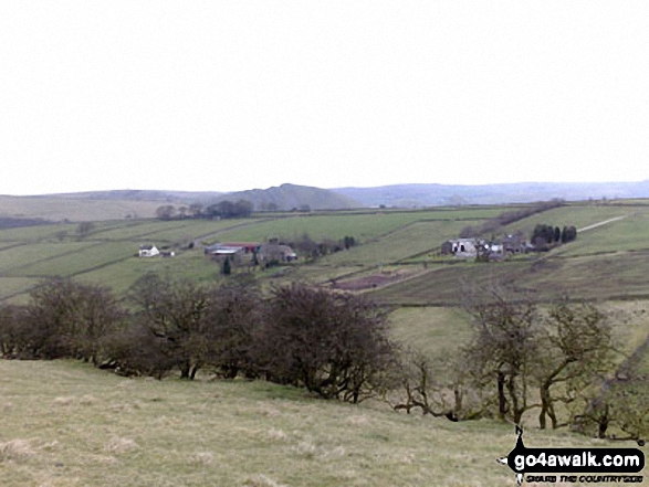
More Photographs & Pictures of views from, on or of Chrome Hill
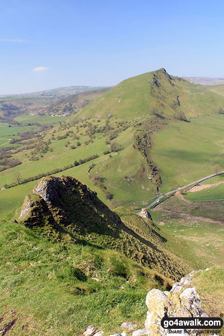
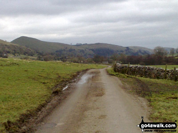
North East to Chrome Hill from where the footpath joins road into Hollinsclough
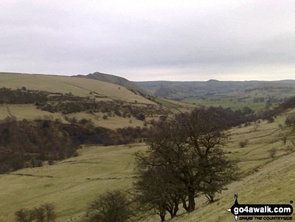
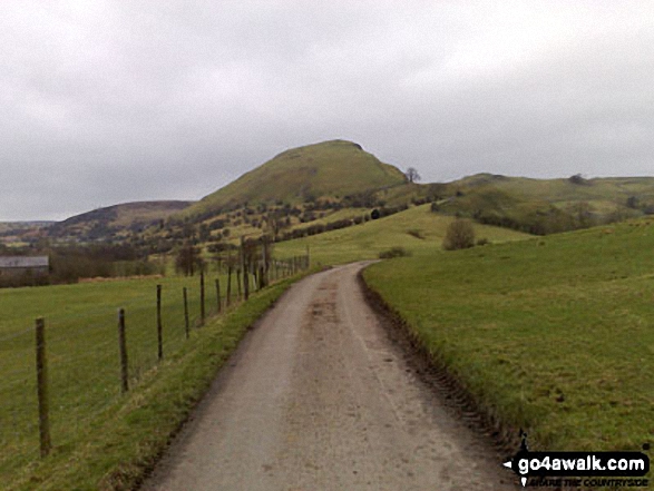
Approaching Chrome Hill on the footpath between Hollinsclough and Glutton Bridge
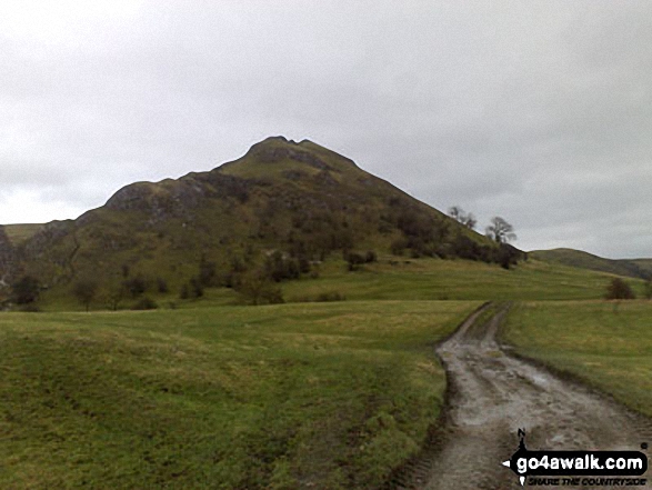
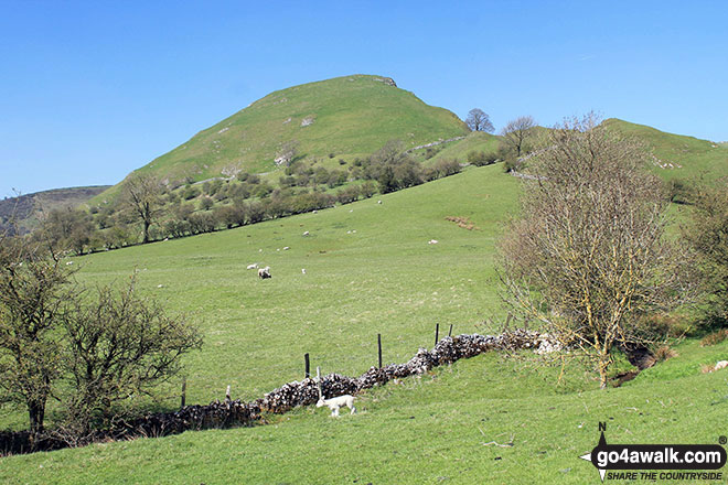
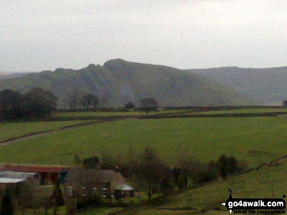
The distinctive outline of Chrome Hill in the distance, just north of the village of Hollinsclough. Taken from footpath between Hill Top Farm and Wilshaw (Moseley)
Chrome Hill from the footpath between Hill Top Farm and Wilshaw (Moseley)
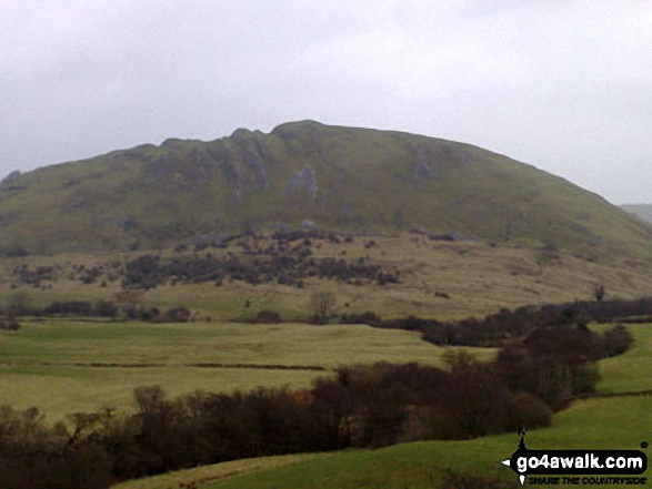
Looking North East to Chrome Hill from where the footpath joins the road into Hollinsclough
Send us your photographs and pictures on, of, or from Chrome Hill
If you would like to add your walk photographs and pictures featuring views from, on or of Chrome Hill to this page, please send them as email attachments (configured for any computer) along with your name to:
and we shall do our best to publish them.
(Guide Resolution = 300dpi. At least = 660pixels (wide) x 440 pixels (high).)

You can also submit photos via our Facebook Page.
NB. Please indicate where each photo was taken and whether you wish us to credit your photos with a Username or your First Name/Last Name.
Not familiar with this top?


