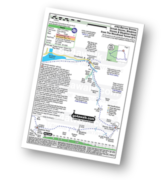
Walk d164 Barrow Stones, Grinah Stones, Bleaklow Stones and Bleaklow Head (Bleaklow Hill) from Woodhead
This 13¼ mile, Grade 7 (Hard), easy-to-follow, hand-crafted walk, complete with GPS Waypoints, starts at Woodhead Tunnel & will take about 7 hrs to complete.
   |
Vital Statistics:
| Length: | 13¼mls (21km) |
| Ascent: | 2,081ft (634m) |
| Time: | 7hrs |
| Grade: |  |
Route outline for walk d164:
Woodhead Tunnel - Far Black Clough - Swains Head - Swains Greave - Barrow Stones - Grinah Stones - Bleaklow Stones (Bleaklow Hill) - Bleaklow Head (Bleaklow Hill) - The Wain Stones (or Kissing Stones) - The Pennine Way - Joseph Patch - John Track Well - Torside Clough - Peaknaze Moor - Reaps Farm - The Longdendale Trail - Torside Reservoir - Woodhead Reservoir - Woodhead Tunnel
Peaks, Summits and Tops reached on this walk:
 1 English Mountain |
 0 Wainwrights |
 1 English Nuttall |
 0 English Deweys |
 0 Wainwright Outlying Fells |
 0 Marilyns |
 2 Bridgets |
Peak Bagging Statistics for this walk:
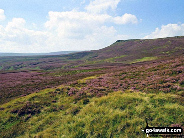
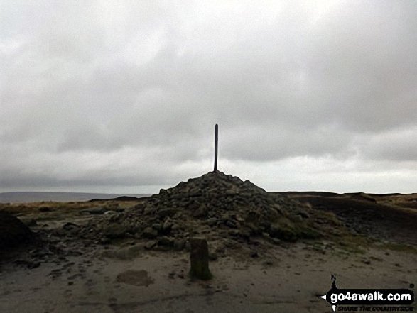
The highest point of this walk is Bleaklow Head (Bleaklow Hill) at 633m (2077ft). Bleaklow Head (Bleaklow Hill) is classified as an English Mountain (Hewitt) (159th highest in England, 271st highest in England & Wales)
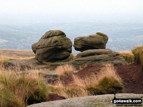
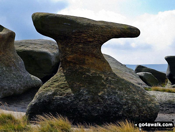
Bleaklow Head (Bleaklow Hill) is also known as an English Nuttall (212th highest in England, 364th highest in England & Wales). The summit of Bleaklow Head (Bleaklow Hill) is marked by a large cairn with a wooden pole stuck in it. The famous Wain Stones lie 250m SW of the summit.
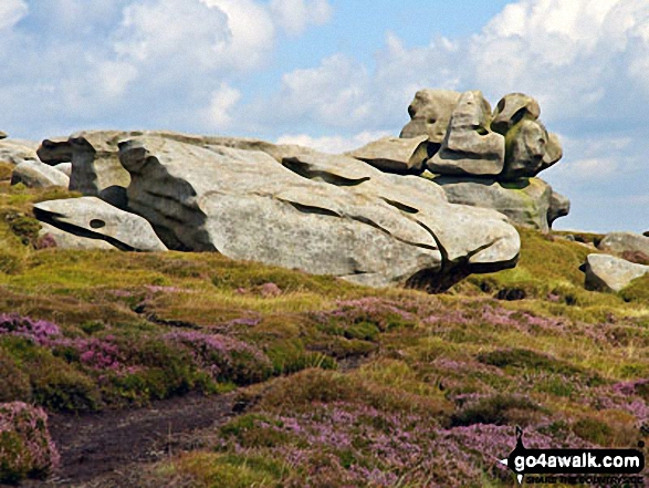
Completing this walk will also take you to the top of Bleaklow Stones (Bleaklow Hill) at 628m (2061ft). Bleaklow Stones (Bleaklow Hill) is known as an English Bridget.
You will also reach the summit of Barrow Stones at 591m (1940ft). Barrow Stones is known as an English Bridget.
National Trails & Long Paths included on this walk:
Part of this walk follows a section of The Longdendale Trail, an 11km (7 miles) linear footpath connecting Hadfield in Derbyshire, England with Salter's Brook on the border with West Yorkshire, England. The Longdendale Trail also forms part of the Trans Pennine Trail that runs coast to coast across the UK from Southport in Merseyside to Hornsea in The East Riding of Yorkshire.The Longdendale Trail follows part of the former Great Central Railway. This line from Manchester to Sheffield Railway was also known as 'The Woodhead Route'. It passed through the picturesque Longdendale valley which includes five reservoirs surrounded by high moorland. The reservoirs were completed in 1877 & were, at the time, the largest artificial expanse of water in the world. The line itself was closed in 1981 amid much controversy. The Longdendale Trail is waymarked by named discs. For more walks that include a section of this trail see The Longdendale Trail.
Part of this walk also follows a section of The Pennine Way, a 404km (251 miles) linear footpath connecting Edale in Derbyshire, England with Kirk Yetholm in The Borders, Scotland. The Pennine Way is waymarked by a National Trail Acorn. For more walks that include a section of this trail see The Pennine Way.
You can find this walk and other nearby walks on these unique Interactive Walk Planning Maps:
(worth a look if you're new to go4awalk.com & have never seen one of these before.)
1:25,000 scale OS Explorer Map (orange/yellow covers):
1:50,000 scale OS Landranger Map (pink/magenta covers):
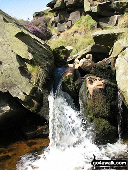
Some Photos and Pictures from Walk d164 Barrow Stones, Grinah Stones, Bleaklow Stones and Bleaklow Head (Bleaklow Hill) from Woodhead
In no particular order . . .


Send us your photographs and pictures from your walks and hikes
We would love to see your photographs and pictures from walk d164 Barrow Stones, Grinah Stones, Bleaklow Stones and Bleaklow Head (Bleaklow Hill) from Woodhead. Send them in to us as email attachments (configured for any computer) along with your name and where the picture was taken to:
and we shall do our best to publish them.
(Guide Resolution = 300dpi. At least = 660 pixels (wide) x 440 pixels (high).)

You can also submit photos from walk d164 Barrow Stones, Grinah Stones, Bleaklow Stones and Bleaklow Head (Bleaklow Hill) from Woodhead via our Facebook Page.
NB. Please indicate where each photo was taken.
To contribute to go4awalk.com or to contact us about anything at all - see Talk To Us.
For help see Help.
go4awalk.com and go4awalk.co.uk are registered trademarks of TMDH Limited.
Copyright © 2000-2026 TMDH Limited. All rights reserved.
Copyright Terms & Conditions Privacy Statement
A - Z Walks Home Log On/Accounts Photo Gallery Walk Ideas and Collections Fell Facts Hill Skills Walking Questions and Answers Your Stories News Competitions Product Reviews/Gear Tests Walking Gear Guides Peaks and Mountains Peak Bagging Find New Walking Friends Camping GPS Waypoints for Walking Contents Walk Search Talk To Us go4awalk.com Help Free Example Walks Newsletter


