The West Midlands region of England - a fully detailed list of all the Mountains, Peaks, Tops and Hills (Page of 3)
The West Midlands region of England comprises the traditional counties of Herefordshire, Shropshire, Staffordshire, Warwickshire, West Midlands, Worcestershire and parts of the Peak District National Park.
If you include all the Mountains (Hewitts), the Deweys, the Nuttalls, the Marilyns, the Bridgets (Hills) and all the Mountains, Tops, Peaks and Hills with a Trig Point on them there are 176 tops to climb, bag & conquer and the highest point is Black Hill (Craswall) at 641m (2,103ft).
To see these Mountains, Peaks, Tops and Hills displayed in different ways - see the options in the left-hand column and towards the bottom of this page.
LOG ON and RELOAD this page to show which Mountains, Peaks, Tops and Hills you have already climbed, bagged & conquered [. . . more details]
Page 1 of 3 Go to page:
1 2 3 |
See this list in: Alphabetical Order‡
| Height Order
To reverse the order select the link again.
Mountain, Peak, Top or Hill:
Bagged
1. Yearlet
466m (1,529ft)
Bridget
We hope to have walks that climb & bag Yearlet very soon
See the location of Yearlet and walks up it on a google MapYearlet is on interactive maps:
OS Explorer (Orange Covers): 241
OS Landranger (Pink Covers): 137
Yearlet is on downloadable PDF you can Print or Save to your Phone:
|
2. Wolverton Wood
255m (836ft)
Bridget
We hope to have walks that climb & bag Wolverton Wood very soon
See the location of Wolverton Wood and walks up it on a google MapWolverton Wood is on interactive maps:
OS Explorer (Orange Covers): 241
OS Landranger (Pink Covers): 137
Wolverton Wood is on downloadable PDF you can Print or Save to your Phone:
|
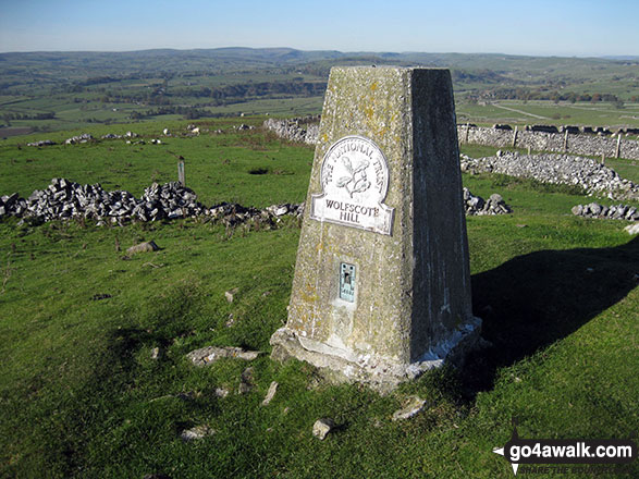
3. Wolfscote Hill
388m (1,273ft)
Bridget
OS Trig Point
To walk, climb & bag Wolfscote Hill use this easy-to-follow walk:
See the location of Wolfscote Hill and walks up it on a google MapWolfscote Hill is on interactive maps:
OS Explorer (Orange Covers): OL24
OS Landranger (Pink Covers): 119
Wolfscote Hill is on downloadable PDF you can Print or Save to your Phone:
|
4. Winhill Pike (Win Hill)
462m (1,516ft)
Bridget
OS Trig Point
To walk, climb & bag Winhill Pike (Win Hill) use any of these easy-to-follow walks:
See the location of Winhill Pike (Win Hill) and walks up it on a google MapWinhill Pike (Win Hill) is on interactive maps:
OS Explorer (Orange Covers): OL1
OS Landranger (Pink Covers): 110
Winhill Pike (Win Hill) is on downloadable PDF you can Print or Save to your Phone:
|
5. Windgate Edge
523m (1,716ft)
Bridget
To walk, climb & bag Windgate Edge use this easy-to-follow walk:
See the location of Windgate Edge and walks up it on a google MapWindgate Edge is on interactive maps:
OS Explorer (Orange Covers): OL1
OS Landranger (Pink Covers): 110
|
6. Wigmore Rolls
288m (945ft)
Bridget
OS Trig Point
We hope to have walks that climb & bag Wigmore Rolls very soon
See the location of Wigmore Rolls and walks up it on a google MapWigmore Rolls is on interactive maps:
OS Explorer (Orange Covers): 203
OS Landranger (Pink Covers): 137 and
148
|
7. White Hill (Herefordshire)
173m (567ft)
Bridget
OS Trig Point
We hope to have walks that climb & bag White Hill (Herefordshire) very soon
See the location of White Hill (Herefordshire) and walks up it on a google MapWhite Hill (Herefordshire) is on interactive maps:
OS Explorer (Orange Covers): 202
OS Landranger (Pink Covers): 149
|
8. White Edge (Big Moor) (South East Top)
365m (1,197ft)
OS Trig Point
To walk, climb & bag White Edge (Big Moor) (South East Top) use either of these easy-to-follow walks:
See the location of White Edge (Big Moor) (South East Top) and walks up it on a google MapWhite Edge (Big Moor) (South East Top) is on interactive maps:
OS Explorer (Orange Covers): OL24
OS Landranger (Pink Covers): 119
White Edge (Big Moor) (South East Top) is on downloadable PDF you can Print or Save to your Phone:
|
9. White Edge (Big Moor)
366m (1,201ft)
Bridget
OS Trig Point
To walk, climb & bag White Edge (Big Moor) use either of these easy-to-follow walks:
See the location of White Edge (Big Moor) and walks up it on a google MapWhite Edge (Big Moor) is on interactive maps:
OS Explorer (Orange Covers): OL24
OS Landranger (Pink Covers): 119
White Edge (Big Moor) is on downloadable PDF you can Print or Save to your Phone:
|
10. Wetton Hill
371m (1,217ft)
Bridget
To walk, climb & bag Wetton Hill use any of these easy-to-follow walks:
See the location of Wetton Hill and walks up it on a google MapWetton Hill is on interactive maps:
OS Explorer (Orange Covers): OL24
OS Landranger (Pink Covers): 119
Wetton Hill is on downloadable PDF you can Print or Save to your Phone:
|
11. Westend Moor (Alport Moor)
503m (1,650ft)
Bridget
OS Trig Point
We hope to have walks that climb & bag Westend Moor (Alport Moor) very soon
See the location of Westend Moor (Alport Moor) and walks up it on a google MapWestend Moor (Alport Moor) is on interactive maps:
OS Explorer (Orange Covers): OL1
OS Landranger (Pink Covers): 110
|
12. Wart Hill
324m (1,063ft)
Bridget
OS Trig Point
We hope to have walks that climb & bag Wart Hill very soon
See the location of Wart Hill and walks up it on a google MapWart Hill is on interactive maps:
OS Explorer (Orange Covers): 217
OS Landranger (Pink Covers): 137
Wart Hill is on downloadable PDF you can Print or Save to your Phone:
|
13. Wardlow Hay Cop
370m (1,214ft)
Bridget
OS Trig Point
To walk, climb & bag Wardlow Hay Cop use this easy-to-follow walk:
See the location of Wardlow Hay Cop and walks up it on a google MapWardlow Hay Cop is on interactive maps:
OS Explorer (Orange Covers): OL24
OS Landranger (Pink Covers): 119
Wardlow Hay Cop is on downloadable PDF you can Print or Save to your Phone:
|
14. Wapley Hill
329m (1,079ft)
Marilyn (118th in England, 1332nd in GB)
We hope to have walks that climb & bag Wapley Hill very soon
See the location of Wapley Hill and walks up it on a google MapWapley Hill is on interactive maps:
OS Explorer (Orange Covers): 201
OS Landranger (Pink Covers): 137 and
148 and
149
|
15. Walton Hill
316m (1,037ft)
Marilyn (126th in England, 1354th in GB)
OS Trig Point
We hope to have walks that climb & bag Walton Hill very soon
See the location of Walton Hill and walks up it on a google MapWalton Hill is on interactive maps:
OS Explorer (Orange Covers): 219
OS Landranger (Pink Covers): 139
|
16. View Edge (Weo Edge)
321m (1,054ft)
Marilyn (123rd in England, 1345th in GB)
To walk, climb & bag View Edge (Weo Edge) use either of these easy-to-follow walks:
See the location of View Edge (Weo Edge) and walks up it on a google MapView Edge (Weo Edge) is on interactive maps:
OS Explorer (Orange Covers): 217
OS Landranger (Pink Covers): 137
View Edge (Weo Edge) is on downloadable PDF you can Print or Save to your Phone:
|
17. Turner's Hill
271m (889ft)
Bridget
Turner's Hill is the highest point in the county of West Midlands
We hope to have walks that climb & bag Turner's Hill very soon
See the location of Turner's Hill and walks up it on a google MapTurner's Hill is on interactive maps:
OS Explorer (Orange Covers): 219
OS Landranger (Pink Covers): 139
|
18. Totley Moor
395m (1,296ft)
Bridget
OS Trig Point
To walk, climb & bag Totley Moor use this easy-to-follow walk:
See the location of Totley Moor and walks up it on a google MapTotley Moor is on interactive maps:
OS Explorer (Orange Covers): OL24
OS Landranger (Pink Covers): 119
Totley Moor is on downloadable PDF you can Print or Save to your Phone:
|
19. Topley Plantation
301m (987ft)
Bridget
We hope to have walks that climb & bag Topley Plantation very soon
See the location of Topley Plantation and walks up it on a google MapTopley Plantation is on interactive maps:
OS Explorer (Orange Covers): 241
OS Landranger (Pink Covers): 137
Topley Plantation is on downloadable PDF you can Print or Save to your Phone:
|
20. Titterstone Clee Hill
533m (1,749ft)
Dewey (106th in England, 247th in England & Wales)
Marilyn (69th in England, 912th in GB)
OS Trig Point
To walk, climb & bag Titterstone Clee Hill use this easy-to-follow walk:
See the location of Titterstone Clee Hill and walks up it on a google MapTitterstone Clee Hill is on interactive maps:
OS Explorer (Orange Covers): 217
OS Landranger (Pink Covers): 137 and
138
Titterstone Clee Hill is on downloadable PDF you can Print or Save to your Phone:
|
21. Thorpe Cloud
287m (941ft)
Bridget
To walk, climb & bag Thorpe Cloud use any of these easy-to-follow walks:
See the location of Thorpe Cloud and walks up it on a google MapThorpe Cloud is on interactive maps:
OS Explorer (Orange Covers): OL24
OS Landranger (Pink Covers): 119
Thorpe Cloud is on downloadable PDF you can Print or Save to your Phone:
|
22. The Wrekin
407m (1,335ft)
Marilyn (96th in England, 1193rd in GB)
OS Trig Point
To walk, climb & bag The Wrekin use this easy-to-follow walk:
See the location of The Wrekin and walks up it on a google MapThe Wrekin is on interactive maps:
OS Explorer (Orange Covers): 242
OS Landranger (Pink Covers): 127
The Wrekin is on downloadable PDF you can Print or Save to your Phone:
|
23. The Lawley
377m (1,237ft)
Bridget
To walk, climb & bag The Lawley use either of these easy-to-follow walks:
See the location of The Lawley and walks up it on a google MapThe Lawley is on interactive maps:
OS Explorer (Orange Covers): 217
OS Landranger (Pink Covers): 137 and
138
The Lawley is on downloadable PDF you can Print or Save to your Phone:
|
24. The Edge (Kinder Scout)
624m (2,048ft)
Bridget
OS Trig Point
To walk, climb & bag The Edge (Kinder Scout) use any of these easy-to-follow walks:
See the location of The Edge (Kinder Scout) and walks up it on a google MapThe Edge (Kinder Scout) is on interactive maps:
OS Explorer (Orange Covers): OL1
OS Landranger (Pink Covers): 110
The Edge (Kinder Scout) is on downloadable PDF you can Print or Save to your Phone:
|
25. Switchback Hill
373m (1,224ft)
Bridget
We hope to have walks that climb & bag Switchback Hill very soon
See the location of Switchback Hill and walks up it on a google MapSwitchback Hill is on interactive maps:
OS Explorer (Orange Covers): 216
OS Landranger (Pink Covers): 137
Switchback Hill is on downloadable PDF you can Print or Save to your Phone:
|
26. Sunnyhill
393m (1,289ft)
Bridget
We hope to have walks that climb & bag Sunnyhill very soon
See the location of Sunnyhill and walks up it on a google MapSunnyhill is on interactive maps:
OS Explorer (Orange Covers): 203 and
216
OS Landranger (Pink Covers): 137
Sunnyhill is on downloadable PDF you can Print or Save to your Phone:
|
27. Stow Hill
441m (1,447ft)
Bridget
OS Trig Point
We hope to have walks that climb & bag Stow Hill very soon
See the location of Stow Hill and walks up it on a google MapStow Hill is on interactive maps:
OS Explorer (Orange Covers): 201
OS Landranger (Pink Covers): 137 and
148
Stow Hill is on downloadable PDF you can Print or Save to your Phone:
|
28. Stiperstones (Manstone Rock)
536m (1,759ft)
Dewey (101st in England, 234th in England & Wales)
Marilyn (68th in England, 904th in GB)
OS Trig Point
To walk, climb & bag Stiperstones (Manstone Rock) use either of these easy-to-follow walks:
See the location of Stiperstones (Manstone Rock) and walks up it on a google MapStiperstones (Manstone Rock) is on interactive maps:
OS Explorer (Orange Covers): 217
OS Landranger (Pink Covers): 137
Stiperstones (Manstone Rock) is on downloadable PDF you can Print or Save to your Phone:
|
29. Stapeley Hill
403m (1,322ft)
Bridget
We hope to have walks that climb & bag Stapeley Hill very soon
See the location of Stapeley Hill and walks up it on a google MapStapeley Hill is on interactive maps:
OS Explorer (Orange Covers): 216
OS Landranger (Pink Covers): 137
Stapeley Hill is on downloadable PDF you can Print or Save to your Phone:
|
30. Stanton Moor
323m (1,060ft)
Bridget
OS Trig Point
To walk, climb & bag Stanton Moor use any of these easy-to-follow walks:
See the location of Stanton Moor and walks up it on a google MapStanton Moor is on interactive maps:
OS Explorer (Orange Covers): OL24
OS Landranger (Pink Covers): 119
Stanton Moor is on downloadable PDF you can Print or Save to your Phone:
|
31. Sir William Hill
429m (1,407ft)
Bridget
OS Trig Point
To walk, climb & bag Sir William Hill use any of these easy-to-follow walks:
See the location of Sir William Hill and walks up it on a google MapSir William Hill is on interactive maps:
OS Explorer (Orange Covers): OL24
OS Landranger (Pink Covers): 119
Sir William Hill is on downloadable PDF you can Print or Save to your Phone:
|
32. Short Wood
313m (1,027ft)
Bridget
We hope to have walks that climb & bag Short Wood very soon
See the location of Short Wood and walks up it on a google MapShort Wood is on interactive maps:
OS Explorer (Orange Covers): 203 and
216
OS Landranger (Pink Covers): 137
Short Wood is on downloadable PDF you can Print or Save to your Phone:
|
33. Shobdon Hill
326m (1,069ft)
Marilyn (120th in England, 1339th in GB)
OS Trig Point
We hope to have walks that climb & bag Shobdon Hill very soon
See the location of Shobdon Hill and walks up it on a google MapShobdon Hill is on interactive maps:
OS Explorer (Orange Covers): 201
OS Landranger (Pink Covers): 137 and
148 and
149
|
34. Shelve Hill
381m (1,250ft)
Bridget
We hope to have walks that climb & bag Shelve Hill very soon
See the location of Shelve Hill and walks up it on a google MapShelve Hill is on interactive maps:
OS Explorer (Orange Covers): 216
OS Landranger (Pink Covers): 137
Shelve Hill is on downloadable PDF you can Print or Save to your Phone:
|
35. Sheen Hill
380m (1,247ft)
Bridget
OS Trig Point
Sheen Hill is on private farmland. However, the kind owners seem not to mind visitors to the summit Trig Point providing they stay away from the farmhouse.
To walk, climb & bag Sheen Hill use this easy-to-follow walk:
See the location of Sheen Hill and walks up it on a google MapSheen Hill is on interactive maps:
OS Explorer (Orange Covers): OL24
OS Landranger (Pink Covers): 119
Sheen Hill is on downloadable PDF you can Print or Save to your Phone:
|
36. Seager Hill (Bunker's Hill)
272m (892ft)
Marilyn (145th in England, 1431st in GB)
OS Trig Point
We hope to have walks that climb & bag Seager Hill (Bunker's Hill) very soon
See the location of Seager Hill (Bunker's Hill) and walks up it on a google MapSeager Hill (Bunker's Hill) is on interactive maps:
OS Explorer (Orange Covers): 189
OS Landranger (Pink Covers): 149
|
37. Roveries Wood
262m (859ft)
Bridget
We hope to have walks that climb & bag Roveries Wood very soon
See the location of Roveries Wood and walks up it on a google MapRoveries Wood is on interactive maps:
OS Explorer (Orange Covers): 216
OS Landranger (Pink Covers): 137
Roveries Wood is on downloadable PDF you can Print or Save to your Phone:
|
38. Roman Bank
279m (915ft)
Bridget
We hope to have walks that climb & bag Roman Bank very soon
See the location of Roman Bank and walks up it on a google MapRoman Bank is on interactive maps:
OS Explorer (Orange Covers): 241
OS Landranger (Pink Covers): 137
Roman Bank is on downloadable PDF you can Print or Save to your Phone:
|
39. Revidge
401m (1,316ft)
Bridget
OS Trig Point
To walk, climb & bag Revidge use this easy-to-follow walk:
See the location of Revidge and walks up it on a google MapRevidge is on interactive maps:
OS Explorer (Orange Covers): OL24
OS Landranger (Pink Covers): 119
Revidge is on downloadable PDF you can Print or Save to your Phone:
|
40. Ragleth Hill
398m (1,306ft)
Bridget
To walk, climb & bag Ragleth Hill use any of these easy-to-follow walks:
See the location of Ragleth Hill and walks up it on a google MapRagleth Hill is on interactive maps:
OS Explorer (Orange Covers): 217
OS Landranger (Pink Covers): 137 and
138
Ragleth Hill is on downloadable PDF you can Print or Save to your Phone:
|
41. Radnor Wood
325m (1,066ft)
Bridget
We hope to have walks that climb & bag Radnor Wood very soon
See the location of Radnor Wood and walks up it on a google MapRadnor Wood is on interactive maps:
OS Explorer (Orange Covers): 201
OS Landranger (Pink Covers): 137
Radnor Wood is on downloadable PDF you can Print or Save to your Phone:
|
42. Pole Wood
302m (991ft)
Bridget
We hope to have walks that climb & bag Pole Wood very soon
See the location of Pole Wood and walks up it on a google MapPole Wood is on interactive maps:
OS Explorer (Orange Covers): 241
OS Landranger (Pink Covers): 137
Pole Wood is on downloadable PDF you can Print or Save to your Phone:
|
43. Pole Bank (Long Mynd)
516m (1,693ft)
Dewey (149th in England, 341st in England & Wales)
Marilyn (74th in England, 948th in GB)
OS Trig Point
To walk, climb & bag Pole Bank (Long Mynd) use this easy-to-follow walk:
See the location of Pole Bank (Long Mynd) and walks up it on a google MapPole Bank (Long Mynd) is on interactive maps:
OS Explorer (Orange Covers): 217
OS Landranger (Pink Covers): 137
Pole Bank (Long Mynd) is on downloadable PDF you can Print or Save to your Phone:
|
44. Parkhouse Hill
352m (1,155ft)
Bridget
To walk, climb & bag Parkhouse Hill use any of these easy-to-follow walks:
See the location of Parkhouse Hill and walks up it on a google MapParkhouse Hill is on interactive maps:
OS Explorer (Orange Covers): OL24
OS Landranger (Pink Covers): 119
Parkhouse Hill is on downloadable PDF you can Print or Save to your Phone:
|
45. Overmoor
288m (945ft)
Bridget
We hope to have walks that climb & bag Overmoor very soon
See the location of Overmoor and walks up it on a google MapOvermoor is on interactive maps:
OS Explorer (Orange Covers): 258
OS Landranger (Pink Covers): 118
Overmoor is on downloadable PDF you can Print or Save to your Phone:
|
46. Oliver Hill
513m (1,684ft)
Dewey (154th in England, 354th in England & Wales)
To walk, climb & bag Oliver Hill use any of these easy-to-follow walks:
See the location of Oliver Hill and walks up it on a google MapOliver Hill is on interactive maps:
OS Explorer (Orange Covers): OL24
OS Landranger (Pink Covers): 119
Oliver Hill is on downloadable PDF you can Print or Save to your Phone:
|
47. Oaker Wood
243m (797ft)
Bridget
We hope to have walks that climb & bag Oaker Wood very soon
See the location of Oaker Wood and walks up it on a google MapOaker Wood is on interactive maps:
OS Explorer (Orange Covers): 203
OS Landranger (Pink Covers): 137
Oaker Wood is on downloadable PDF you can Print or Save to your Phone:
|
48. Oakeley Mynd
309m (1,014ft)
Bridget
OS Trig Point
We hope to have walks that climb & bag Oakeley Mynd very soon
See the location of Oakeley Mynd and walks up it on a google MapOakeley Mynd is on interactive maps:
OS Explorer (Orange Covers):
OS Landranger (Pink Covers): 137
|
49. Nover's Hill
305m (1,001ft)
Bridget
We hope to have walks that climb & bag Nover's Hill very soon
See the location of Nover's Hill and walks up it on a google MapNover's Hill is on interactive maps:
OS Explorer (Orange Covers): 241
OS Landranger (Pink Covers): 137
Nover's Hill is on downloadable PDF you can Print or Save to your Phone:
|
50. Norton Camp
294m (964ft)
Bridget
We hope to have walks that climb & bag Norton Camp very soon
See the location of Norton Camp and walks up it on a google MapNorton Camp is on interactive maps:
OS Explorer (Orange Covers): 217
OS Landranger (Pink Covers): 137
|
51. Norbury Hill (Linley Hill)
411m (1,348ft)
Bridget
We hope to have walks that climb & bag Norbury Hill (Linley Hill) very soon
See the location of Norbury Hill (Linley Hill) and walks up it on a google MapNorbury Hill (Linley Hill) is on interactive maps:
OS Explorer (Orange Covers): 216
OS Landranger (Pink Covers): 137
Norbury Hill (Linley Hill) is on downloadable PDF you can Print or Save to your Phone:
|
52. Nick Knolls
374m (1,227ft)
Bridget
We hope to have walks that climb & bag Nick Knolls very soon
See the location of Nick Knolls and walks up it on a google MapNick Knolls is on interactive maps:
OS Explorer (Orange Covers): 216
OS Landranger (Pink Covers): 126
Nick Knolls is on downloadable PDF you can Print or Save to your Phone:
|
53. Nelson's Monument (Birchen Edge)
302m (991ft)
Bridget
OS Trig Point
To walk, climb & bag Nelson's Monument (Birchen Edge) use either of these easy-to-follow walks:
See the location of Nelson's Monument (Birchen Edge) and walks up it on a google MapNelson's Monument (Birchen Edge) is on interactive maps:
OS Explorer (Orange Covers): OL24
OS Landranger (Pink Covers): 119
Nelson's Monument (Birchen Edge) is on downloadable PDF you can Print or Save to your Phone:
|
54. Narrowdale Hill
367m (1,204ft)
Bridget
To walk, climb & bag Narrowdale Hill use this easy-to-follow walk:
See the location of Narrowdale Hill and walks up it on a google MapNarrowdale Hill is on interactive maps:
OS Explorer (Orange Covers): OL24
OS Landranger (Pink Covers): 119
Narrowdale Hill is on downloadable PDF you can Print or Save to your Phone:
|
55. Mucklewick Hill
371m (1,217ft)
Bridget
We hope to have walks that climb & bag Mucklewick Hill very soon
See the location of Mucklewick Hill and walks up it on a google MapMucklewick Hill is on interactive maps:
OS Explorer (Orange Covers): 216
OS Landranger (Pink Covers): 137
Mucklewick Hill is on downloadable PDF you can Print or Save to your Phone:
|
56. Mogg Forest
289m (948ft)
Bridget
OS Trig Point
We hope to have walks that climb & bag Mogg Forest very soon
See the location of Mogg Forest and walks up it on a google MapMogg Forest is on interactive maps:
OS Explorer (Orange Covers): 241
OS Landranger (Pink Covers): 137
Mogg Forest is on downloadable PDF you can Print or Save to your Phone:
|
57. Mill Hill (Ashop Head)
544m (1,785ft)
Dewey (86th in England, 197th in England & Wales)
To walk, climb & bag Mill Hill (Ashop Head) use any of these easy-to-follow walks:
See the location of Mill Hill (Ashop Head) and walks up it on a google MapMill Hill (Ashop Head) is on interactive maps:
OS Explorer (Orange Covers): OL1
OS Landranger (Pink Covers): 109
Mill Hill (Ashop Head) is on downloadable PDF you can Print or Save to your Phone:
|
58. Mere Hill
258m (846ft)
Bridget
We hope to have walks that climb & bag Mere Hill very soon
See the location of Mere Hill and walks up it on a google MapMere Hill is on interactive maps:
OS Explorer (Orange Covers): 203
OS Landranger (Pink Covers): 137 and
148 and
149
|
59. Merbach Hill
318m (1,043ft)
Bridget
OS Trig Point
We hope to have walks that climb & bag Merbach Hill very soon
See the location of Merbach Hill and walks up it on a google MapMerbach Hill is on interactive maps:
OS Explorer (Orange Covers): OL13 and
201
OS Landranger (Pink Covers): 148 and
164
|
60. Masson Hill (Heights of Abraham)
338m (1,109ft)
Bridget
OS Trig Point
We hope to have walks that climb & bag Masson Hill (Heights of Abraham) very soon
See the location of Masson Hill (Heights of Abraham) and walks up it on a google MapMasson Hill (Heights of Abraham) is on interactive maps:
OS Explorer (Orange Covers): OL24
OS Landranger (Pink Covers): 119
Masson Hill (Heights of Abraham) is on downloadable PDF you can Print or Save to your Phone:
|
Page 1 of 3 Go to page:
1 2 3 |
View these 176 Mountains, Peaks, Tops and Hills:
Is there a Mountain, Peak, Top or Hill missing from the above google map or list?
Let us know an we will add it to our database.


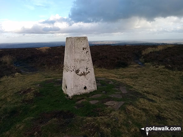

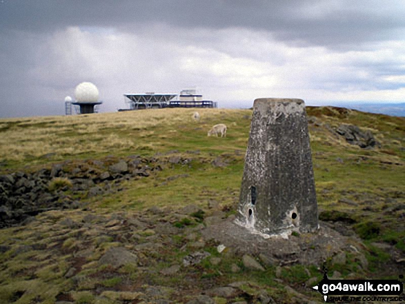
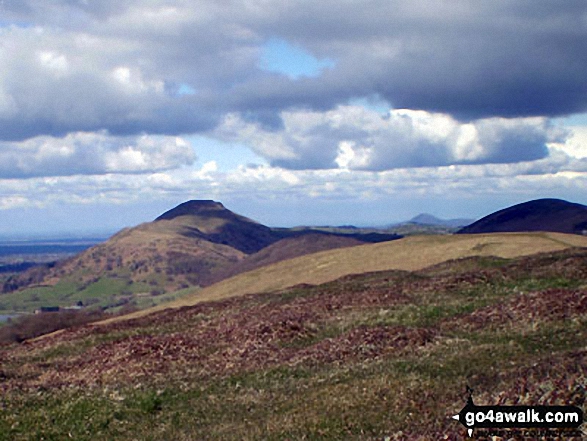

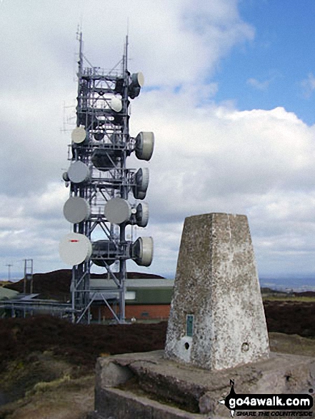 The summit of Brown Clee Hill (Abdon Burf) in The White Peak Area


