The South West region of England - a fully detailed list of all the Mountains, Peaks, Tops and Hills (Page of 3)
The South West region of England comprises the traditional counties of Cornwall, Devon, Somerset and Dorset and includes Dartmoor National Park and Exmoor National Park.
If you include all the Mountains (Hewitts), the Deweys, the Nuttalls, the Marilyns, the Bridgets (Hills) and all the Mountains, Tops, Peaks and Hills with a Trig Point on them there are 123 tops to climb, bag & conquer and the highest point is High Willhays at 622m (2,041ft).
To see these Mountains, Peaks, Tops and Hills displayed in different ways - see the options in the left-hand column and towards the bottom of this page.
LOG ON and RELOAD this page to show which Mountains, Peaks, Tops and Hills you have already climbed, bagged & conquered [. . . more details]
Page 1 of 3 Go to page:
1 2 3 |
See this list in: Alphabetical Order‡
| Height Order
To reverse the order select the link again.
Mountain, Peak, Top or Hill:
Bagged
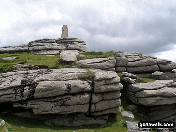
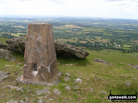
1. Yes Tor
619m (2,031ft)
Nuttall (237th in England, 412th in England & Wales)
OS Trig Point
To walk, climb & bag Yes Tor use any of these easy-to-follow walks:
See the location of Yes Tor and walks up it on a google MapYes Tor is on interactive maps:
OS Explorer (Orange Covers): OL28
OS Landranger (Pink Covers): 191
Yes Tor is on downloadable PDF you can Print or Save to your Phone:
|
2. Worlebury Hill
109m (357ft)
Bridget
We hope to have walks that climb & bag Worlebury Hill very soon
See the location of Worlebury Hill and walks up it on a google MapWorlebury Hill is on interactive maps:
OS Explorer (Orange Covers): 153
OS Landranger (Pink Covers): 182
|
3. Woodbury Castle (Woodbury Common)
183m (600ft)
Bridget
We hope to have walks that climb & bag Woodbury Castle (Woodbury Common) very soon
See the location of Woodbury Castle (Woodbury Common) and walks up it on a google MapWoodbury Castle (Woodbury Common) is on interactive maps:
OS Explorer (Orange Covers): 115
OS Landranger (Pink Covers): 192
|
4. Wills Neck (Bagborough Hill)
386m (1,266ft)
Marilyn (101st in England, 1231st in GB)
OS Trig Point
We hope to have walks that climb & bag Wills Neck (Bagborough Hill) very soon
See the location of Wills Neck (Bagborough Hill) and walks up it on a google MapWills Neck (Bagborough Hill) is on interactive maps:
OS Explorer (Orange Covers): 140
OS Landranger (Pink Covers): 181
A downloadable go4awalk.com PDF Peak Bagging Map featuring Wills Neck (Bagborough Hill) will be available soon. |
5. Wigford Down
273m (895ft)
Bridget
We hope to have walks that climb & bag Wigford Down very soon
See the location of Wigford Down and walks up it on a google MapWigford Down is on interactive maps:
OS Explorer (Orange Covers): OL28
OS Landranger (Pink Covers): 191
Wigford Down is on downloadable PDF you can Print or Save to your Phone:
|
6. White Tor
468m (1,535ft)
Bridget
We hope to have walks that climb & bag White Tor very soon
See the location of White Tor and walks up it on a google MapWhite Tor is on interactive maps:
OS Explorer (Orange Covers): OL28
OS Landranger (Pink Covers): 191
White Tor is on downloadable PDF you can Print or Save to your Phone:
|
7. White Ridge
506m (1,660ft)
Dewey (171st in England, 395th in England & Wales)
We hope to have walks that climb & bag White Ridge very soon
See the location of White Ridge and walks up it on a google MapWhite Ridge is on interactive maps:
OS Explorer (Orange Covers): OL28
OS Landranger (Pink Covers): 191
White Ridge is on downloadable PDF you can Print or Save to your Phone:
|
8. White Down (White Down Copse)
167m (548ft)
Bridget
We hope to have walks that climb & bag White Down (White Down Copse) very soon
See the location of White Down (White Down Copse) and walks up it on a google MapWhite Down (White Down Copse) is on interactive maps:
OS Explorer (Orange Covers): 115
OS Landranger (Pink Covers): 192
|
9. Weston Down
112m (368ft)
Bridget
We hope to have walks that climb & bag Weston Down very soon
See the location of Weston Down and walks up it on a google MapWeston Down is on interactive maps:
OS Explorer (Orange Covers): 154
OS Landranger (Pink Covers): 171 or
172
|
10. Wavering Down
211m (692ft)
Bridget
OS Trig Point
We hope to have walks that climb & bag Wavering Down very soon
See the location of Wavering Down and walks up it on a google MapWavering Down is on interactive maps:
OS Explorer (Orange Covers): 182
141
153
OS Landranger (Pink Covers): 172
|
11. Watch Croft (White Downs)
252m (827ft)
Marilyn (155th in England, 1465th in GB)
OS Trig Point
We hope to have walks that climb & bag Watch Croft (White Downs) very soon
See the location of Watch Croft (White Downs) and walks up it on a google MapWatch Croft (White Downs) is on interactive maps:
OS Explorer (Orange Covers): 102
OS Landranger (Pink Covers): 203
A downloadable go4awalk.com PDF Peak Bagging Map featuring Watch Croft (White Downs) will be available soon. |
12. Waddles Down
248m (813ft)
Bridget
OS Trig Point
We hope to have walks that climb & bag Waddles Down very soon
See the location of Waddles Down and walks up it on a google MapWaddles Down is on interactive maps:
OS Explorer (Orange Covers): 114
OS Landranger (Pink Covers): 191
|
13. Ugborough Beacon
378m (1,240ft)
Bridget
We hope to have walks that climb & bag Ugborough Beacon very soon
See the location of Ugborough Beacon and walks up it on a google MapUgborough Beacon is on interactive maps:
OS Explorer (Orange Covers): OL28
OS Landranger (Pink Covers): 191
Ugborough Beacon is on downloadable PDF you can Print or Save to your Phone:
|
14. Tregonning Hill
194m (636ft)
Bridget
OS Trig Point
We hope to have walks that climb & bag Tregonning Hill very soon
See the location of Tregonning Hill and walks up it on a google MapTregonning Hill is on interactive maps:
OS Explorer (Orange Covers): 102
OS Landranger (Pink Covers): 203
|
15. Top Tor
432m (1,417ft)
Bridget
We hope to have walks that climb & bag Top Tor very soon
See the location of Top Tor and walks up it on a google MapTop Tor is on interactive maps:
OS Explorer (Orange Covers): OL28
OS Landranger (Pink Covers): 191
Top Tor is on downloadable PDF you can Print or Save to your Phone:
|
16. Three Barrows (Ugborough Moor)
464m (1,522ft)
Bridget
OS Trig Point
We hope to have walks that climb & bag Three Barrows (Ugborough Moor) very soon
See the location of Three Barrows (Ugborough Moor) and walks up it on a google MapThree Barrows (Ugborough Moor) is on interactive maps:
OS Explorer (Orange Covers): OL28
OS Landranger (Pink Covers): 191
|
17. The Verne (Portland Bill)
149m (489ft)
Bridget
We hope to have walks that climb & bag The Verne (Portland Bill) very soon
See the location of The Verne (Portland Bill) and walks up it on a google MapThe Verne (Portland Bill) is on interactive maps:
OS Explorer (Orange Covers): OL15
OS Landranger (Pink Covers): 194
|
18. The Beacon (Corton Hill)
196m (643ft)
Bridget
OS Trig Point
We hope to have walks that climb & bag The Beacon (Corton Hill) very soon
See the location of The Beacon (Corton Hill) and walks up it on a google MapThe Beacon (Corton Hill) is on interactive maps:
OS Explorer (Orange Covers): 129
OS Landranger (Pink Covers): 183
|
19. Telegraph Hill (Minterne Magna)
267m (876ft)
Bridget
We hope to have walks that climb & bag Telegraph Hill (Minterne Magna) very soon
See the location of Telegraph Hill (Minterne Magna) and walks up it on a google MapTelegraph Hill (Minterne Magna) is on interactive maps:
OS Explorer (Orange Covers): 117
OS Landranger (Pink Covers): 194
|
20. Swyre Head
208m (682ft)
Bridget
OS Trig Point
Swyre Head was demoted from Marilyn status in 2015
To walk, climb & bag Swyre Head use either of these easy-to-follow walks:
See the location of Swyre Head and walks up it on a google MapSwyre Head is on interactive maps:
OS Explorer (Orange Covers): OL15
OS Landranger (Pink Covers): 195
A downloadable go4awalk.com PDF Peak Bagging Map featuring Swyre Head will be available soon. |
21. Stoke Hill
162m (531ft)
Bridget
We hope to have walks that climb & bag Stoke Hill very soon
See the location of Stoke Hill and walks up it on a google MapStoke Hill is on interactive maps:
OS Explorer (Orange Covers): 114
OS Landranger (Pink Covers): 192
|
22. Steeperton Tor
532m (1,746ft)
Dewey (110th in England, 258th in England & Wales)
To walk, climb & bag Steeperton Tor use either of these easy-to-follow walks:
See the location of Steeperton Tor and walks up it on a google MapSteeperton Tor is on interactive maps:
OS Explorer (Orange Covers): OL28
OS Landranger (Pink Covers): 191
Steeperton Tor is on downloadable PDF you can Print or Save to your Phone:
|
23. Staple Hill
315m (1,033ft)
Marilyn (128th in England, 1356th in GB)
OS Trig Point
We hope to have walks that climb & bag Staple Hill very soon
See the location of Staple Hill and walks up it on a google MapStaple Hill is on interactive maps:
OS Explorer (Orange Covers): 128
OS Landranger (Pink Covers): 193
A downloadable go4awalk.com PDF Peak Bagging Map featuring Staple Hill will be available soon. |
24. Stalldown Barrow
415m (1,362ft)
Bridget
We hope to have walks that climb & bag Stalldown Barrow very soon
See the location of Stalldown Barrow and walks up it on a google MapStalldown Barrow is on interactive maps:
OS Explorer (Orange Covers): OL28
OS Landranger (Pink Covers): 191
|
25. St Rayn Hill
238m (781ft)
Bridget
OS Trig Point
We hope to have walks that climb & bag St Rayn Hill very soon
See the location of St Rayn Hill and walks up it on a google MapSt Rayn Hill is on interactive maps:
OS Explorer (Orange Covers): 116
OS Landranger (Pink Covers): 193
|
26. South Hessary Tor
450m (1,476ft)
Bridget
To walk, climb & bag South Hessary Tor use this easy-to-follow walk:
See the location of South Hessary Tor and walks up it on a google MapSouth Hessary Tor is on interactive maps:
OS Explorer (Orange Covers): OL28
OS Landranger (Pink Covers): 191
South Hessary Tor is on downloadable PDF you can Print or Save to your Phone:
|
27. Sourton Tors
440m (1,444ft)
Bridget
OS Trig Point
To walk, climb & bag Sourton Tors use any of these easy-to-follow walks:
See the location of Sourton Tors and walks up it on a google MapSourton Tors is on interactive maps:
OS Explorer (Orange Covers): OL28
OS Landranger (Pink Covers): 191
|
28. Sittaford Tor
538m (1,765ft)
Bridget
We hope to have walks that climb & bag Sittaford Tor very soon
See the location of Sittaford Tor and walks up it on a google MapSittaford Tor is on interactive maps:
OS Explorer (Orange Covers): OL28
OS Landranger (Pink Covers): 191
|
29. Sheeps Tor (Yellowmead Down)
369m (1,211ft)
Bridget
We hope to have walks that climb & bag Sheeps Tor (Yellowmead Down) very soon
See the location of Sheeps Tor (Yellowmead Down) and walks up it on a google MapSheeps Tor (Yellowmead Down) is on interactive maps:
OS Explorer (Orange Covers): OL28
OS Landranger (Pink Covers): 191 and
192
|
30. Sharpitor (Peek Hill)
401m (1,316ft)
Bridget
We hope to have walks that climb & bag Sharpitor (Peek Hill) very soon
See the location of Sharpitor (Peek Hill) and walks up it on a google MapSharpitor (Peek Hill) is on interactive maps:
OS Explorer (Orange Covers): OL28
OS Landranger (Pink Covers): 191
|
31. Sharp Tor
380m (1,247ft)
Bridget
To walk, climb & bag Sharp Tor use this easy-to-follow walk:
See the location of Sharp Tor and walks up it on a google MapSharp Tor is on interactive maps:
OS Explorer (Orange Covers): OL28
OS Landranger (Pink Covers): 191
Sharp Tor is on downloadable PDF you can Print or Save to your Phone:
|
32. Shaptor Rock (Shaptor Down)
268m (879ft)
Bridget
We hope to have walks that climb & bag Shaptor Rock (Shaptor Down) very soon
See the location of Shaptor Rock (Shaptor Down) and walks up it on a google MapShaptor Rock (Shaptor Down) is on interactive maps:
OS Explorer (Orange Covers): OL28
OS Landranger (Pink Covers): 191
Shaptor Rock (Shaptor Down) is on downloadable PDF you can Print or Save to your Phone:
|
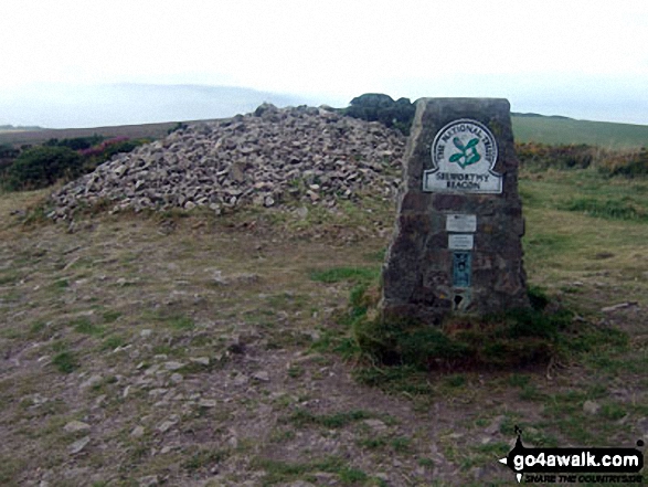
33. Selworthy Beacon
308m (1,010ft)
Marilyn (130th in England, 1369th in GB)
OS Trig Point
To walk, climb & bag Selworthy Beacon use this easy-to-follow walk:
See the location of Selworthy Beacon and walks up it on a google MapSelworthy Beacon is on interactive maps:
OS Explorer (Orange Covers): OL9
OS Landranger (Pink Covers): 181
A downloadable go4awalk.com PDF Peak Bagging Map featuring Selworthy Beacon will be available soon. |
34. Ryder's Hill
515m (1,690ft)
Dewey (152nd in England, 348th in England & Wales)
OS Trig Point
We hope to have walks that climb & bag Ryder's Hill very soon
See the location of Ryder's Hill and walks up it on a google MapRyder's Hill is on interactive maps:
OS Explorer (Orange Covers): OL28
OS Landranger (Pink Covers): 191
Ryder's Hill is on downloadable PDF you can Print or Save to your Phone:
|
35. Roos Tor
454m (1,490ft)
Bridget
To walk, climb & bag Roos Tor use either of these easy-to-follow walks:
See the location of Roos Tor and walks up it on a google MapRoos Tor is on interactive maps:
OS Explorer (Orange Covers): OL28
OS Landranger (Pink Covers): 191
Roos Tor is on downloadable PDF you can Print or Save to your Phone:
|
36. Rippon Tor
473m (1,552ft)
Bridget
OS Trig Point
We hope to have walks that climb & bag Rippon Tor very soon
See the location of Rippon Tor and walks up it on a google MapRippon Tor is on interactive maps:
OS Explorer (Orange Covers): OL28
OS Landranger (Pink Covers): 191
|
37. Ridgeway Hill
198m (653ft)
Bridget
We hope to have walks that climb & bag Ridgeway Hill very soon
See the location of Ridgeway Hill and walks up it on a google MapRidgeway Hill is on interactive maps:
OS Explorer (Orange Covers): OL15
OS Landranger (Pink Covers): 195
|
38. Riddon Ridge
380m (1,247ft)
Bridget
We hope to have walks that climb & bag Riddon Ridge very soon
See the location of Riddon Ridge and walks up it on a google MapRiddon Ridge is on interactive maps:
OS Explorer (Orange Covers): OL28
OS Landranger (Pink Covers): 191
|
39. Quickbeam Hill
481m (1,578ft)
Bridget
We hope to have walks that climb & bag Quickbeam Hill very soon
See the location of Quickbeam Hill and walks up it on a google MapQuickbeam Hill is on interactive maps:
OS Explorer (Orange Covers): OL28
OS Landranger (Pink Covers): 191
Quickbeam Hill is on downloadable PDF you can Print or Save to your Phone:
|
40. Prestonbury Common
249m (817ft)
Bridget
We hope to have walks that climb & bag Prestonbury Common very soon
See the location of Prestonbury Common and walks up it on a google MapPrestonbury Common is on interactive maps:
OS Explorer (Orange Covers): OL28
OS Landranger (Pink Covers): 191
Prestonbury Common is on downloadable PDF you can Print or Save to your Phone:
|
41. Periton Hill
297m (974ft)
Marilyn (132nd in England, 1381st in GB)
OS Trig Point
We hope to have walks that climb & bag Periton Hill very soon
See the location of Periton Hill and walks up it on a google MapPeriton Hill is on interactive maps:
OS Explorer (Orange Covers): OL9
OS Landranger (Pink Covers): 181
A downloadable go4awalk.com PDF Peak Bagging Map featuring Periton Hill will be available soon. |
42. Pepperdon Down
353m (1,158ft)
Bridget
We hope to have walks that climb & bag Pepperdon Down very soon
See the location of Pepperdon Down and walks up it on a google MapPepperdon Down is on interactive maps:
OS Explorer (Orange Covers): OL28
OS Landranger (Pink Covers): 191
Pepperdon Down is on downloadable PDF you can Print or Save to your Phone:
|
43. Penhale Hill
179m (587ft)
Bridget
We hope to have walks that climb & bag Penhale Hill very soon
See the location of Penhale Hill and walks up it on a google MapPenhale Hill is on interactive maps:
OS Explorer (Orange Covers): 106
OS Landranger (Pink Covers): 200
|
44. North Hessary Tor
517m (1,696ft)
Dewey (147th in England, 336th in England & Wales)
OS Trig Point
To walk, climb & bag North Hessary Tor use either of these easy-to-follow walks:
See the location of North Hessary Tor and walks up it on a google MapNorth Hessary Tor is on interactive maps:
OS Explorer (Orange Covers): OL28
OS Landranger (Pink Covers): 191
North Hessary Tor is on downloadable PDF you can Print or Save to your Phone:
|
45. Nine Barrow Down (Coringdon)
199m (653ft)
Marilyn (170th in England, 1522nd in GB)
OS Trig Point
We hope to have walks that climb & bag Nine Barrow Down (Coringdon) very soon
See the location of Nine Barrow Down (Coringdon) and walks up it on a google MapNine Barrow Down (Coringdon) is on interactive maps:
OS Explorer (Orange Covers): OL15
OS Landranger (Pink Covers): 195
A downloadable go4awalk.com PDF Peak Bagging Map featuring Nine Barrow Down (Coringdon) will be available soon. |
46. Natterdon Common
333m (1,092ft)
Bridget
We hope to have walks that climb & bag Natterdon Common very soon
See the location of Natterdon Common and walks up it on a google MapNatterdon Common is on interactive maps:
OS Explorer (Orange Covers): OL28
OS Landranger (Pink Covers): 191
Natterdon Common is on downloadable PDF you can Print or Save to your Phone:
|
47. Monkham Hill (Withycombe Common)
382m (1,253ft)
Bridget
OS Trig Point
We hope to have walks that climb & bag Monkham Hill (Withycombe Common) very soon
See the location of Monkham Hill (Withycombe Common) and walks up it on a google MapMonkham Hill (Withycombe Common) is on interactive maps:
OS Explorer (Orange Covers): OL9
OS Landranger (Pink Covers): 181
|
48. Meldon Hill (Dartmoor)
390m (1,279ft)
Bridget
OS Trig Point
We hope to have walks that climb & bag Meldon Hill (Dartmoor) very soon
See the location of Meldon Hill (Dartmoor) and walks up it on a google MapMeldon Hill (Dartmoor) is on interactive maps:
OS Explorer (Orange Covers): OL28
OS Landranger (Pink Covers): 191
|
49. Mardon Down
356m (1,168ft)
Bridget
We hope to have walks that climb & bag Mardon Down very soon
See the location of Mardon Down and walks up it on a google MapMardon Down is on interactive maps:
OS Explorer (Orange Covers): OL28
OS Landranger (Pink Covers): 191
Mardon Down is on downloadable PDF you can Print or Save to your Phone:
|
50. Lyscombe Hill
262m (859ft)
Bridget
We hope to have walks that climb & bag Lyscombe Hill very soon
See the location of Lyscombe Hill and walks up it on a google MapLyscombe Hill is on interactive maps:
OS Explorer (Orange Covers): 117
OS Landranger (Pink Covers): 194
|
51. Lype Hill
423m (1,388ft)
Bridget
OS Trig Point
We hope to have walks that climb & bag Lype Hill very soon
See the location of Lype Hill and walks up it on a google MapLype Hill is on interactive maps:
OS Explorer (Orange Covers): OL9
OS Landranger (Pink Covers): 181
|
52. Loxton Hill (Bleadon Hill)
176m (577ft)
Bridget
OS Trig Point
We hope to have walks that climb & bag Loxton Hill (Bleadon Hill) very soon
See the location of Loxton Hill (Bleadon Hill) and walks up it on a google MapLoxton Hill (Bleadon Hill) is on interactive maps:
OS Explorer (Orange Covers): 153
OS Landranger (Pink Covers): 182
A downloadable go4awalk.com PDF Peak Bagging Map featuring Loxton Hill (Bleadon Hill) will be available soon. |
53. Lewesdon Hill
279m (915ft)
Marilyn (140th in England, 1418th in GB)
Lewesdon Hill is the highest point in the county of Dorset.
We hope to have walks that climb & bag Lewesdon Hill very soon
See the location of Lewesdon Hill and walks up it on a google MapLewesdon Hill is on interactive maps:
OS Explorer (Orange Covers): 116
OS Landranger (Pink Covers): 193
A downloadable go4awalk.com PDF Peak Bagging Map featuring Lewesdon Hill will be available soon. |
54. Leedon Tor
389m (1,276ft)
Bridget
We hope to have walks that climb & bag Leedon Tor very soon
See the location of Leedon Tor and walks up it on a google MapLeedon Tor is on interactive maps:
OS Explorer (Orange Covers): OL28
OS Landranger (Pink Covers): 191
Leedon Tor is on downloadable PDF you can Print or Save to your Phone:
|
55. Lee Moor (Penn Moor)
492m (1,614ft)
Bridget
OS Trig Point
We hope to have walks that climb & bag Lee Moor (Penn Moor) very soon
See the location of Lee Moor (Penn Moor) and walks up it on a google MapLee Moor (Penn Moor) is on interactive maps:
OS Explorer (Orange Covers): OL28
OS Landranger (Pink Covers): 191
|
56. Laployd Hill
323m (1,060ft)
Bridget
We hope to have walks that climb & bag Laployd Hill very soon
See the location of Laployd Hill and walks up it on a google MapLaployd Hill is on interactive maps:
OS Explorer (Orange Covers): OL28
OS Landranger (Pink Covers): 191
Laployd Hill is on downloadable PDF you can Print or Save to your Phone:
|
57. Lambert's Castle Hill
256m (840ft)
Bridget
OS Trig Point
We hope to have walks that climb & bag Lambert's Castle Hill very soon
See the location of Lambert's Castle Hill and walks up it on a google MapLambert's Castle Hill is on interactive maps:
OS Explorer (Orange Covers): 116
OS Landranger (Pink Covers): 193
|
58. Kitty Tor (Amicombe Hill)
585m (1,919ft)
Dewey (24th in England, 61st in England & Wales)
To walk, climb & bag Kitty Tor (Amicombe Hill) use either of these easy-to-follow walks:
See the location of Kitty Tor (Amicombe Hill) and walks up it on a google MapKitty Tor (Amicombe Hill) is on interactive maps:
OS Explorer (Orange Covers): OL28
OS Landranger (Pink Covers): 191
Kitty Tor (Amicombe Hill) is on downloadable PDF you can Print or Save to your Phone:
|
59. Kit Hill
334m (1,096ft)
Marilyn (116th in England, 1324th in GB)
OS Trig Point
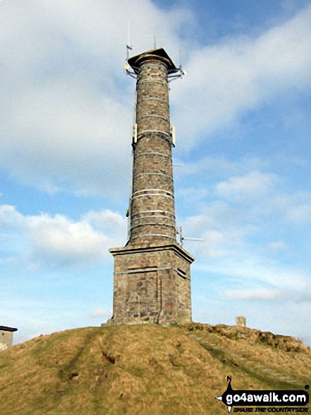
Prince Charles gave Kit Hill to the people of Cornwall in 1982 for their enjoyment to celebrate the birth of Prince William.
To walk, climb & bag Kit Hill use this easy-to-follow walk:
See the location of Kit Hill and walks up it on a google MapKit Hill is on interactive maps:
OS Explorer (Orange Covers): 108
OS Landranger (Pink Covers): 201
A downloadable go4awalk.com PDF Peak Bagging Map featuring Kit Hill will be available soon. |
60. Kilmar Tor (Twelve Men's Moor)
390m (1,279ft)
Bridget
OS Trig Point
We hope to have walks that climb & bag Kilmar Tor (Twelve Men's Moor) very soon
See the location of Kilmar Tor (Twelve Men's Moor) and walks up it on a google MapKilmar Tor (Twelve Men's Moor) is on interactive maps:
OS Explorer (Orange Covers): 109
OS Landranger (Pink Covers): 201
|
Page 1 of 3 Go to page:
1 2 3 |
View these 123 Mountains, Peaks, Tops and Hills:
Is there a Mountain, Peak, Top or Hill missing from the above google map or list?
Let us know an we will add it to our database.


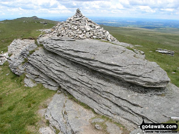 The summit of High Willhays in Tamar Valley


