Walk d156 Kinder Low (Kinder Scout), Brown Knoll (Edale), South Head (Hayfield) and Mount Famine from Bowden Bridge, Hayfield

A steady climb to high level views


Route outline for walk d156:

Bowden Bridge  -  Hayfield  -  Booth Sheepwash  -  Farlands  -  Broad Clough  -  Kinderlow End  -  Three Knolls  -  Cluther Rocks  -  Red Brook  -  The Pennine Way  -  Kinder Downfall  -  Kinder Low (Kinder Scout)  -  Brown Knoll (Edale)  -  South Head (Hayfield)  -  Mount Famine  -  Elle Bank  -  The Pennine Bridleway  -  Tunstead House  -  Hayfield


Peaks, Summits and Tops reached on this walk:

hewitt
0
English
Mountains
Wainwright
0
Wainwrights
 English Nuttalls
0
English
Nuttalls
Dewey
1
English
Dewey
Wainwright Outlying Fell
0
Wainwright
Outlying Fells
marilyn
0
Marilyns
Bridget
3
Bridgets

Peak Bagging Statistics for this walk:

The highest point of this walk is Kinder Low (Kinder Scout) at 633m (2078ft). Kinder Low (Kinder Scout) is known as an English Bridget. The summit of Kinder Low (Kinder Scout) is marked by an Ordnance Survey Trig Point.

Completing this walk will also take you to the top of Brown Knoll (Edale) at 569m (1867ft). Brown Knoll (Edale) is also known as an English Dewey (41st highest in England, 91st in England & Wales) The summit of Brown Knoll (Edale) is marked by an Ordnance Survey Trig Point.

You will also reach the summit of South Head (Hayfield) at 494m (1621ft). South Head (Hayfield) is known as an English Bridget.

Along the way you will also bag:

National Trails & Long Paths included on this walk:

Part of this walk follows a section of The Pennine Way, a 404km (251 miles) linear footpath connecting Edale in Derbyshire, England with Kirk Yetholm in The Borders, Scotland. The Pennine Way is waymarked by a National Trail Acorn. For more walks that include a section of this trail see The Pennine Way.


You can find more walks near this one on these unique free-to-access Interactive Walk Planning Maps: (click/TAP to select)

The Peak District National Park


1:25,000 scale OS Explorer Map (the ones with orange/yellow covers):

OL1 The Peak District - Dark Peak area


1:50,000 scale OS Landranger Map (the ones with pink/magenta covers):

110 Sheffield & Huddersfield, Glossop & Holmfirth


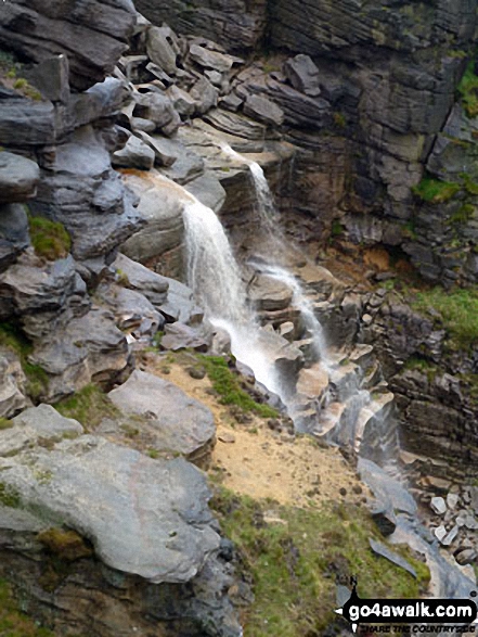
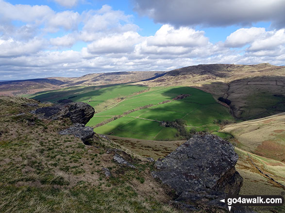
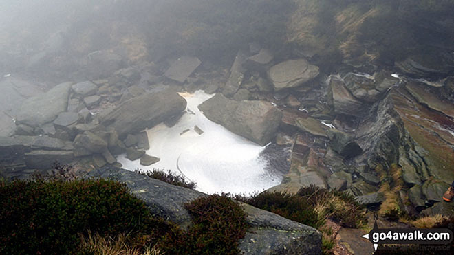
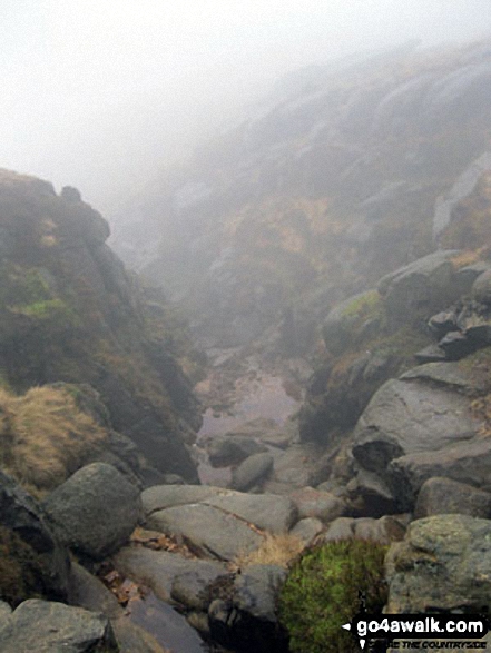
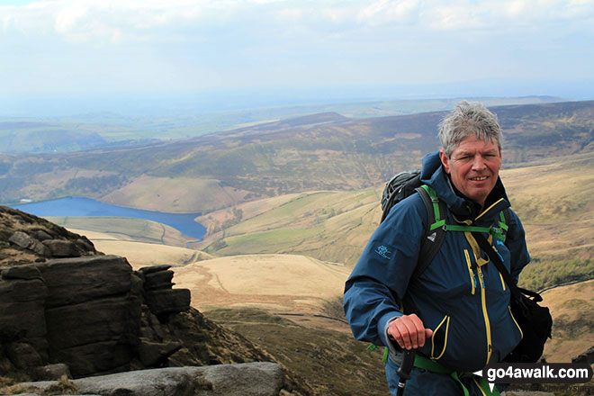
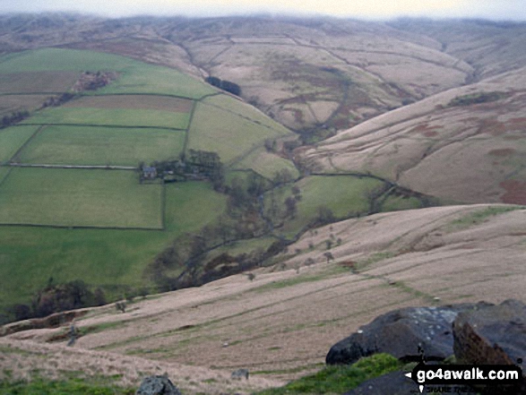
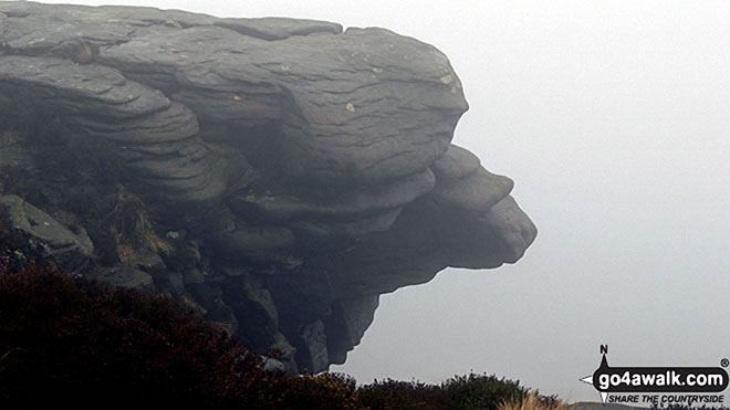
Some Photos and Pictures from Walk d156 Kinder Low (Kinder Scout), Brown Knoll (Edale), South Head (Hayfield) and Mount Famine from Bowden Bridge, Hayfield

In no particular order . . .

Walk d156 Kinder Low (Kinder Scout), Brown Knoll (Edale), South Head (Hayfield) and Mount Famine from Bowden Bridge, Hayfield - Kinder Downfall

Kinder Downfall

Photo: Roger Thornber (4)

Walk d156 Kinder Low (Kinder Scout), Brown Knoll (Edale), South Head (Hayfield) and Mount Famine from Bowden Bridge, Hayfield - Chris on top of Kinder Low (Kinder Scout)

Chris on top of Kinder Low (Kinder Scout)

Photo: Linda Tweed (1)

Walk d156 Kinder Low (Kinder Scout), Brown Knoll (Edale), South Head (Hayfield) and Mount Famine from Bowden Bridge, Hayfield - Caldron on a misty Kinder Scout

Caldron on a misty Kinder Scout

Photo: Bob Ferguson (99)

Walk d156 Kinder Low (Kinder Scout), Brown Knoll (Edale), South Head (Hayfield) and Mount Famine from Bowden Bridge, Hayfield - Looking over Kinder Downfall

Looking over Kinder Downfall

Photo: Stella Whittaker (11)

Walk d156 Kinder Low (Kinder Scout), Brown Knoll (Edale), South Head (Hayfield) and Mount Famine from Bowden Bridge, Hayfield - The Pennine Way on Kinder Low (Kinder Scout)

The Pennine Way on Kinder Low (Kinder Scout)

Photo: Judith Thiery (4)

Walk d156 Kinder Low (Kinder Scout), Brown Knoll (Edale), South Head (Hayfield) and Mount Famine from Bowden Bridge, Hayfield - Old packhorse bridge near Bowden Bridge Car Park, Hayfield

Old packhorse bridge near Bowden Bridge Car Park, Hayfield

Photo: Simon Jacks (18)

Walk d156 Kinder Low (Kinder Scout), Brown Knoll (Edale), South Head (Hayfield) and Mount Famine from Bowden Bridge, Hayfield - The River Kinder being blown UP Kinder Downfall by the wind

The River Kinder being blown UP Kinder Downfall by the wind

Photo: Ian Windle (49)

Walk d156 Kinder Low (Kinder Scout), Brown Knoll (Edale), South Head (Hayfield) and Mount Famine from Bowden Bridge, Hayfield - Kinder Reservoir from Kinder Downfall

Kinder Reservoir from Kinder Downfall

Photo: Dorsal Finn (120)

Walk d156 Kinder Low (Kinder Scout), Brown Knoll (Edale), South Head (Hayfield) and Mount Famine from Bowden Bridge, Hayfield - Kinder Downfall Waterfall

Kinder Downfall Waterfall

Photo: David Morecroft (7)

Walk d156 Kinder Low (Kinder Scout), Brown Knoll (Edale), South Head (Hayfield) and Mount Famine from Bowden Bridge, Hayfield - Rocks on the Mount Famine ridge

Rocks on the Mount Famine ridge

Photo: Simon Jacks (15)

Walk d156 Kinder Low (Kinder Scout), Brown Knoll (Edale), South Head (Hayfield) and Mount Famine from Bowden Bridge, Hayfield - At Kinder Downfall

At Kinder Downfall

Photo: Steve Gilmore (3)

Walk d156 Kinder Low (Kinder Scout), Brown Knoll (Edale), South Head (Hayfield) and Mount Famine from Bowden Bridge, Hayfield - Rob, Big Truck and Carl at the top of Kinder Downfall

Rob, Big Truck and Carl at the top of Kinder Downfall

Photo: Dorsal Finn (127)

Walk d156 Kinder Low (Kinder Scout), Brown Knoll (Edale), South Head (Hayfield) and Mount Famine from Bowden Bridge, Hayfield - Brown Knoll summit Trig Point

Brown Knoll summit Trig Point

Photo: Christine Shepherd (746)

Walk d156 Kinder Low (Kinder Scout), Brown Knoll (Edale), South Head (Hayfield) and Mount Famine from Bowden Bridge, Hayfield - Rock formation near Kinder Downfall

Rock formation near Kinder Downfall

Photo: Stella Whittaker (7)

Walk d156 Kinder Low (Kinder Scout), Brown Knoll (Edale), South Head (Hayfield) and Mount Famine from Bowden Bridge, Hayfield - Hayfield Church

Hayfield Church

Photo: Richard Hooper (23)

Walk d156 Kinder Low (Kinder Scout), Brown Knoll (Edale), South Head (Hayfield) and Mount Famine from Bowden Bridge, Hayfield - My friends and me on Kinder Scout

My friends and me on Kinder Scout

Photo: Maccs Pescatore (1)

Walk d156 Kinder Low (Kinder Scout), Brown Knoll (Edale), South Head (Hayfield) and Mount Famine from Bowden Bridge, Hayfield - The River Kinder from Kinder Downfall

The River Kinder from Kinder Downfall

Photo: Stella Whittaker (8)

Walk d156 Kinder Low (Kinder Scout), Brown Knoll (Edale), South Head (Hayfield) and Mount Famine from Bowden Bridge, Hayfield - South Head (Hayfield)

South Head (Hayfield)

Photo: Simon Jacks (10)

Walk d156 Kinder Low (Kinder Scout), Brown Knoll (Edale), South Head (Hayfield) and Mount Famine from Bowden Bridge, Hayfield - Rock formations on the northern edge of Kinder Scout with Featherbed Moss over Black Ashop Moor in the background.

Rock formations on the northern edge of Kinder Scout with Featherbed Moss over Black Ashop Moor in the background.

Photo: Paul Tonge (1)

Walk d156 Kinder Low (Kinder Scout), Brown Knoll (Edale), South Head (Hayfield) and Mount Famine from Bowden Bridge, Hayfield - Looking Down Red Brook from Kinder Scout

Looking Down Red Brook from Kinder Scout

Photo: Bob Green (1)


. . . load all 107 walk photos from Walk d156 Kinder Low (Kinder Scout), Brown Knoll (Edale), South Head (Hayfield) and Mount Famine from Bowden Bridge, Hayfield


Send us your photographs and pictures from your walks and hikes

We would love to see your photographs and pictures from walk d156 Kinder Low (Kinder Scout), Brown Knoll (Edale), South Head (Hayfield) and Mount Famine from Bowden Bridge, Hayfield. Send them in to us as email attachments (configured for any computer) along with your name and where the picture was taken to:

and we shall do our best to publish them.

(Guide Resolution = 300dpi. At least = 660 pixels (wide) x 440 pixels (high).)

Send us your walking and hiking photographs and pictures from walk d156 Kinder Low (Kinder Scout), Brown Knoll (Edale), South Head (Hayfield) and Mount Famine from Bowden Bridge, Hayfield via Facebook

You can also submit photos from walk d156 Kinder Low (Kinder Scout), Brown Knoll (Edale), South Head (Hayfield) and Mount Famine from Bowden Bridge, Hayfield via our Facebook Page.

NB. Please indicate where each photo was taken.


Follow go4awalk.com on Twitter Follow go4awalk.com on Facebook


Find new Friends to go walking with

Walk all 214 Wainwrights in just 59 Walks. Download GPS Waypoints - Great Walks you must not miss!

Walk The Yorkshire Three Peaks Challenge Walk - All the Latest Route Information, GPS Waypoints and Split Times to keep you on Schedule

Walk The British Three Peaks Challenge Walk - All the Latest Route Information and GPS Waypoints

See our pick of The Best Walks in The Lake District - Great Walks you must not miss!

Walk our pick of the Best Lake District Ridge Walks - Great Walks you must not miss!

Walk our pick of the Best Lake District Walks to do in the rain - Great Walks you must not miss!

Walk our pick of The Best Walks in Snowdonia - Great Walks you must not miss!

Walk our pick of The Best Ridge Walks in Wales - Walks you must not miss!

Walk our pick of The Best Walks in The Brecon Beacons - Great Walks you must not miss!

Walk our pick of The Best Walks in The Yorkshire Dales - Walks you must not miss!

Walk our pick of The Best Walks in The Peak District - Walks you must not miss!

Walk our pick of The Best Walks in The Forest of Bowland - Walks you must not miss!

Walk our pick of The Best Walks in Shropshire - Walks you must not miss!

Walk our pick of The Best Walks in Cheshire - Walks you must not miss!

Walk our pick of The Best Walks in Lancashire - Walks you must not miss!

Not sure where to walk next? Try Peak Bagging - Great Walks you must not miss!

Not sure where to walk next? Walk part of a National Trail - Great Walks you must not miss!

Walks with Downloadable and Uploadable GPS Waypoint Data

Walking Kit and Gear Tested by Walkers

Full Site Search