Wales - a fully detailed list of all the Mountains, Peaks, Tops and Hills (Page 4 of 5)
Wales is defined as the whole of the principality of Wales which includes the National Parks of Snowdonia,
Bannau Brycheiniog (The Brecon Beacons) and The Pembrokeshire Coast as well as Mynyddoedd Cambria (The Cambrian Mountains), Radnor Forest, Anglesey, The Llynn Peninsula, The Preseli Mountains and The Gower Peninsula.
If you count only the Mountains (Hewitts) there are 136 tops to climb, bag & conquer and the highest point is Snowdon (Yr Wyddfa) at 1,085m (3,561ft).
To see these Mountains, Peaks, Tops and Hills displayed in different ways - see the options in the left-hand column and towards the bottom of this page.
LOG ON and RELOAD this page to show which Mountains, Peaks, Tops and Hills you have already climbed, bagged & conquered [. . . more details]
Page 4 of 5 Go to page:
1 2 3 4 5 |
See this list in: Alphabetical Order
| Height Order‡
To reverse the order select the link again.
Mountain, Peak, Top or Hill:
Bagged
91. Fan Hir
760m (2,494ft)
Mountain (46th in Wales, 112th in England & Wales)
Nuttall (57th in Wales, 136th in England & Wales)
To walk, climb & bag Fan Hir use either of these easy-to-follow walks:
See the location of Fan Hir and walks up it on a google MapFan Hir is on interactive maps:
OS Explorer (Orange Covers): OL12
OS Landranger (Pink Covers): 160
Fan Hir is on downloadable PDF you can Print or Save to your Phone:
|
92. Gallt yr Ogof
763m (2,504ft)
Mountain (45th in Wales, 108th in England & Wales)
Nuttall (56th in Wales, 132nd in England & Wales)
To walk, climb & bag Gallt yr Ogof use either of these easy-to-follow walks:
See the location of Gallt yr Ogof and walks up it on a google MapGallt yr Ogof is on interactive maps:
OS Explorer (Orange Covers): OL17
OS Landranger (Pink Covers): 115
Gallt yr Ogof is on downloadable PDF you can Print or Save to your Phone:
|
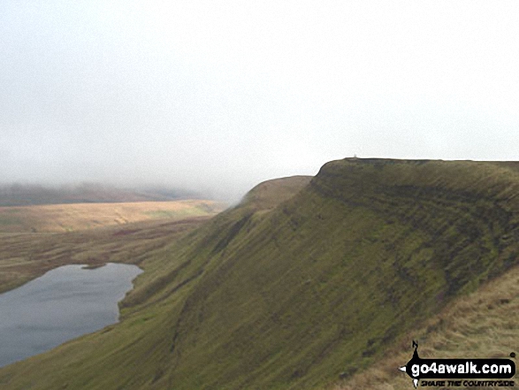
93. Waun Rydd
769m (2,524ft)
Mountain (44th in Wales, 105th in England & Wales)
Nuttall (55th in Wales, 129th in England & Wales)
Marilyn (20th in Wales, 452nd in GB)
OS Trig Point
To walk, climb & bag Waun Rydd use any of these easy-to-follow walks:
See the location of Waun Rydd and walks up it on a google MapWaun Rydd is on interactive maps:
OS Explorer (Orange Covers): OL12
OS Landranger (Pink Covers): 160
Waun Rydd is on downloadable PDF you can Print or Save to your Phone:
|
94. Moelwyn Mawr
770m (2,527ft)
Mountain (43rd in Wales, 103rd in England & Wales)
Nuttall (54th in Wales, 127th in England & Wales)
Marilyn (19th in Wales, 448th in GB)
OS Trig Point
To walk, climb & bag Moelwyn Mawr use any of these easy-to-follow walks:
See the location of Moelwyn Mawr and walks up it on a google MapMoelwyn Mawr is on interactive maps:
OS Explorer (Orange Covers): OL18
OS Landranger (Pink Covers): 124
Moelwyn Mawr is on downloadable PDF you can Print or Save to your Phone:
|
95. Drum (Carneddau)
771m (2,530ft)
Mountain (42nd in Wales, 102nd in England & Wales)
Nuttall (53rd in Wales, 126th in England & Wales)
To walk, climb & bag Drum (Carneddau) use any of these easy-to-follow walks:
See the location of Drum (Carneddau) and walks up it on a google MapDrum (Carneddau) is on interactive maps:
OS Explorer (Orange Covers): OL17
OS Landranger (Pink Covers): 115
Drum (Carneddau) is on downloadable PDF you can Print or Save to your Phone:
|
96. Glasgwm
779m (2,556ft)
Mountain (41st in Wales, 95th in England & Wales)
Nuttall (52nd in Wales, 117th in England & Wales)
Marilyn (18th in Wales, 432nd in GB)
To walk, climb & bag Glasgwm use this easy-to-follow walk:
See the location of Glasgwm and walks up it on a google MapGlasgwm is on interactive maps:
OS Explorer (Orange Covers): OL23
OS Landranger (Pink Covers): 124 and
125
Glasgwm is on downloadable PDF you can Print or Save to your Phone:
|
97. Moel Hebog
783m (2,569ft)
Mountain (40th in Wales, 94th in England & Wales)
Nuttall (51st in Wales, 114th in England & Wales)
Marilyn (17th in Wales, 425th in GB)
OS Trig Point
To walk, climb & bag Moel Hebog use this easy-to-follow walk:
See the location of Moel Hebog and walks up it on a google MapMoel Hebog is on interactive maps:
OS Explorer (Orange Covers): OL17
OS Landranger (Pink Covers): 115
Moel Hebog is on downloadable PDF you can Print or Save to your Phone:
|
98. Cadair Bronwen
783m (2,570ft)
Mountain (39th in Wales, 92nd in England & Wales)
Nuttall (50th in Wales, 112th in England & Wales)
To walk, climb & bag Cadair Bronwen use any of these easy-to-follow walks:
See the location of Cadair Bronwen and walks up it on a google MapCadair Bronwen is on interactive maps:
OS Explorer (Orange Covers): 255
OS Landranger (Pink Covers): 125
Cadair Bronwen is on downloadable PDF you can Print or Save to your Phone:
|
99. Craig Cwm Amarch
791m (2,596ft)
Mountain (38th in Wales, 86th in England & Wales)
Nuttall (49th in Wales, 105th in England & Wales)
To walk, climb & bag Craig Cwm Amarch use any of these easy-to-follow walks:
See the location of Craig Cwm Amarch and walks up it on a google MapCraig Cwm Amarch is on interactive maps:
OS Explorer (Orange Covers): OL23
OS Landranger (Pink Covers): 124
Craig Cwm Amarch is on downloadable PDF you can Print or Save to your Phone:
|
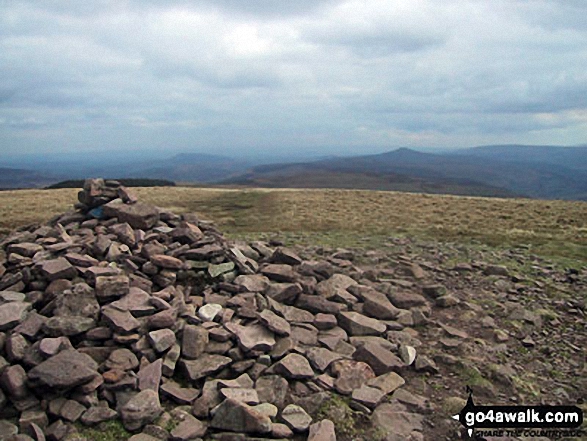
100. Cribyn
795m (2,609ft)
Mountain (37th in Wales, 82nd in England & Wales)
Nuttall (47th in Wales, 99th in England & Wales)
To walk, climb & bag Cribyn use any of these easy-to-follow walks:
See the location of Cribyn and walks up it on a google MapCribyn is on interactive maps:
OS Explorer (Orange Covers): OL12
OS Landranger (Pink Covers): 160
Cribyn is on downloadable PDF you can Print or Save to your Phone:
|
101. Pen Llithrig y Wrach
799m (2,622ft)
Mountain (36th in Wales, 80th in England & Wales)
Nuttall (46th in Wales, 96th in England & Wales)
Marilyn (16th in Wales, 395th in GB)
To walk, climb & bag Pen Llithrig y Wrach use any of these easy-to-follow walks:
See the location of Pen Llithrig y Wrach and walks up it on a google MapPen Llithrig y Wrach is on interactive maps:
OS Explorer (Orange Covers): OL17
OS Landranger (Pink Covers): 115
Pen Llithrig y Wrach is on downloadable PDF you can Print or Save to your Phone:
|
102. Pen y Gadair Fawr
800m (2,625ft)
Mountain (35th in Wales, 79th in England & Wales)
Nuttall (45th in Wales, 95th in England & Wales)
To walk, climb & bag Pen y Gadair Fawr use either of these easy-to-follow walks:
See the location of Pen y Gadair Fawr and walks up it on a google MapPen y Gadair Fawr is on interactive maps:
OS Explorer (Orange Covers): OL13
OS Landranger (Pink Covers): 161
Pen y Gadair Fawr is on downloadable PDF you can Print or Save to your Phone:
|
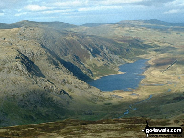
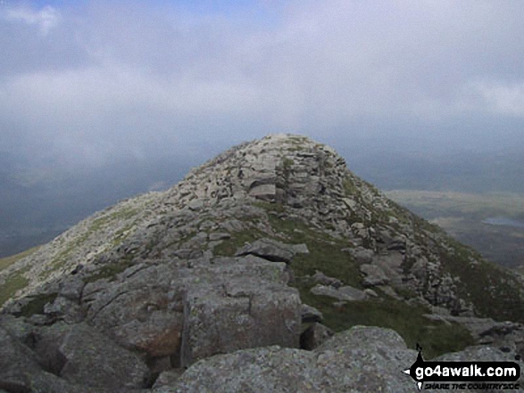
103. Fan Brycheiniog (Twr y Fan Foel)
802m (2,632ft)
Mountain (34th in Wales, 76th in England & Wales)
Nuttall (43rd in Wales, 91st in England & Wales)
Marilyn (15th in Wales, 390th in GB)
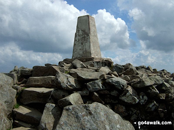
OS Trig Point
Fan Brycheiniog (Twr y Fan Foel) became the local Mountain (Hewitt) and 'Nuttall' after a survey found the top to be 0.75m higher than the Trig Point.
To walk, climb & bag Fan Brycheiniog (Twr y Fan Foel) use either of these easy-to-follow walks:
See the location of Fan Brycheiniog (Twr y Fan Foel) and walks up it on a google MapFan Brycheiniog (Twr y Fan Foel) is on interactive maps:
OS Explorer (Orange Covers): OL12
OS Landranger (Pink Covers): 160
Fan Brycheiniog (Twr y Fan Foel) is on downloadable PDF you can Print or Save to your Phone:
|
104. Y Foel Goch
805m (2,642ft)
Mountain (33rd in Wales, 72nd in England & Wales)
Nuttall (42nd in Wales, 87th in England & Wales)
To walk, climb & bag Y Foel Goch use either of these easy-to-follow walks:
See the location of Y Foel Goch and walks up it on a google MapY Foel Goch is on interactive maps:
OS Explorer (Orange Covers): OL17
OS Landranger (Pink Covers): 115
Y Foel Goch is on downloadable PDF you can Print or Save to your Phone:
|
105. Cyfrwy
811m (2,662ft)
Mountain (31st in Wales, 68th in England & Wales)
Nuttall (39th in Wales, 82nd in England & Wales)
To walk, climb & bag Cyfrwy use any of these easy-to-follow walks:
See the location of Cyfrwy and walks up it on a google MapCyfrwy is on interactive maps:
OS Explorer (Orange Covers): OL23
OS Landranger (Pink Covers): 124
Cyfrwy is on downloadable PDF you can Print or Save to your Phone:
|
106. Waun Fach
811m (2,662ft)
Mountain (32nd in Wales, 69th in England & Wales)
Nuttall (40th in Wales, 83rd in England & Wales)
Marilyn (14th in Wales, 368th in GB)
OS Trig Point
To walk, climb & bag Waun Fach use either of these easy-to-follow walks:
See the location of Waun Fach and walks up it on a google MapWaun Fach is on interactive maps:
OS Explorer (Orange Covers): OL13
OS Landranger (Pink Covers): 161
Waun Fach is on downloadable PDF you can Print or Save to your Phone:
|
107. Carnedd y Filiast (Glyderau)
822m (2,698ft)
Mountain (30th in Wales, 64th in England & Wales)
Nuttall (36th in Wales, 75th in England & Wales)
To walk, climb & bag Carnedd y Filiast (Glyderau) use this easy-to-follow walk:
See the location of Carnedd y Filiast (Glyderau) and walks up it on a google MapCarnedd y Filiast (Glyderau) is on interactive maps:
OS Explorer (Orange Covers): OL17
OS Landranger (Pink Covers): 115
Carnedd y Filiast (Glyderau) is on downloadable PDF you can Print or Save to your Phone:
|
108. Moel Sych
827m (2,712ft)
Mountain (29th in Wales, 62nd in England & Wales)
Nuttall (34th in Wales, 72nd in England & Wales)
To walk, climb & bag Moel Sych use this easy-to-follow walk:
See the location of Moel Sych and walks up it on a google MapMoel Sych is on interactive maps:
OS Explorer (Orange Covers): 255
OS Landranger (Pink Covers): 125
Moel Sych is on downloadable PDF you can Print or Save to your Phone:
|
109. Foel-goch
831m (2,727ft)
Mountain (28th in Wales, 59th in England & Wales)
Nuttall (32nd in Wales, 68th in England & Wales)
To walk, climb & bag Foel-goch use either of these easy-to-follow walks:
See the location of Foel-goch and walks up it on a google MapFoel-goch is on interactive maps:
OS Explorer (Orange Covers): OL17
OS Landranger (Pink Covers): 115
Foel-goch is on downloadable PDF you can Print or Save to your Phone:
|
110. Cadair Berwyn
832m (2,730ft)
Mountain (27th in Wales, 58th in England & Wales)
Nuttall (31st in Wales, 67th in England & Wales)
Marilyn (13th in Wales, 341st in GB)
Cadair Berwyn is the highest point in the county of Denbighshire.
To walk, climb & bag Cadair Berwyn use this easy-to-follow walk:
See the location of Cadair Berwyn and walks up it on a google MapCadair Berwyn is on interactive maps:
OS Explorer (Orange Covers): 255
OS Landranger (Pink Covers): 125
Cadair Berwyn is on downloadable PDF you can Print or Save to your Phone:
|
111. Pen yr Helgi Du
833m (2,734ft)
Mountain (26th in Wales, 57th in England & Wales)
Nuttall (30th in Wales, 66th in England & Wales)
To walk, climb & bag Pen yr Helgi Du use any of these easy-to-follow walks:
See the location of Pen yr Helgi Du and walks up it on a google MapPen yr Helgi Du is on interactive maps:
OS Explorer (Orange Covers): OL17
OS Landranger (Pink Covers): 115
Pen yr Helgi Du is on downloadable PDF you can Print or Save to your Phone:
|
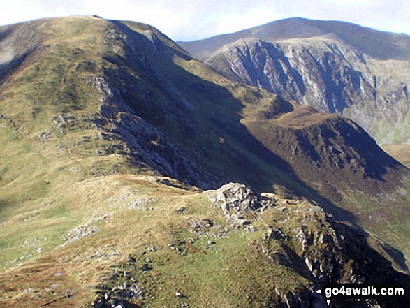
112. Llwytmor
849m (2,786ft)
Mountain (25th in Wales, 49th in England & Wales)
Nuttall (28th in Wales, 56th in England & Wales)
To walk, climb & bag Llwytmor use this easy-to-follow walk:
See the location of Llwytmor and walks up it on a google MapLlwytmor is on interactive maps:
OS Explorer (Orange Covers): OL17
OS Landranger (Pink Covers): 115
Llwytmor is on downloadable PDF you can Print or Save to your Phone:
|
113. Arenig Fawr (Moel Yr Eglwys)
854m (2,802ft)
Mountain (24th in Wales, 46th in England & Wales)
Nuttall (27th in Wales, 53rd in England & Wales)
Marilyn (12th in Wales, 311th in GB)
OS Trig Point
To walk, climb & bag Arenig Fawr (Moel Yr Eglwys) use any of these easy-to-follow walks:
See the location of Arenig Fawr (Moel Yr Eglwys) and walks up it on a google MapArenig Fawr (Moel Yr Eglwys) is on interactive maps:
OS Explorer (Orange Covers): OL18
OS Landranger (Pink Covers): 124 and
125
Arenig Fawr (Moel Yr Eglwys) is on downloadable PDF you can Print or Save to your Phone:
|
114. Mynydd Moel
863m (2,832ft)
Mountain (23rd in Wales, 40th in England & Wales)
Nuttall (26th in Wales, 47th in England & Wales)
To walk, climb & bag Mynydd Moel use any of these easy-to-follow walks:
See the location of Mynydd Moel and walks up it on a google MapMynydd Moel is on interactive maps:
OS Explorer (Orange Covers): OL23
OS Landranger (Pink Covers): 124
Mynydd Moel is on downloadable PDF you can Print or Save to your Phone:
|
115. Carnedd Moel Siabod
872m (2,861ft)
Mountain (21st in Wales, 36th in England & Wales)
Nuttall (23rd in Wales, 41st in England & Wales)
Marilyn (11th in Wales, 281st in GB)
OS Trig Point
To walk, climb & bag Carnedd Moel Siabod use any of these easy-to-follow walks:
See the location of Carnedd Moel Siabod and walks up it on a google MapCarnedd Moel Siabod is on interactive maps:
OS Explorer (Orange Covers): OL17
OS Landranger (Pink Covers): 115
Carnedd Moel Siabod is on downloadable PDF you can Print or Save to your Phone:
|
116. Erw y Ddafad-ddu
872m (2,861ft)
Mountain (22nd in Wales, 37th in England & Wales)
Nuttall (24th in Wales, 42nd in England & Wales)
To walk, climb & bag Erw y Ddafad-ddu use either of these easy-to-follow walks:
See the location of Erw y Ddafad-ddu and walks up it on a google MapErw y Ddafad-ddu is on interactive maps:
OS Explorer (Orange Covers): OL23
OS Landranger (Pink Covers): 124
Erw y Ddafad-ddu is on downloadable PDF you can Print or Save to your Phone:
|
117. Aran Benllyn
885m (2,905ft)
Mountain (20th in Wales, 32nd in England & Wales)
Nuttall (22nd in Wales, 37th in England & Wales)
To walk, climb & bag Aran Benllyn use either of these easy-to-follow walks:
See the location of Aran Benllyn and walks up it on a google MapAran Benllyn is on interactive maps:
OS Explorer (Orange Covers): OL23
OS Landranger (Pink Covers): 124
Aran Benllyn is on downloadable PDF you can Print or Save to your Phone:
|
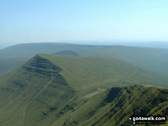
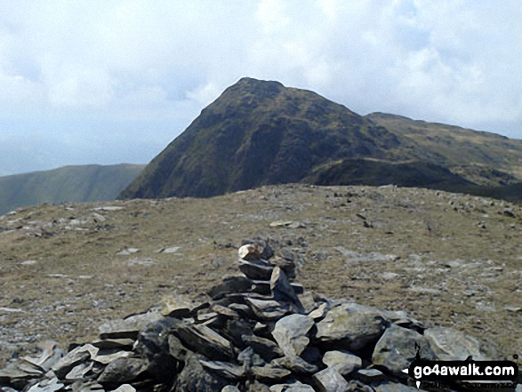
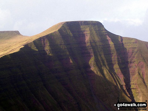
118. Pen y Fan
886m (2,907ft)
Mountain (19th in Wales, 31st in England & Wales)
Nuttall (21st in Wales, 36th in England & Wales)
Marilyn (10th in Wales, 259th in GB)
OS Trig Point
Pen y Fan is the highest point in The Brecon Beacons National Park and the highest point in the county of Powys.
To walk, climb & bag Pen y Fan use any of these easy-to-follow walks:
See the location of Pen y Fan and walks up it on a google MapPen y Fan is on interactive maps:
OS Explorer (Orange Covers): OL12
OS Landranger (Pink Covers): 160
Pen y Fan is on downloadable PDF you can Print or Save to your Phone:
|
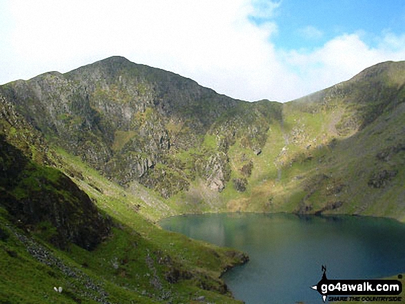
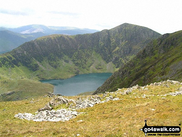
119. Cadair Idris (Penygadair)
892m (2,929ft)
Mountain (18th in Wales, 27th in England & Wales)
Nuttall (20th in Wales, 32nd in England & Wales)
Marilyn (9th in Wales, 247th in GB)
OS Trig Point
To walk, climb & bag Cadair Idris (Penygadair) use any of these easy-to-follow walks:
See the location of Cadair Idris (Penygadair) and walks up it on a google MapCadair Idris (Penygadair) is on interactive maps:
OS Explorer (Orange Covers): OL23
OS Landranger (Pink Covers): 124
Cadair Idris (Penygadair) is on downloadable PDF you can Print or Save to your Phone:
|
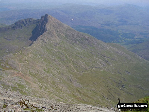
120. Y Lliwedd
898m (2,947ft)
Mountain (17th in Wales, 26th in England & Wales)
Nuttall (18th in Wales, 29th in England & Wales)
Marilyn (8th in Wales, 240th in GB)
To walk, climb & bag Y Lliwedd use either of these easy-to-follow walks:
See the location of Y Lliwedd and walks up it on a google MapY Lliwedd is on interactive maps:
OS Explorer (Orange Covers): OL17
OS Landranger (Pink Covers): 115
Y Lliwedd is on downloadable PDF you can Print or Save to your Phone:
|
Page 4 of 5 Go to page:
1 2 3 4 5 |
View these 136 Mountains, Peaks, Tops and Hills:
Is there a Mountain, Peak, Top or Hill missing from the above google map or list?
Let us know an we will add it to our database.

 Snowdon (Yr Wyddfa) in The Snowdon AreaWales


