The Mountains, Peaks, Tops and Hills in The White Peak Area of The Peak District, Cheshire, Derbyshire and Staffordshire with all the tops you are yet to climb first & then the ones you have already bagged in second.
The White Peak Area of The Peak District National Park, Cheshire, Derbyshire and Staffordshire is area within the National Park boundary south of the A6 from Hazel Grove to Chapel-en-le-Frith, the A623 to Sparrowpit, the minor road from Sparrowpit along Rushup Edge to Castleton and the A6187 from Castleton to Sheffield.
If you include the Marilyns, the Bridgets (Hills) and all the Mountains, Tops, Peaks and Hills with a Trig Point on them there are 44 tops to climb, bag & conquer and the highest point is Shining Tor at 559m (1,835ft).
To see these Mountains, Peaks, Tops and Hills displayed in different ways - see the options in the left-hand column and towards the bottom of this page.
![]() Your Personal Bagging Record for The White Peak Area of The Peak District
Your Personal Bagging Record for The White Peak Area of The Peak District
LOG ON and RELOAD this page to show which Mountains, Peaks, Tops and Hills you have already climbed, bagged & conquered [. . . more details]
Scroll down this list of mountains, peaks, tops & hills below and tap/click on each name (in blue) to locate it on the map above.
See this list in: Alphabetical Order | Height Order‡
To reverse the order select the link again.
Top yet to be climbed, bagged & conquered:
Bagged

![]()
1. Shining Tor
559m (1835ft)
Marilyn and Trig Point
See more details, photos, trip reports and easy-to-follow walks up Shining Tor

![]()
2. Axe Edge (Axe Edge Moor)
551m (1808ft)
Trig Point
See more details, photos, trip reports and easy-to-follow walks up Axe Edge (Axe Edge Moor)

![]()
3. Cheeks Hill
520m (1707ft)
Bridget
See more details, photos, trip reports and easy-to-follow walks up Cheeks Hill
![]()
4. Black Edge (Combs Moss)
507m (1663ft)
Trig Point
See more details, photos, trip reports and easy-to-follow walks up Black Edge (Combs Moss)
![]()
5. Shutlingsloe
506m (1660ft)
Trig Point
See more details, photos, trip reports and easy-to-follow walks up Shutlingsloe
![]()
6. The Roaches
505m (1657ft)
Trig Point
See more details, photos, trip reports and easy-to-follow walks up The Roaches

![]()
7. Burbage Edge
500m (1641ft)
Bridget and Trig Point
See more details, photos, trip reports and easy-to-follow walks up Burbage Edge
![]()
8. Blake Mere (Merryton Low)
489m (1604ft)
Bridget and Trig Point
See more details, photos, trip reports and easy-to-follow walks up Blake Mere (Merryton Low)
![]()
9. Bradwell Moor
471m (1545ft)
Bridget and Trig Point
See more details, photos, trip reports and easy-to-follow walks up Bradwell Moor
![]()
10. Eldon Hill (Perryfoot)
470m (1542ft)
Bridget
See more details, photos, trip reports and easy-to-follow walks up Eldon Hill (Perryfoot)
![]()
11. Hollins Hill
451m (1480ft)
Bridget
See more details, photos, trip reports and easy-to-follow walks up Hollins Hill
![]()
12. Sir William Hill
429m (1407ft)
Bridget and Trig Point
See more details, photos, trip reports and easy-to-follow walks up Sir William Hill
![]()
13. Hill House
425m (1395ft)
Bridget and Trig Point
See more details, photos, trip reports and easy-to-follow walks up Hill House
![]()
14. Chrome Hill
423m (1388ft)
Bridget
See more details, photos, trip reports and easy-to-follow walks up Chrome Hill
![]()
15. High Wheeldon
422m (1385ft)
Bridget and Trig Point
See more details, photos, trip reports and easy-to-follow walks up High Wheeldon
![]()
16. Burton Bole End (Abney Moor)
417m (1369ft)
Bridget
See more details, photos, trip reports and easy-to-follow walks up Burton Bole End (Abney Moor)
![]()
17. Sponds Hill
410m (1346ft)
Bridget and Trig Point
See more details, photos, trip reports and easy-to-follow walks up Sponds Hill
![]()
18. Revidge
401m (1316ft)
Bridget and Trig Point
See more details, photos, trip reports and easy-to-follow walks up Revidge
![]()
19. Longstone Moor
395m (1296ft)
Bridget
See more details, photos, trip reports and easy-to-follow walks up Longstone Moor
![]()
20. Totley Moor
395m (1296ft)
Bridget and Trig Point
See more details, photos, trip reports and easy-to-follow walks up Totley Moor
![]()
21. Wolfscote Hill
388m (1273ft)
Bridget and Trig Point
See more details, photos, trip reports and easy-to-follow walks up Wolfscote Hill
![]()
22. Gun (Staffordshire)
385m (1264ft)
Marilyn and Trig Point
See more details, photos, trip reports and easy-to-follow walks up Gun (Staffordshire)
![]()
23. Wincle Minn
384m (1260ft)
Bridget
See more details, photos, trip reports and easy-to-follow walks up Wincle Minn
![]()
24. Carder Low
380m (1247ft)
Bridget
See more details, photos, trip reports and easy-to-follow walks up Carder Low
![]()
25. Sheen Hill
380m (1247ft)
Bridget and Trig Point
See more details, photos, trip reports and easy-to-follow walks up Sheen Hill
![]()
26. Grindon Moor (Grindon Moor)
377m (1237ft)
Bridget and Trig Point
See more details, photos, trip reports and easy-to-follow walks up Grindon Moor (Grindon Moor)
![]()
27. Beeley Moor
371m (1217ft)
Bridget
See more details, photos, trip reports and easy-to-follow walks up Beeley Moor
![]()
28. Wetton Hill
371m (1217ft)
Bridget
See more details, photos, trip reports and easy-to-follow walks up Wetton Hill
![]()
29. Wardlow Hay Cop
370m (1214ft)
Bridget and Trig Point
See more details, photos, trip reports and easy-to-follow walks up Wardlow Hay Cop
![]()
30. Ecton Hill
369m (1211ft)
Bridget and Trig Point
See more details, photos, trip reports and easy-to-follow walks up Ecton Hill
![]()
31. Beeley Moor (South East Top)
367m (1204ft)
Trig Point
See more details, photos, trip reports and easy-to-follow walks up Beeley Moor (South East Top)
![]()
32. Narrowdale Hill
367m (1204ft)
Bridget
See more details, photos, trip reports and easy-to-follow walks up Narrowdale Hill
![]()
33. White Edge (Big Moor)
366m (1201ft)
Bridget and Trig Point
See more details, photos, trip reports and easy-to-follow walks up White Edge (Big Moor)
![]()
34. White Edge (Big Moor) (South East Top)
365m (1197ft)
Trig Point
![]()
35. Gratton Hill
363m (1191ft)
Bridget
See more details, photos, trip reports and easy-to-follow walks up Gratton Hill
![]()
36. Hitter Hill
362m (1188ft)
Bridget
See more details, photos, trip reports and easy-to-follow walks up Hitter Hill
![]()
37. Parkhouse Hill
352m (1155ft)
Bridget
See more details, photos, trip reports and easy-to-follow walks up Parkhouse Hill
![]()
38. Kenslow Knoll
337m (1106ft)
Bridget
See more details, photos, trip reports and easy-to-follow walks up Kenslow Knoll
![]()
39. Fin Cop
327m (1073ft)
Bridget
See more details, photos, trip reports and easy-to-follow walks up Fin Cop
![]()
40. Stanton Moor
323m (1060ft)
Bridget and Trig Point
See more details, photos, trip reports and easy-to-follow walks up Stanton Moor
![]()
41. Nelson's Monument (Birchen Edge)
302m (991ft)
Bridget and Trig Point
See more details, photos, trip reports and easy-to-follow walks up Nelson's Monument (Birchen Edge)
![]()
42. Anthony Hill
293m (961ft)
Bridget
See more details, photos, trip reports and easy-to-follow walks up Anthony Hill
![]()
43. Calton Pastures
289m (948ft)
Bridget and Trig Point
See more details, photos, trip reports and easy-to-follow walks up Calton Pastures
![]()
44. Thorpe Cloud
287m (941ft)
Bridget
See more details, photos, trip reports and easy-to-follow walks up Thorpe Cloud
Mountain, Peak, Top or Hill already bagged:
Bagged
![]() Your Personal Bagging Record for The White Peak Area of The Peak District
Your Personal Bagging Record for The White Peak Area of The Peak District
LOG ON and RELOAD this page to show which Mountains, Peaks, Tops and Hills you have already climbed, bagged & conquered [. . . more details]
View these 44 Mountains, Peaks, Tops and Hills:
- On a Downloadable PDF you can Print or Save to your Phone#
- On an Interactive Google Map (loads faster)
- On an Interactive Google Map with a list of tops below it.
(makes it easier to locate a particular top) - On a Detailed List in:
Alphabetical Order | Height Order - On one page with 'yet-to-be-bagged' listed 1st & then 'already-bagged' tops listed 2nd in:
Alphabetical Order | Height Order - On one page with 'already-bagged' tops listed 1st & then 'yet-to-be-bagged' tops listed 2nd in:
Alphabetical Order | Height Order
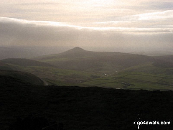 The view from Shining Tor in The White Peak Area area of The Peak District
Photo: Rachael Barber
# Whether you print a copy or download it to your phone, this Peak Baggers' Map will prove incredibly useful if you want to know what's what when you are up in the mountains and cannot get a phone signal.
Is there a Mountain, Peak, Top or Hill missing from the above google map or list?


