All The Mountains, Peaks, Tops and Hills in the North West region of England as a detailed list

The North West region of England comprises the traditional counties of Cheshire, Cumbria, Greater Manchester, Lancashire and Mersyside and includes The Lake District National Park, The Forest of Bowland and parts of The Yorkshire Dales National Park and the Peak District National Park.


If you include all the Mountains (Hewitts), the Deweys, the Nuttalls and the Marilyns there are 325 tops to climb, bag & conquer and the highest point is Scafell Pike at 978m (3,210ft).


Wainwright
214/0
Wainwrights
Hewitt
143/0
English
Mountains
Dewey
87/0
English
Deweys
nuttall
210/0
English
Nuttalls
Wainwright Outlying Fell
116/0
Wainwright
Outlying Fells
marilyn
81/0
English
Marilyns
Bridget
122/0
English
Bridgets
Trig Point
154/0
Trig
Points


To see all Mountains, Peaks, Tops and Hills displayed in different ways - see the options in the left-hand column and towards the bottom of this page.


LOG ON and RELOAD this page to show which Mountains, Peaks, Tops and Hills you have already climbed, bagged & conquered [. . . more]


Page 7 of 11    Go to page: 1 2 3 4 5 6 7 8 9 10 Next Last


See this list in: Alphabetical Order | Height Order
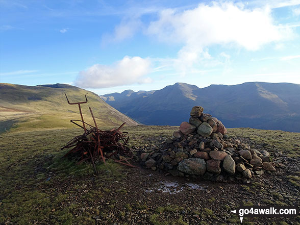
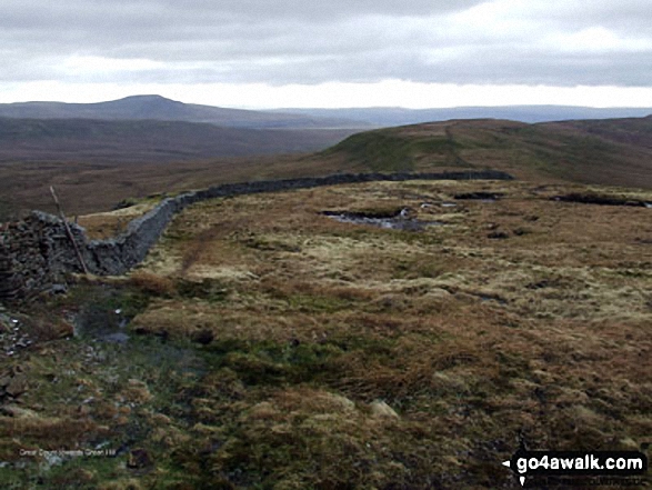
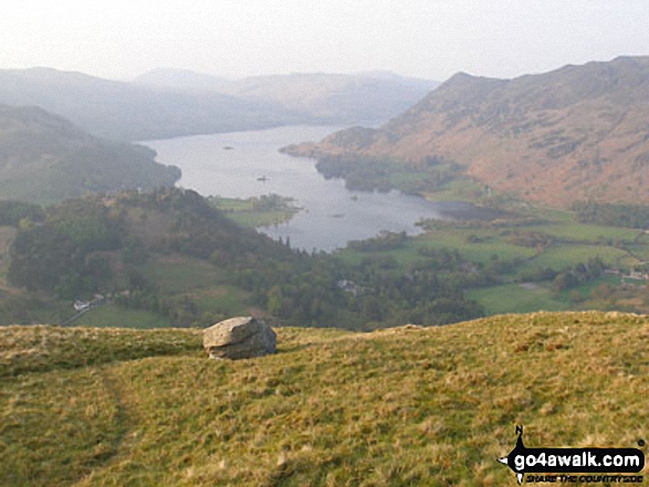
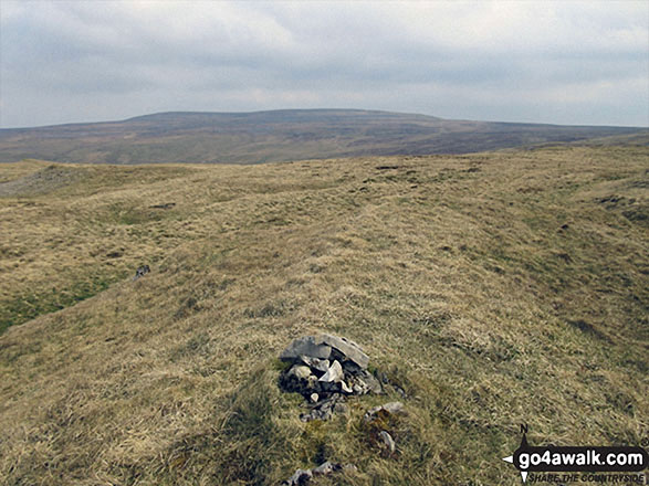
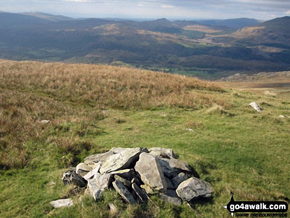
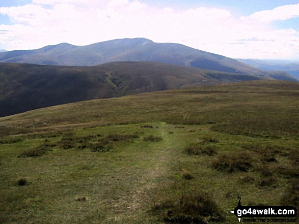
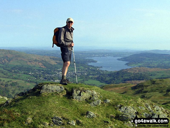
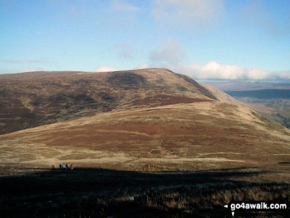
To reverse the order select the link again.


Mountain, Peak, Top or Hill:

Bagged


181. Starling Dodd

633m (2,077ft)

  • Wainwright (No. 122)
  • Mountain (158th in England, 270th in England & Wales)
  • Nuttall (213th in England, 365th in England & Wales)

  • To walk, climb & bag Starling Dodd use any of these easy to follow walks:

    Google Maps Icon
    See the location of Starling Dodd and walks up it on a google Map

    Starling Dodd is on interactive maps:

  • OS Explorer (Orange Covers): OL4
  • OS Landranger (Pink Covers): 89

  • Starling Dodd is on Peak Bagging Map and Hill Tick List:

    *Version including the walk routes marked on it that you need to follow to Walk all 214 Wainwrights in just 59 walks.


    182. Seathwaite Fell

    632m (2,074ft)

  • Wainwright (No. 123)
  • Mountain (160th in England, 273rd in England & Wales)
  • Nuttall (214th in England, 367th in England & Wales)

  • To walk, climb & bag Seathwaite Fell use this easy to follow walk:

    Google Maps Icon
    See the location of Seathwaite Fell and walks up it on a google Map

    Seathwaite Fell is on interactive maps:

  • OS Explorer (Orange Covers): OL6
  • OS Landranger (Pink Covers): 89 and 90

  • Seathwaite Fell is on Peak Bagging Map and Hill Tick List:

    *Version including the walk routes marked on it that you need to follow to Walk all 214 Wainwrights in just 59 walks.


    183. Seathwaite Fell (South Top)

    631m (2,070ft)

  • Nuttall (215th in England, 370th in England & Wales)

  • To walk, climb & bag Seathwaite Fell (South Top) use this easy to follow walk:

    Google Maps Icon
    See the location of Seathwaite Fell (South Top) and walks up it on a google Map

    Seathwaite Fell (South Top) is on interactive maps:

  • OS Explorer (Orange Covers): OL6
  • OS Landranger (Pink Covers): 89 and 90

  • Seathwaite Fell (South Top) is on Peak Bagging Map and Hill Tick List:

    *Version including the walk routes marked on it that you need to follow to Walk all 214 Wainwrights in just 59 walks.


    184. Yewbarrow

    628m (2,062ft)

  • Wainwright (No. 124)
  • Mountain (161st in England, 279th in England & Wales)
  • Nuttall (216th in England, 378th in England & Wales)

  • To walk, climb & bag Yewbarrow use any of these easy to follow walks:

    Google Maps Icon
    See the location of Yewbarrow and walks up it on a google Map

    Yewbarrow is on interactive maps:

  • OS Explorer (Orange Covers): OL6
  • OS Landranger (Pink Covers): 89

  • Yewbarrow is on Peak Bagging Map and Hill Tick List:

    *Version including the walk routes marked on it that you need to follow to Walk all 214 Wainwrights in just 59 walks.


    185. Green Hill (Gragareth)

    628m (2,061ft)

  • Nuttall (217th in England, 379th in England & Wales)

  • To walk, climb & bag Green Hill (Gragareth) use any of these easy to follow walks:

    Google Maps Icon
    See the location of Green Hill (Gragareth) and walks up it on a google Map

    Green Hill (Gragareth) is on interactive maps:

  • OS Explorer (Orange Covers): OL2
  • OS Landranger (Pink Covers): 98

  • Green Hill (Gragareth) is on Peak Bagging Map and Hill Tick List:


    186. Gragareth

    628m (2,060ft)

  • Mountain (162nd in England, 281st in England & Wales)
  • Nuttall (218th in England, 381st in England & Wales)
  • OS Trig Point
  • Gragareth is the highest point in the county of Lancashire.


    To walk, climb & bag Gragareth use any of these easy to follow walks:

    Google Maps Icon
    See the location of Gragareth and walks up it on a google Map

    Gragareth is on interactive maps:

  • OS Explorer (Orange Covers): OL2
  • OS Landranger (Pink Covers): 98

  • Gragareth is on Peak Bagging Map and Hill Tick List:


    187. Rough Crag (Riggindale)

    628m (2,060ft)

  • Mountain (163rd in England, 282nd in England & Wales)
  • Nuttall (219th in England, 382nd in England & Wales)

  • To walk, climb & bag Rough Crag (Riggindale) use any of these easy to follow walks:

    Google Maps Icon
    See the location of Rough Crag (Riggindale) and walks up it on a google Map

    Rough Crag (Riggindale) is on interactive maps:

  • OS Explorer (Orange Covers): OL5
  • OS Landranger (Pink Covers): 90

  • Rough Crag (Riggindale) is on Peak Bagging Map and Hill Tick List:

    *Version including the walk routes marked on it that you need to follow to Walk all 214 Wainwrights in just 59 walks.


    188. Looking Stead (Pillar)

    627m (2,058ft)

  • Nuttall (220th in England, 383rd in England & Wales)

  • To walk, climb & bag Looking Stead (Pillar) use any of these easy to follow walks:

    Google Maps Icon
    See the location of Looking Stead (Pillar) and walks up it on a google Map

    Looking Stead (Pillar) is on interactive maps:

  • OS Explorer (Orange Covers): OL4
  • OS Landranger (Pink Covers): 89 and 90

  • Looking Stead (Pillar) is on Peak Bagging Map and Hill Tick List:

    *Version including the walk routes marked on it that you need to follow to Walk all 214 Wainwrights in just 59 walks.


    189. Hare Stones

    627m (2,057ft)

  • Nuttall (221st in England, 384th in England & Wales)

  • To walk, climb & bag Hare Stones use any of these easy to follow walks:

    Google Maps Icon
    See the location of Hare Stones and walks up it on a google Map

    Hare Stones is on interactive maps:

  • OS Explorer (Orange Covers): OL5
  • OS Landranger (Pink Covers): 90

  • Hare Stones is on Peak Bagging Map and Hill Tick List:

    *Version including the walk routes marked on it that you need to follow to Walk all 214 Wainwrights in just 59 walks.


    190. Birks

    624m (2,047ft)

  • Wainwright (No. 125)
  • Nuttall (222nd in England, 387th in England & Wales)

  • To walk, climb & bag Birks use any of these easy to follow walks:

    Google Maps Icon
    See the location of Birks and walks up it on a google Map

    Birks is on interactive maps:

  • OS Explorer (Orange Covers): OL5
  • OS Landranger (Pink Covers): 90

  • Birks is on Peak Bagging Map and Hill Tick List:

    *Version including the walk routes marked on it that you need to follow to Walk all 214 Wainwrights in just 59 walks.


    191. Randygill Top

    624m (2,047ft)

  • Mountain (165th in England, 286th in England & Wales)
  • Nuttall (224th in England, 389th in England & Wales)

  • To walk, climb & bag Randygill Top use any of these easy to follow walks:

    Google Maps Icon
    See the location of Randygill Top and walks up it on a google Map

    Randygill Top is on interactive maps:

  • OS Explorer (Orange Covers): OL19
  • OS Landranger (Pink Covers): 91

  • Randygill Top is on Peak Bagging Map and Hill Tick List:


    192. Tinside Rigg

    624m (2,047ft)

  • Nuttall (225th in England, 390th in England & Wales)
  • Tinside Rigg was promoted to 'Nuttall' status in November, 2016


    To walk, climb & bag Tinside Rigg use this easy to follow walk:

    Google Maps Icon
    See the location of Tinside Rigg and walks up it on a google Map

    Tinside Rigg is on interactive maps:

  • OS Explorer (Orange Covers): OL19
  • OS Landranger (Pink Covers): 91

  • Tinside Rigg is on Peak Bagging Map and Hill Tick List:


    193. Long Fell

    623m (2,045ft)

  • Nuttall (226th in England, 391st in England & Wales)
  • Long Fell was promoted to 'Nuttall' status in November, 2016.


    To walk, climb & bag Long Fell use this easy to follow walk:

    Google Maps Icon
    See the location of Long Fell and walks up it on a google Map

    Long Fell is on interactive maps:

  • OS Explorer (Orange Covers): OL19
  • OS Landranger (Pink Covers): 91

  • Long Fell is on Peak Bagging Map and Hill Tick List:


    194. Bush Howe

    623m (2,044ft)

  • Nuttall (227th in England, 393rd in England & Wales)

  • To walk, climb & bag Bush Howe use either of these easy to follow walks:

    Google Maps Icon
    See the location of Bush Howe and walks up it on a google Map

    Bush Howe is on interactive maps:

  • OS Explorer (Orange Covers): OL19
  • OS Landranger (Pink Covers): 97

  • Bush Howe is on Peak Bagging Map and Hill Tick List:


    195. Cold Fell Pike (Geltsdale)

    621m (2,038ft)

  • Mountain (167th in England, 290th in England & Wales)
  • Nuttall (230th in England, 400th in England & Wales)
  • Marilyn (48th in England, 725th in GB)
  • OS Trig Point

  • To walk, climb & bag Cold Fell Pike (Geltsdale) use either of these easy to follow walks:

    Google Maps Icon
    See the location of Cold Fell Pike (Geltsdale) and walks up it on a google Map

    Cold Fell Pike (Geltsdale) is on interactive maps:

  • OS Explorer (Orange Covers): OL31
  • OS Landranger (Pink Covers): 86

  • Cold Fell Pike (Geltsdale) is on Peak Bagging Map and Hill Tick List:


    196. Rydal Fell (Heron Pike North Top)

    621m (2,038ft)

  • Nuttall (231st in England, 402nd in England & Wales)

  • To walk, climb & bag Rydal Fell (Heron Pike North Top) use any of these easy to follow walks:

    Google Maps Icon
    See the location of Rydal Fell (Heron Pike North Top) and walks up it on a google Map

    Rydal Fell (Heron Pike North Top) is on interactive maps:

  • OS Explorer (Orange Covers): OL7
  • OS Landranger (Pink Covers): 90

  • Rydal Fell (Heron Pike North Top) is on Peak Bagging Map and Hill Tick List:

    *Version including the walk routes marked on it that you need to follow to Walk all 214 Wainwrights in just 59 walks.


    197. Walna Scar

    621m (2,038ft)

  • Nuttall (232nd in England, 404th in England & Wales)
  • Wainwright Outlying Fell (No. 1)

  • To walk, climb & bag Walna Scar use this easy to follow walk:

    Google Maps Icon
    See the location of Walna Scar and walks up it on a google Map

    Walna Scar is on interactive maps:

  • OS Explorer (Orange Covers): OL6
  • OS Landranger (Pink Covers): 96 and 97

  • A go4awalk.com Peak Bagging Map and Hill Tick List featuring Walna Scar will be available soon.


    198. Bellbeaver Rigg (Tynehead Fell)

    620m (2,035ft)

  • Nuttall (233rd in England, 405th in England & Wales)

  • To walk, climb & bag Bellbeaver Rigg (Tynehead Fell) use any of these easy to follow walks:

    Google Maps Icon
    See the location of Bellbeaver Rigg (Tynehead Fell) and walks up it on a google Map

    Bellbeaver Rigg (Tynehead Fell) is on interactive maps:

  • OS Explorer (Orange Covers): OL31
  • OS Landranger (Pink Covers): 91

  • Bellbeaver Rigg (Tynehead Fell) is on Peak Bagging Map and Hill Tick List:


    199. Hartsop Dodd

    619m (2,031ft)

  • Wainwright (No. 126)
  • Nuttall (235th in England, 410th in England & Wales)

  • To walk, climb & bag Hartsop Dodd use any of these easy to follow walks:

    Google Maps Icon
    See the location of Hartsop Dodd and walks up it on a google Map

    Hartsop Dodd is on interactive maps:

  • OS Explorer (Orange Covers): OL5
  • OS Landranger (Pink Covers): 90

  • Hartsop Dodd is on Peak Bagging Map and Hill Tick List:

    *Version including the walk routes marked on it that you need to follow to Walk all 214 Wainwrights in just 59 walks.


    200. Yewbarrow (North Top)

    616m (2,023ft)

  • Mountain (170th in England, 298th in England & Wales)
  • Nuttall (238th in England, 414th in England & Wales)

  • To walk, climb & bag Yewbarrow (North Top) use any of these easy to follow walks:

    Google Maps Icon
    See the location of Yewbarrow (North Top) and walks up it on a google Map

    Yewbarrow (North Top) is on interactive maps:

  • OS Explorer (Orange Covers): OL6
  • OS Landranger (Pink Covers): 89

  • Yewbarrow (North Top) is on Peak Bagging Map and Hill Tick List:

    *Version including the walk routes marked on it that you need to follow to Walk all 214 Wainwrights in just 59 walks.


    201. Great Lingy Hill

    616m (2,022ft)

  • Nuttall (240th in England, 416th in England & Wales)

  • To walk, climb & bag Great Lingy Hill use any of these easy to follow walks:

    Google Maps Icon
    See the location of Great Lingy Hill and walks up it on a google Map

    Great Lingy Hill is on interactive maps:

  • OS Explorer (Orange Covers): OL5
  • OS Landranger (Pink Covers): 90

  • Great Lingy Hill is on Peak Bagging Map and Hill Tick List:

    *Version including the walk routes marked on it that you need to follow to Walk all 214 Wainwrights in just 59 walks.


    202. Great Borne

    616m (2,021ft)

  • Wainwright (No. 127)
  • Mountain (172nd in England, 300th in England & Wales)
  • Nuttall (241st in England, 417th in England & Wales)
  • OS Trig Point

  • To walk, climb & bag Great Borne use any of these easy to follow walks:

    Google Maps Icon
    See the location of Great Borne and walks up it on a google Map

    Great Borne is on interactive maps:

  • OS Explorer (Orange Covers): OL4
  • OS Landranger (Pink Covers): 89

  • Great Borne is on Peak Bagging Map and Hill Tick List:

    *Version including the walk routes marked on it that you need to follow to Walk all 214 Wainwrights in just 59 walks.


    203. Flinty Fell

    614m (2,016ft)

  • Mountain (173rd in England, 302nd in England & Wales)
  • Nuttall (242nd in England, 420th in England & Wales)
  • OS Trig Point

  • To walk, climb & bag Flinty Fell use this easy to follow walk:

    Google Maps Icon
    See the location of Flinty Fell and walks up it on a google Map

    Flinty Fell is on interactive maps:

  • OS Explorer (Orange Covers): OL31
  • OS Landranger (Pink Covers): 86 and 87

  • Flinty Fell is on Peak Bagging Map and Hill Tick List:


    204. White Maiden

    612m (2,010ft)

  • Nuttall (245th in England, 428th in England & Wales)

  • To walk, climb & bag White Maiden use this easy to follow walk:

    Google Maps Icon
    See the location of White Maiden and walks up it on a google Map

    White Maiden is on interactive maps:

  • OS Explorer (Orange Covers): OL6
  • OS Landranger (Pink Covers): 96

  • A go4awalk.com Peak Bagging Map and Hill Tick List featuring White Maiden will be available soon.


    205. Heron Pike

    612m (2,008ft)

  • Wainwright (No. 128)
  • Nuttall (246th in England, 430th in England & Wales)

  • To walk, climb & bag Heron Pike use any of these easy to follow walks:

    Google Maps Icon
    See the location of Heron Pike and walks up it on a google Map

    Heron Pike is on interactive maps:

  • OS Explorer (Orange Covers): OL7
  • OS Landranger (Pink Covers): 90

  • Heron Pike is on Peak Bagging Map and Hill Tick List:

    *Version including the walk routes marked on it that you need to follow to Walk all 214 Wainwrights in just 59 walks.


    206. Rosthwaite Cam (Rosthwaite Fell)

    612m (2,008ft)

  • Nuttall (248th in England, 432nd in England & Wales)

  • To walk, climb & bag Rosthwaite Cam (Rosthwaite Fell) use either of these easy to follow walks:

    Google Maps Icon
    See the location of Rosthwaite Cam (Rosthwaite Fell) and walks up it on a google Map

    Rosthwaite Cam (Rosthwaite Fell) is on interactive maps:

  • OS Explorer (Orange Covers): OL4
  • OS Landranger (Pink Covers): 90

  • Rosthwaite Cam (Rosthwaite Fell) is on Peak Bagging Map and Hill Tick List:

    *Version including the walk routes marked on it that you need to follow to Walk all 214 Wainwrights in just 59 walks.


    207. Bullman Hills

    610m (2,001ft)

  • Nuttall (251st in England, 439th in England & Wales)

  • To walk, climb & bag Bullman Hills use this easy to follow walk:

    Google Maps Icon
    See the location of Bullman Hills and walks up it on a google Map

    Bullman Hills is on interactive maps:

  • OS Explorer (Orange Covers): OL31
  • OS Landranger (Pink Covers): 91

  • Bullman Hills is on Peak Bagging Map and Hill Tick List:


    208. Miller Moss

    610m (2,001ft)

  • Nuttall (252nd in England, 440th in England & Wales)
  • Miller Moss was declared a 'Nuttall' in August, 2018


    To walk, climb & bag Miller Moss use any of these easy to follow walks:

    Google Maps Icon
    See the location of Miller Moss and walks up it on a google Map

    Miller Moss is on interactive maps:

  • OS Explorer (Orange Covers): OL4
  • OS Landranger (Pink Covers): 89 and 90

  • Miller Moss is on Peak Bagging Map and Hill Tick List:

    *Version including the walk routes marked on it that you need to follow to Walk all 214 Wainwrights in just 59 walks.


    209. Calf Top

    609m (2,000ft)

  • Mountain (180th in England, 317th in England & Wales)
  • Nuttall (253rd in England, 441st in England & Wales)
  • Marilyn (51st in England, 752nd in GB)
  • OS Trig Point
  • Calf Top was reclassified from a 'Dewey' to a Mountain (Hewitt) and 'Nuttall' in September 2016. Formerly thought to be fractionally under the 609.6m (2000ft) required for mountain status, the Ordnance Survey recalculated the height of the mountain using the OSTN15/OSGM15 transformation to a height of 609.606m (2000ft and 1/4 inch).


    To walk, climb & bag Calf Top use this easy to follow walk:

    Google Maps Icon
    See the location of Calf Top and walks up it on a google Map

    Calf Top is on interactive maps:

  • OS Explorer (Orange Covers): OL2
  • OS Landranger (Pink Covers): 98

  • Calf Top is on Peak Bagging Map and Hill Tick List:


    210. Renwick Fell (Thack Moor)

    609m (2,000ft)

  • Mountain (179th in England, 316th in England & Wales)
  • Nuttall (254th in England, 443rd in England & Wales)
  • OS Trig Point
  • Renwick Fell (Thack Moor) was reclassified from a 'Dewey' to a Mountain (Hewitt) and 'Nuttall' in April 2013. Formerly thought to be fractionally under the 609.6m (2000ft) required for mountain status, the Ordnance Survey has confirmed the height to be 609.62m (2000ft and 3/4 inch).


    To walk, climb & bag Renwick Fell (Thack Moor) use either of these easy to follow walks:

    Google Maps Icon
    See the location of Renwick Fell (Thack Moor) and walks up it on a google Map

    Renwick Fell (Thack Moor) is on interactive maps:

  • OS Explorer (Orange Covers): OL43
  • OS Landranger (Pink Covers): 86

  • Renwick Fell (Thack Moor) is on Peak Bagging Map and Hill Tick List:


    Page 7 of 11    Go to page: 1 2 3 4 5 6 7 8 9 10 Next Last


    View all 610 Mountains, Peaks, Tops and Hills in North West:


    Is there a Mountain, Peak, Top or Hill missing from the above google map or list?

    Let us know an we will add it to our database.


    Do not miss our pick of the Best Walks in Britain


    Follow go4awalk.com on Twitter Follow go4awalk.com on Facebook


    Home


    Find new Friends to go walking with

    Walk all 214 Wainwrights in just 59 Walks. Download GPS Waypoints - Great Walks you must not miss!

    Walk The Yorkshire Three Peaks Challenge Walk - All the Latest Route Information, GPS Waypoints and Split Times to keep you on Schedule

    Walk The British Three Peaks Challenge Walk - All the Latest Route Information and GPS Waypoints

    See our pick of The Best Walks in The Lake District - Great Walks you must not miss!

    Walk our pick of the Best Lake District Ridge Walks - Great Walks you must not miss!

    Walk our pick of the Best Lake District Walks to do in the rain - Great Walks you must not miss!

    Walk our pick of The Best Walks in Snowdonia - Great Walks you must not miss!

    Walk our pick of The Best Ridge Walks in Wales - Walks you must not miss!

    Walk our pick of The Best Walks in The Brecon Beacons - Great Walks you must not miss!

    Walk our pick of The Best Walks in The Yorkshire Dales - Walks you must not miss!

    Walk our pick of The Best Walks in The Peak District - Walks you must not miss!

    Walk our pick of The Best Walks in The Forest of Bowland - Walks you must not miss!

    Walk our pick of The Best Walks in Shropshire - Walks you must not miss!

    Walk our pick of The Best Walks in Cheshire - Walks you must not miss!

    Walk our pick of The Best Walks in Lancashire - Walks you must not miss!

    Not sure where to walk next? Try Peak Bagging - Great Walks you must not miss!

    Not sure where to walk next? Walk part of a National Trail - Great Walks you must not miss!

    Walks with Downloadable and Uploadable GPS Waypoint Data

    Walking Kit and Gear Tested by Walkers

    Full Site Search
    Do not miss our pick of the Best Walks in Britain